Glastonbury dates to 1636, and 12 of its places are on the National Register
More historic than 85% of U.S. towns · #74 of 155 in Connecticut. What drives it
Most of Glastonbury was built recently: 8% of its homes predate 1940 and the median home dates from 1976. 12 places in town are on the National Register, among them the Kimberly Mansion, a National Historic Landmark, and six historic districts with 496 buildings between them. Below: 10 old photos and papers, maps from 1893 on, and the census since 1820.
On its age, its old homes and the National Register, Glastonbury is more historic than 85% of U.S. towns, #74 of 155 in Connecticut. Its age holds the grade up; its share of homes from before 1940 pulls it down.
A−
HistoryA character grade: shown, never part of Glastonbury’s overall grade.
Connecticut towns list more on the Register than most of the country (a typical Connecticut town has 73.3 per 10,000 residents, the U.S. 2.4), so Glastonbury’s 144 sits near the middle of its state (65% of Connecticut towns have fewer) while its 507 historic buildings outnumber those of 97% of U.S. towns.
NoteThe founding year comes from Wikidata alone; no second source gives 1636.
How sure. Graded on any two of the three inputs instead, the letter would range from B+ to A+. The pre-1940 share (±1.6 points) is firm at this size.
Founding year: Wikidata (other dates in Quick answers). Homes: Census ACS 2020–24. National Register: National Park Service, May 2026 list; each listing counted once (boundary changes and added documentation belong to their listing), and a historic district counts its contributing buildings. How TownRatings grades history →
What stands out about Glastonbury’s past
Read from the archive, the National Register and the record. The page puts what stands out first.
In 1636, 30 families settled in Pyaug, a tract of land belonging to Wethersfield on the eastern bank of the Connecticut River, purchased from the Native American chief Sowheag for 12 yards (11 m) of trading cloth. In 1672, the General Court granted Wethersfield and Hartford permission to extend Pyaug's boundary line 5 miles (8 km) to the east. By 1690, Wethersfield had permitted Pyaug residents to form a separate town and the town of Glassenbury was created in 1693.
Passages that mention Glastonbury, cut from the printed page as they were published.
The history of ancient Wethersfield, Connecticut1904Read the page →
Read the text
disposed of the assets of tlie two towns, but the liabilities of Wetliersfield as they existed July 10, 1S71, occasioned more trouble. The Town of Wetliersfield claimed that her expenses in fighting the Town of Glastonbury through the whole of that ^lay session of the Ocneral Assembly, and afterwards, shoidd be shared by Xewington, although the latter town had no interest in that controversy whatever; and it was claimed on her behalf that she could not be held liable for any expenses in Court or Legislatiu'e made after July 10, 1S71. An amicable
Text read by machine from the scan; it may contain errors.
The history of ancient Wethersfield, Connecticut1904Read the page →
Read the text
Connecticut Valley, about 50 miles in length and 20 in breadth. Immediately below, lies the beautiful town of Weth., with its inter\a]s on the East, and finely sloping hills on the West. Between these intervals, and those of Glastonbury, winds the Conn. River. Still further East is the town of Glastonbury itself. On the Xorth is the City of Hartford, and the undulating country which lies westward of it. The Lmie range limits the view on the East, and that of ^It. Tom on the West ; and on the Xorth, at the distance of 42 miles, it is bounded by the moun-
Text read by machine from the scan; it may contain errors.
Scans and text from the Internet Archive. Books published in 1930 or earlier, which are in the public domain.
By decade
Glastonbury, decade by decade
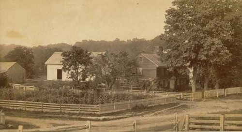
6 decades in the archive, from the 1860s to the 1970s. Scroll each row; tap a photo for its story.
Nothing in the archives for these yearsWeddings on Main Street, storms, parades, school pictures, the old store. If it’s in your family album, it belongs here.
Nothing in the archives for these yearsWeddings on Main Street, storms, parades, school pictures, the old store. If it’s in your family album, it belongs here.
In 1636, according to Wikidata. Glastonbury’s post office opened in 1806, and the census of 1820 counted 3,114 people here.
How does Glastonbury rank for history?
Glastonbury is more historic than 85% of U.S. towns, #74 of 155 in Connecticut. The History grade combines the town’s founding era, the share of homes built before 1940 and its National Register listings. It’s a character grade, so it isn’t part of the overall grade. How it works.
What is on the National Register in Glastonbury?
12 listings: 7 buildings, among them the Kimberly Mansion (a National Historic Landmark since 1974) and the Gideon Welles House (listed 1970, the first), and 6 historic districts with 496 contributing buildings. 507 historic buildings in all.
How old are the homes in Glastonbury?
8% of Glastonbury’s homes were built before 1940 (Census estimate, ±1.6 points), against a typical 15% for a Connecticut town; the median home was built in 1976.
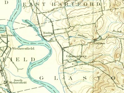
Founding dates: Wikidata, Wikipedia, the U.S. post office records of Blevins & Helbock (CC0) and the Census. Homes by year built: Census ACS 2020–24. National Register of Historic Places: National Park Service (list of May 22, 2026). Old photos, postcards and papers: Wikimedia Commons, the Library of Congress and other public archives, credited on each item’s page. Maps: U.S. Geological Survey historical topographic maps (via Esri) and Sanborn fire-insurance maps (Library of Congress). History text and census tables: Wikipedia (CC BY-SA 4.0). Places that used to be: USGS Geographic Names Information System (2021).
From Wikimedia Commons (30), the National Register of Historic Places (13), Wikipedia, Wikidata and Wikipedia for famous people, U.S. Geological Survey historical maps, U.S. Census counts (via Wikipedia), the US Post Offices dataset (Blevins & Helbock), the USGS Geographic Names Information System and old county and town histories (Internet Archive). Archive images are copied here with their credits and licenses, shown on each photo’s page. Refreshed monthly.


 ★ Landmark





![Connecticut Valley, about 50 miles in length and 20 in breadth. Immediately below, lies the beautiful town of Weth., with its inter\a]s on the East, and finely sloping hills on the West. Between these intervals, and those of Glastonbury, winds the Conn. River. Still further East is the town of Glas…](https://images.townratings.com/story/19530/bk-6241a6494a25b5f9-l.jpg)
 c. 1919
 1936
 1936
 1936
 2018
 2018
 2016
 2016
 2014
 2014
 2014
 2014
 2014
 2013
 2013
 2013
 2013
 2013
 2011
 2010
 2010
 2007
 2007
 2006


