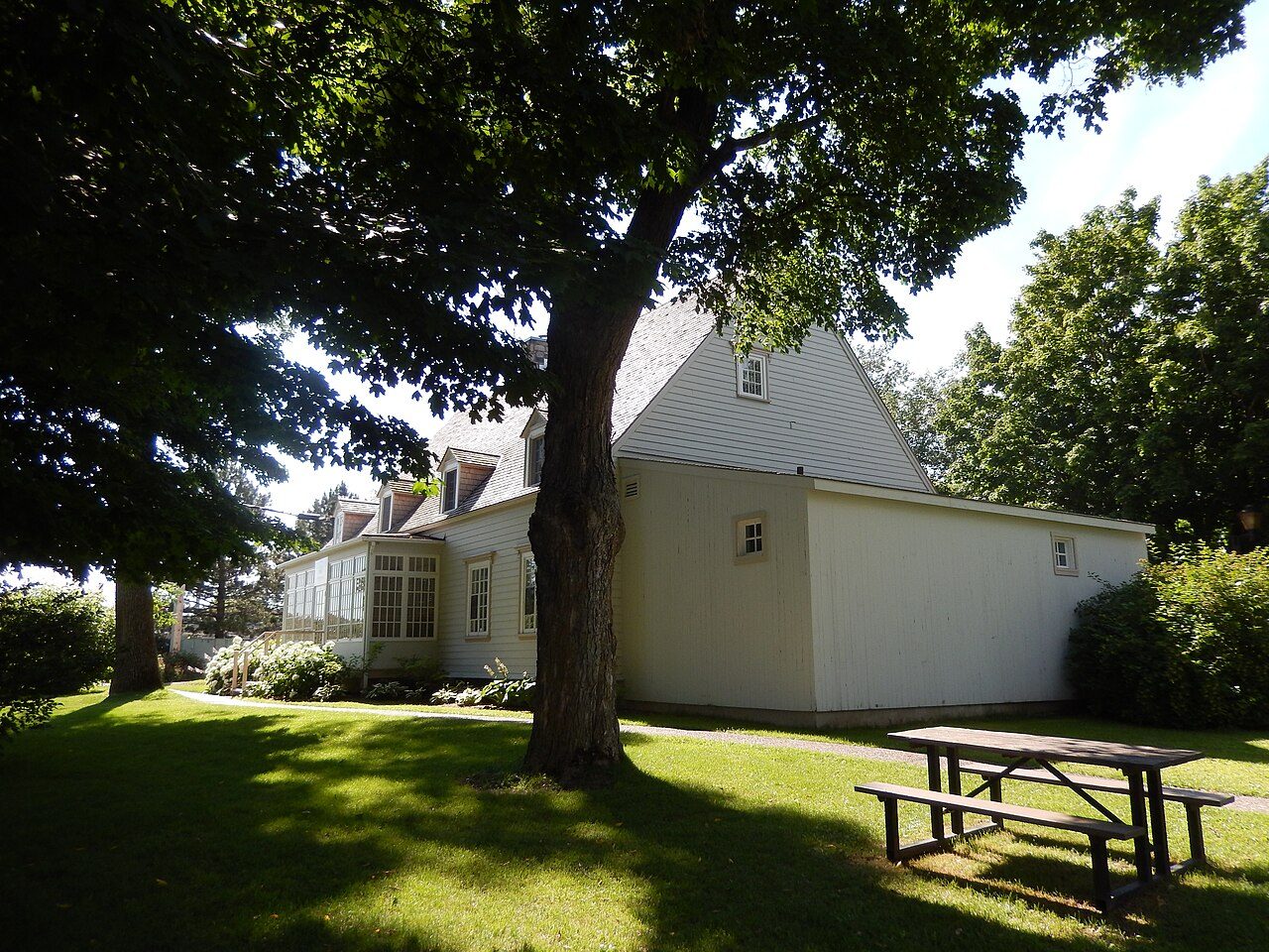
Manoir et four à pain Couillard · Photo: Fralambert · CC BY-SA 4.0
6historic places on the registers
History of Montmagny · Canada’s heritage registers
Montmagny keeps a building from 1739: Maison Têtu
Homes from before 1961 make up 38% of Montmagny’s stock, above the 18% of the typical town. All told the heritage lists hold 6 historic places within the town, and 3 sit in the top tier. Its 5.3 per 10,000 residents puts it ahead of 95% of Canadian towns. The record has a Recognized Federal Heritage Building, a municipal citation and a heritage railway station.
2 of the 3 highest designations in Montmagny, in photos
Of the places pictured in Montmagny, Manoir et four à pain Couillard is the oldest, from 1800. 3 designated places in Montmagny have a photo. Open a place’s page for its old views: 2 places in Montmagny have them.
Photos from Wikimedia Commons, each credited to its photographer with its licence; names open the place’s page. Tap a photo to step through them full screen.
Through time
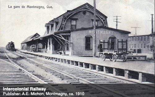
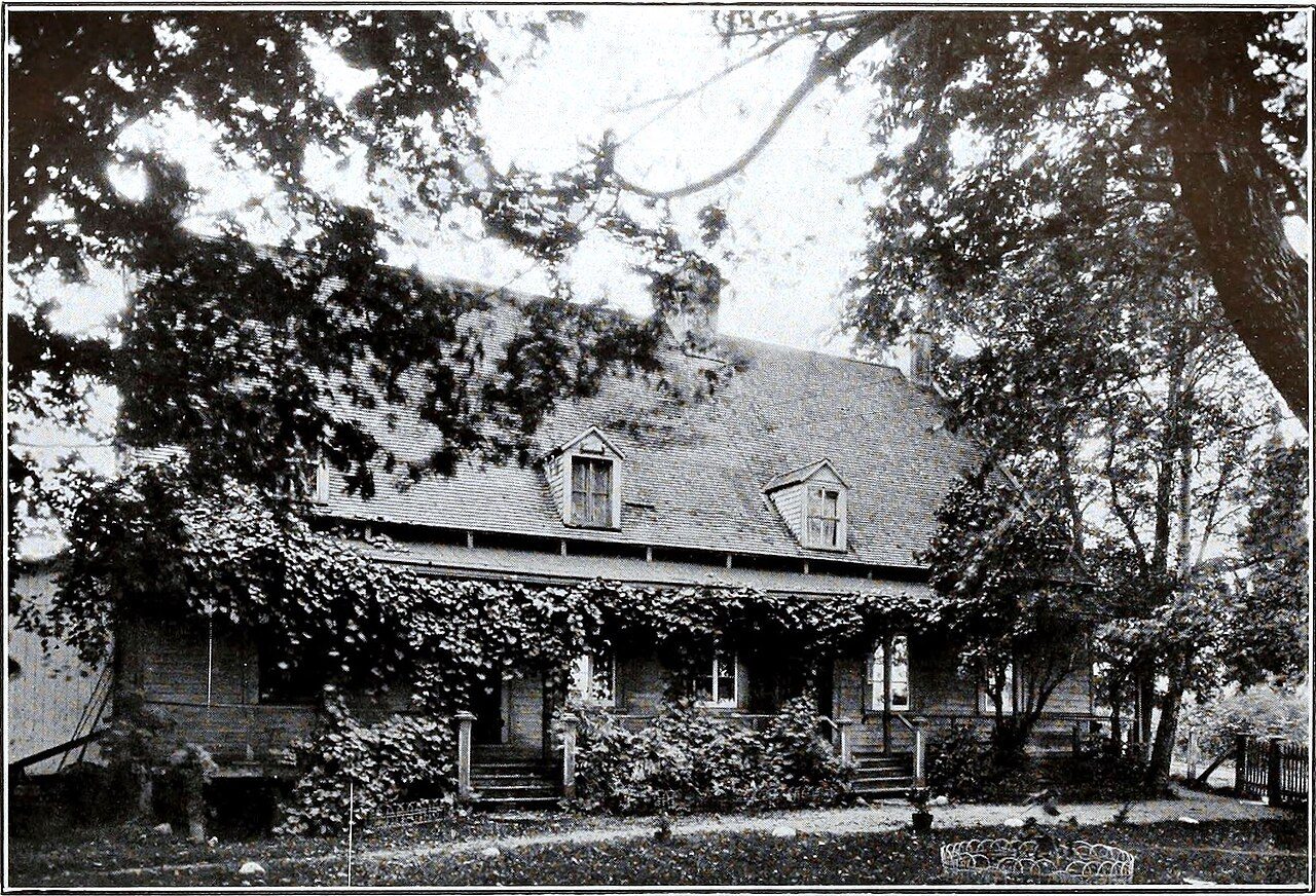
Back in time: Montmagny, 1910–1927
Set out by date: the oldest views of 2 of its historic places. Tap any picture to see it full screen.
1890190019101920193019401950Confederation to 1900Boom yearsThe wars and betweenAfter the war
Public domain or CC0, made before 1950, from Wikimedia Commons; old views of places can be drawings, prints or maps of their time. Each credit opens the image’s page.
How old
Montmagny’s dated places lean to the years before Confederation
Each place by the first construction date on its record.
New France before 17601
British North America 1760–18663
After Confederation 1867–19131
Wars and Depression 1914–19451
Since 1946 1946 on0
Of the 6 with a date, 4 predate 1867.
How it began
From 1881: Montmagny’s first milestones
April 2, 1966 is the date of Montmagny’s municipality in Wikidata, and like many such dates it may record a charter, not the first homes. By 1881 the place had a station: Montmagny railway station.
Every place on the registers inside the town, by its designation.
Highest designationsOther federal designationsProvincial and local listings
Dots open their places’ pages; hover first to read the name.
The 6, by tier
3 Highest designations2 Other federal designations1 Provincial and local listings
Federal designations come from Parks Canada; Québec’s own register adds what the province has classified and what the municipality has cited.
Points from Wikidata (Parks Canada’s files carry none) and from Québec’s register, as mapped there.
Highest designations
3 places in Montmagny with the highest designation
The first was designated in 1961, the latest in 1990. Here that means 2 places classified by Québec and a National Historic Site. National Historic Sites and Classified Federal Heritage Buildings, Canada’s highest federal recognition. Each one opens its own page.
They date from 1881 (“VIA Rail Station, Montmagny, Quebec”) to 1915. Here that means a Recognized Federal Heritage Building and a heritage railway station. Recognized Federal Heritage Buildings, heritage railway stations and lighthouses. Each one opens its own page.
Homes built from 2001 to 2015 make up just 9.9% of Montmagny’s, against 15% in the typical town. Montmagny built little from 1981 to 2000: 18% of its homes, where most towns have 23%. New building in Montmagny runs at the usual pace: 4.4% of homes from 2016–21, the typical town 4.1%.
38%
Before 1961
30%
1961–80
18%
1981–2000
9.9%
2001–15
4.4%
2016–21
MontmagnyTypical town
2021 Census, private dwellings by period of construction (Statistics Canada); the typical town is the middle Canadian town of 2,500 or more.
People of the past
People of Montmagny’s past, one of them designated by Canada
At the other end is René Bernatchez, from 1913. Étienne-Paschal Taché House, one of the town’s historic places, recalls Sir Étienne Paschal Taché. Best known is Robert Talbot, with articles in 7 Wikipedia languages. It starts with Félix Têtu, born in 1769. The 20 best known are on the timeline.
Félix Têtu
Jean-Baptiste Taché
Barthélemy Joliette
Antoine-Gaspard Couillard
Vital Têtu
Louis-Jacques Casault
Jean-Baptiste Couillard Dupuis
Damase Boulanger
Eugène-Étienne Taché
Joseph Marmette
Roch-Pamphile Vallée
Pierre-Raymond-Léonard Martineau
Emma Gaudreau Casgrain
David Ovide L'Espérance
Édouard Montpetit
Robert Talbot
Fernand Choquette
Marius Paré
Edwin Bélanger
René Bernatchez
175017751800182518501875190019251950
RT
Robert Talbot1893–1954 · Canadian conductor, violinist and composer
EB
Edwin Bélanger1910–2005 · Canadian conductor, violinist, violist, arranger, and music educator
JM
Joseph Marmette1844–1895 · Canadian writer
Édouard Montpetit1881–1954 · Canadian writer
Fernand Choquette1895–1975 · Canadian Quebec MNA and judge of the Quebec Court of Appeal
MP
Marius Paré1903–2002 · Canadian catholic priest
Eugène-Étienne Taché1836–1912 · Canadian architect
EC
Emma Gaudreau Casgrain1861–1934 · First woman dentist in Canada
Everyone born in Montmagny → Born before 1914, or named by one of the town’s historic places. Birthplaces from Wikidata, each checked against Wikipedia; national historic persons from Parks Canada’s Directory of Federal Heritage Designations, matched by name and life years.
Towns its size
Montmagny has the 1st most of 16 towns its size
Towns of 11,300 to 11,400 residents, by places on the registers.
Older stock first: 38% of homes in Montmagny were standing by 1961, against 18% in the typical town. In all there are 6 historic places, 3 with the highest designation. No town its size has more historic places: it leads the 16 nearest in population.
3 of the 6 dated places belong to the years before Confederation. Of its people of the past, the best known are Robert Talbot (1893), Edwin Bélanger (1910) and Joseph Marmette (1844). Everything else is close to the norm: the list grew between 1961 and 2008.
How to read these numbers
What this data can and can’t tell you
•
Map points. Where a federal place sits on the map is Wikidata’s placing; the directory itself has no coordinates.
•
The federal register. Federal places come from Parks Canada’s directory, which counts National Historic Sites, federal heritage buildings, stations and lighthouses; their statements are the register’s own.
•
Québec’s register. Québec’s Répertoire du patrimoine culturel records the province’s classements and declarations and every municipal citation, each with a description and a point.
•
The tiers. Three tiers: the top for National Historic Sites, classified federal buildings and Québec’s classements, a second for the other federal designations, a third for provincial and municipal listings.
•
People and events. Persons of national historic significance come with no location; a town gets one only by birthplace (name and both life years agreeing) or by one of its own places that bears the name and whose record tells the story. Events, which can’t be tied, are left out.
•
The grade. History is described, not graded, for every Canadian town.
•
Protection. Here the register is also the protection: classement and citation under Québec’s cultural heritage law control changes, while federal recognition does not.
Questions about Montmagny’s history
What is the oldest building in Montmagny?
Maison Têtu, a Municipal citation (Québec), begun in 1739.
How old are the homes in Montmagny?
38% of its homes were built before 1961, against 18% in the typical Canadian town.
Which places in Montmagny have the highest designation?
These: Étienne-Paschal Taché House, Maison et laiterie Casault and Manoir et four à pain Couillard.
Contains information licensed under the Open Government Licence – Canada (Parks Canada). Québec register data: Ministère de la Culture et des Communications du Québec, CC BY 4.0.
Sources: Parks Canada, Directory of Federal Heritage Designations · Canadian Register of Historic Places (federal extract) · Répertoire du patrimoine culturel du Québec (MCC, Données Québec) · Wikidata (CC0) for map points, other names and articles · Statistics Canada, 2021 Census (homes by period of construction). Under the Statistics Canada Open Licence.


 1910
 1927
 Top
 Top
 Fed


