
KingOntario
The town has 29,077 residents and lies in Ontario. Statistics Canada counts it in the Toronto metro area.
Is King a good place to live?
King does the important things well, at a cost. Schools do well (A−). With a B+ overall, King is better than 69% of Canadian towns and ranks #230 of 858 in Ontario. Health outcomes beat most towns (A−). Buying in is costly (C−). The rest of its grades are middling: C+ for jobs & income and B− for walkability.
Rents here are the metro area's average, shared by every town and neighbourhood in it. Safety is the regional police service's figure, shared with its other towns. Health is graded on the health region's survey figures and life expectancy, with the distance to hospital giving the town its own spread.
How King grades
Each subject compares King with Canadian towns of 2,500 or more, ordered by how far it is from the middle. Towns in other countries are graded separately.
How TownRatings grades Canadian towns →
What makes King stand out
The 3 things King does most differently from other towns.
The data
Data highlights are ordered by what stands out in King.
Hazard risk in King is lower than in 95% of Canadian towns
One flood study covers the town, by Toronto Regional Conservation Authority. For earthquakes King is middling, $0.021 a year per $1,000 against $0.030 for the typical town.
Radon tests above the guideline · share of tested homes, 200 Bq/m³
| Hazards | King | Ontario | Canada |
|---|---|---|---|
| Radon tests above the guideline | 0% | 4% | 6.6% |
| Earthquake loss per $1,000 of buildings a year | $0.021 | $0.043 | $0.030 |
NRCan seismic risk model and burned areas, Health Canada radon survey, the Flood Hazard Map Inventory
Four parallel systems run King’s schools through 8 boards: English and French, public and Catholic
Of the 70, 3 teach in French (10% of schools in Ontario). Cardinal Carter Catholic Secondary School is the biggest, at 1,375 students. On the tests, 32 of 69 schools land above the middle in Ontario, 14 under it. Elementary school is 5.2 km away at the nearest, above Ontario’s towns (0.5 km) and Canadian towns (0.5 km) alike.
| School | Level | Students | System |
|---|---|---|---|
| Fieldcrest Elementary School Middle fifth in OntarioLargest elementary schoolElementary · Grades JK–8 | Elementary · Grades JK–8 | 785 | English public |
| Cardinal Carter Catholic Secondary School CatholicLargest secondary schoolSecondary · Grades 9–12 | Secondary · Grades 9–12 | 1,375 | English Catholic |
| ÉSC Renaissance FrenchTeaches in FrenchSecondary · Grades 9–12 | Secondary · Grades 9–12 | 435 | French Catholic |
| Aurora High School Top fifth in OntarioResults in the top fifth in OntarioSecondary · Grades 9–12 | Secondary · Grades 9–12 | 1,020 | English public |
Schools by system · Schools within 3 km
| Schools within 3 km | King | Ontario | Canada |
|---|---|---|---|
| School boards | 8 | 4 | 3 |
| Nearest elementary school | 5.2 km | 0.5 km | 0.5 km |
| Nearest secondary school | 5.3 km | 1.2 km | 1.2 km |
Provincial school lists and results, 2024-25
More households own their home in King than in Ontario’s towns or across Canadian towns: 88%
A year’s rent came to 17% of the median household income, below Ontario’s towns (22%) and Canadian towns (20%) alike. 27% of households spent 30% or more of their income on shelter, above both Ontario’s towns (22%) and Canadian towns (18%). Figures for rent as a share of income and monthly rent for a two-bedroom are published for the Toronto metro area as a whole, not for King alone.
What homes were worth · The median owner’s estimate at the 2021 census
| Census 2021 | King | Ontario | Canada |
|---|---|---|---|
| Households spending 30%+ on shelter | 27% | 22% | 18% |
| Households owning their home | 88% | 76% | 74% |
| Rent as a share of income | 17% | 22% | 20% |
Statistics Canada, Census 2021; CMHC Rental Market Survey via Statistics Canada · Values come from owners at the 2021 census and incomes from 2020, so they predate the later rise in rates.
King’s region outlives the typical Canadian town by 4.8 years: life expectancy 86.3
Closer to home, a hospital is 12 km from the average resident of King, further than the usual 3.7 km. About as many adults call their health very good or excellent here as across Ontario, 51% against 51%. The three chronic conditions the survey tracks average 16% of adults, below both Ontario’s towns (17%) and Canadian towns (17%). Behind health survey and life expectancy sits data gathered across the York Regional Health Unit, with King one part of it.
Very good or excellent health · adults, age-standardised
| Health | King | Ontario | Canada |
|---|---|---|---|
| Life expectancy at birth | 86.3 | 82.8 | 81.5 |
| Chronic conditions (average share) | 16% | 17% | 17% |
| Smokers | 10% | 10% | 12% |
Statistics Canada, Canadian Community Health Survey 2023/2024 and life expectancy 2022/2024; Open Database of Healthcare Facilities
King is graded a B+ for safety
Shared with the rest of the York Region service area: Crime Severity Index, Violent Crime Severity Index, violent crime and property crime per 1,000
Its police area records 21.4 property incidents per 1,000 residents a year. The index for the force that serves it came to 53, below Ontario’s towns (56) and Canadian towns (67) alike. Where it is policed, 9.7 violent incidents per 1,000 residents are recorded each year.
Year by year · Crime Severity Index for each year
| 2023–2025 | King | Ontario | Canada |
|---|---|---|---|
| Property crime per 1,000 | 21.4 | 30.5 | 31.2 |
| Violent Crime Severity Index | 67 | 76 | 86 |
| Crime Severity Index | 53 | 56 | 67 |
Statistics Canada, Uniform Crime Reporting Survey, 2023–2025 average
Summer runs warm in King: July highs of 27.3°C, above Ontario’s towns and Canadian towns
A normal June brings 87 mm of precipitation, more than any other month. The frost-free season runs from 3 May to 13 October, 161 days. January nights in King drop to −10.1°C on average. Snow peaks in January: 40 cm in a normal year.
Average high by season · ECCC normals, 1991–2020
| Normals, 1991–2020 | King | Ontario | Canada |
|---|---|---|---|
| July afternoon high | 27.3°C | 26.7°C | 25.5°C |
| January night low | −10.1°C | −9.1°C | −13.5°C |
| Days with frost a year | 145 | 139 | 159 |
Environment and Climate Change Canada, Canadian Climate Normals 1991–2020 (Toronto Buttonville (Airport))
Trips to work from King take longer than from Ontario’s towns or Canadian towns: 34 min on average
The car carried 94% of commuters at the census.
How working residents got to work · census 2021
| Census 2021 | King | Ontario | Canada |
|---|---|---|---|
| Average trip | 34 min | 29 min | 26 min |
| Car or van | 94% | 88% | 89% |
Statistics Canada, Census 2021 (labour and commuting) · Counted in May 2021, under pandemic rules: fewer commutes and more people between jobs than in a normal year.
Expect November days around 7°C in King, nights around −1°C
Next comes December, with normal highs of 2°C and lows of −6°C. Expect around 12 cm of snow in November. A normal November brings 77 mm of rain and snow. At the extremes, July afternoons reach 27°C and January nights −10°C.
Normal highs, the months ahead · ECCC normals, 1991–2020
| Season | High | Low | Rain and snow |
|---|---|---|---|
| Winter | 0°C | −9°C | 177 mm |
| Spring | 12°C | 1°C | 211 mm |
| Summer | 26°C | 14°C | 244 mm |
| Autumn | 15°C | 5°C | 230 mm |
ECCC normals, 1991–2020 (Toronto Buttonville (Airport)); the forecast is on the Weather page
Just 1,076 votes decided King—Vaughan in 2021, closer than 95% of Canada’s ridings
Voters in King chose Steve Pellegrini as mayor in October 2022, for a 7-seat council.
| Turnout | King | Ontario | Canada |
|---|---|---|---|
| Municipal election, 2022 | 21% | 31% | 31% |
Wikidata, MAMH, MMAH, Statistics Canada
At 2.8 loans per person served, King Township Public Library lends less than 79% of Ontario’s town libraries
From 4 branches, King Township Public Library serves 29,467 people.
Provincial library statistics, OpenStreetMap, the CRA and Statistics Canada
A national park 18 km from King: Rouge National Urban Park
The 10 km around town hold 94 protected areas. Holland Landing Prairie Provincial Park is the closest provincial park, at 2.5 km. The largest is Elgin West Channel Lands: 89 ha, 1.2 km from the edge of town. Out to 10 km from the town’s edge, 4.1% of the land is protected; 2.3% is typical for a Canadian town.
Protected land · of the land within 10 km
| Outdoors | King | Ontario | Canada |
|---|---|---|---|
| Public protected areas within 10 km | 42 | 4 | 4 |
| Protected land within 10 km | 4.1% | 2.3% | 2.3% |
Canadian Protected and Conserved Areas Database (CPCAD), OpenStreetMap routes and beaches
King grew 12% from 2016 to 2021, faster than most Canadian towns
18% are under 15, above Ontario’s towns (15%) and Canadian towns (16%) alike. Retirement age and beyond: 16% of residents are 65 or older.
Ages · Share of residents in each age group, Census 2021
Schooling · Highest qualification, residents 15 and over
Women and men · all residents
49.5% of King’s residents are women
Women numbered 13,520 and men 13,815 in 2021, next to a 50.9% share of women for Canada.
| King | Ontario | Canada | |
|---|---|---|---|
| Under 15 | 18% | 15% | 16% |
| 15 to 64 | 66% | 65% | 64% |
| 65+ | 16% | 19% | 19% |
| No certificate, diploma or degree | 13% | 15% | 16% |
| Postsecondary qualification | 60% | 56% | 56% |
Statistics Canada, Census 2021; Ontario and Canada: medians of towns of 2,500+
Everything we know about King
King Township Museum and 4 more in and around King
Museums, historic sites, parks, gardens and days out in and near King, the best known first.
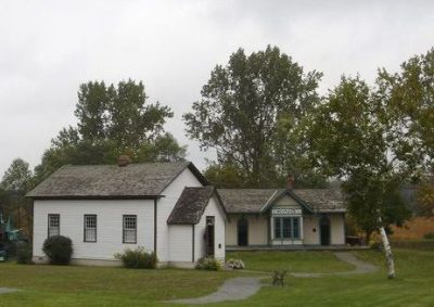 MuseumKing Township Museumin town
 Heritage railwaySouth Simcoe Railway4.6 km outside town, to the west
 MuseumElman W. Campbell Museum4 km outside town, to the northeastTheme parkTheme parkAlbion-Bolton Fairgrounds1.8 km outside town, to the southwestMuseumMuseumAurora Museum & Archives2.4 km outside town, to the northeast
Photos: each place’s Wikidata image, from Wikimedia Commons under the licence below (our copy, resized).
Photo credits (3)
- King Township Museum: Andrea Kollo, uploading as Kingtourism at en.wikipedia, Public domain, Wikimedia Commons
- South Simcoe Railway: Peter Broster, CC BY-SA 4.0, Wikimedia Commons
- Elman W. Campbell Museum: Mhsheikholeslami, CC BY-SA 4.0, Wikimedia Commons
Famous people from King
23 notable people were born in King.


Photo credits
Alex Pietrangelo: Johnmaxmena2, CC BY-SA 4.0 · Rosie MacLennan: Madchester at English Wikipedia, CC BY-SA 3.0 · Daniel Carcillo: David Kindler from Oak Park, United States, CC BY 2.0 · Nick Boynton: Hockeybroad, CC BY 3.0 · George Stewart Henry: Lyonde, L., Public domain · Brandon Burlon: TheAHL, CC BY 2.0
About King
Town in Ontario
King is a municipality in Ontario, read by TownRatings as Statistics Canada draws it: one census subdivision, so its figures cover the whole municipality.
Statistics Canada: population estimates 2025 (17-10-0155), Census of Population 2021, 2021 census boundaries.
- Population
- 29,077 (people, 2025 estimate)
- Province or territory
- Ontario
- Census division
- York
- Metro area
- Toronto
- Census subdivision
- 3519049
King’s neighbours
The nearest places of 1,000 or more. Statistics Canada
| Town | People | km | Overall | Cost | Safety | Health |
|---|---|---|---|---|---|---|
| King | 29,077 | — | B+ | C− | B+ | A− |
| Hope | 6,997 | 8.9 | A− | C− | B+ | A |
| Teston | 7,437 | 9.4 | A− | C | B+ | A |
| Peace Village | 14,598 | 9.8 | A− | D | B+ | A |
| Purpleville | 19,918 | 10 | A− | C | B+ | A |
| Aurora | 67,385 | 11 | A− | D | B+ | A− |
| Upper Thornhill Estates | 10,435 | 12 | A− | C | B+ | A |
People: Statistics Canada, Census 2021. Distances: centre to centre.
Questions about King
Is King growing?
Yes: the census counted 24,512 in 2016 and 27,333 in 2021, a rise of 11.5%, against 4.1% for the median of Canadian towns. The 2025 estimate is 29,077.
What kind of homes are in King?
87% of homes are single-detached houses, against 64% for the median of Canadian towns, and 3% are in apartment buildings of five storeys or more. A household averages 3 people; 16% are one person living alone.
How old are the people of King?
Its median age is 43.2, where Canadian towns sit at 45.2. Under-15s are 18% of residents; over-65s, 16%.
Sources: Statistics Canada, Census of Population 2021 · population estimates 2025 (17-10-0155) and 2021 census boundaries · Uniform Crime Reporting Survey 2023–25 (35-10-0026, 35-10-0183 to 35-10-0190) · CMHC rents as published by Statistics Canada (34-10-0133) · grades by TownRatings. Under the Statistics Canada Open Licence.
Adapted from Statistics Canada (Census of Population 2021, population estimates 2025, 2021 census boundaries) under the Statistics Canada Open Licence; this does not constitute an endorsement by Statistics Canada. Neighbourhood names in some cities © OpenStreetMap contributors (ODbL).