Guest, Sign inJoin
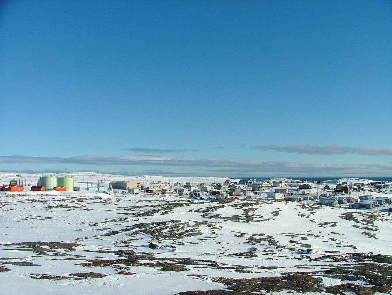
Repulse BayPhoto: https://www.flickr.com/people/naturallight/ Leslie Philipp · CC BY 2.0
Weather in Naujaat · ECCC forecast and 1991–2020 normals

Weather in Naujaat: -8 degrees tomorrow, warm for November

What counts as normal for Naujaat in November: highs come to −15°C and lows to −22°C. Tomorrow carries a chance of snow of 30% and a breeze of 30 km/h; the low is −10°C. Highs in the days that follow range from −19°C to −3°C, warmest on Monday.

Right now
−2°C
Light Snow
High −8°C · Low −10°C · Wind 14 km/h
Tomorrow 7°C warmer than a normal 14 November
Sunrise 08:33 · sunset 14:24
Observed at Naujaat, 18:00
Tomorrow
−8°C / −10°C
A normal 14 November: −15°C / −22°C
Chance of snow
30%
Possible in the next 24 hours
Wind
14 km/h
From the WSW · gusts 28 km/h · up to 30 km/h tomorrow
Wind chill
−7
what it feels like now
Daylight
5 h 55 min
08:31 to 14:27
Hour by hour · °C

The next 24 hours in Naujaat

Look for −2°C around 19:00 and −11°C around 17:00. Snow most likely around 19:00 (30%).

19:00 · −2°C · Periods of snow mixed with ice pellets · 30% chance of snow · wind 10 km/h30%−2°Now20:00 · −3°C · Periods of snow mixed with ice pellets · 30% chance of snow · wind 10 km/h21:00 · −3°C · Chance of snow. Risk of freezing drizzle · 30% chance of snow · wind 10 km/h−3°22:00 · −4°C · Chance of snow. Risk of freezing drizzle · 30% chance of snow · wind 10 km/h22:0023:00 · −4°C · Chance of snow. Risk of freezing drizzle · 30% chance of snow · wind 10 km/h−4°00:00 · −5°C · Chance of snow. Risk of freezing drizzle · 30% chance of snow · wind 20 km/h01:00 · −5°C · Chance of snow. Risk of freezing drizzle · 30% chance of snow · wind 20 km/h−5°01:0002:00 · −6°C · Chance of snow. Risk of freezing drizzle · 30% chance of snow · wind 20 km/h03:00 · −6°C · Chance of snow. Risk of freezing drizzle · 30% chance of snow · wind 30 km/h−6°04:00 · −6°C · Chance of snow. Risk of freezing drizzle · 30% chance of snow · wind 30 km/h04:0005:00 · −7°C · Chance of snow. Risk of freezing drizzle · 30% chance of snow · wind 30 km/h−7°06:00 · −7°C · Chance of snow. Risk of freezing drizzle · 30% chance of snow · wind 30 km/h07:00 · −7°C · Chance of snow. Risk of freezing drizzle · 30% chance of snow · wind 30 km/h−7°07:0008:00 · −8°C · Chance of snow. Risk of freezing drizzle · 30% chance of snow · wind 30 km/h09:00 · −8°C · Chance of snow. Risk of freezing drizzle · 30% chance of snow · wind 30 km/h−8°10:00 · −8°C · Chance of snow. Risk of freezing drizzle · 30% chance of snow · wind 30 km/h10:0011:00 · −9°C · Chance of snow. Risk of freezing drizzle · 30% chance of snow · wind 30 km/h−9°12:00 · −9°C · A mix of sun and cloud · 20% chance of snow · wind 30 km/h13:00 · −9°C · A mix of sun and cloud · 20% chance of snow · wind 30 km/h−9°13:0014:00 · −10°C · Partly cloudy · 20% chance of snow · wind 30 km/h15:00 · −10°C · Partly cloudy · 20% chance of snow · wind 20 km/h−10°16:00 · −10°C · Partly cloudy · 20% chance of snow · wind 20 km/h16:0017:00 · −11°C · Partly cloudy · 20% chance of snow · wind 20 km/h−11°18:00 · −11°C · Partly cloudy · 20% chance of snow · wind 20 km/h
TemperatureChance of snowNight
7 days · °C

The week ahead, against a normal week

A mix: some days above normal, some below. Tap a day for more.

Sat14 NovChance of snow30% chance−10°−8°+7°

Saturday: A mix of sun and cloud. 30 percent chance of snow in the morning with risk of freezing drizzle. Wind northwest 30 km/h gusting to 50. Temperature falling to minus 11 in the afternoon. Wind chill near minus 19.

Saturday night: Partly cloudy. Becoming cloudy near midnight then periods of light snow. Wind northwest 20 km/h becoming light in the evening. Temperature rising to minus 5 by morning. Wind chill minus 19 in the evening and minus 11 overnight.

Sun15 NovCloudy−7°−5°+10°

Sunday: Cloudy. High minus 5.

Sunday night: Periods of snow. Low minus 7.

Mon16 NovPeriods of snow−15°−3°+12°

Monday: Periods of snow. High minus 3.

Monday night: Cloudy periods. Low minus 15.

Tue17 NovA mix of sun and cloud−20°−14°+2°

Tuesday: A mix of sun and cloud. High minus 14.

Tuesday night: Cloudy periods. Low minus 20.

Wed18 NovA mix of sun and cloud−22°−19°−3°

Wednesday: A mix of sun and cloud. High minus 19.

Wednesday night: Cloudy periods. Low minus 22.

Thu19 NovA mix of sun and cloud−20°−4°

Thursday: A mix of sun and cloud. High minus 20.

Normal range for the date (ECCC 1991–2020 normals, Naujaat/Repulse Bay)Forecast low to high

What stands out about Naujaat’s weather

Where Naujaat’s 30-year normals sit among Canadian towns: tap a card for the Climate page.

Climate →
A normal year

Where today sits in Naujaat’s year

Typical highs and lows month by month, from the ECCC averages.

Full climate →
Winter
−25° / −32°
61 mm of rain and snow
Spring
−13° / −20°
67 mm of rain and snow
Summer
10° / 3°
105 mm of rain and snow, the wettest season
Autumn now
−5° / −11°
95 mm of rain and snow
Best months to be outside
No month has highs of 17°C or more with nights of 8°C or more: summers here are cool.

Warnings and more

ECCC issues Canada’s weather alerts; check its warnings page before travelling in bad weather.

Forecast, current conditions and alerts: Environment and Climate Change Canada’s city page for Naujaat, fetched 13 November, 18:19. Normals: ECCC 1991–2020, Naujaat/Repulse Bay. Data Source: Environment and Climate Change Canada · ECCC Data Services End-use Licence

Adapted from Statistics Canada (Census of Population 2021, population estimates 2025, 2021 census boundaries) under the Statistics Canada Open Licence; this does not constitute an endorsement by Statistics Canada. Neighbourhood names in some cities © OpenStreetMap contributors (ODbL).