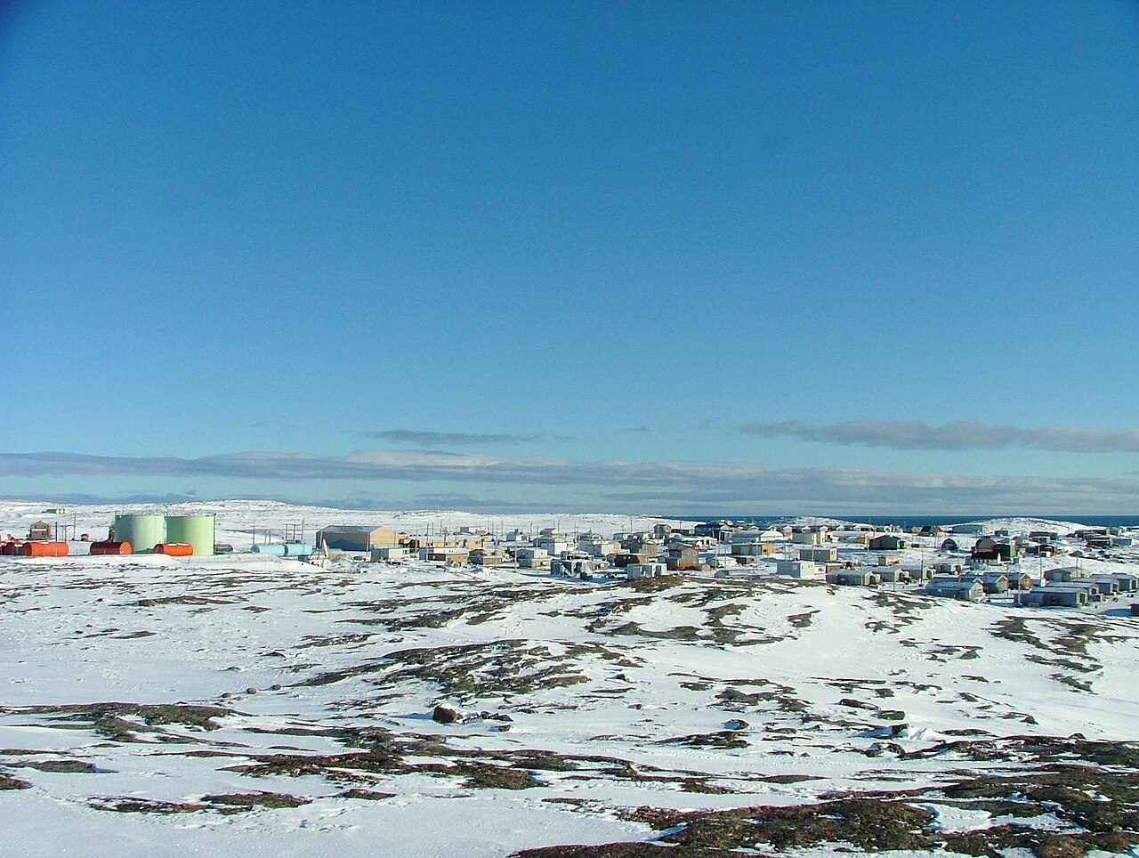
 Photo: https://www.flickr.com/people/naturallight/ Leslie Philipp · CC BY 2.0
Parks and protected land around Naujaat
Protected areas cover 0% of the land within 10 km; for the typical Canadian town it is 2.3%. 7 beaches are mapped within 5 km, none with a name. Ukkusiksalik National Park is the closest national park, 76 km from town.
Where Naujaat stands out outdoors
Each figure against Canadian towns of 2,500+; tap a tile for the detail.
Naujaat’s best card is its beaches. The gap is protected land nearby.
Naujaat beside other Canadian towns, figure by figure
Each figure against the 2,611 Canadian towns and neighbourhoods of 2,500+ (not city hubs or reserves), with the town marked and the typical one’s line. There is no Outdoors grade for Canadian towns; the figures stand beside the country’s towns of 2,500+ without a letter.
CPCAD 2.9.0 (ECCC, 2026), OpenStreetMap (November 2026). Distances from the town’s outline.
Naujaat has the least protected land nearby of 40 towns its size
The 40 Canadian towns nearest in population (1,385 to 2,587 residents), by the share of the land within 10 km that is protected. Hover for each one’s figures; click for its page.
Where Naujaat trails its peers is public protected areas; 33 of 39 have more.
Every town in the comparison
| Town | Protected within 10 km | In town | Areas | Routes | Beaches | |
|---|---|---|---|---|---|---|
| 1 | Anmore BC | 22% | 47% | 16 | 5 | 98 |
| 2 | Saint-Alexandre-de-Kamouraska QC | 19% | 0% | 28 | 0 | 0 |
| 3 | Gracefield QC | 19% | 19% | 34 | 0 | 6 |
| 4 | East Preston NS | 16% | 6.3% | 20 | 1 | 5 |
| 5 | Clearwater BC | 7.7% | 4.1% | 4 | 0 | 3 |
| 6 | Roberval QC | 6.1% | 1.2% | 22 | 0 | 0 |
| 7 | Saint-Louis-de-Gonzague QC | 5.8% | 0% | 20 | 0 | 0 |
| 8 | North Frontenac ON | 5.7% | 5.2% | 13 | 6 | 4 |
| 9 | Cap-Chat QC | 5.3% | 0.4% | 13 | 0 | 10 |
| 10 | Killaloe, Hagarty and Richards ON | 4.4% | 1.5% | 9 | 0 | 4 |
| 11 | Saint-Polycarpe QC | 4.2% | 0% | 11 | 0 | 2 |
| 12 | Macassa ON | 4.1% | 0% | 18 | 1 | 0 |
| 13 | Saint-Damien QC | 4% | 3.2% | 22 | 1 | 9 |
| 14 | Unity SK | 3.4% | 0% | 3 | 0 | 0 |
| 15 | Sherwood ON | 3.4% | 0% | 19 | 2 | 0 |
| 16 | McNab SK | 2.6% | 0% | 4 | 0 | 1 |
| 17 | Mandeville QC | 2.5% | 1.8% | 19 | 4 | 7 |
| 18 | Esterhazy SK | 1.8% | 0% | 5 | 0 | 0 |
| 19 | City Commercial Core ON | 1.8% | 0% | 20 | 0 | 0 |
| 20 | Caswell Hill SK | 1.4% | 0% | 16 | 0 | 3 |
| 21 | Fossambault-sur-le-Lac QC | 1.3% | 7.8% | 15 | 0 | 14 |
| 22 | Pembina MB | 1.1% | 1.8% | 10 | 0 | 0 |
| 23 | Burrows-Keewatin MB | 1% | 0% | 10 | 0 | 0 |
| 24 | Elmwood AB | 0.8% | 0% | 3 | 2 | 0 |
| 25 | Hatley QC | 0.7% | 0% | 9 | 0 | 5 |
| 26 | Munroe West MB | 0.4% | 0% | 10 | 0 | 0 |
| 27 | Brooke-Alvinston ON | 0.3% | 0.2% | 6 | 0 | 0 |
| 28 | Rosedale AB | 0.3% | 0% | 2 | 1 | 1 |
| 29 | Minchau AB | 0.3% | 0% | 2 | 0 | 3 |
| 30 | Lunenburg NS | 0.1% | 0% | 19 | 0 | 5 |
| 31 | Salisbury NB | 0.1% | 2.1% | 4 | 0 | 0 |
| 32 | Dufferin MB | 0.1% | 0% | 1 | 0 | 0 |
| 33 | Ekota AB | 0.1% | 0% | 1 | 0 | 4 |
| 34 | Satoo AB | 0.1% | 0% | 1 | 0 | 2 |
| 35 | Saint-Éphrem-de-Beauce QC | 0% | 0% | 1 | 0 | 1 |
| 36 | Magrath AB | 0% | 0% | 0 | 0 | 0 |
| 37 | Nanton AB | 0% | 0% | 0 | 0 | 0 |
| 38 | Rimbey AB | 0% | 0% | 0 | 0 | 0 |
| 39 | Sexsmith AB | 0% | 0% | 0 | 0 | 0 |
| 40 | Naujaat NU | 0% | 0% | 0 | 0 | 7 |
In Naujaat, parks are rarely a short walk away
Residents of each 2021 dissemination area, at a point inside it, within 400 m (about a 5-minute walk) of a park or playing field mapped on OpenStreetMap.
Around 1,400 residents are further than 400 m from a park. The usual figure for a Canadian town is 83%, above this.
No protected area lies within 10 km of Naujaat
Every protected and conserved area in CPCAD within 10 km of the town’s edge: parks, reserves, wildlife areas and conservation land.
Source: Canadian Protected and Conserved Areas Database (CPCAD) 2.9.0, Environment and Climate Change Canada. Contains information licensed under the Open Government Licence – Canada.
Ukkusiksalik National Park, 76 km off
National parks (Parks Canada) and provincial or territorial parks by direction and distance from the town’s edge: every one within 10 km, and the nearest of each within 100 km.
Ukkusiksalik National Park
Source: CPCAD 2.9.0 (ECCC): areas and outlines, distances outline to outline; directions from the town’s centre point.
No mapped walking route near Naujaat
Named walking and hiking routes on OpenStreetMap with at least 300 m within 2 km of the town, longest first; national routes lead.
No walking route is mapped within 2 km of the town. Mapping of trails as routes varies a great deal across Canada.
Source: OpenStreetMap (route relations hiking, foot and walking), © OpenStreetMap contributors, ODbL. Trans Canada Trail sections as OSM maps them.
The walking year in Naujaat
Daylight at the town’s latitude and ECCC’s 1991–2020 normals (Naujaat/Repulse Bay, 1.5 km away). Good months: long days, highs of 15–30 °C, light rain.
| Jan | Feb | Mar | Apr | May | Jun | Jul | Aug | Sep | Oct | Nov | Dec | |
|---|---|---|---|---|---|---|---|---|---|---|---|---|
| Daylight (h) | 4.1 | 7.9 | 11.4 | 15.3 | 19.4 | 24.0 | 21.5 | 16.9 | 13.0 | 9.2 | 5.4 | 2.3 |
| High (°C) | -28 | -28 | -22 | -13 | -3 | 6 | 14 | 11 | 3 | -4 | -15 | -21 |
| Rain & snow (mm) | 22 | 18 | 22 | 27 | 19 | 25 | 31 | 50 | 36 | 32 | 28 | 21 |
Summer highs reach 14 °C in July; in January they stay near -28 °C. Rain and snow peak in August (50 mm) and ease in February (18 mm). Some 230 cm of snow falls each winter. The climate in Naujaat →
7 unnamed beaches near Naujaat
Beaches on OpenStreetMap within 5 km of the town’s edge, nearest first, with directions.
The coast is close: 359 km of shoreline within 5 km. No national or provincial register of beach water quality is published as open data, so check the local health unit before swimming.
Source: OpenStreetMap (natural=beach), © OpenStreetMap contributors, ODbL.
2 things to do outdoors near Naujaat
Viewpoints, peaks, waterfalls, picnic sites, nature reserves, playgrounds, dog parks, campsites and boat launches mapped within 2 km of the town.
Every named place, with directions
Hills and peaks 2
Source: OpenStreetMap (tourism, natural, waterway and leisure tags), © OpenStreetMap contributors, ODbL.
What this data can and can’t tell you
- Beaches. Beaches are OpenStreetMap’s, named or not; in the north many are unnamed shoreline imports.
- Protected land. CPCAD maps each protected area; the page counts how much of the 10 km around the town they cover, lakes and sea included.
- Walking routes. A route counts when 300 m or more of it lies within 2 km of the town. Coverage of trails on OpenStreetMap varies by region.
- Private land. Areas held by land trusts or private owners stay unnamed here, though they count in the shares.
- National and provincial parks. The nearest national park and the nearest provincial park are always shown when they are within 100 km.
Questions about the outdoors in Naujaat
How far is Naujaat from a national park?
It is Ukkusiksalik National Park, 76 km off.
Where can you swim near Naujaat?
The beaches mapped within 5 km have no names on the map.
Where Naujaat’s outdoors figures come from
Protected areas: Canadian Protected and Conserved Areas Database (CPCAD) 2.9.0, Environment and Climate Change Canada, 2026: every area within 10 km and the nearest national and provincial parks, measured outline to outline.
Walking routes and beaches: OpenStreetMap, November 2026: named hiking, foot and walking route relations within 2 km and beaches within 5 km.
Towns: Statistics Canada 2021 Census boundaries and populations; the comparison is the Canadian towns and neighbourhoods of 2,500+, not city hubs or reserves.
When to go: Environment and Climate Change Canada, Canadian Climate Normals 1991–2020, from the nearest station that publishes them.
Green space, paths, woods, things to do: OpenStreetMap (Geofabrik’s Canada extract), November 2026: parks, gardens, playing fields, woods, footpaths, the coastline and things to do in and around each town.
Residents: Statistics Canada 2021 Census dissemination areas (population, boundaries), each at a point inside it.
Walking routes and beaches © OpenStreetMap contributors, available under the Open Database Licence (ODbL).
Not on this page: trailheads and trail grades, and beach water quality. No open Canadian dataset gives these for every town yet.
Adapted from Statistics Canada (Census of Population 2021, population estimates 2025, 2021 census boundaries) under the Statistics Canada Open Licence; this does not constitute an endorsement by Statistics Canada. Neighbourhood names in some cities © OpenStreetMap contributors (ODbL).