


 Top
National Historic Site · 1793–1794York RedoubtShore Road and Purcell's Cove RoadPhoto: Saffron Blaze · CC BY-SA 3.0 · Commons file
 Fire Command Post · Photo: Properpostman · CC BY-SA 4.0
11historic places on the registers
History of Harrietsfield · Canada’s heritage registers
History in Harrietsfield goes back to 1758: Lighttower
Inside Harrietsfield the registers count 11 historic places; 4 are top designations. Scaled to its population the record is long: 16 per 10,000 residents, more than 99% of Canadian towns. Designations here include 7 Recognized Federal Heritage Buildings. Just beyond the boundary, the registers place one more.
Historic places
11
16 per 10,000 residents
Highest designations
4
National Historic Sites and Classified Federal Heritage Buildings
Other federal designations
7
Recognized buildings, railway stations, lighthouses
Oldest building
1758
the first construction date on its record
Homes built before 1961
16%
typical town: 18%
In pictures
All 4 of Harrietsfield’s highest-designated places, photographed
Up first are Fire Command Post and Battery. 9 of the places on Harrietsfield’s heritage registers are pictured here; the others keep their register record. 4 photographers took them.
Photos from Wikimedia Commons, each credited to its photographer with its licence; names open the place’s page. Tap a photo to step through them full screen.
How old
Harrietsfield’s dated places lean to the decades after Confederation
Each place by the first construction date on its record.
New France before 17601
British North America 1760–18661
After Confederation 1867–19135
Wars and Depression 1914–19453
Since 1946 1946 on0
2 of the 10 dated places were built before Confederation.
The map
Where Harrietsfield’s history is
Every place on the registers inside the town, by its designation.
Highest designationsOther federal designations400 m from Battery
3 of 4within 400 m of Battery, the heart of the town’s history
Each dot is a place: point at it for the name, tap it for its page.
The 11, by tier
4 Highest designations7 Other federal designations
Parks Canada’s Directory of Federal Heritage Designations lists the places the Government of Canada has recognized; outside Québec, provincial and municipal listings come only through Wikidata, and only those with an encyclopedia article get a page.
Points from Wikidata (Parks Canada’s files carry none) and from Québec’s register, as mapped there.
Highest designations
4 places in Harrietsfield with the highest designation
Lighttower is the earliest, from 1758; the latest dates from 1942. By designation: 3 Classified Federal Heritage Buildings and a National Historic Site. National Historic Sites and Classified Federal Heritage Buildings, Canada’s highest federal recognition. Each one opens its own page.
 Top
Classified Federal Heritage Building · 1758–1761LighttowerPhoto: Letterofmarque · CC BY-SA 3.0 · Commons file
 Top
Classified Federal Heritage Building · 1942–1944BatteryShore Road and Purcell's Cove RoadPhoto: Properpostman · CC BY-SA 4.0 · Commons file
 Top
Classified Federal Heritage Building · 1942–1944Fire Command PostPhoto: Properpostman · CC BY-SA 4.0 · Commons file
Other federal designations
Federal heritage in Harrietsfield: 7 more places
Recognized Federal Heritage Buildings, heritage railway stations and lighthouses. “Main Magazine, Building 611” is the earliest, from 1869; the latest dates from 1940. Each one opens its own page.
 Fed
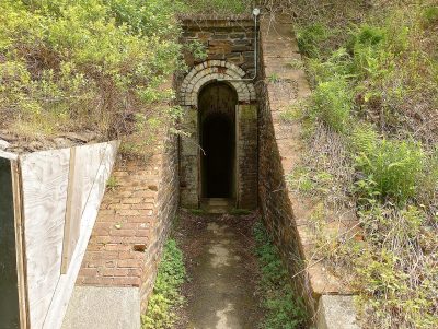
Recognized Federal Heritage Building · 1869–1871Main Magazine, Building 611Photo: Properpostman · CC BY-SA 4.0 · Commons file
 Fed
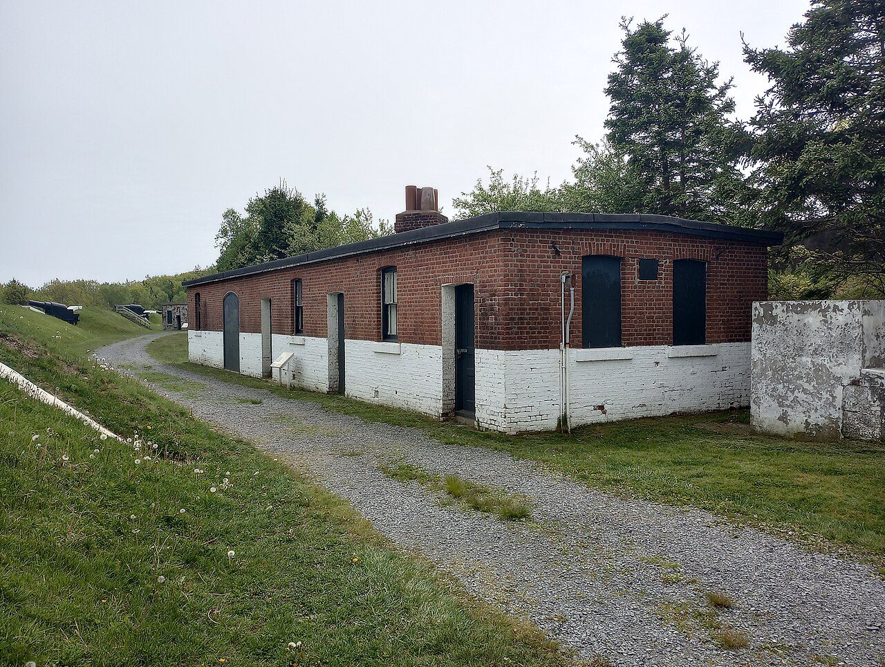
Recognized Federal Heritage Building · 1873–1874Cookhouse, Building 626Photo: Properpostman · CC BY-SA 4.0 · Commons file
 Fed
Recognized Federal Heritage Building · 1890–1905Range Finder BunkerPhoto: Properpostman · CC BY-SA 4.0 · Commons file
 Fed
Recognized Federal Heritage Building · 1940–1942Searchlights 690, 691, 692Photo: Dennis G. Jarvis · CC BY-SA 2.0 · Commons file
 Fed
Recognized Federal Heritage BuildingSouth CaponierPhoto: Properpostman · CC BY-SA 4.0 · Commons file
Recognized Federal Heritage Building · 1870–1874Former Artillery Stores, Building 629
Recognized Federal Heritage Building · 1890–1915Command PostSpion Kop
What’s designated
Harrietsfield’s record leans to forts and military buildings: 55%
2 places make mills, shops and works the second group. The top of the list holds York Redoubt and Lighttower. Its places fall into 4 kinds.
Forts and military buildings6
Mills, shops and works2
Stations, lighthouses and bridges1
Other places2
Each place sits in one group, from its name first, then the uses its register lists.
When designated
Harrietsfield’s list was mostly made in 1996
The places by the year of their designation.
1996 · 10
1960198020002020
The first was York Redoubt, in 1965. 10 came in 1996. Nothing has been added since 2011.
Just outside
Just outside Harrietsfield
Places the registers give to the town from within 5 km of its edge, nearest first.
Just outside Harrietsfield: 1
| Gas HouseRecognized Federal Heritage Building · 600 m outside the town |
Homes by age
Most of Harrietsfield’s homes went up from 1981 to 2000: 34%
New building is strong in Harrietsfield: 5.6% of homes date from 2016–21, where most towns have 4.1%. 16% of Harrietsfield’s homes predate 1961, close to the typical town’s 18%. Over half of the homes in Harrietsfield were already standing by 2001.
16%
Before 1961
28%
1961–80
34%
1981–2000
15%
2001–15
5.6%
2016–21
HarrietsfieldTypical town
2021 Census, private dwellings by period of construction (Statistics Canada); the typical town is the middle Canadian town of 2,500 or more.
Towns its size
Harrietsfield has the most of 16 towns its size
Towns of 6,800 to 6,800 residents, by places on the registers.
Harrietsfield11
The typical town its size has 0. 11 of them have none.
Neighbours
Harrietsfield and its neighbours
| Town | People | Places | Highest | Oldest |
|---|---|---|---|---|
| Harrietsfield | 6,786 | 11 | 4 | 1758 |
| Hatchet Lake | 9,930 | 2 | 1 | 1894 |
| South End | 22,012 | 5 | 4 | 1796 |
| Westmount | 23,207 | 1 | 0 | 1917 |
| Schmidtville | 18,105 | 53 | 23 | 1749 |
| Mount Royale | 9,340 | 0 | 0 | — |
| North End | 19,733 | 14 | 7 | 1756 |
In brief
Harrietsfield in brief
Inside Harrietsfield there are 11 historic places, 4 with the highest designation, led by York Redoubt. Of the 16 towns closest in size, it has the most historic places. The densest spot is around Battery: 3 of its places of the highest designation within 400 m. Most of the places, 55%, are forts and military buildings.
Of the 10 with a date, 5 come from the decades after Confederation. Its housing is young: only 16% predates 1961, against 18% in the typical town. Of 11 designations, 10 came in 1996.
How to read these numbers
What this data can and can’t tell you
- The federal register. Every federal designation is in Parks Canada’s directory, and the Canadian Register of Historic Places gives most of them a bilingual statement of significance.
- Protection. A National Historic Site designation recognises significance; it doesn’t by itself protect a building the federal government doesn’t own. Legal protection comes from provincial and municipal designations, whose own registers aren’t open data outside Québec.
- Provincial and municipal lists. Provincial and municipal listings here come from Wikidata alone, since the provinces’ own registers can’t be reused; a listing needs an encyclopedia article to get a page.
- The grade. History isn’t one of Canada’s graded pillars, so this page describes and compares without a letter.
- People and events. Parks Canada’s open file gives its national historic persons no place. A town’s page names one only when the person was born there (matched by name and both life years) or one of its own historic places carries the name and its record speaks of them; national historic events stay off.
- Map points. Where a federal place sits on the map is Wikidata’s placing; the directory itself has no coordinates.
- The tiers. National Historic Sites and the most protected buildings form the top tier; recognized federal buildings, stations and lighthouses the second; provincial and municipal listings the third.
Questions about Harrietsfield’s history
What is the oldest building in Harrietsfield?
Lighttower, a Classified Federal Heritage Building, begun in 1758.
Which places in Harrietsfield have the highest designation?
They are York Redoubt, Lighttower, Battery and Fire Command Post.
Why might a heritage building in Harrietsfield be missing here?
Provincial and municipal registers outside Québec aren’t open data. Wikidata knows 2 more listings in Harrietsfield, but without an open description or an encyclopedia article they get no page.
How old are the homes in Harrietsfield?
Before 1961: 16% of its homes; the typical town has 18%.
Contains information licensed under the Open Government Licence – Canada (Parks Canada).
Sources: Parks Canada, Directory of Federal Heritage Designations · Canadian Register of Historic Places (federal extract) · Wikidata (CC0) for map points, other names and articles · Statistics Canada, 2021 Census (homes by period of construction). Under the Statistics Canada Open Licence.
Adapted from Statistics Canada (Census of Population 2021, population estimates 2025, 2021 census boundaries) under the Statistics Canada Open Licence; this does not constitute an endorsement by Statistics Canada. Neighbourhood names in some cities © OpenStreetMap contributors (ODbL).