 Top
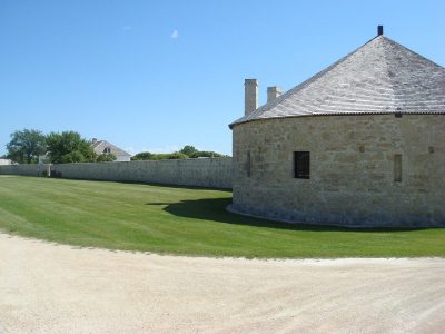
National Historic Site · 1830–1851Lower Fort GarryHighway 9Photo: Vintotal · Public domain · Commons file
 St. Andrew's Anglican Church · Photo: Shahnoor Habib Munmun · CC BY 3.0
7historic places on the registers
History of St. Andrews · Canada’s heritage registers
St. Andrews: 7 historic places, 6 with the highest designation
Among the places are a Recognized Federal Heritage Building. Few towns have as much for their size as St. Andrews: 5.8 for every 10,000 residents, more than 95% of Canadian towns. Go back to 1830 and you reach Lower Fort Garry, the oldest of them. 4 more places on provincial or local lists are counted from Wikidata without pages.
Historic places
7
5.8 per 10,000 residents
Highest designations
6
National Historic Sites and Classified Federal Heritage Buildings
Other federal designations
1
Recognized buildings, railway stations, lighthouses
Oldest building
1830
the first construction date on its record
Homes built before 1961
15%
typical town: 18%
In pictures
St. Andrews’s landmarks in 6 photos, with 1 old views
To start: St. Andrew's Anglican Church, and St. Andrews Caméré Curtain Bridge Dam. 6 of the places on St. Andrews’s heritage registers are pictured here; the others keep their register record. They come from 3 photographers.
 St. Andrews Caméré Curtain Bridge Dam
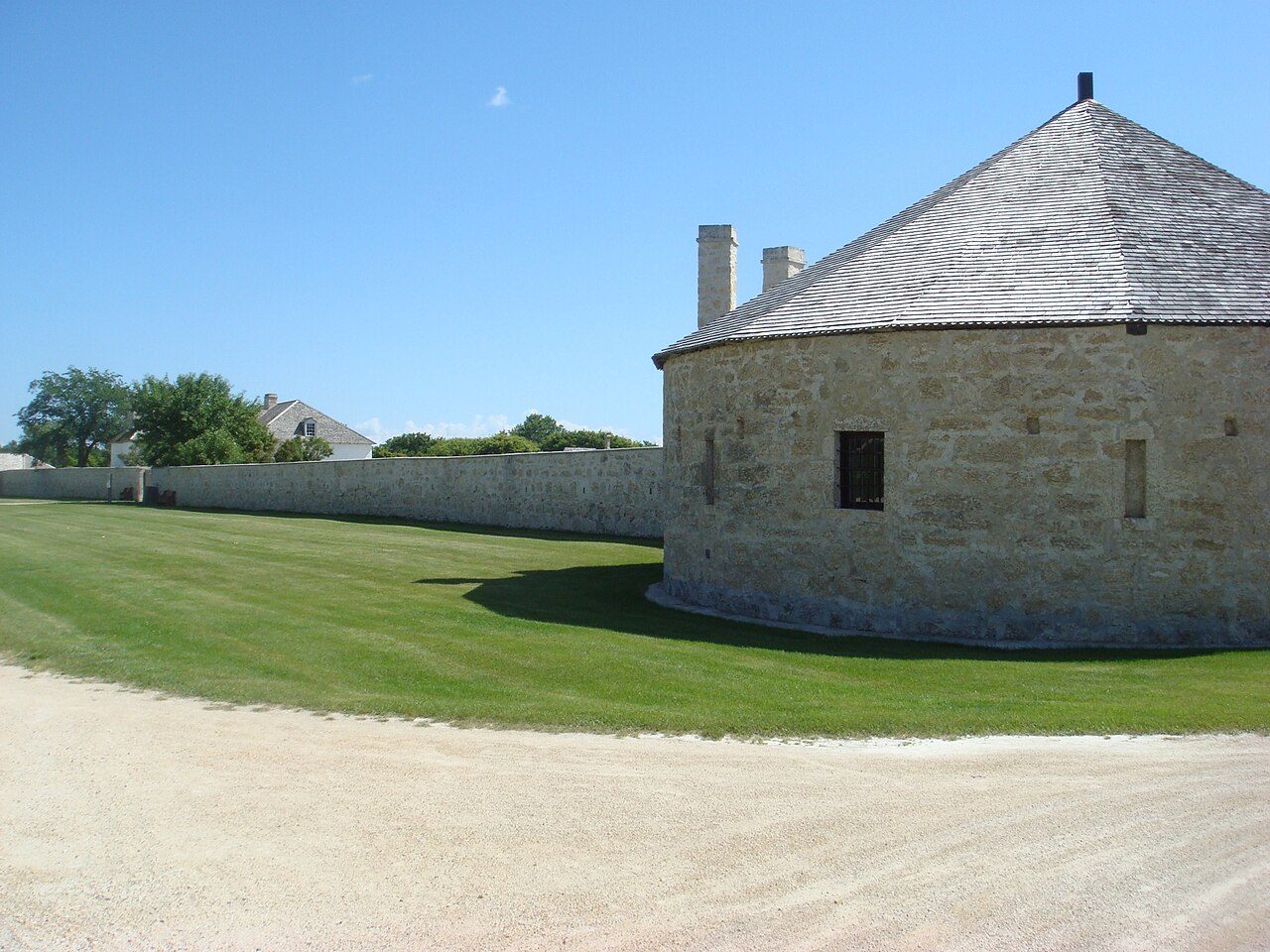 Lower Fort Garry
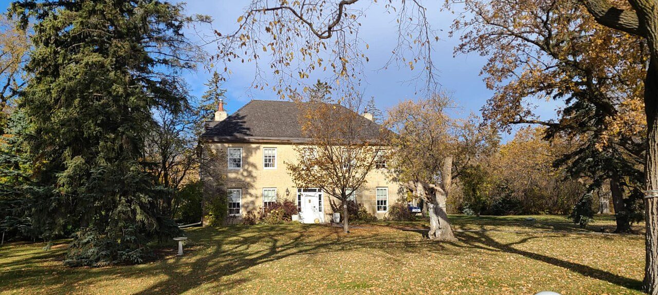 Miss Davis' School Residence / Twin Oaks
 St. Boniface Hospital Nurses' Residence
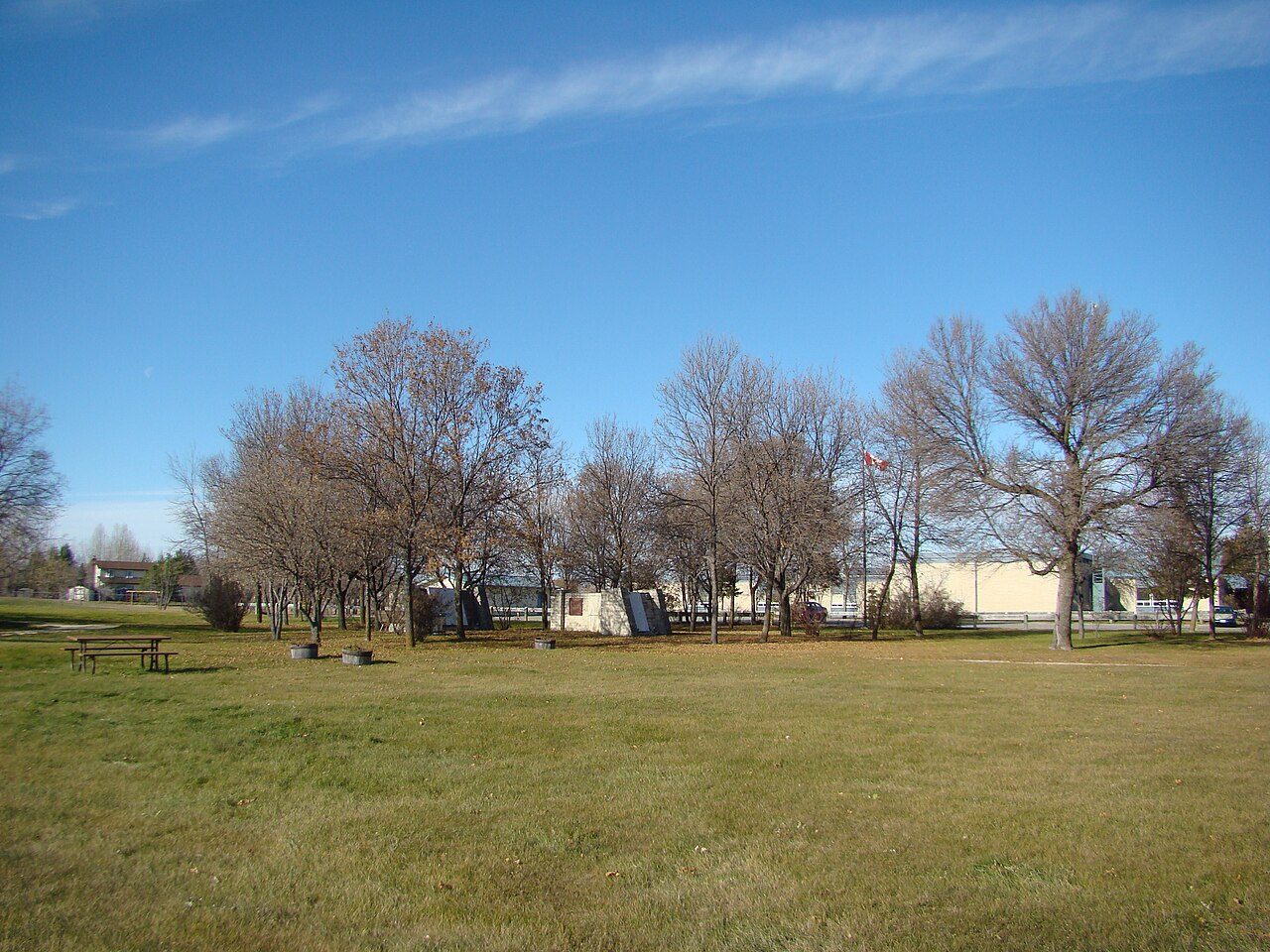 St. Andrew's Rectory+1See all photos
Photos from Wikimedia Commons, each credited to its photographer with its licence; names open the place’s page. Tap a photo to step through them full screen.
Through time
St. Andrews before 1950
A single old picture: the oldest view of one of its historic places. Tap the picture to enlarge it.
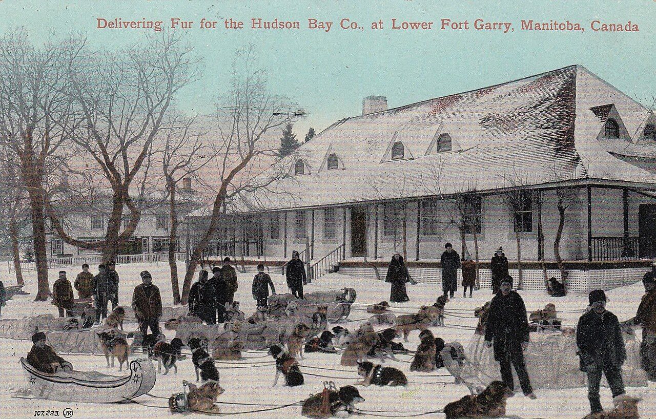 1913
Public domain or CC0, made before 1950, from Wikimedia Commons; old views of places can be drawings, prints or maps of their time. Each credit opens the image’s page.
The map
Where St. Andrews’s history is
Every place on the registers inside the town, by its designation.
Highest designations
Each dot is a place: point at it for the name, tap it for its page.
The 7, by tier
6 Highest designations1 Other federal designations
What the map shows is the open record: the federal directory in full, and from provincial or municipal lists only the places Wikidata ties to an encyclopedia article.
Points from Wikidata (Parks Canada’s files carry none) and from Québec’s register, as mapped there. One place, placed by its register’s municipality, has no point and isn’t on the map.
Highest designations
6 places in St. Andrews with the highest designation
Their dates run from 1830, with Lower Fort Garry, to 1927. National Historic Sites and Classified Federal Heritage Buildings, Canada’s highest federal recognition. The first was designated in 1950, the latest in 1998. Each one opens its own page.
 Top
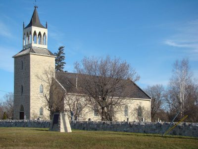
National Historic Site · 1845–1850St. Andrew's Anglican Church374 River RoadPhoto: Shahnoor Habib Munmun · CC BY 3.0 · Commons file
 Top
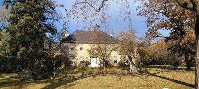
National Historic Site · 1850–1860Miss Davis' School Residence / Twin OaksRiver Road, Lot 51Photo: Silver Dovelet · CC BY-SA 3.0 · Commons file
 Top
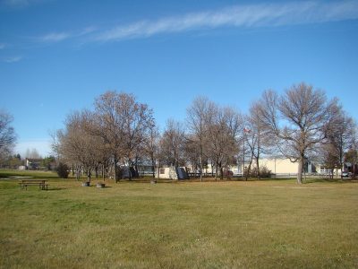
National Historic Site · 1852–1855St. Andrew's Rectory374 River Road and St. Andrew's RoadPhoto: Shahnoor Habib Munmun · CC BY 3.0 · Commons file
 Top
National Historic Site · 1907–1911St. Andrews Caméré Curtain Bridge Dam625 River RoadPhoto: Shahnoor Habib Munmun · CC BY 3.0 · Commons file
 Top
National Historic Site · 1927–1929St. Boniface Hospital Nurses' Residence431 Taché AvenuePhoto: Silver Dovelet · CC BY-SA 3.0 · Commons file
Other federal designations
One more federal designation in St. Andrews
Recognized Federal Heritage Buildings, heritage railway stations and lighthouses. Each one opens its own page.
Recognized Federal Heritage Building · 1976–1979Visitor Reception Centre, Lower Fort Garry NHS5925 Highway 9
What’s designated
Forts and military buildings and public buildings share the lead in St. Andrews, 2 each
Leading by designation: Lower Fort Garry and St. Andrew's Anglican Church. The list spans 4 kinds of place.
Forts and military buildings2
Public buildings2
Churches and religious buildings2
Stations, lighthouses and bridges1
Kinds read from each place’s name and the functions its register gives; a building keeps the kind it was built as.
How old
Most of St. Andrews’s dated places come from the years before Confederation
Each place by the first construction date on its record.
British North America 1760–18664
After Confederation 1867–19131
Wars and Depression 1914–19451
Since 1946 1946 on1
4 of the 7 dated places are older than Confederation.
Homes by age
Most of St. Andrews’s homes went up from 1961 to 1980: 34%
Homes built from 1981 to 2000 make up 30% of St. Andrews’s, against 23% in the typical town. Like the typical town (18%), St. Andrews has 15% of its homes from before 1961. From 2016 on, St. Andrews built 3.3% of its homes, near the typical 4.1%.
15%
Before 1961
34%
1961–80
30%
1981–2000
18%
2001–15
3.3%
2016–21
St. AndrewsTypical town
2021 Census, private dwellings by period of construction (Statistics Canada); the typical town is the middle Canadian town of 2,500 or more.
Towns its size
St. Andrews has the most of 16 towns its size
Towns of 11,900 to 12,100 residents, by places on the registers.
St. Andrews7
The middle one has 0. 10 of them have nothing on the registers.
Neighbours
St. Andrews and its neighbours
| Town | People | Places | Highest | Oldest |
|---|---|---|---|---|
| St. Andrews | 12,021 | 7 | 6 | 1830 |
| Selkirk | 11,570 | 6 | 2 | 1830 |
| St. Clements | 12,029 | 1 | 1 | 1962 |
| Stony Mountain | 9,180 | 1 | 0 | 1931 |
| West St. Paul | 10,796 | 0 | 0 | — |
In brief
St. Andrews in brief
Canada’s heritage lists give St. Andrews 7 historic places, 6 with the highest designation. No town its size has more historic places: it leads the 16 nearest in population. By date, the years before Confederation lead: 4 of 7. Most of its homes are post-1960: only 15% came earlier, against 18% in the typical town. The other figures are unremarkable: people of its past such as John Norquay (1841) and Jacob Anderson (1875); and its places were designated between 1950 and 2020.
How to read these numbers
What this data can and can’t tell you
- People and events. Parks Canada’s open file gives its national historic persons no place. A town’s page names one only when the person was born there (matched by name and both life years) or one of its own historic places carries the name and its record speaks of them; national historic events stay off.
- Protection. Being on these registers doesn’t mean a building can’t change. Federal designation commemorates; protection is provincial or municipal, and those lists aren’t open here.
- The grade. History is described, not graded, for every Canadian town.
- Map points. Pins for federal places come from Wikidata rather than Parks Canada, which gives no points.
- Provincial and municipal lists. Provincial and municipal listings here come from Wikidata alone, since the provinces’ own registers can’t be reused; a listing needs an encyclopedia article to get a page.
- The tiers. Three tiers: the top for National Historic Sites, classified federal buildings and Québec’s classements, a second for the other federal designations, a third for provincial and municipal listings.
- The federal register. Every federal designation is in Parks Canada’s directory, and the Canadian Register of Historic Places gives most of them a bilingual statement of significance.
Questions about St. Andrews’s history
Which places in St. Andrews have the highest designation?
They are Lower Fort Garry, St. Andrew's Anglican Church, Miss Davis' School Residence / Twin Oaks, St. Andrew's Rectory, St. Andrews Caméré Curtain Bridge Dam and St. Boniface Hospital Nurses' Residence.
What is the oldest building in St. Andrews?
Lower Fort Garry, a National Historic Site, begun in 1830.
Why might a heritage building in St. Andrews be missing here?
Only federal designations are fully open outside Québec. 4 more listings in St. Andrews are known through Wikidata alone, so they are counted, not paged.
How old are the homes in St. Andrews?
The 2021 Census dates 15% of its homes before 1961 (18% in the typical town).
Contains information licensed under the Open Government Licence – Canada (Parks Canada).
Sources: Parks Canada, Directory of Federal Heritage Designations · Canadian Register of Historic Places (federal extract) · Wikidata (CC0) for map points, other names and articles · Statistics Canada, 2021 Census (homes by period of construction). Under the Statistics Canada Open Licence.
Adapted from Statistics Canada (Census of Population 2021, population estimates 2025, 2021 census boundaries) under the Statistics Canada Open Licence; this does not constitute an endorsement by Statistics Canada. Neighbourhood names in some cities © OpenStreetMap contributors (ODbL).