Valley FordCA
A town in California.
Is Valley Ford a good place to live?
Valley Ford’s typical July afternoon high is 73°F, below both California’s towns (89°F) and U.S. towns (85°F). 31% of the land in Valley Ford is conserved, against 4.3% in California’s towns and 4.3% across U.S. towns. The biggest park or preserve is Greater Farallones National Marine Sanctuary, at 32 acres. We don’t grade Valley Ford yet; the figures below are still real.
Fort Ross and 39 more within 40 miles
Museums, parks, gardens and other places to visit around Valley Ford. Close and well known come first.
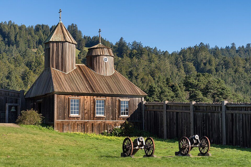 22 mi Ancient siteFort Ross
 34 mi National MonumentMuir Woods National Monument757K visitors a year
 7 mi National SeashorePoint Reyes National Seashore2.4M visitors a year
 6 mi Ancient siteBodega Bay
 33 mi MountainMount Tamalpais
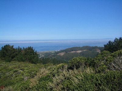 7 mi National Recreation AreaGolden Gate National Recreation Area15.7M visitors a year
Photo credits
Fort Ross: Frank Schulenburg, CC BY-SA 4.0 · Muir Woods National Monument: Unknown, CC BY-SA 3.0 · Point Reyes National Seashore: King of Hearts, CC BY-SA 4.0 · Bodega Bay: Pixistik1687, Public domain · Mount Tamalpais: Originally uploaded by Nelso (Transferred by DimiTalen), CC BY-SA 3.0 · Golden Gate National Recreation Area: Unknown, CC BY-SA 3.0


Moving to Valley Ford: who provides what
Valley Ford is unincorporated, so Sonoma County and regional agencies provide most services.
EPA SDWIS (Oct 9, 2026) · HIFLD + EIA-861 2025 · Census 2020 ZCTAs · NCES 2024–25 · registration: vote.gov, updated Nov 18, 2024.
The data
Ordered by what stands out in Valley Ford.
Natural hazards: very high risk in Valley Ford, mostly inland flooding
Compared with 91% of U.S. communities, expected storm and flood damage in Valley Ford is higher. Two fifths of the town’s expected losses from natural hazards come from inland flooding, followed by earthquakes at 36%. Federal disaster aid has reached households in Valley Ford after 2 declared disasters, most recently in 2017.
FEMA disaster declarations and aid · FEMA National Risk Index · OpenFEMA
Open space protected for good: nearly a third of Valley Ford
In 1 park or preserve, walkers have 0.8 miles of trail. The concentration of trails for Valley Ford comes to 0.3 miles per square mile.
| Biggest places to walk | Trails | Acres |
|---|---|---|
| 1. Greater Farallones National Marine Sanctuary | — | 32 |
Trails & parks © OpenStreetMap contributors · Conserved land: USGS PAD-US
Typical low → high °F
NOAA U.S. Climate Normals, 1991–2020
Valley Ford has 1.2 jobs for every working resident, and 66 people commute in
Since 2013, Valley Ford has added 27 jobs, to 66 in 2023. Half of commuters travel less than 17 miles. The top destinations are Santa Rosa (14%), Sebastopol (11%) and San Francisco (9%).
Where working residents work
Census LEHD 2023 · ACS
How healthy Valley Ford is
The share of adults in Valley Ford who have been diagnosed with depression: 24%. 16% of adults in Valley Ford get no exercise outside work; 8.4% have diabetes.
| Valley Ford | California towns | U.S. towns | |
|---|---|---|---|
| Feel lonely (CDC PLACES) | 30% | 36% | 33% |
| Get no exercise (CDC PLACES) | 16% | 24% | 25% |
| Diabetes (CDC PLACES) | 8.4% | 12% | 12% |
| Obesity (CDC PLACES) | 26% | 29% | 35% |
| What stands out | Valley Ford | CA |
|---|---|---|
| Fewer older adults who have lost all their teeth | 5% | 10.6% |
| Fewer adults facing food insecurity | 9.5% | 17.9% |
| More adults who have had cancer | 8.5% | 6.4% |
CDC PLACES 2025 · modeled estimates for adults · CMS · HRSA
Zillow Home Value Index · Redfin Data Center
Everything we know about Valley Ford
Colleges nearby
2 within 15 miles of the center of Valley Ford
About Valley Ford
Unincorporated community in California, United States
Valley Ford is an unincorporated community and census-designated place (CDP) in western Sonoma County, California, United States. As of the 2020 census, Valley Ford had a population of 148. It is located on State Route 1 north of San Francisco. Like all of Sonoma County, Valley Ford is included in both the San Francisco Bay Area and the Redwood Empire. The village lies just north of Americano Creek, approximately 5 mi (8 km) from the Pacific Ocean. It is 7 mi (11 km) north of Dillon Beach, 9 mi (14 km) east of the town of Bodega Bay and 20 mi (32 km) southeast of Jenner. The Estero Americano is protected by the Estero Americano State Marine Recreational Management Area.
From Wikipedia, licensed CC BY-SA 4.0 · facts via Wikidata (CC0)
- Area
- 2.6 sq mi
- Elevation
- 52 ft
- ZIP code
- 94972
Questions about Valley Ford
Short answers, built from the data on this page.
Is Valley Ford, CA a good place to live?
We don’t grade Valley Ford yet; the figures below are still real. A town in California.