Tustin was first counted by the census in 1880, and 4 of its places are on the National Register
More historic than 36% of U.S. towns · #276 of 847 in California. What drives it
Most of Tustin was built recently: 2% of its homes predate 1940 and the median home dates from 1983. Below: 5 old photos and papers, maps from 1895 on, and the census since 1880.
On its age, its old homes and the National Register, Tustin is more historic than 36% of U.S. towns, #276 of 847 in California. Its National Register listings hold the grade up; its share of homes from before 1940 pulls it down.
C+
HistoryA character grade: shown, never part of Tustin’s overall grade.
Few California towns list much on the Register (a typical California town has 0.0 per 10,000 residents, the U.S. 2.4), so Tustin’s 0.5 sits above most of its state (70% of California towns have fewer) while its 4 listings outnumber those of 68% of U.S. towns.
How sure. Graded on any two of the three inputs instead, the letter would range from C− to B−. The pre-1940 share (±0.6 points) is firm at this size.
Founding year: the first census (other dates in Quick answers). Homes: Census ACS 2020–24. National Register: National Park Service, May 2026 list; each listing counted once (boundary changes and added documentation belong to their listing), and a historic district counts its contributing buildings. How TownRatings grades history →
What stands out about Tustin’s past
Read from the archive, the National Register and the record. The page puts what stands out first.
Lost post offices, old corners and places now gone
Tustin’s post office has been open since 1894. Another post office, Tustin City, opened and closed inside today’s town.
Tustin City
1872–1894
Tustin
1894–today
18701950today
Hamlets and corners on the map
AlisoBrowningMontesilla Mobile Home ClubParque Santiago Mobile Home ParkRail-A-Way Trailer ParkSaddleback Mobile LodgeTustin Village Mobile Home ClubVilla Valencia
Gone or out of use
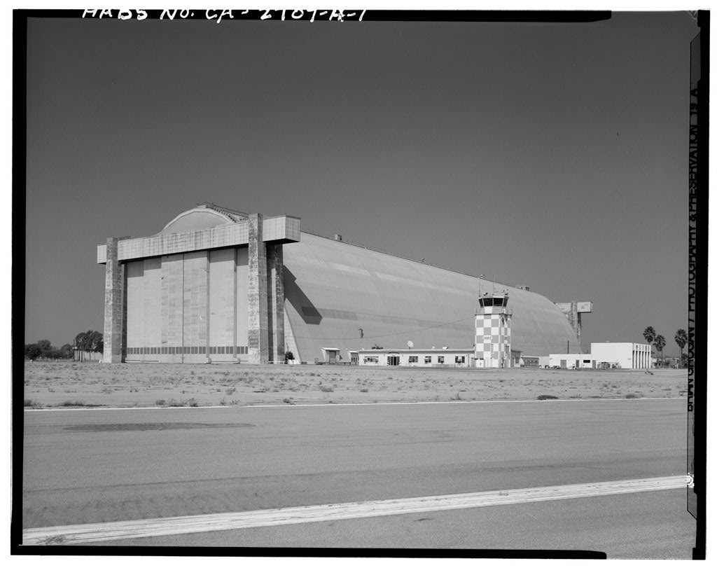
Marine Corps Air Station TustinmilitaryNaval Air Station Santa Anamilitary
US Post Offices dataset (Blevins & Helbock, CC0). Places and cemeteries from the USGS Geographic Names Information System (2021).
On the map
Tustin on the map, 1896 to 1981
Every edition of the U.S. Geological Survey’s map of Tustin. Tap a year, or press play to watch the town change.
1896Santa Ana sheet · 1:62,500
U.S. Geological Survey historical topographic maps (public domain), via Esri’s collection of the scans. The red ring marks the center of Tustin.
On the National Register
4 historic places in Tustin
The country’s official list of buildings and places worth saving.
Presently known as Red Hill, it was previously called the Katuktu hill by the indigenous while the Spanish also came up with the name "Cerrito de las ranas" which translates to little hill of frogs due to the quantity of frogs inhabiting the area.
On November 1, 1776, Mission San Juan Capistrano became the area's first permanent European settlement in Alta California, New Spain.
Passages that mention Tustin, cut from the printed page as they were published.
History of Orange County, California1921 · page 203Read the page →
Read the text
Spurgeon in honor of the old Spanish grant. When he located here there were but few trees in the entire valley and the country was covered with wild mustard so high that he could not look over it from horseback, and in order to view the valley that contained his purchase he climbed one of the sycamore trees. The town of Tustin had just been started and the Los Angeles and San Diego stage road lay through the town and about three miles from Mr. Spurgeon's land. In order to get the stage to come through his purchase and to get a post office established he cut a road through the mustard at his own expense. He then built a small building of redwood on what
Text read by machine from the scan; it may contain errors.
History of Orange County, California1921 · page 630Read the page →
Read the text
Ray attended the public schools at Tustin and put in a couple of years at the Santa Ana high school. Then he engaged in the nursery business at Tustin until he came to his present place on the Irvine ranch, in 1913, having secured an optional lease on 160 acres and immediately began the work of developing water, which he found he could have in abundance by sinking two wells 300 feet deep. He began with one well, and now both are pumped by two engines of twenty-five horsepower each, giving him over 100 inches of water which is more than ample to irrigate his entire holding.
Text read by machine from the scan; it may contain errors.
Scans and text from the Internet Archive. Books published in 1930 or earlier, which are in the public domain.
Timeline
Tustin, 1872 to 1990
Woven from the archive, old maps, post office records, the National Register and the people born here.
The Tustin post office opened in 1880, the earliest record of the town by name (U.S. post office records).
How does Tustin rank for history?
Tustin is more historic than 36% of U.S. towns, #276 of 847 in California. The History grade combines the town’s founding era, the share of homes built before 1940 and its National Register listings. It’s a character grade, so it isn’t part of the overall grade. How it works.
What is on the National Register in Tustin?
4 listings: 3 buildings and 1 structure.
How old are the homes in Tustin?
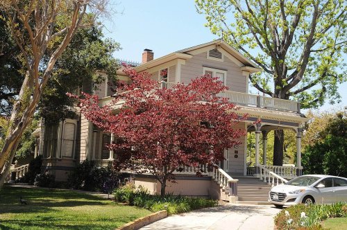
2% of Tustin’s homes were built before 1940 (Census estimate), against a typical 3.4% for a California town; the median home was built in 1983.
Founding dates: Wikidata, Wikipedia, the U.S. post office records of Blevins & Helbock (CC0) and the Census. Homes by year built: Census ACS 2020–24. National Register of Historic Places: National Park Service (list of May 22, 2026). Old photos, postcards and papers: Wikimedia Commons, the Library of Congress and other public archives, credited on each item’s page. Maps: U.S. Geological Survey historical topographic maps (via Esri) and Sanborn fire-insurance maps (Library of Congress). History text and census tables: Wikipedia (CC BY-SA 4.0). Places that used to be: USGS Geographic Names Information System (2021).
From Wikimedia Commons (11), the Library of Congress (5), Wikidata (3), the National Register of Historic Places (4), Wikipedia, Wikidata and Wikipedia for famous people, U.S. Geological Survey historical maps, U.S. Census counts (via Wikipedia), the US Post Offices dataset (Blevins & Helbock), the USGS Geographic Names Information System, Sanborn fire insurance maps (Library of Congress) and old county and town histories (Internet Archive). Archive images are copied here with their credits and licenses, shown on each photo’s page. Refreshed monthly.





 Date?
 Date?
 Date?
 Date?
 Date?
 2025
 2025
 2017
 2017
 2017
 2017
 2017
 2010
 2009
 2008
 2005

