Santa Ana dates to 1869, and 23 of its places are on the National Register
More historic than 64% of U.S. towns · #80 of 847 in California. What drives it
Most of Santa Ana was built recently: 8% of its homes predate 1940 and the median home dates from 1969. 23 places in town are on the National Register, among them three historic districts with 773 buildings between them. Below: 5 old photos and papers, maps from 1885 on, and the census since 1880.
Founding year: Wikidata. First post office: 1870.The full story ↓
History grade
What drives Santa Ana’s History grade
On its age, its old homes and the National Register, Santa Ana is more historic than 64% of U.S. towns, #80 of 847 in California. Its National Register listings hold the grade up; its age pulls it down.
B
HistoryA character grade: shown, never part of Santa Ana’s overall grade.
Among the 400 U.S. cities of 100,000 or more, Santa Ana ranks #195 on History.
Few California towns list much on the Register (a typical California town has 0.0 per 10,000 residents, the U.S. 2.4), so Santa Ana’s 25.4 sits above most of its state (95% of California towns have fewer) while its 795 historic buildings outnumber those of 98% of U.S. towns.
How sure. Graded on any two of the three inputs instead, the letter would range from C to A−. The pre-1940 share (±0.7 points) is firm at this size. Two sources give 1869.
Founding year: Wikidata (other dates in Quick answers). Homes: Census ACS 2020–24. National Register: National Park Service, May 2026 list; each listing counted once (boundary changes and added documentation belong to their listing), and a historic district counts its contributing buildings. How TownRatings grades history →
What stands out about Santa Ana’s past
Read from the archive, the National Register and the record. The page puts what stands out first.
National Park Service, National Register of Historic Places. Photos from Wikimedia Commons, credited on each place’s page.
Places that used to be
Lost post offices, old corners, places now gone and burying grounds
Santa Ana’s post office has been open since 1870. Another post office, Gloryetta, opened and closed inside today’s town.
Santa Ana
1870–today
Gloryetta
1915–1936
18701950today
Hamlets and corners on the map
Bali-Hi Mobile Home LodgeBit-O-Home Trailer ParkCalifornia Mobile Home ParkCoach Royal Trailer ParkDyerFairview Mobile Home EstatesGardners Trailer ParkHyde Park Mobile Home EstatesKona Kai Mobile Home ParkLake Park Santa AnaLiberty Mobile Home CourtPlaza Mobile Home EstatesQuiet Village Mobile Home ParkSahara Mobile Home ParkSandalwood Mobile Home ParkSanta Ana GardensSouth Santa AnaStandard Avenue Mobile Home ParkStoneridge Mobile Home ParkTaggin Wagon Mobile Home ParkThe GablesTown and Country VillaVilla Grande Mobile Home Park
Gone or out of use
Garden Grove SchoolschoolIglesia de Cristo PentecosteschurchMcKinley SchoolschoolOrange StationlocaleOur Lady of the Pillar SchoolschoolYost Theatrebuilding
3cemeteries and burying grounds inside Santa Ana
Fairhaven Memorial Park and MortuarySaint John's LutheranSanta Ana
US Post Offices dataset (Blevins & Helbock, CC0). Places and cemeteries from the USGS Geographic Names Information System (2021).
Members of the Tongva and Juaneño/Luiseño are indigenous to the area. The Tongva called the Santa Ana area "Hotuuk". The village of Pajbenga was located at modern day Santa Ana along the Santa Ana River. The Santa Ana river was a source for many of the Tongva villages and the Spanish Portola Expedition stayed and named this river.
After the 1769 expedition of Gaspar de Portolá out of Mexico City, then capital of New Spain, Friar Junípero Serra named the area Vallejo de Santa Ana (Valley of Saint Anne, or Santa Ana Valley). On November 1, 1776, Mission San Juan Capistrano was established within this valley.
Passages that mention Santa Ana, cut from the printed page as they were published.
History of Orange County, California1921 · page 964Read the page →
Read the text
\'alencia oranges. He also purchased forty acres on the Newport Road and Santa Fe Railroad at the foot of Glen Avenue, which was devoted to general farming. However, this was not the limit of Mr. Crawford's capabilities, for he was a live business man and saw a great future for Santa Ana and Orange County, so he conceived the idea of starting the first wholesale grocery store in Santa Ana, and incorporated the Santa Ana Wholesale Grocery Company, of which he was president and manager.
Text read by machine from the scan; it may contain errors.
History of Orange County, California1921 · page 204Read the page →
Read the text
Spurgeon turned his attention to the establishment of a bank and, with others, incorporated the First National Bank of Santa Ana, of which institution he was chosen president, and during the term of his service the bank secured the solid financial basis upon which its subsequent prosperity has been built. He promoted the Santa Ana Gas Company, which he served as president, was a stockholder and director of the Santa Ana Gas and Electric Company, which succeeded to the business of the former company, and he was financially interested in the Santa Ana Valley Irrigation Company for five years, and for three years served as its president, and also as a
Text read by machine from the scan; it may contain errors.
Scans and text from the Internet Archive. Books published in 1930 or earlier, which are in the public domain.
Timeline
Santa Ana, 1869 to 1996
Woven from the archive, old maps, post office records, the National Register and the people born here.
Nothing in the archives for these yearsWeddings on Main Street, storms, parades, school pictures, the old store. If it’s in your family album, it belongs here.
Every edition of the U.S. Geological Survey’s map of Santa Ana. Tap a year, or press play to watch the town change.
1896Santa Ana sheet · 1:62,500
U.S. Geological Survey historical topographic maps (public domain), via Esri’s collection of the scans. The red ring marks the center of Santa Ana.
Every building
Santa Ana, building by building, 1885–1906
Fire insurance maps drew every building, what it was made of and what it was used for, so insurers could price the risk of fire. Pick a year, then a sheet.
In 1869, according to Wikidata. Santa Ana’s post office opened in 1870, and the census of 1880 counted 711 people here.
How does Santa Ana rank for history?
Santa Ana is more historic than 64% of U.S. towns, #80 of 847 in California. The History grade combines the town’s founding era, the share of homes built before 1940 and its National Register listings. It’s a character grade, so it isn’t part of the overall grade. How it works.
What is on the National Register in Santa Ana?
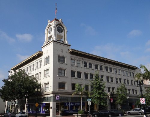
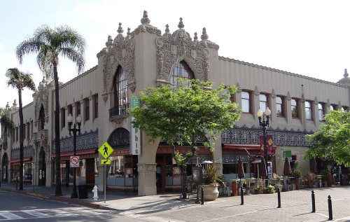
23 listings: 20 buildings, among them the Howe-Waffle House and Carriage House (listed 1977, the first), and 3 historic districts, the French Park Historic District, the Downtown Santa Ana Historic Districts (North, Government/Institutional and South, Retail) and the Floral Park Historic District, with 773 contributing buildings. 795 historic buildings in all.
How old are the homes in Santa Ana?
8% of Santa Ana’s homes were built before 1940 (Census estimate), against a typical 3.4% for a California town; the median home was built in 1969.
Founding dates: Wikidata, Wikipedia, the U.S. post office records of Blevins & Helbock (CC0) and the Census. Homes by year built: Census ACS 2020–24. National Register of Historic Places: National Park Service (list of May 22, 2026). Old photos, postcards and papers: Wikimedia Commons, the Library of Congress and other public archives, credited on each item’s page. Maps: U.S. Geological Survey historical topographic maps (via Esri) and Sanborn fire-insurance maps (Library of Congress). History text and census tables: Wikipedia (CC BY-SA 4.0). Places that used to be: USGS Geographic Names Information System (2021).
From Wikimedia Commons (3), the Library of Congress (2), the National Register of Historic Places (23), Wikipedia, Wikidata and Wikipedia for famous people, U.S. Geological Survey historical maps, U.S. Census counts (via Wikipedia), the US Post Offices dataset (Blevins & Helbock), the USGS Geographic Names Information System, Sanborn fire insurance maps (Library of Congress) and old county and town histories (Internet Archive). Archive images are copied here with their credits and licenses, shown on each photo’s page. Refreshed monthly.






 1906


