
Shoshone Limit Closeup, 2004
Shoshone’s story
116 years in pictures
Census counts: 52 in 2000, 22 in 2020. The archive holds 6 old photos and papers going back to 2004 and 2 maps from 1951 on.
- 1910Shoshone is settled
Each edition grades its towns against each other only.
Home to 18 people, the town was settled in 1910.
100% of adults 25 and older hold a bachelor’s degree or more in Shoshone, above both California’s towns (29%) and U.S. towns (29%). Shoshone has fewer than 1,000 residents, too few for fair grades; the figures below are still real.
In a town this size, neighbors are the best guide. Ask them anything.
Census counts: 52 in 2000, 22 in 2020. The archive holds 6 old photos and papers going back to 2004 and 2 maps from 1951 on.
Museums, parks, gardens and other places to visit around Shoshone. Close and well known come first.
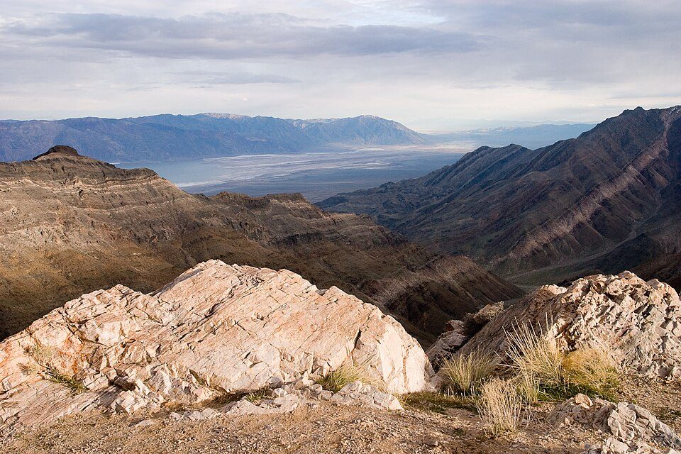 Big draw3 mi National ParkDeath Valley National Park1.3M visitors a year
 33 mi CaveDevils Hole
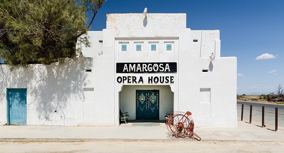 25 mi TheatreAmargosa Opera House and Hotel
 30 mi AttractionDante's View
Death Valley National Park: Greg Willis from Denver, CO, usa, CC BY-SA 2.0 · Devils Hole: Stan Shebs, CC BY-SA 3.0 · Amargosa Opera House and Hotel: Tuxyso, CC BY-SA 3.0 · Dante's View: Roger469, Public domain
Shoshone is unincorporated, so Inyo County and regional agencies provide most services.
EPA SDWIS (Oct 9, 2026) · HIFLD + EIA-861 2025 · Census 2020 ZCTAs · NCES 2024–25 · registration: vote.gov, updated Nov 18, 2024.
Ordered by what stands out in Shoshone.
Storm and flood damage is expected to run higher than in 79% of U.S. communities. Expected losses in Shoshone break down as 37% from avalanches and 26% from heat waves.
FEMA National Risk Index · OpenFEMA
Public schools: the Death Valley Unified school district. Two of the 3 schools are below, and why each made the list.
| School | Level | Students | Letter |
|---|---|---|---|
| Shoshone ElementaryLargest public elementary schoolGrades K–6 | Grades K–6 | 17 | – |
| Death Valley High AcademyLargest public high schoolGrades 7–12 | Grades 7–12 | 4 | – |
NCES · EDFacts
Expect mild winters and scorching summers in Shoshone, with very little rain. July afternoons reach 106°, January nights drop to 37° and snow is almost unheard of.
NOAA U.S. Climate Normals, 1991–2020
26 miles of trail. For Shoshone, the trail density is 0.9 miles per square mile.
| Shoshone | California towns | U.S. towns | |
|---|---|---|---|
| Miles of trail per square mile | 0.9 miles per square mile | 1.0 | 0.4 |
| Conserved land | 3.2% | 4.3% | 4.3% |
Trails & parks © OpenStreetMap contributors · Conserved land: USGS PAD-US
None within 15 miles of Shoshone; the nearest are
About 0 of every 100 Shoshone residents are enrolled in college, against 8 across California.
Place in California, United States
Shoshone is a census-designated place (CDP) in Inyo County, California, United States. The population was 22 at the 2020 census, down from 31 at the 2010 census. The town was founded in 1910. Its name may refer to the Shoshone people. Although small, it is notable as a southern gateway to Death Valley National Park; in addition to being a junction of roads leading from Baker, California and Pahrump, Nevada, it has the last services available before the Furnace Creek area in the park. The commercial district of the town, including a post office, gas station, restaurant, bar and coffee house, is just north of the southern intersection of California State Routes 127 and 178. Shoshone has a sin…
From Wikipedia, licensed CC BY-SA 4.0 · facts via Wikidata (CC0)
Short answers, built from the data on this page.
Shoshone has fewer than 1,000 residents, too few for fair grades; the figures below are still real.


