163 years in pictures
Census counts: 197 in 2000, 191 in 2020. The archive holds 6 old photos and papers going back to 2010 and 2 maps from 1956 on.
2 places on the National Register of Historic Places.
- 1863Markleeville is settled
Each edition grades its towns against each other only.

2 of its places are on the National Register of Historic Places.
Markleeville’s median age is 57.9 years, where California’s towns sit at 39 years and U.S. towns at 40.5 years. Among 847 California towns, just 6 have a lower January low than Markleeville. 80% of the land in Markleeville is conserved, above both California’s towns (4.3%) and U.S. towns (4.3%). The biggest park or preserve is Mokelumne Wilderness, at 1,533 acres. Markleeville has fewer than 1,000 residents, too few for fair grades; the figures below are still real.
Where Markleeville beats most towns.
In a town this size, neighbors are the best guide. Ask them anything.
Census counts: 197 in 2000, 191 in 2020. The archive holds 6 old photos and papers going back to 2010 and 2 maps from 1956 on.
2 places on the National Register of Historic Places.
Markleeville is unincorporated, so Alpine County and regional agencies provide most services.
EPA SDWIS (Oct 9, 2026) · HIFLD + EIA-861 2025 · Census 2020 ZCTAs · NCES 2024–25 · registration: vote.gov, updated Nov 18, 2024.
Ordered by what stands out in Markleeville.
Walkers can cover 7.2 miles of trail in 3 parks and preserves. Markleeville’s trail network density is 1.1 miles per square mile. Parks and preserves locally: 3, covering 1,635 acres.
| Biggest places to walk | Trails | Acres |
|---|---|---|
| 1. Grover Hot Springs State Park | 0.7 mi | 99 |
| 2. Mokelumne Wilderness | — | 1,533 |
| 3. Heritage Park and Nature Area | — | 3 |
Trails & parks © OpenStreetMap contributors · Conserved land: USGS PAD-US
Among adults 25 and older in Markleeville, 35% hold a bachelor’s degree or more.
Somewhere between 23% and 57% women
The Census survey reached too few of Markleeville’s residents to say more: its margin here is ±17 points. Across California, 50.1% of residents are women.
| Markleeville | CA | U.S. | |
|---|---|---|---|
| Under 10 | 10% | 11.4% | 11.6% |
| 10 to 17 | 10% | 10.5% | 10.3% |
| 18 to 24 | 0% | 9.1% | 9.1% |
| 25 to 34 | 0% | 14.8% | 13.7% |
| 35 to 44 | 14.5% | 13.9% | 13.2% |
| 45 to 54 | 0% | 12.5% | 12.2% |
| 55 to 64 | 22.7% | 12.1% | 12.7% |
| 65 to 74 | 10% | 9.2% | 10.2% |
| 75 and older | 32.7% | 6.5% | 7% |
| No diploma | 0% | 15.3% | 10.4% |
| High school | 34.1% | 20.5% | 26% |
| Some college | 13.6% | 19.3% | 19.1% |
| Associate’s | 17% | 7.9% | 8.8% |
| Bachelor’s | 25% | 22.7% | 21.6% |
| Graduate | 10.2% | 14.4% | 14.1% |
U.S. Census Bureau · ACS 2020-2024 5-year estimates · in a town of 100, single groups can be off by several points
Of the losses FEMA expects in Markleeville, 38% come from avalanches and 29% from inland flooding. Expected damage from storms and floods is higher here than in 88% of U.S. communities.
FEMA National Risk Index · OpenFEMA
For Markleeville, the mean commuting time is 29 minutes. Half commute less than 94 miles. In Markleeville, 6.4% of residents live below the poverty line. The top destinations are South Lake Tahoe (6%), Sacramento (4%) and Redwood City (3%).
| Markleeville | California towns | U.S. towns | |
|---|---|---|---|
| Below the poverty line | 6.4% | 10% | 9.6% |
| Average trip to work | 29 minutes | 28 minutes | 25 minutes |
Census LEHD 2023 · ACS
For households in Markleeville, the share who own their home is 79%. Over the 12 months to September 2026, the typical home lost 2% of its value.
Census ACS, 2020–24 · Zillow Home Value Index · Redfin Data Center
July afternoons reach 84°, January nights drop to 22° and about 77 inches of snow falls in a winter.
NOAA U.S. Climate Normals, 1991–2020
30% of adults sleep under 7 hours in Markleeville. The town does better than the California average on 13 of 32 CDC measures and worse on 7.
| Markleeville | California towns | U.S. towns | |
|---|---|---|---|
| Feel lonely (CDC PLACES) | 31% | 36% | 33% |
| Sleep under 7 hours (CDC PLACES) | 30% | 35% | 36% |
| Frequent mental distress (CDC PLACES) | 15% | 17% | 17% |
| High blood pressure (CDC PLACES) | 38% | 31% | 35% |
| What stands out | Markleeville | CA |
|---|---|---|
| Fewer uninsured adults | 4.2% | 10.6% |
| Fewer adults facing housing insecurity | 6.9% | 14.9% |
| More adults who have had cancer | 12.2% | 6.4% |
CDC PLACES 2025 · modeled estimates for adults · CMS · HRSA
Museums, parks, gardens and other places to visit around Markleeville. Close and well known come first.
Big draw30 mi LakeLake Tahoe
Big draw37 mi National ParkYosemite National Park4.3M visitors a year
13 mi Ski areaKirkwood Mountain Resort58 runs · 1,650 ft vertical18 mi Ski areaHeavenly Mountain Resort141 runs · 3,370 ft vertical
24 mi State parkEmerald Bay State Park
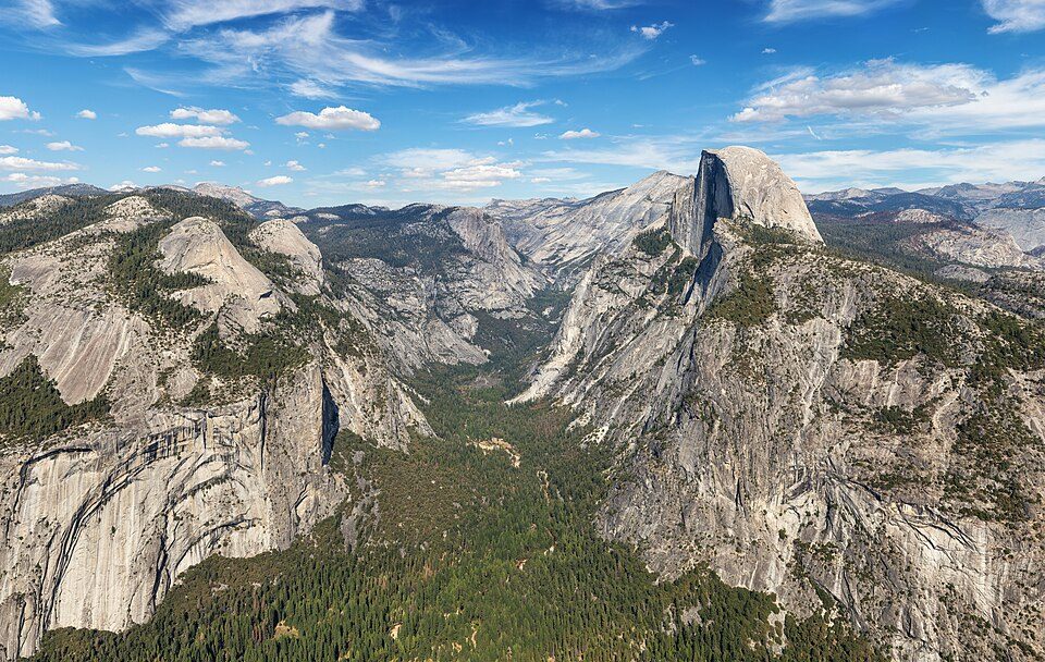
25 mi Park & preserveDesolation WildernessLake Tahoe: Lara Farhadi, CC BY 2.0 · Yosemite National Park: Thomas Wolf, www.foto-tw.de, CC BY-SA 3.0 · Kirkwood Mountain Resort: Gabeguss, CC BY-SA 3.0 · Emerald Bay State Park: Michael, CC BY 2.0 · Desolation Wilderness: Phreakdigital at English Wikipedia, GFDL
None within 15 miles of Markleeville; the nearest are
About 0 of every 100 Markleeville residents are enrolled in college, against 8 across California.
79.8% of the town is conserved land, across 3 parks and preserves.
2 places in Markleeville on the National Register of Historic Places.
Place in California, United States
Markleeville (formerly Markleville) is a census-designated place (CDP) in and the county seat of Alpine County, California, United States. The population was 191 at the 2020 census, down from 210 at the 2010 census.
From Wikipedia, licensed CC BY-SA 4.0 · facts via Wikidata (CC0)
Short answers, built from the data on this page.
Markleeville has fewer than 1,000 residents, too few for fair grades; the figures below are still real. 2 of its places are on the National Register of Historic Places.