
Emerald Bay State Park
Emerald Bay State Park is a state park of California in the United States, centered on Lake Tahoe's Emerald Bay, a National Natural Landmark. It is 6 mi west of South Lake Tahoe. Records date it to 1953.

A state park, 6 mi west of South Lake Tahoe
South Lake Tahoe is the nearest base
South Lake Tahoe is 6 miles east, with 141 places to stay. Where to stay ↓
A day trip from Sacramento
Sacramento is about 79 miles west (straight-line). Where to stay ↓
Best months: Jun, Jul, Aug and Sep
June, July, August and September are the mild months, with highs of 73–81°. When to go ↓
Established in 1953
Emerald Bay State Park dates from 1953. About ↓
Written from NOAA 1991–2020 normals, Overture places to stay, Census town figures, Wikidata and Wikipedia.
When to go
Here is how the weather at Emerald Bay changes month by month.
Emerald Bay State Park
Emerald Bay State Park is a state park of California in the United States, centered on Lake Tahoe's Emerald Bay, a National Natural Landmark. Park features include Eagle Falls and Vikingsholm, a 38-room mansion that is considered one of the finest examples of Scandinavian architecture in the United States. The architect was Leonard Palme, who was hired by his aunt Lora Josephine Knight to design and build Vikingsholm. The park contains the only island in Lake Tahoe, Fannette Island. The park is accessible by California State Route 89 near the southwest shore of the lake. Emerald Bay is one of Lake Tahoe's most photographed and popular locations.
- Type
- State park
- Established
- 1953
- Listed
- National Natural Landmark
- Wikipedia readers
- 9.1K a year
Where to base yourself for Emerald Bay State Park
Hotels, motels or campgrounds are closest in South Lake Tahoe (141) and Tahoma (15).
- 1Lake Tahoe
- 2Palisades Tahoe Olympic Valley
- 3Donner Lake
- 4Desolation Wilderness
- 5Heavenly Mountain
- 6Donner Memorial
- 7Sugar Bowl
- 8Homewood
South Lake Tahoe
The closest town with somewhere to stay.
21,115 people · 36% vacation homes
6 mi east of Emerald Bay
Compare 8 towns
| Town | From Emerald Bay | Drive | Places to stay | People | Typical home | Safety |
|---|---|---|---|---|---|---|
| South Lake Tahoe 36% vacation homes | 6 mi east | 10 min | 141 87 hotels · 14 motels · 10 inns & B&Bs · 26 lodges & cabins · 1 hostel · 2 campgrounds · 1 RV park | 21,115 | $682K | D |
| Tahoma 77% vacation homes | 8 mi north | 10 min | 15 7 hotels · 3 inns & B&Bs · 2 lodges & cabins · 3 campgrounds | 873 | $901K | — |
| Kingsbury 32% vacation homes | 12 mi east | 15 min | 21 20 hotels · 1 lodge or cabins | 2,209 | $1,077K | — |
| Stateline | 8 mi east | 10 min | 10 9 hotels · 1 campground | 503 | — | — |
| Sunnyside-Tahoe City 66% vacation homes | 14 mi north | 20 min | 15 5 hotels · 3 inns & B&Bs · 5 lodges & cabins · 2 campgrounds | 1,599 | $1,019K | — |
| Meyers 45% vacation homes | 9 mi southeast | 15 min | 7 3 hotels · 2 lodges & cabins · 2 campgrounds | 1,995 | $647K | — |
| Round Hill Village 47% vacation homes | 10 mi east | 15 min | 5 4 hotels · 1 campground | 823 | $1,296K | — |
| Carson City | 23 mi northeast | 35 min | 26 19 hotels · 6 motels · 1 campground | 58,571 | $453K | — |
Day trip from
Straight-line miles.
Getting there
Nearest airports with airline service
Also near Emerald Bay
These well-known places are within 28 miles.
 Big draw110 mi LakeLake Tahoe
 218 mi Ski areaPalisades Tahoe Olympic Valley122 runs · 2,542 ft vertical
 327 mi LakeDonner Lake
 45 mi Park & preserveDesolation Wilderness510 mi Ski areaHeavenly Mountain Resort141 runs · 3,370 ft vertical
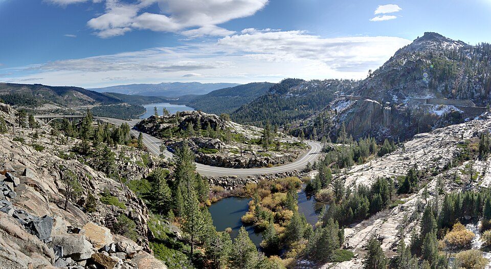 627 mi State parkDonner Memorial State Park727 mi Ski areaSugar Bowl Resort94 runs · 1,452 ft vertical810 mi Ski areaHomewood Ski Area70 runs · 1,639 ft vertical
Photo credits
Lake Tahoe: Lara Farhadi, CC BY 2.0 · Palisades Tahoe Olympic Valley: Jonnyboyca at English Wikipedia, Public domain · Donner Lake: J.smith, CC BY-SA 3.0 · Desolation Wilderness: Phreakdigital at English Wikipedia, GFDL · Donner Memorial State Park: Joe Parks from Berkeley, CA, CC BY 2.0


Visiting Emerald Bay
What town is Emerald Bay State Park near?
South Lake Tahoe, CA, about 6 miles east.
When is the best time to visit Emerald Bay State Park?
June, July, August and September, with highs of 73–81°.
How far is Emerald Bay State Park from Sacramento and Stockton?
About 79 miles west of Sacramento and about 94 miles southwest of Stockton, as the crow flies.
What is the closest airport to Emerald Bay State Park?
Truckee Tahoe (TKF), about 25 miles away. The nearest big hub is Reno Tahoe (RNO), about 42 miles.
Where should I stay near Emerald Bay State Park?
South Lake Tahoe (6 mi, 141 places to stay), Tahoma (8 mi, 15 places to stay) and Kingsbury (12 mi, 21 places to stay).
South Lake Tahoe has the answers
Ask a question, or answer one, in South Lake Tahoe’s Town Square.
Sources: National Park Service · ski areas © OpenSkiMap / OpenStreetMap contributors · Wikidata · Wikipedia readership · NOAA climate normals · U.S. Census.