
Desolation Wilderness
The Desolation Wilderness is a 63,960-acre (258.8 km2) federally protected wilderness area in the Eldorado National Forest and Lake Tahoe Basin Management Unit, in El Dorado County, California.

A park & preserve, 10 mi south of Tahoma
Tahoma is the nearest base
Tahoma is 10 miles north, with 15 places to stay. Where to stay ↓
A day trip from Sacramento
Sacramento is about 74 miles west (straight-line). Where to stay ↓
Best months: Jun, Jul, Aug and Sep
June, July, August and September are the mild months, with highs of 71–80°. When to go ↓
Established in 1969
Desolation Wilderness dates from 1969. About ↓
Written from NOAA 1991–2020 normals, Overture places to stay, Census town figures, Wikidata and Wikipedia.
Weather, month by month
Typical highs and lows in Tahoma. Green months are the mild ones.
Desolation Wilderness
The Desolation Wilderness is a 63,960-acre (258.8 km2) federally protected wilderness area in the Eldorado National Forest and Lake Tahoe Basin Management Unit, in El Dorado County, California. The crest of the Sierra Nevada runs through it, just west of Lake Tahoe.
- Type
- Park & preserve
- Established
- 1969
- Area
- 100 square miles
- Wikipedia readers
- 9.1K a year
Where to stay near Desolation Wilderness
The closest towns with hotels, motels or campgrounds are South Lake Tahoe (141) and Tahoma (15).
- 1Lake Tahoe
- 2Palisades Tahoe Olympic Valley
- 3Donner Lake
- 4Emerald Bay
- 5Heavenly Mountain
- 6Donner Memorial
- 7Sugar Bowl
- 8Kirkwood Mountain
South Lake Tahoe
The closest town with somewhere to stay.
21,115 people · 36% vacation homes
10 mi east of Desolation Wilderness
Compare 8 towns
| Town | From Desolation Wilderness | Drive | Places to stay | People | Typical home | Safety |
|---|---|---|---|---|---|---|
| South Lake Tahoe 36% vacation homes | 10 mi east | 15 min | 141 87 hotels · 14 motels · 10 inns & B&Bs · 26 lodges & cabins · 1 hostel · 2 campgrounds · 1 RV park | 21,115 | $682K | D |
| Tahoma 77% vacation homes | 10 mi north | 15 min | 15 7 hotels · 3 inns & B&Bs · 2 lodges & cabins · 3 campgrounds | 873 | $901K | — |
| Kingsbury 32% vacation homes | 16 mi east | 25 min | 21 20 hotels · 1 lodge or cabins | 2,209 | $1,077K | — |
| Stateline | 13 mi east | 20 min | 10 9 hotels · 1 campground | 503 | — | — |
| Sunnyside-Tahoe City 66% vacation homes | 16 mi north | 25 min | 15 5 hotels · 3 inns & B&Bs · 5 lodges & cabins · 2 campgrounds | 1,599 | $1,019K | — |
| Meyers 45% vacation homes | 10 mi southeast | 15 min | 7 3 hotels · 2 lodges & cabins · 2 campgrounds | 1,995 | $647K | — |
| Kirkwood 87% vacation homes | 17 mi south | 25 min | 11 9 hotels · 1 lodge or cabins · 1 campground | 218 | $783K | — |
| Truckee 48% vacation homes | 30 mi north | 45 min | 39 21 hotels · 3 inns & B&Bs · 7 lodges & cabins · 7 campgrounds · 1 RV park | 17,278 | $948K | C+ |
Day trip from
Straight-line miles.
Getting there
Nearest airports with airline service
Also near Desolation Wilderness
Other well-known places within 29 miles. Numbered ones are on the map above.
 Big draw113 mi LakeLake Tahoe
 219 mi Ski areaPalisades Tahoe Olympic Valley122 runs · 2,542 ft vertical
 328 mi LakeDonner Lake
 45 mi State parkEmerald Bay State Park514 mi Ski areaHeavenly Mountain Resort141 runs · 3,370 ft vertical
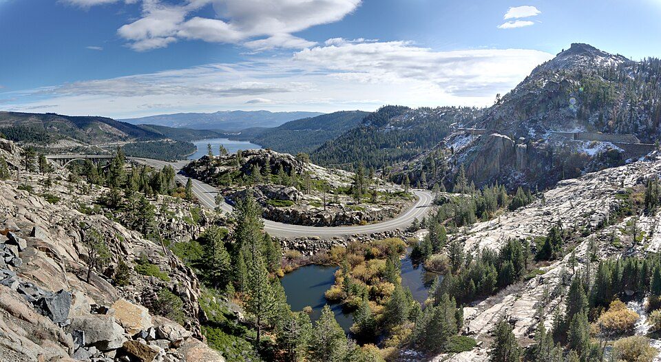 628 mi State parkDonner Memorial State Park728 mi Ski areaSugar Bowl Resort94 runs · 1,452 ft vertical
 818 mi Ski areaKirkwood Mountain Resort58 runs · 1,650 ft vertical
Photo credits
Lake Tahoe: Lara Farhadi, CC BY 2.0 · Palisades Tahoe Olympic Valley: Jonnyboyca at English Wikipedia, Public domain · Donner Lake: J.smith, CC BY-SA 3.0 · Emerald Bay State Park: Michael, CC BY 2.0 · Donner Memorial State Park: Joe Parks from Berkeley, CA, CC BY 2.0 · Kirkwood Mountain Resort: Gabeguss, CC BY-SA 3.0


Visiting Desolation Wilderness
What town is Desolation Wilderness near?
Tahoma, CA, about 10 miles north.
When is the best time to visit Desolation Wilderness?
June, July, August and September, with highs of 71–80°.
How far is Desolation Wilderness from Sacramento and Stockton?
About 74 miles west of Sacramento and about 90 miles southwest of Stockton, as the crow flies.
What is the closest airport to Desolation Wilderness?
Truckee Tahoe (TKF), about 28 miles away. The nearest big hub is Reno Tahoe (RNO), about 45 miles.
Where should I stay near Desolation Wilderness?
South Lake Tahoe (10 mi, 141 places to stay), Tahoma (10 mi, 15 places to stay) and Kingsbury (16 mi, 21 places to stay).
Tips from people in Tahoma
No tips yet. Ask, or answer, in Tahoma’s Town Square.
Sources: National Park Service · ski areas © OpenSkiMap / OpenStreetMap contributors · Wikidata · Wikipedia readership · NOAA climate normals · U.S. Census.