
Inyokern, 2008
Inyokern’s story
116 years in pictures
Census counts: 984 in 2000, 988 in 2020. The archive holds 5 old photos and papers going back to 2008 and 2 maps from 1943 on.
- 1910Inyokern is settled
Each edition grades its towns against each other only.

A town of 912, settled in 1910.
Inyokern’s July high is 102°F, against 89°F in California’s towns and 85°F across U.S. towns. Among 834 California towns, just 2 have a lower median rent than Inyokern. Inyokern has fewer than 1,000 residents, too few for fair grades; the figures below are still real.
In a town this size, neighbors are the best guide. Ask them anything.
Census counts: 984 in 2000, 988 in 2020. The archive holds 5 old photos and papers going back to 2008 and 2 maps from 1943 on.
Inyokern is unincorporated, so Kern County and regional agencies provide most services.
EPA SDWIS (Oct 9, 2026) · HIFLD + EIA-861 2025 · Census 2020 ZCTAs · NCES 2024–25 · registration: vote.gov, updated Nov 18, 2024.
Ordered by what stands out in Inyokern.
The typical Inyokern home is worth about $267,000, down 0.7% in a year, 65% below the California typical home.
Zillow Home Value Index · Redfin Data Center
Its public schools are run by the Sierra Sands Unified school district. Its one school is below.
| School | Level | Students | Letter |
|---|---|---|---|
| Inyokern ElementaryLargest public elementary schoolGrades K–5 | Grades K–5 | 161 | C− |
NCES · EDFacts
Most working residents leave Inyokern for work: only 3% work in town. 23% of Inyokern residents live below the poverty line, above both California’s towns (10%) and U.S. towns (9.6%). Inyokern’s average trip to work is 20 minutes.
| Inyokern | California towns | U.S. towns | |
|---|---|---|---|
| Below the poverty line | 23% | 10% | 9.6% |
| Average trip to work | 20 minutes | 28 minutes | 25 minutes |
| Working residents who work in town | 2.6% | 6.6% | 8% |
Census LEHD 2023 · ACS
Expected storm and flood damage is higher than in 76% of U.S. communities.
FEMA National Risk Index · OpenFEMA
Inyokern has mild winters and scorching summers, with very little rain. The January low in Inyokern is 32°F.
NOAA U.S. Climate Normals, 1991–2020
Inyokern beats the California average on 11 of 32 CDC measures and trails it on 8. 31% of adults feel lonely in Inyokern.
| Inyokern | California towns | U.S. towns | |
|---|---|---|---|
| Feel lonely (CDC PLACES) | 31% | 36% | 33% |
| High blood pressure (CDC PLACES) | 38% | 31% | 35% |
| Yearly checkup (CDC PLACES) | 78% | 72% | 79% |
| No health insurance, 18–64 (CDC PLACES) | 5.5% | 9% | 8.1% |
| What stands out | Inyokern | CA |
|---|---|---|
| Fewer uninsured adults | 5.5% | 10.6% |
| Fewer adults facing food insecurity | 11.7% | 17.9% |
| More adults who have had cancer | 10.7% | 6.4% |
CDC PLACES 2025 · modeled estimates for adults · CMS · HRSA
| Biggest places to walk | Trails | Acres |
|---|---|---|
| 1. Inyokern County Park | — | 2 |
Trails & parks © OpenStreetMap contributors · Conserved land: USGS PAD-US
Museums, parks, gardens and other places to visit around Inyokern. Close and well known come first.
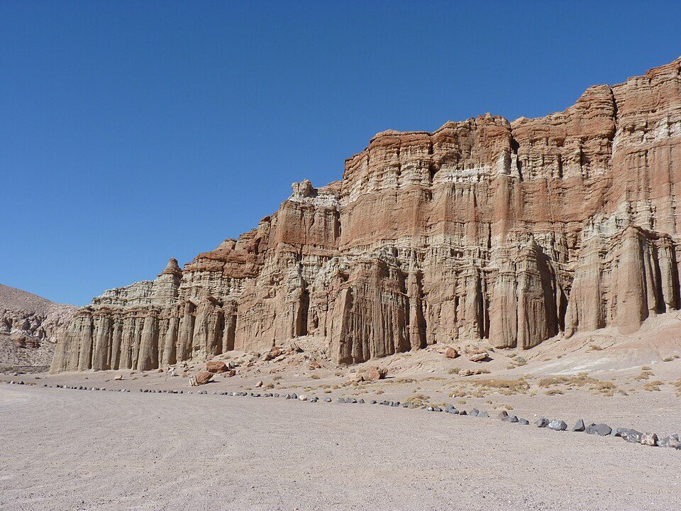 22 mi State parkRed Rock Canyon State Park
 26 mi Park & preserveTrona Pinnacles
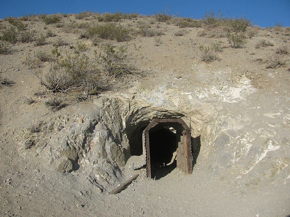 17 mi Park & preserveBurro Schmidt Tunnel
 9 mi MuseumMaturango Museum
 10 mi MuseumNaval Museum of Armament & Technology
Red Rock Canyon State Park: Jean trans h+, CC BY-SA 4.0 · Trona Pinnacles: Doug Dolde at English Wikipedia, Public domain · Burro Schmidt Tunnel: Kurtis2014, CC BY-SA 3.0 · Maturango Museum: Qfl247 (talk) (Transferred by Citypeek/Original uploaded by Qfl247), CC BY-SA 3.0 · Naval Museum of Armament & Technology: U.S. Navy photo by Geoffrey Patrick., Public domain
1 within 15 miles of the center of Inyokern
About 1 of every 100 Inyokern residents are enrolled in college, against 8 across California.
1,099 counted in 2010 and 988 in 2020.
U.S. Census 2010 & 2020 counts
Place in California, United States
Inyokern (formerly Siding 16 and Magnolia) is a census-designated place (CDP) in Kern County, California, United States. Its name derives from its location near the border between Inyo and Kern Counties. Inyokern is located 8 miles (13 km) west of Ridgecrest, at an elevation of 2,434 feet (742 m). It is on the western side of the Indian Wells Valley. The population was 988 in the 2020 census, down from 1,099 in the 2010 census. It was a railroad town established along the Southern Pacific railroad's Lone Pine Branch (now removed) and with WWII became site of the Naval Air Weapons Station China Lake. It is served by Inyokern Airport.
From Wikipedia, licensed CC BY-SA 4.0 · facts via Wikidata (CC0)
Short answers, built from the data on this page.
Inyokern has fewer than 1,000 residents, too few for fair grades; the figures below are still real.


