
Channel Islands BeachCA
A town of 2,726.
What should you know before moving to Channel Islands Beach?
Homes are expensive, about $1.1 million for a typical one and 10.1 times the Oxnard metro’s $110K median household income. Overall it grades C, ranked 397th of 841 in California. The median household earns $107K and CDC estimates put its residents' health ahead of 87% of the country. Its weakest subject is hazard risk: FEMA rates its natural-hazard risk higher than 89% of U.S. communities, with inland flooding at the top. Channel Islands Beach’s peak summer temperature is 70°F, against 89°F in California’s towns and 85°F across U.S. towns. Channel Islands Beach has 1 place on the National Register.
What makes Channel Islands Beach stand out
Where Channel Islands Beach beats most towns, and one thing worth knowing.
97% of working residents leave Channel Islands Beach for work
Where Channel Islands Beach’s working residents go each day. Line width shows the share.
Census LEHD 2023
How Channel Islands Beach grades
Each subject compared with towns across the country (schools within California), ordered by how far Channel Islands Beach is from typical.
Its grades run from A for jobs and income (better than 88% of comparable towns) to D− for cost of living (better than 1%), so the C overall blends very different results.
How TownRatings grades towns →
Channel Islands National Park and 33 more within 40 miles
Museums, parks, gardens and other places to visit around Channel Islands Beach. Close and well known come first.
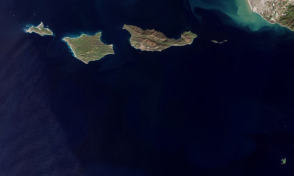 6 mi National ParkChannel Islands National Park227K visitors a year
 24 mi MuseumRonald Reagan Presidential Library
 39 mi MuseumGetty Villa454K visitors a year
 27 mi MountainPoint Dume
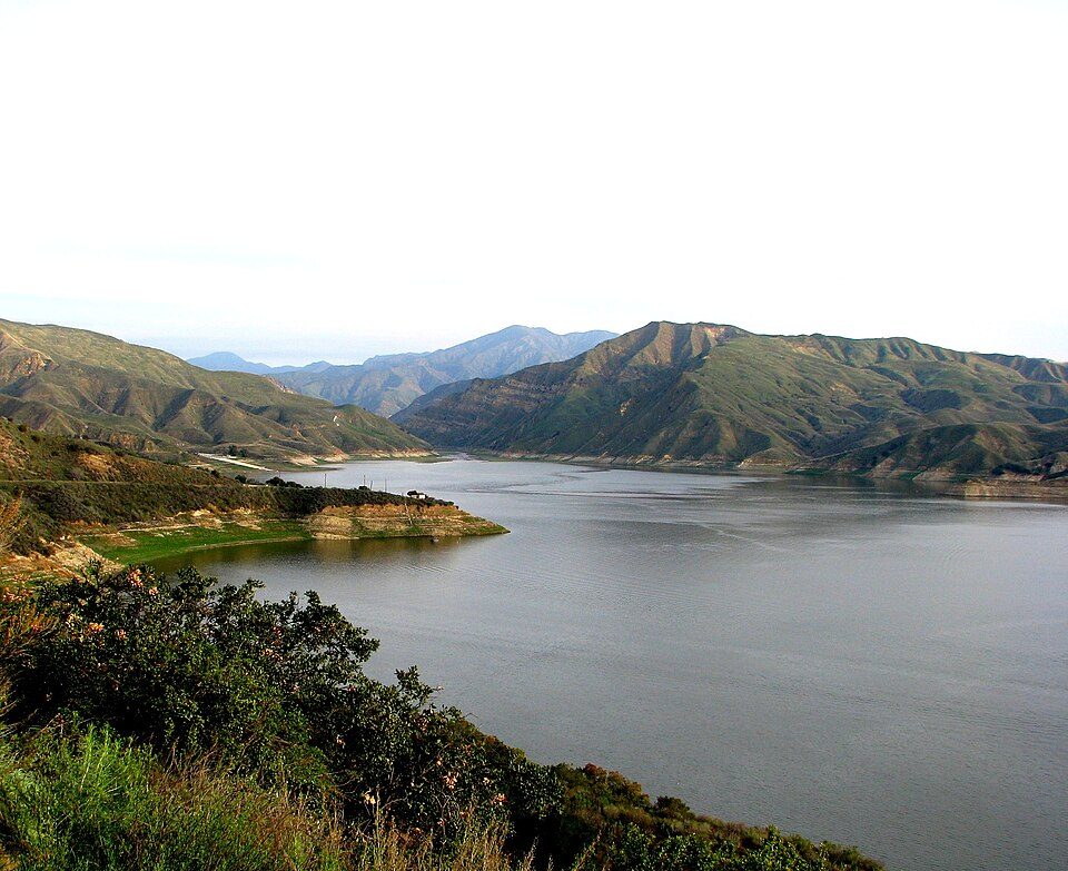 34 mi LakeLake Piru
 9 mi National Recreation AreaSanta Monica Mountains National Recreation Area723K visitors a year
Photo credits
Channel Islands National Park: Copernicus Sentinel-2, ESA, CC BY-SA 3.0 igo · Ronald Reagan Presidential Library: Unknown authorUnknown author, Public domain · Getty Villa: Bobak Ha'Eri, CC BY 3.0 · Point Dume: OMCV, Public domain · Lake Piru: tomsaint11, CC BY 2.0 · Santa Monica Mountains National Recreation Area: Seanydelight, CC BY-SA 3.0


Moving to Channel Islands Beach: who provides what
Channel Islands Beach is unincorporated, so Ventura County and regional agencies provide most services.
EPA SDWIS (Oct 9, 2026) · HIFLD + EIA-861 2025 · Census 2020 ZCTAs · NCES 2024–25 · registration: vote.gov, updated Nov 18, 2024.
The data
Ordered by what stands out in Channel Islands Beach.
Channel Islands Beach is a second-home town and has milder winter nights than nearly all U.S. towns, but it has homes that cost more against local pay than most of California.
Channel Islands Beach’s grade for health is an A
30% of adults feel lonely in Channel Islands Beach. The town does better than the California average on 14 of 32 CDC measures and worse on 2. In Channel Islands Beach, nearly a quarter of adults have obesity, and 18% get no exercise outside work.
| Channel Islands Beach | California towns | U.S. towns | |
|---|---|---|---|
| Feel lonely (CDC PLACES) | 30% | 36% | 33% |
| Obesity (CDC PLACES) | 24% | 29% | 35% |
| Get no exercise (CDC PLACES) | 18% | 24% | 25% |
| Sleep under 7 hours (CDC PLACES) | 32% | 35% | 36% |
| What stands out | Channel Islands Beach | CA |
|---|---|---|
| Fewer uninsured adults | 4.9% | 10.6% |
| Fewer adults facing food insecurity | 8.5% | 17.9% |
| More adults who have had cancer | 10.3% | 6.4% |
CDC PLACES 2025 · modeled estimates for adults · CMS · HRSA
On state tests, Channel Islands Beach’s schools trail 76% of California districts
Its one school is below. Public schools: the Hueneme Elementary school district. Enrollment at Channel Islands Beach’s public school: 289 students.
| School | Level | Students | Letter |
|---|---|---|---|
| Hollywood Beach ElementaryLargest public elementary schoolGrades K–6 | Grades K–6 | 289 | – |
NCES · EDFacts · graded within CA on state tests and graduation
Natural hazards: very high risk in Channel Islands Beach, mostly inland flooding
FEMA puts 60% of Channel Islands Beach’s expected hazard losses down to inland flooding, and 31% to earthquakes.
FEMA National Risk Index · OpenFEMA
Most of Channel Islands Beach’s workers commute out: the town has 0.4 jobs for each of them
Jobs based here grew from 358 in 2013 to 684.
Only 3% of working residents stay in Channel Islands Beach for work; the rest commute out. Among residents in the town, 4.8% live below the poverty line. Since 2013, Channel Islands Beach has added 326 jobs, to 684 in 2023. For Channel Islands Beach, the average commute is 29 minutes.
| Channel Islands Beach | California towns | U.S. towns | |
|---|---|---|---|
| Below the poverty line | 4.8% | 10% | 9.6% |
| Median household income | $107,000 | $95,000 | $80,000 |
| Average trip to work | 29 minutes | 28 minutes | 25 minutes |
| Working residents who work in town | 2.8% | 6.6% | 8% |
Where working residents work
Census LEHD 2023 · ACS
Expect mild winters and pleasant summers in Channel Islands Beach
January nights average 47.7°, milder than in 98% of U.S. towns; July afternoons average 70.3°.
In Channel Islands Beach, the January low is 48°F. Snowfall is close to zero.
Typical low → high °F
NOAA U.S. Climate Normals, 1991–2020
Conserved land covers 1.3% of Channel Islands Beach
The density of trails for Channel Islands Beach comes to 0.3 miles per square mile. In 1 park or preserve, walkers have 0.2 miles of trail. One park or preserve covers 3 acres here.
| Channel Islands Beach | California towns | U.S. towns | |
|---|---|---|---|
| Miles of trail per square mile | 0.3 miles per square mile | 1.0 | 0.4 |
| Conserved land | 1.3% | 4.3% | 4.3% |
| Biggest places to walk | Trails | Acres |
|---|---|---|
| 1. Boat Launch Ramp and Park | — | 3 |
Trails & parks © OpenStreetMap contributors · Conserved land: USGS PAD-US
A home in Channel Islands Beach sells for about $1.54M at the median
At 10.1 years of the Oxnard metro’s $110K median household income, the typical home costs more against local pay than in 78% of California towns; that ratio is one input to its D− for cost of living.
For households in Channel Islands Beach, the share who live in a home they own is 54%. Its typical rent stands at $2,392 a month.
| Channel Islands Beach | California towns | U.S. towns | |
|---|---|---|---|
| Median rent | $2,392 a month | $1,895 a month | $1,185 a month |
| Households that own their home | 54% | 64% | 73% |
Census ACS, 2020–24 · Zillow Home Value Index · Redfin Data Center
Everything we know about Channel Islands Beach
Colleges nearby
4 within 15 miles of the center of Channel Islands Beach
About 3 of every 100 Channel Islands Beach residents are enrolled in college, against 8 across California.
About Channel Islands Beach
Place in California, United States
Channel Islands Beach is an unincorporated community in Ventura County, California, United States consisting of three historic neighborhoods: Hollywood Beach, Hollywood by the Sea, and Silver Strand Beach. This densely populated narrow 1.3-mile-long strip (2.1 km) along the coastal edge of the Oxnard Plain was subdivided using the glamor of Hollywood to sell lots in the mid-1920s since the sand dunes had been used for movies. Adjacent development has left this sandy beachfront neighborhood hemmed in by Channel Islands Harbor and Naval Base Ventura County. The harbor mouth separates them into two communities resulting in a round-about travel route around the harbor between them although the …
From Wikipedia, licensed CC BY-SA 4.0 · facts via Wikidata (CC0)
- Area
- 0.4 sq mi
- Elevation
- 7 ft
Channel Islands Beach’s neighbors
2 towns share a border with Channel Islands Beach.
| Town | CA rank | Overall | Cost | Safety | Schools | Health |
|---|---|---|---|---|---|---|
| Channel Islands Beach | #397 | C | D− | — | C− | A |
| Oxnard | #697 | D | D | C− | C− | C+ |
| Port Hueneme | #636 | D | D | C− | C− | B− |
Channel Islands Beach reports no FBI crime data of its own. Compare Channel Islands Beach with a neighbor →
Questions about Channel Islands Beach
Short answers, built from the data on this page.
Is Channel Islands Beach, CA a good place to live?
Channel Islands Beach grades C overall, better than 29% of U.S. towns and #397 of 841 in California. It grades A for health and C− for schools. Cost of living is its weak spot, with a D−.
Is Channel Islands Beach, CA expensive?
Yes. The typical home is worth about $1,111,000, 46% above the California typical home. Cost of living, which also weighs rents, property taxes and how many households pay 30% or more of their income for housing, grades D−.