155 years in pictures
Census counts: 166 in 1880, 21,954 in 2020. The archive holds 9 old photos and papers going back to 1880 and 4 maps from 1904 on.
2 places on the National Register of Historic Places.
- 1871Port Hueneme is settled
Each edition grades its towns against each other only.

Port Hueneme grades D overall, 636th of 841 graded towns in California, mostly because of safety and schools. Its police reported 94 violent crimes reported to the FBI in 2025, a higher rate per resident than 77% of U.S. towns. Its public schools trail 76% of California towns on state tests and graduation. One bright spot: it is easier to get around on foot or by transit than 93% of U.S. towns. Port Hueneme’s typical July afternoon high is 70°F, against 89°F in California’s towns and 85°F across U.S. towns. Port Hueneme's civic life (library use, community groups, volunteering) trails 95% of U.S. towns. Homes are expensive, about $622K for a typical one and 5.7 times the Oxnard metro’s $110K median household income.
Where Port Hueneme beats most towns, and one thing worth knowing.
BerylwoodWhere Port Hueneme’s working residents go each day. Line width shows the share.
Census LEHD 2023
Each subject compared with towns across the country (schools within California), ordered by how far Port Hueneme is from typical.
How TownRatings grades towns →
Census counts: 166 in 1880, 21,954 in 2020. The archive holds 9 old photos and papers going back to 1880 and 4 maps from 1904 on.
2 places on the National Register of Historic Places.
Museums, parks, gardens and other places to visit around Port Hueneme. Close and well known come first.
Big draw39 mi Theme parkSix Flags Magic Mountain3.3M visitors a year
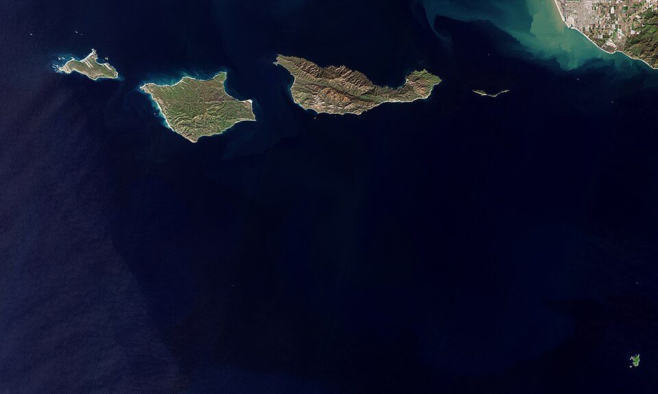
7 mi National ParkChannel Islands National Park227K visitors a year
23 mi MuseumRonald Reagan Presidential Library
38 mi MuseumGetty Villa454K visitors a year
25 mi MountainPoint Dume
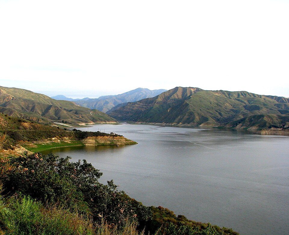
34 mi LakeLake PiruSix Flags Magic Mountain: Alton, CC BY 3.0 · Channel Islands National Park: Copernicus Sentinel-2, ESA, CC BY-SA 3.0 igo · Ronald Reagan Presidential Library: Unknown authorUnknown author, Public domain · Getty Villa: Bobak Ha'Eri, CC BY 3.0 · Point Dume: OMCV, Public domain · Lake Piru: tomsaint11, CC BY 2.0
Who provides power, water and the rest in Port Hueneme, and how to reach them.
EPA SDWIS (Oct 9, 2026) · HIFLD + EIA-861 2025 · Census 2020 ZCTAs · NCES 2024–25 · registration: vote.gov, updated Nov 18, 2024.
Ordered by what stands out in Port Hueneme.
Port Hueneme fares better on crime within California than nationally, has milder winter nights than nearly all U.S. towns and owes part of its health edge to its incomes.
Compared with 93% of U.S. communities, expected storm and flood damage in Port Hueneme is higher. FEMA puts 55% of the town’s expected hazard losses down to earthquakes, and 44% to inland flooding. Federal aid has come to Port Hueneme households in 4 declared disasters; the latest was in 2022.
FEMA disaster declarations and aid · FEMA flood insurance claims · FEMA National Risk Index · OpenFEMA
One of its 4 schools is below, with the reason it’s listed. Public schools: the Hueneme Elementary school district.
| School | Level | Students | Letter |
|---|---|---|---|
| Richard Bard ElementaryLargest public elementary schoolGrades K–5 | Grades K–5 | 539 | – |
NCES · EDFacts · graded within CA on state tests and graduation
At 33.3 crimes per 1,000 residents a year, it reports more crime than 61% of California’s graded towns. Reported crimes rose from 399 to 467 over the last three FBI years, a rise beyond ordinary year-to-year swings.
Its rate of thefts and burglaries comes in at 17.6 per 1,000 residents. Port Hueneme’s violent offense rate comes in at 4.4 per 1,000 residents.
| Port Hueneme | California towns | U.S. towns | |
|---|---|---|---|
| Violent crimes per 1,000 (2025) | 4.4 per 1,000 residents | 2.9 | 1.6 |
| Property crimes per 1,000 (2025) | 17.6 per 1,000 residents | 13.3 | 9.9 |
FBI crime data, 2025 · crimes reported to police
The average commute for its 9,508 working residents takes 22.6 minutes, against 28.7 across California.
For working residents in Port Hueneme, the share who work locally is 3.8%. This California town had 3,224 jobs in 2023, up 336 from 2013. The average commute in the town is 23 minutes. The top destinations are Oxnard (18%), Los Angeles (13%) and San Buenaventura (Ventura) (11%).
| Port Hueneme | California towns | U.S. towns | |
|---|---|---|---|
| Average trip to work | 23 minutes | 28 minutes | 25 minutes |
| Work from home | 8% | 14% | 11% |
| Working residents who work in town | 3.8% | 6.6% | 8% |
| Below the poverty line | 11% | 10% | 9.6% |
Census LEHD 2023 · ACS
January nights average 47.9°, milder than in 98% of U.S. towns; July afternoons average 70°.
For Port Hueneme, the January low is 48°F. Snow almost never falls.
NOAA U.S. Climate Normals, 1991–2020
48% of households own their home in Port Hueneme. The typical Port Hueneme home is worth about $622,000, up 1.3% in a year, 18% below the California typical home. Its midpoint rent is $2,228 a month.
| Port Hueneme | California towns | U.S. towns | |
|---|---|---|---|
| Households that own their home | 48% | 64% | 73% |
| Median rent | $2,228 a month | $1,895 a month | $1,185 a month |
Census ACS, 2020–24 · Zillow Home Value Index · Redfin Data Center
Across 7 parks and preserves: 0.5 miles of trail. The biggest park or preserve is Richard Bard Bubbling Springs Park, at 33 acres. The concentration of trails for Port Hueneme comes to 0.1 miles per square mile.
| Port Hueneme | California towns | U.S. towns | |
|---|---|---|---|
| Miles of trail per square mile | 0.1 miles per square mile | 1.0 | 0.4 |
| Conserved land | 2.8% | 4.3% | 4.3% |
| Biggest places to walk | Trails | Acres |
|---|---|---|
| 1. Richard Bard Bubbling Springs Park | — | 33 |
| 2. Port Hueneme Beach Park | 0.1 mi | 17 |
| 3. Walter B Moranda Park | — | 10 |
Trails & parks © OpenStreetMap contributors · Conserved land: USGS PAD-US
Against the 9,614 U.S. towns with household incomes like Port Hueneme’s, it is less healthy than 65%: its national edge comes with its incomes.
The share of adults in Port Hueneme who feel lonely: 36%. Among adults locally, 25% say their health is fair or poor and 21% worry about having enough food.
| Port Hueneme | California towns | U.S. towns | |
|---|---|---|---|
| Yearly checkup (CDC PLACES) | 72% | 72% | 79% |
| No health insurance, 18–64 (CDC PLACES) | 14% | 9% | 8.1% |
| Fair or poor health (CDC PLACES) | 25% | 22% | 19% |
| Food insecurity (CDC PLACES) | 21% | 16% | 14% |
| What stands out | Port Hueneme | CA |
|---|---|---|
| More uninsured adults | 13.8% | 10.6% |
| More adults facing housing insecurity | 18% | 14.9% |
| More adults facing a utility shut-off | 8.6% | 7.3% |
CDC PLACES 2025 · modeled estimates for adults · CMS · HRSA
4 within 15 miles of the center of Port Hueneme
About 7 of every 100 Port Hueneme residents are enrolled in college, about the same as California.
2 places in Port Hueneme on the National Register of Historic Places.
5 notable people were born in Port Hueneme.
City in California, United States
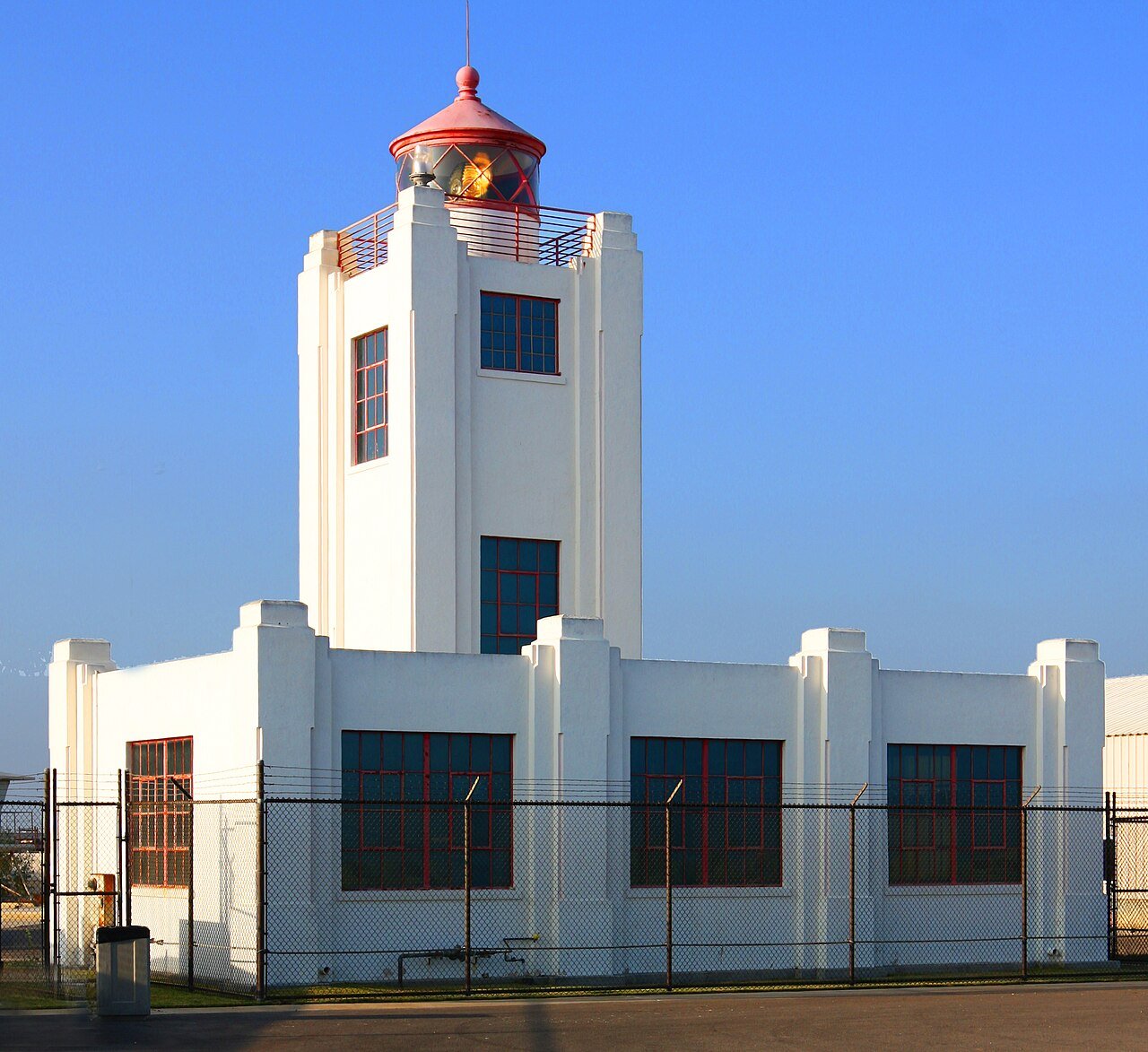
Port Hueneme ( wy-NEE-mee; Chumash: Wene Me) is a small beach city in Ventura County, California, surrounded by the city of Oxnard and the Santa Barbara Channel. Both the Port of Hueneme and Naval Base Ventura County lie within the city limits. Port Hueneme has a south-facing sand beach, known for its surfing. The beach has a wooden fishing pier and is about a mile long between Ormond Beach downcoast and Point Hueneme Light at the harbor entrance shared by the naval base and the port. The Waterfront Promenade, also known as the Lighthouse Promenade, provides a paved public access along the shoreline with two historic sites at viewpoints, the 1872 Wharf and the Oxnard Packing House.
From Wikipedia, licensed CC BY-SA 4.0 · facts via Wikidata (CC0)
2 towns share a border with Port Hueneme.
| Town | CA rank | Overall | Cost | Safety | Schools | Health |
|---|---|---|---|---|---|---|
| Port Hueneme | #636 | D | D | C− | C− | B− |
| Oxnard | #697 | D | D | C− | C− | C+ |
| Channel Islands Beach | #397 | C | D− | — | C− | A |
Channel Islands Beach reports no FBI crime data of its own. Compare Port Hueneme with a neighbor →
Short answers, built from the data on this page.
Port Hueneme grades D overall, better than 8% of U.S. towns and #636 of 841 in California. It grades B− for health, C− for safety and C− for schools. Hazard risk is its weak spot, with a D−.
Yes. Cost of living, which also weighs rents, property taxes and how many households pay 30% or more of their income for housing, grades D.
5 notable people were born here, including Maria Bamford and Jerod Mixon.