Guest, Sign inJoin

Post to Oxnard

We’ll email a one-tap link to publish your post. No password, and nothing is public until you click it.
Already a member? Sign in
Embassy Suites Lobby Front, Oxnard, CA,USA May 2009 - panoramio (cropped)
California›Ventura County

OxnardCA

A city of 199,651, settled in 1898. Home to 58 notable people.

4 bordering townsMap →
Photo: Tori Sloane · CC BY-SA 3.0
Photo of Oxnard

Oxnard, CA · Photo: Tori Sloane · CC BY-SA 3.0 · Source ↗

Is Oxnard a good place to live?

Oxnard earns a D, 697th among California's 841 graded towns, mostly because of safety and schools. Its police reported 1,109 violent crimes reported to the FBI in 2025, a higher rate per resident than 85% of U.S. towns. Its public schools trail 76% of California towns on state tests and graduation. What it does well: it is more walkable than 80% of U.S. towns. Oxnard’s peak summer temperature is 73°F, where California’s towns sit at 89°F and U.S. towns at 85°F. Oxnard's civic life (library use, community groups, volunteering) trails 98% of U.S. towns. Oxnard is home to Oxnard College.

What makes Oxnard stand out

Where Oxnard beats most towns, and one thing worth knowing.

College town

Oxnard College calls Oxnard home

College Scorecard · IPEDS

How Oxnard grades

Each subject compared with towns across the country (schools within California), ordered by how far Oxnard is from typical.

How grading works
Character Graded, but not part of the overall grade.
Described, not graded Taste, not quality: snow or an older crowd is neither good nor bad.

How TownRatings grades towns →

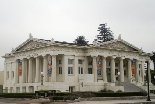
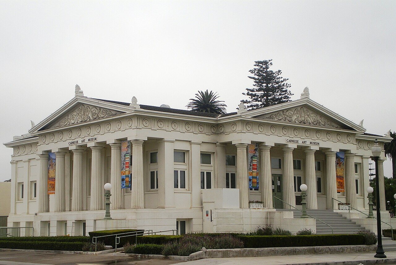
Oxnard Public Library
Oxnard Public Library · National Register of Historic Places
Oxnard’s story

128 years in pictures

Census counts: 2,555 in 1910, 202,063 in 2020. The archive holds 24 old photos and papers going back to 1880 and 4 maps from 1904 on.

4 places on the National Register of Historic Places.

  • 1898Oxnard is settled
Explore the history →
Nearby attractions

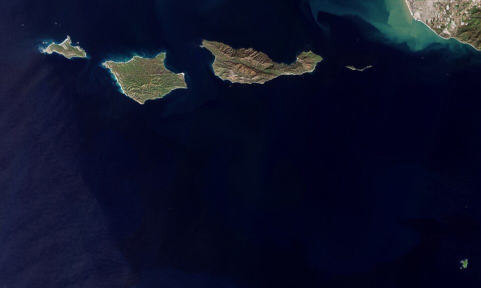
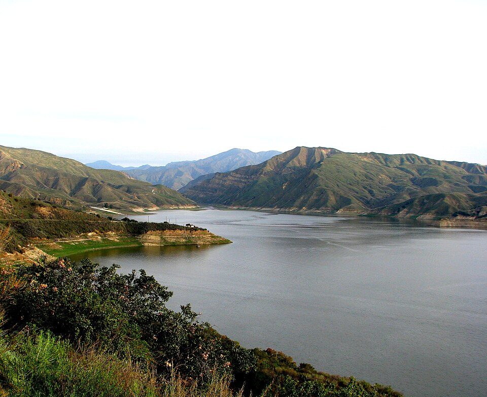
Six Flags Magic Mountain and 35 more within 40 miles

Museums, parks, gardens and other places to visit around Oxnard. Close and well known come first.

All 186 attractions →
Sources: National Park Service · ski areas © OpenSkiMap / OpenStreetMap contributors · Wikidata · Wikipedia readership · photos via Wikimedia Commons
Photo credits

Six Flags Magic Mountain: Alton, CC BY 3.0 · Channel Islands National Park: Copernicus Sentinel-2, ESA, CC BY-SA 3.0 igo · Ronald Reagan Presidential Library: Unknown authorUnknown author, Public domain · Getty Villa: Bobak Ha'Eri, CC BY 3.0 · Lake Piru: tomsaint11, CC BY 2.0 · Point Dume: OMCV, Public domain

Getting set up

Moving to Oxnard: who provides what

Who provides power, water and the rest in Oxnard, and how to reach them.

The full setup list →
PowerSouthern California Edison31.5¢/kWh · EIA 2025HIFLD · EIA
WaterUnited Wtr Cons Dist water systemNo health-based violations in 5 years · EPAEPA
Internet5 providers98% of addresses get 100/20 MbpsFCC
Trash & dumpDel Norte Recycling Center111 South Del Norte BoulevardOpenStreetMap
SchoolsOxnard Union High School DistrictOxnard Elementary School DistrictRio Elementary School District3 districts serve Oxnard; which school depends on your address and gradeNCES
Register to voteOnlineIn California you can register online until 15 days before Election Day, in person up to and including Election Day, or by mail (postmarked 15 days before).vote.gov
Who runs elections hereVentura County Clerk-ElectionsVentura County; contacts on the Handbook page.FVAP, Sep 2025
ZIP codes93033, 93030, 93036, 9303593033 39% · 93030 29% · 93036 19% · 93035 12%Census 2020

EPA SDWIS (Oct 9, 2026) · HIFLD + EIA-861 2025 · Census 2020 ZCTAs · NCES 2024–25 · registration: vote.gov, updated Nov 18, 2024.

The data

Ordered by what stands out in Oxnard.

Oxnard has milder winter nights than nearly all U.S. towns and has seen reported crime fall beyond ordinary swings, but it trails even towns with similar incomes on health.

SafetyC−

Oxnard earns a C− for safety

Reported crimes fell from 4,698 to 4,324 over the last three FBI years, a drop beyond ordinary year-to-year swings.

For Oxnard, the violent offense rate is 5.5 per 1,000 residents. Its level of property crime stands at 16.1 per 1,000 residents.

15%of U.S. towns report more crimeC−Safety Grade
OxnardCalifornia townsU.S. towns
Violent crimes per 1,000 (2025)5.5 per 1,000 residents2.91.6
Property crimes per 1,000 (2025)16.1 per 1,000 residents13.39.9

Violent crime per 1,000 residents

Oxnard5.5
California4.4
U.S.3.3

Property crime per 1,000 residents

Oxnard16.1
California18.2
U.S.15.5
15th
percentile among U.S. towns we grade
22nd
percentile among CA towns
1,109
violent crimes reported in 2025
3,215
property crimes reported in 2025

FBI crime data, 2025 · crimes reported to police

SchoolsC−

Oxnard earns a C− for schools

Three of its 53 schools are below, each with the reason it’s listed. 6 public schools serve Oxnard, with 5,092 students in all.

24%of CA districts it outscoresC−School Grade
SchoolLevelStudentsLetter
Charles Blackstock Junior HighLargest public middle schoolGrades 6–8Grades 6–81,239C−
Pacifica HighLargest public high schoolGrades 9–12Grades 9–122,675B−
Oxnard Middle College HighTop results in townGrades 9–12Grades 9–12194A

NCES · EDFacts · graded within CA on state tests and graduation

Natural hazardsHazard risk grade D

The biggest natural risk in Oxnard is earthquakes, at a very high overall level

Households in Oxnard have drawn federal disaster aid in 7 declared disasters, most recently in 2022. Storm and flood damage is expected to run higher than in 90% of U.S. communities. This California town has had 47 paid flood insurance claims since 1978. Of the losses FEMA expects locally, 64% come from earthquakes and 35% from inland flooding.

90risk score of 100
FEMA risk score
90Very high riskLowerHigher
EarthquakesInland flooding
47
paid flood claims since 1978
7
federal disasters paid out here

FEMA disaster declarations and aid · FEMA flood insurance claims · FEMA National Risk Index · OpenFEMA

Work & commuteJobs & income grade B

With 0.7 jobs for every working resident, most of Oxnard’s workers commute out

About one worker in four stays in Oxnard for work. 7.4% of Oxnard workers work from home. For half of commuters, work is under 9 miles away. The top destinations are San Buenaventura (Ventura) (13%), Camarillo (8%) and Los Angeles (7%).

27%work in town
OxnardCalifornia townsU.S. towns
Working residents who work in town27%6.6%8%
Work from home7.4%14%11%
Median household income$96,000$95,000$80,000
Average trip to work25 minutes28 minutes25 minutes

Where working residents work

In Oxnard27%
San Buenaventura (Ventura)13%
Camarillo8%
Los Angeles7%
Thousand Oaks3%
9 mi
median commute distance
53,457
jobs based in Oxnard
A commuter town
jobs vs. working residents
A−
Walkability grade: more walkable than 80% of U.S. towns

Census LEHD 2023 · ACS

OutdoorsA−

Oxnard keeps 6.5% of its land conserved

The biggest place to walk is McGrath State Beach, 373 acres with 1.7 miles of trail. There are 27 miles of trail across 50 parks and preserves. Oxnard’s concentration of trails comes in at 0.7 miles per square mile.

#475for trails in CA
OxnardCalifornia townsU.S. towns
Miles of trail per square mile0.7 miles per square mile1.00.4
Conserved land6.5%4.2%4.3%
6.5%
conserved · 1,620 of 24,950 acres
27 mi
of trails · 0.7 per sq mi
Biggest places to walkTrailsAcres
1. McGrath State Beach1.7 mi373
2. College Park1.5 mi70
3. Wilson Park0.9 mi7

Trails & parks © OpenStreetMap contributors · Conserved land: USGS PAD-US

Climate

Expect mild winters and pleasant summers in Oxnard

January nights average 46.3°, milder than in 97% of U.S. towns; July afternoons average 72.8°.

It almost never snows. In Oxnard, the January low is 46°F.

75°summer high

Typical low → high °F

Winter46–66°
Spring50–67°
Summer58–72°
Fall54–73°
+2.7°
vs. the 20th-century average
75°
typical summer high

NOAA U.S. Climate Normals, 1991–2020

HealthC+

Oxnard is less healthy than 58% of U.S. towns

Against the 9,147 U.S. towns with household incomes like Oxnard’s, it is less healthy than 79%, so it trails even them.

The share of adults in Oxnard who get no exercise outside work: 31%. CDC measures, 32 in all: Oxnard beats California on 2 and trails on 11. Among adults locally, 29% say their health is fair or poor and 70% had a checkup this year.

42%healthier than U.S. townsC+Health Grade
OxnardCalifornia townsU.S. towns
No health insurance, 18–64 (CDC PLACES)19%9%8.1%
Food insecurity (CDC PLACES)27%16%14%
Fair or poor health (CDC PLACES)29%22%19%
Yearly checkup (CDC PLACES)70%72%79%
32 measures vs. California
2 better19 too close to call11 worse
What stands outOxnardCA
Fewer adults who have had cancer4.8%6.4%
Fewer adults with arthritis17.6%20.8%
More uninsured adults19.2%10.6%
St. Johns Regional Medical Center
3 mi away · emergency room
2 of 3
care shortages: dental, mental health
30th
percentile among CA towns

CDC PLACES 2025 · modeled estimates for adults · CMS · HRSA

HousingCost of living grade D

Oxnard’s typical home value is about $758K

On the market in Oxnard: a median 41 days to sell. Its rent at the middle of the market is $2,032 a month. 54% of households own their home locally.

$758KZillow home value
OxnardCalifornia townsU.S. towns
Median rent$2,032 a month$1,895 a month$1,185 a month
Households that own their home54%64%73%
Renters paying 30%+ of income on rent57%55%48%

Typical home value

Oxnard$758K
California$762K
Market temperature
BalancedA seller's marketBuyer’sSeller’s
41
days on market
99.6%
sale-to-list price
+1.3%
value change, 1 year
57
homes sold in May

Census ACS, 2020–24 · Zillow Home Value Index · Redfin Data Center

Keep exploring

Everything we know about Oxnard

20pages on Oxnard
After high school

Colleges nearby

4 within 15 miles of the center of Oxnard

Landmarks

4 places in Oxnard on the National Register of Historic Places.

All landmarks →

Famous people from Oxnard

58 notable people were born in Oxnard.

See all 58 →

About Oxnard

City in California, United States

Official town website ↗

Oxnard ( ) is a city in Ventura County, California, United States. On California's Central Coast, it is the most populous city in Ventura County and the 22nd-most-populous city in California. Incorporated in 1903, Oxnard lies approximately 60 miles (97 km) northwest of downtown Los Angeles. It is at the western edge of the fertile Oxnard Plain, adjacent to agricultural fields with strawberries, lima beans and other vegetable crops. Oxnard is also a major transportation hub in Southern California, with Amtrak, Union Pacific, Metrolink, Greyhound, and Intercalifornias stopping there. It also has a small regional airport, Oxnard Airport (OXR). The town also has significant connections to the n…

From Wikipedia, licensed CC BY-SA 4.0 · facts via Wikidata (CC0)

Area
39 sq mi
Elevation
52 ft
ZIP code
93030, 93031, 93032
Area code
805

Oxnard’s neighbors

4 towns share a border with Oxnard.

Explore the map →
How the neighbors grade
TownCA rankOverallCostSafetySchoolsHealth
Oxnard#697DDC−C−C+
Channel Islands Beach#397CD−—C−A
El Rio#765D−D—C+C
Port Hueneme#636DDC−C−B−
San Buenaventura (Ventura)#418CDC−BB+

Channel Islands Beach and El Rio report no FBI crime data of their own. Compare Oxnard with a neighbor →

Questions about Oxnard

Short answers, built from the data on this page.

Is Oxnard, CA a good place to live?

Oxnard grades D overall, better than 5% of U.S. towns and #697 of 841 in California. It grades C+ for health, C− for safety and C− for schools. Hazard risk is its weak spot, with a D.

Is Oxnard, CA expensive?

Yes. That is 6.9 years of the area's median household income ($109,797 across the Oxnard-Thousand Oaks-Ventura, CA metro area). Cost of living, which also weighs rents, property taxes and how many households pay 30% or more of their income for housing, grades D.

What is Oxnard, CA known for?

58 notable people were born here, including Jeffrey Combs and Tony Ferguson.