
Lava Beds National Monument
Lava Beds National Monument is located in northeastern California, in Siskiyou and Modoc counties. Its address puts it 17 mi south of Tulelake. Running it is the National Park Service. Last counted in 2025, visitors numbered 144K.

A national monument, 17 mi south of Tulelake
Visits hit a record in 2025
The National Park Service counted 143,659 visitors in 2025, the most in 10 years of counts. Visitors ↓
Plan where you’ll sleep
The nearest town with many places to stay is Altamont, 35 miles north. Where to stay ↓
Best month: Jun
June is the mild month, with a high of 77°. When to go ↓
Established in 1925
Lava Beds National Monument dates from 1925 and is run by National Park Service. About ↓
Written from National Park Service visitor counts, NOAA 1991–2020 normals, Overture places to stay, Census town figures, Wikidata and Wikipedia. Updated when the Park Service posts a new month.
How the year runs
Each month at Lava Beds has its visitors and its weather below.
Lava Beds National Monument
Lava Beds National Monument is located in northeastern California, in Siskiyou and Modoc counties. The monument lies on the northeastern flank of Medicine Lake Volcano, which is the largest volcano by area in the Cascade Range.
The region in and around Lava Beds National Monument lies at the junction of the Sierra-Klamath, Cascade, and Great Basin physiographic provinces. The monument was established as a national monument on November 21, 1925, and includes more than 46,000 acres (190 km2).
- Type
- National Monument
- Established
- 1925
- Area
- 73 square miles
- Run by
- National Park Service
- Listed
- National Register of Historic Places (1991)
- Wikipedia readers
- 12K a year
- Official site
- nps.gov/labe
Getting in
- Private Vehicle$25
- Motorcycle$20
- Per Person$15
Towns to stay in near Lava Beds National Monument
You can sleep inside the park (1 place). The closest lodging is in Altamont (13) and Merrill (3).
Stay in the park
- Indian Well Campground RV park
Altamont
The closest town with somewhere to stay.
19,927 people
35 mi north of Lava Beds Visitor Center · 26 mi to the park
Compare 5 towns
| Town | From the visitor center | Drive | Places to stay | People | Typical home |
|---|---|---|---|---|---|
| Altamont | 35 mi north | 55 min | 13 8 hotels · 2 motels · 1 lodge or cabins · 1 campground · 1 RV park | 19,927 | $249K |
| Merrill | 22 mi north | 35 min | 3 1 hotel · 1 motel · 1 campground | 865 | $205K |
| Dorris | 27 mi northwest | 40 min | 4 1 motel · 2 inns & B&Bs · 1 RV park | 803 | $155K |
| Tulelake | 17 mi north | 25 min | 1 1 motel | 833 | $170K |
| Tennant 66% vacation homes | 23 mi southwest | 35 min | 1 1 lodge or cabins | 71 | $66K |
Getting there
Nearest airports with airline service, from the visitor center
Pair Lava Beds with these
More places people know lie within 67 miles.
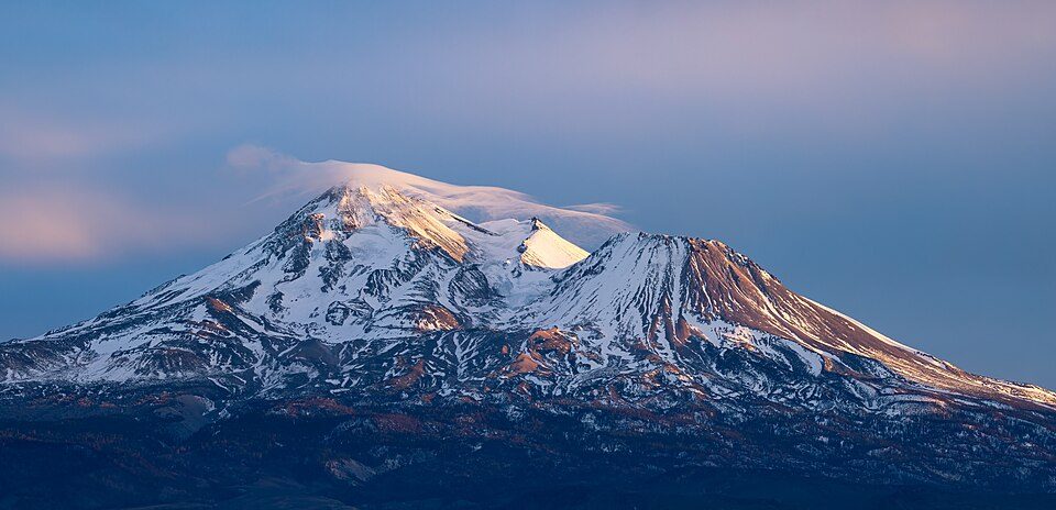 Big draw41 mi MountainMount Shasta
 114 mi National MonumentTule Lake National Monument5K visitors a year
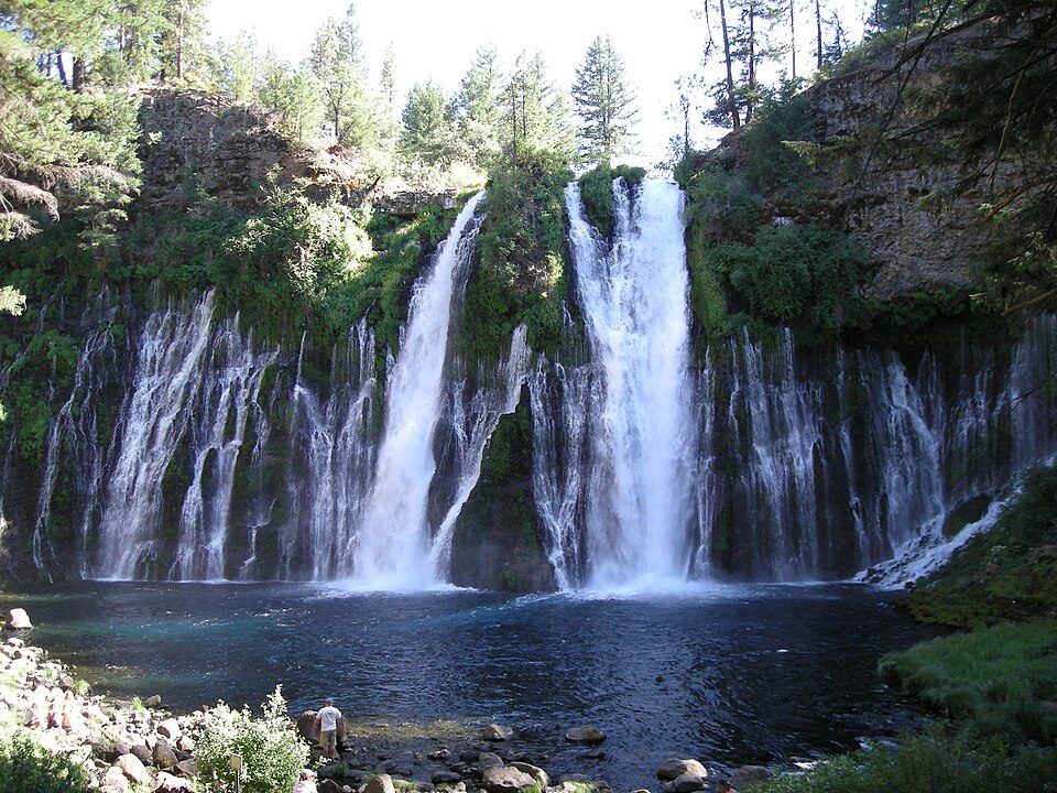 49 mi WaterfallBurney Falls
 51 mi WaterfallMossbrae Falls
 61 mi MuseumTrain Mountain Railroad
 67 mi Ski areaMount Ashland39 runs · 1,160 ft vertical45 mi Ski areaMt. Shasta Ski Park36 runs · 2,081 ft vertical
 50 mi City parkMount Shasta City Park
Photo credits
Mount Shasta: Frank Schulenburg, CC BY-SA 4.0 · Tule Lake National Monument: Russell Lee, Public domain · Burney Falls: Dvortygirl, CC BY-SA 3.0 · Mossbrae Falls: Pinecar at English Wikipedia, Public domain · Train Mountain Railroad: Tom703, CC BY-SA 3.0 · Mount Ashland: Alex Lockhart, Public domain · Mount Shasta City Park: Daniel Mayer (talk · contribs), CC BY-SA 3.0


Most visitors yet: 143,659 (2025)
See how visits changed from 2016 to 2025.
Quick answers on Lava Beds
What town is Lava Beds National Monument near?
Tulelake, CA, about 17 miles north.
When is the best time to visit Lava Beds National Monument?
June, with a high of 77°. July is the busiest month (about 23,354 visitors).
How many people visit Lava Beds National Monument each year?
143,659 in 2025, according to the National Park Service.
What is the closest airport to Lava Beds National Monument?
Rogue Valley International-Medford (MFR), about 83 miles away. The nearest big hub is Reno Tahoe (RNO), about 178 miles.
Where should I stay near Lava Beds National Monument?
Inside the park: Indian Well Campground. Nearby: Altamont (35 mi, 13 places to stay), Merrill (22 mi, 3 places to stay) and Dorris (27 mi, 4 places to stay).
Word from Tulelake
People in Tulelake have not posted tips yet; their Town Square is open.
Sources: National Park Service · ski areas © OpenSkiMap / OpenStreetMap contributors · Wikidata · Wikipedia readership · National Park Service visitor use statistics · NOAA climate normals · U.S. Census.