
Coconino National Forest
The Coconino National Forest is a 1.856-million acre (751,000 ha) United States National Forest located in northern Arizona in the vicinity of Flagstaff, with elevations ranging from 2,600 ft (800 m) to the highest point in Arizona at 12,633 ft (3,851 m) (Humphrey's Peak). It lies 2 mi south of Village of Oak Creek (Big Park). 1908 is when its story starts.

A national forest, 2 mi south of Village of Oak Creek (Big Park)
Summers are hot
July highs run 98–98°, and about 100 days a year reach 90°. When to go ↓
Village of Oak Creek (Big Park) is the nearest base
Village of Oak Creek (Big Park) is 2 miles north, with 19 places to stay. Where to stay ↓
A day trip from Phoenix
Phoenix is about 84 miles south and Mesa is about 94 miles south (straight-line). Where to stay ↓
Established in 1908
Coconino National Forest dates from 1908. About ↓
Best months: Apr and Oct
April and October are the mild months, with highs of 76–79°. When to go ↓
Written from NOAA 1991–2020 normals, Overture places to stay, Census town figures, Wikidata and Wikipedia.
Picking a season
Pick a month for Coconino National Forest from the weather below.
Coconino National Forest
The Coconino National Forest is a 1.856-million acre (751,000 ha) United States National Forest located in northern Arizona in the vicinity of Flagstaff, with elevations ranging from 2,600 ft (800 m) to the highest point in Arizona at 12,633 ft (3,851 m) (Humphrey's Peak). Originally established in 1898 as the "San Francisco Mountains National Forest Reserve", the area was designated a U.S. National Forest by Pres. Theodore Roosevelt on July 2, 1908, when the San Francisco Mountains National Forest Reserve was merged with lands from other surrounding forest reserves to create the Coconino National Forest. Today, the Coconino National Forest contains diverse landscapes, including deserts, ponderosa pine forests, flatlands, mesas, alpine tundra, and ancient volcanic peaks.
- Type
- National forest
- Established
- 1908
- Wikipedia readers
- 16K a year
Towns to stay in near Coconino National Forest
For a bed close by, look to Sedona (84) and Village of Oak Creek (Big Park) (19).
Sedona
The closest town with somewhere to stay.
9,619 people
7 mi north of Coconino National Forest
Compare 8 towns
| Town | From Coconino National Forest | Drive | Places to stay | People | Typical home | Safety |
|---|---|---|---|---|---|---|
| Sedona | 7 mi north | 10 min | 84 56 hotels · 4 motels · 17 inns & B&Bs · 3 lodges & cabins · 3 campgrounds · 1 RV park | 9,619 | $787K | — |
| Village of Oak Creek (Big Park) | 2 mi north | 5 min | 19 7 hotels · 1 motel · 8 inns & B&Bs · 3 lodges & cabins | 6,356 | $741K | — |
| Cottonwood | 13 mi west | 20 min | 23 11 hotels · 4 motels · 3 inns & B&Bs · 1 campground · 4 RV parks | 12,709 | $324K | B− |
| Cornville | 8 mi west | 10 min | 10 2 hotels · 1 inn or B&B · 4 lodges & cabins · 1 campground · 2 RV parks | 3,618 | $367K | — |
| Camp Verde | 14 mi south | 20 min | 20 8 hotels · 1 motel · 1 lodge or cabins · 1 campground · 9 RV parks | 12,581 | $318K | B− |
| Oak Creek Canyon 54% vacation homes | 13 mi north | 20 min | 12 1 inn or B&B · 8 lodges & cabins · 2 campgrounds · 1 RV park | 356 | $411K | — |
| Lake Montezuma | 9 mi south | 15 min | 4 1 lodge or cabins · 1 campground · 2 RV parks | 4,929 | $285K | — |
| Clarkdale | 17 mi west | 25 min | 11 3 hotels · 5 inns & B&Bs · 1 lodge or cabins · 1 campground · 1 RV park | 4,806 | $374K | A |
Day trip from
Straight-line miles.
Getting there
Nearest airports with airline service
Around Coconino National Forest
These well-known places are within 64 miles.
 111 mi National MonumentMontezuma Castle National Monument320K visitors a year
 25 mi MountainCathedral Rock
 41 mi MountainHumphreys Peak
 311 mi Canyon & gorgeOak Creek Canyon
 63 mi City parkStandin' on the Corner Park
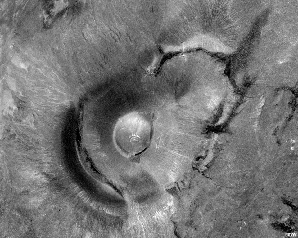 54 mi MountainRoden Crater
 45 mi National MonumentSunset Crater Volcano National Monument108K visitors a year
 40 mi Ski areaArizona Snowbowl53 runs · 2,368 ft vertical
Photo credits
Montezuma Castle National Monument: Bernard Gagnon, CC BY-SA 3.0 · Cathedral Rock: Terrydarc, CC BY-SA 3.0 · Humphreys Peak: Bob Blasi; Coconino National Forest, CC BY-SA 2.0 · Oak Creek Canyon: W. Bulach, CC BY-SA 4.0 · Standin' on the Corner Park: Tpaairman, CC BY-SA 3.0 · Roden Crater: Unknown, Public domain · Sunset Crater Volcano National Monument: National Park Service, Public domain · Arizona Snowbowl: Frederick Dennstedt from los angeles, usa, CC BY-SA 2.0


Visiting Coconino National Forest
What town is Coconino National Forest near?
Village of Oak Creek (Big Park), AZ, about 2 miles north.
When is the best time to visit Coconino National Forest?
April and October, with highs of 76–79°.
How far is Coconino National Forest from Phoenix and Mesa?
About 84 miles south of Phoenix and about 94 miles south of Mesa, as the crow flies.
What is the closest airport to Coconino National Forest?
Flagstaff Pulliam (FLG), about 27 miles away. The nearest big hub is Phoenix Sky Harbor (PHX), about 92 miles.
Where should I stay near Coconino National Forest?
Sedona (7 mi, 84 places to stay), Village of Oak Creek (Big Park) (2 mi, 19 places to stay) and Cottonwood (13 mi, 23 places to stay).
Notes from people in Village of Oak Creek (Big Park)
Ask a question, or answer one, in Village of Oak Creek (Big Park)’s Town Square.
Sources: National Park Service · ski areas © OpenSkiMap / OpenStreetMap contributors · Wikidata · Wikipedia readership · NOAA climate normals · U.S. Census.