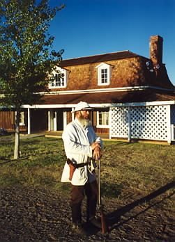
153 years in pictures
Census counts: 285 in 1960, 12,147 in 2020. The archive holds 18 old photos and papers going back to 1870 and 4 maps from 1923 on.
7 places on the National Register of Historic Places.
- 1873Camp Verde is settled
Each edition grades its towns against each other only.

FEMA rates its natural-hazard risk higher than 92% of U.S. communities, with inland flooding at the top. Overall it grades C−, ranked 92nd of 139 in Arizona. Its weakest subject is incomes: the median household income is $69K, and 16% of residents live below the poverty line. 51% of the land in Camp Verde is conserved, against 14% in Arizona’s towns and 4.3% across U.S. towns. Coconino National Forest, at 8,193 acres with 20.1 miles of trail, is the biggest park or preserve.
Where Camp Verde beats most towns, and one thing worth knowing.
Census counts: 285 in 1960, 12,147 in 2020. The archive holds 18 old photos and papers going back to 1870 and 4 maps from 1923 on.
7 places on the National Register of Historic Places.
Each subject compared with towns across the country (schools within Arizona), ordered by how far Camp Verde is from typical.
How TownRatings grades towns →
Who provides power, water and the rest in Camp Verde, and how to reach them.
EPA SDWIS (Oct 9, 2026) · HIFLD + EIA-861 2025 · Census 2020 ZCTAs · NCES 2024–25 · registration: vote.gov, updated Sep 12, 2025.
Ordered by what stands out in Camp Verde.
Camp Verde fares better on crime within Arizona than nationally, keeps more of its land conserved than most of Arizona and has more 90° days than nearly all U.S. towns.
Its 13,719 conserved acres are a larger share of the town than in 84% of Arizona towns.
35 miles of trail in 4 parks and preserves. Camp Verde’s trail density is 0.8 miles per square mile, where Arizona’s towns sit at 1.1 and U.S. towns at 0.4.
| Biggest places to walk | Trails | Acres |
|---|---|---|
| 1. Coconino National Forest | 20.1 mi | 8,193 |
| 2. Rockin' River Ranch State Park | — | 32 |
| 3. Rezzonico Family Park | 0.2 mi | 5 |
Trails & parks © OpenStreetMap contributors · Conserved land: USGS PAD-US
Its public schools are run by the Camp Verde Unified District. Two of its 9 schools are below, each with why it’s listed. The largest public high school is Camp Verde High School, with 499 students.
| School | Level | Students | Letter |
|---|---|---|---|
| Camp Verde Elementary SchoolLargest public elementary schoolGrades PK–5 | Grades PK–5 | 716 | B− |
| Camp Verde High SchoolLargest public high schoolGrades 9–12 | Grades 9–12 | 499 | D− |
NCES · EDFacts · graded within AZ on state tests and graduation
Since 1993, 23 flood insurance claims have been paid out in Camp Verde.
FEMA flood insurance claims · FEMA National Risk Index · OpenFEMA
The Montezuma Castle Nm weather station records that about 135 days a year reach 90°, more than in 99% of U.S. towns. July afternoons average 101.4°, hotter than in 99% of U.S. towns; January nights average 29.6°.
Camp Verde has mild winters and scorching summers, with very little rain. Camp Verde’s July high is 101°F. Snow is almost unheard of.
| Camp Verde | Arizona towns | U.S. towns | |
|---|---|---|---|
| July high | 101°F | 100°F | 85°F |
| January low | 30°F | 37°F | 22°F |
NOAA U.S. Climate Normals, 1991–2020
About one in 3 of Camp Verde’s working residents works in town. Jobs based in Camp Verde grew to 3,485 in 2023, 675 more than in 2013. The average trip to work in Camp Verde is 27 minutes.
| Camp Verde | Arizona towns | U.S. towns | |
|---|---|---|---|
| Working residents who work in town | 30% | 10% | 8% |
| Average trip to work | 27 minutes | 24 minutes | 25 minutes |
Census LEHD 2023 · ACS
Camp Verde beats the Arizona average on 1 of 32 CDC measures and trails it on 16. 17% of Camp Verde adults report frequent physical distress.
| Camp Verde | Arizona towns | U.S. towns | |
|---|---|---|---|
| Frequent physical distress (CDC PLACES) | 17% | 15% | 14% |
| Fair or poor health (CDC PLACES) | 25% | 21% | 19% |
| Smoke cigarettes (CDC PLACES) | 17% | 13% | 14% |
| Yearly checkup (CDC PLACES) | 74% | 75% | 79% |
| What stands out | Camp Verde | AZ |
|---|---|---|
| More adults treating high blood pressure | 76.9% | 73.9% |
| More adults with COPD | 11% | 6.6% |
CDC PLACES 2025 · modeled estimates for adults · CMS · HRSA
At 17.4 crimes per 1,000 residents a year, it reports less crime than 74% of Arizona’s graded towns. Reported crimes fell from 208 to 116 over the last three FBI years, a drop beyond ordinary year-to-year swings.
FBI crime data, 2025 · crimes reported to police
The typical Camp Verde home is worth about $427,000, up 1.7% in a year, close to the Arizona typical home.
| Camp Verde | Arizona towns | U.S. towns | |
|---|---|---|---|
| Median rent | $1,059 a month | $1,206 a month | $1,185 a month |
| Households that own their home | 76% | 76% | 73% |
Zillow Home Value Index · Redfin Data Center
Museums, parks, gardens and other places to visit around Camp Verde. Close and well known come first.
3 mi National MonumentMontezuma Castle National Monument320K visitors a year
18 mi MountainCathedral Rock
14 mi National forestCoconino National Forest
25 mi Canyon & gorgeOak Creek Canyonin town Zoo & aquariumOut of Africa Wildlife Park
16 mi National MonumentTuzigoot National Monument86K visitors a yearMontezuma Castle National Monument: Bernard Gagnon, CC BY-SA 3.0 · Cathedral Rock: Terrydarc, CC BY-SA 3.0 · Coconino National Forest: Adam Baker from Houston / Moscow / Toulouse (travel a lot), CC BY 2.0 · Oak Creek Canyon: W. Bulach, CC BY-SA 4.0 · Tuzigoot National Monument: The original uploader was Jhugg at English Wikipedia., CC BY-SA 3.0
None within 15 miles of Camp Verde; the nearest are
About 3 of every 100 Camp Verde residents are enrolled in college, against 6 across Arizona.
10,873 counted in 2010 and 12,147 in 2020; an estimated 12,581 in 2025.
U.S. Census 2010 & 2020 counts · Census Bureau estimate, July 1, 2025
7 places in Camp Verde on the National Register of Historic Places.
Town in Yavapai County, Arizona
Camp Verde (Yavapai: ʼMatthi:wa; Western Apache: Gambúdih) is a town in Yavapai County, Arizona, United States. As of the 2020 census, Camp Verde had a population of 12,147. Every summer, the downtown area of Camp Verde is the site of the annual Corn Fest; held each year on the third Saturday in July, the popular event is sponsored and organized by local growers, Hauser and Hauser Farms. Other annual local events include the Pecan, Wine and Antiques Festival (February), the Crawdad Festival (June) and Fort Verde Days (October).
From Wikipedia, licensed CC BY-SA 4.0 · facts via Wikidata (CC0)
One town shares a border with Camp Verde.
| Town | AZ rank | Overall | Cost | Safety | Schools | Health |
|---|---|---|---|---|---|---|
| Camp Verde | #92 | C− | B− | B− | B− | C+ |
| Cottonwood | #106 | C− | C | B− | C | B− |
Short answers, built from the data on this page.
Camp Verde grades C− overall, better than 24% of U.S. towns and #92 of 139 in Arizona. It grades C+ for health, B− for safety and B− for schools. Hazard risk is its weak spot, with a D−.
That is 6.1 years of the area's median household income ($69,613 across the Prescott Valley-Prescott, AZ metro area). Cost of living, which also weighs rents, property taxes and how many households pay 30% or more of their income for housing, grades B−.