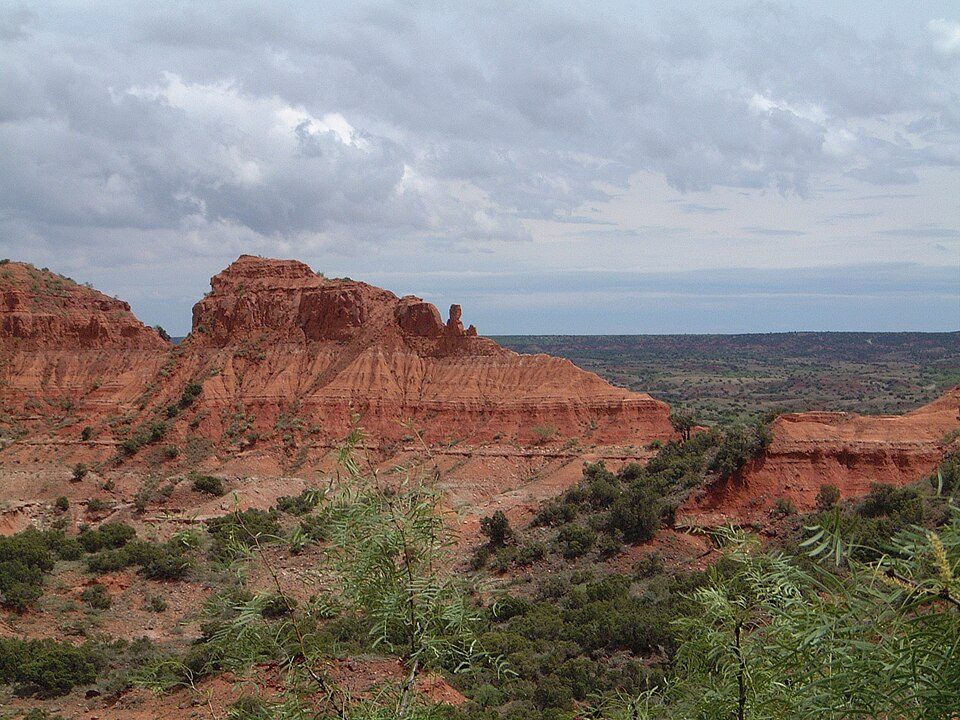
Caprock Canyons State Park and Trailway
Caprock Canyons State Park and Trailway is a 17,500-acre (7,100 ha) state park located along the eastern edge of the Llano Estacado. It stands 15 mi east of Silverton. Running it is Texas Parks and Wildlife Department.

A state park, 15 mi east of Silverton
Plan where you’ll sleep
No town within 30 miles has many hotels or campgrounds. Look at the towns below, or plan to camp. Where to stay ↓
Summers are hot
July and August highs run 91–93°, and about 74 days a year reach 90°. When to go ↓
Best months: Apr, May, Sep and Oct
April, May, September and October are the mild months, with highs of 74–84°. When to go ↓
Established in 1982
Caprock Canyons State Park and Trailway dates from 1982 and is run by Texas Parks and Wildlife Department. About ↓
Written from NOAA 1991–2020 normals, Overture places to stay, Census town figures, Wikidata and Wikipedia.
Weather, month by month
Every month near Caprock Canyons State Park and Trailway is set out below.
Caprock Canyons State Park and Trailway
Caprock Canyons State Park and Trailway is a 17,500-acre (7,100 ha) state park located along the eastern edge of the Llano Estacado in Briscoe County, Texas, United States. The park opened in 1982 and is managed by the Texas Parks and Wildlife Department (TPWD).
- Type
- State park
- Established
- 1982
- Area
- 24 square miles
- Elevation
- 2,438 ft
- Run by
- Texas Parks and Wildlife Department
- Wikipedia readers
- 6.9K a year
Places to stay near Caprock Canyons State Park and Trailway
The closest lodging is in Memphis (3) and Clarendon (3).
Silverton
The closest town with somewhere to stay.
639 people
15 mi west of Caprock Canyons State Park and Trailway
Compare 3 towns
Getting there
Nearest airports with airline service
More to see nearby
These lie within 69 miles as the crow flies.
 49 mi Canyon & gorgePalo Duro Canyon
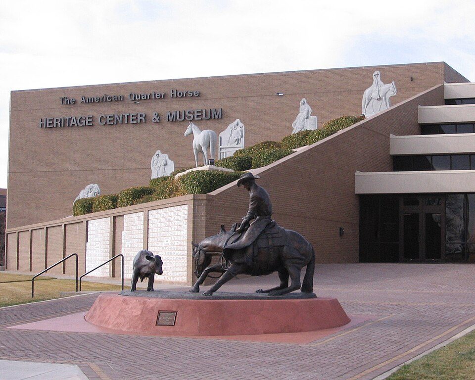 67 mi MuseumAmerican Quarter Horse Hall of Fame
 60 mi MuseumDevils Rope Barbed Wire Museum
 62 mi MuseumPanhandle–Plains Historical Museum
 68 mi MuseumAmarillo Museum of Art
 65 mi MuseumTexas Air & Space Museum2K visitors a year
 65 mi MuseumCarson County Square House Museum
Photo credits
Palo Duro Canyon: Kimberly Vardeman from Lubbock, TX, USA, CC BY 3.0 · American Quarter Horse Hall of Fame: No machine-readable author provided. J. Nguyen~commonswiki assumed (based on cop, CC BY-SA 3.0 · Devils Rope Barbed Wire Museum: Venturist from London, United Kingdom, CC BY 2.0 · Panhandle–Plains Historical Museum: No machine-readable author provided. Who What Where Nguyen Why~commonswiki assum, Public domain · Amarillo Museum of Art: Who What Where Nguyen Why a/k/a Anonymous Cow, CC BY-SA 3.0 · Texas Air & Space Museum: Richardawarner, CC BY-SA 3.0 · Carson County Square House Museum: The original uploader was Billy Hathorn at English Wikipedia., CC BY-SA 3.0


Quick answers on Caprock Canyons State Park and Trailway
What town is Caprock Canyons State Park and Trailway near?
Silverton, TX, about 15 miles west.
When is the best time to visit Caprock Canyons State Park and Trailway?
April, May, September and October, with highs of 74–84°.
What is the closest airport to Caprock Canyons State Park and Trailway?
Rick Husband Amarillo (AMA), about 65 miles away. The nearest big hub is OKC Will Rogers World (OKC), about 206 miles.
Where should I stay near Caprock Canyons State Park and Trailway?
Memphis (35 mi, 3 places to stay) and Clarendon (35 mi, 3 places to stay).
Locals’ advice in Silverton
Questions and tips go in Silverton’s Town Square.
Sources: National Park Service · ski areas © OpenSkiMap / OpenStreetMap contributors · Wikidata · Wikipedia readership · NOAA climate normals · U.S. Census.