Tuscaloosa dates to 1819, and 32 of its places are on the National Register
More historic than 71% of U.S. towns · #36 of 187 in Alabama. What drives it
Most of Tuscaloosa was built recently: 4% of its homes predate 1940 and the median home dates from 1988. 32 places in town are on the National Register, among them the Foster Auditorium, The University of Alabama, a National Historic Landmark, and nine historic districts with 362 buildings between them. Below: 19 old photos and papers, maps from 1884 on, and the census since 1840.
Founding year: Wikidata. First post office: 1818.The full story ↓
History grade
What drives Tuscaloosa’s History grade
On its age, its old homes and the National Register, Tuscaloosa is more historic than 71% of U.S. towns, #36 of 187 in Alabama. Its National Register listings hold the grade up; its share of homes from before 1940 pulls it down.
B+
HistoryA character grade: shown, never part of Tuscaloosa’s overall grade.
Among the 400 U.S. cities of 100,000 or more, Tuscaloosa ranks #164 on History.
Alabama towns list about as much on the Register as the country (a typical Alabama town has 2.7 per 10,000 residents, the U.S. 2.4), so Tuscaloosa’s 34.8 sits above most of its state (73% of Alabama towns have fewer) while its 386 historic buildings outnumber those of 96% of U.S. towns.
How sure. Graded on any two of the three inputs instead, the letter would range from B− to A. The pre-1940 share (±0.7 points) is firm at this size. Two sources give 1819.
Founding year: Wikidata (other dates in Quick answers). Homes: Census ACS 2020–24. National Register: National Park Service, May 2026 list; each listing counted once (boundary changes and added documentation belong to their listing), and a historic district counts its contributing buildings. How TownRatings grades history →
What stands out about Tuscaloosa’s past
Read from the archive, the National Register and the record. The page puts what stands out first.
The country’s official list of buildings and places worth saving. One is a National Historic Landmark, the highest tier. Boundary changes and added documentation are counted with their listing.
National Park Service, National Register of Historic Places. Photos from Wikimedia Commons, credited on each place’s page.
Places that used to be
Lost post offices, old corners, places now gone and burying grounds
Tuscaloosa’s post office has been open since 1822. Four other post offices opened and closed inside today’s town.
Black Warrior
1818–1822
Tuscaloosa
1822–today
Kennedale
1868–1877
Cottondale
1877–today
Box Spring
1878–1880
University
1886–today
Snyder
1901–1909
18101920today
Hamlets and corners on the map
Academy DriveAlberta CityAlberta HeightsAlpine HillsAlta VistaAltamontArcadiaArlington DriveArlington Mobile Home ParkAsburyAudubon PlaceBar Wayne CircleBeech HillsBellview HeightsBerkley HillsBeverley HeightsBox SpringsBrentwoodBriarwoodBroadviewBrookhavenBrooksdaleBuena VistaBurks Garden
Gone or out of use
Alabama Central Female CollegeschoolAlberta Church of ChristchurchBakers MilllocaleBethel SchoolschoolBlackburns MilllocaleBrandon Memorial Methodist ChurchchurchBridge LandinglocaleBrown SchoolschoolBrowns MilllocaleBrycelocaleCastle Hill Elementary SchoolschoolCentral High School East CampusschoolCentral High School West CampusschoolChambers MilllocaleCribbs MilllocaleDowntown Station Tuscaloosa Post Officepost officeEast End Elementary SchoolschoolEast Engineering Buildingbuilding
12cemeteries and burying grounds inside Tuscaloosa
AlbertaBeautiful ZionCenterDardenEvergreenGreenwoodHopewellMemory Hill GardensPine RidgeRobertson ChapelThe OldWest Highland Memorial
US Post Offices dataset (Blevins & Helbock, CC0). Places and cemeteries from the USGS Geographic Names Information System (2021).
Reportedly the name Tuscaloosa is a compound Choctaw Indian word; "tusko" meaning "warrior" and "loosa" meaning "black". The Black Warrior River flows through the north portion of the city. In 1809 Creek chief Occechemolta established a settlement at the falls of the river. (US-T125/Alabama: A Guide to the Deep South/p 244). County seat of Tuscaloosa County 1818 to 1822 and 1826 to the present. State capital from 1826 to 1846.
Passages that mention Tuscaloosa, cut from the printed page as they were published.
Historical and statistical review and mailing and shipping guide of North Alabama (illustrated) embracing the cities of Birmingham, Anniston, Gadsden, Huntsville, Decatur, Tuscaloosa and Bessemer, with their manufacturing and mercantile industries ... and1888 · page 321Read the page →
Read the text
On the line of the Alabama Great Southern Railroad, sixteen miles from Tuscaloosa, there has been opened up a vein of red iron ore over sixteen feet in thickness, which assays forty-seven per cent. iron. Within five miles, on the same line of railroad, are great quantities of brown ore, while limerock of high grade is just at hand. We have the authority of learned geologists for the statement that both the coal and iron of the Warrior field improve in quality as they run to the south.
Text read by machine from the scan; it may contain errors.
Historical and statistical review and mailing and shipping guide of North Alabama (illustrated) embracing the cities of Birmingham, Anniston, Gadsden, Huntsville, Decatur, Tuscaloosa and Bessemer, with their manufacturing and mercantile industries ... and1888 · page 322Read the page →
Read the text
Tuscaloosa Belt Line, steam motor, passenger and freight traffic. Supplies all purchased. Line will be in operation in November. Macon & Tuscaloosa Railway. Charter recently amended to Macon, Tuscaloosa i& Birmingham Railroad.
Text read by machine from the scan; it may contain errors.
Scans and text from the Internet Archive. Books published in 1930 or earlier, which are in the public domain.
Timeline
Tuscaloosa, 1818 to 1945
Woven from the archive, old maps, post office records, the National Register and the people born here.
Every edition of the U.S. Geological Survey’s map of Tuscaloosa. Tap a year, or press play to watch the town change.
1924Tuscaloosa sheet · 1:62,500
U.S. Geological Survey historical topographic maps (public domain), via Esri’s collection of the scans. The red ring marks the center of Tuscaloosa.
Every building
Tuscaloosa, building by building, 1884–1910
Fire insurance maps drew every building, what it was made of and what it was used for, so insurers could price the risk of fire. Pick a year, then a sheet.
In 1819, according to Wikidata. Tuscaloosa’s post office opened in 1818, and the census of 1840 counted 1,949 people here.
How does Tuscaloosa rank for history?
Tuscaloosa is more historic than 71% of U.S. towns, #36 of 187 in Alabama. The History grade combines the town’s founding era, the share of homes built before 1940 and its National Register listings. It’s a character grade, so it isn’t part of the overall grade. How it works.
What is on the National Register in Tuscaloosa?
32 listings: 23 buildings, among them the Foster Auditorium, The University of Alabama (a National Historic Landmark since 2005), and the Collier-Overby House (listed 1971, the first), and 9 historic districts with 362 contributing buildings. 386 historic buildings in all.
How old are the homes in Tuscaloosa?
4% of Tuscaloosa’s homes were built before 1940 (Census estimate), against a typical 3.2% for an Alabama town; the median home was built in 1988.
Founding dates: Wikidata, Wikipedia, the U.S. post office records of Blevins & Helbock (CC0) and the Census. Homes by year built: Census ACS 2020–24. National Register of Historic Places: National Park Service (list of May 22, 2026). Old photos, postcards and papers: Wikimedia Commons, the Library of Congress and other public archives, credited on each item’s page. Maps: U.S. Geological Survey historical topographic maps (via Esri) and Sanborn fire-insurance maps (Library of Congress). History text and census tables: Wikipedia (CC BY-SA 4.0). Places that used to be: USGS Geographic Names Information System (2021).
From Wikimedia Commons (17), the Library of Congress (2), Wikidata (10), the National Register of Historic Places (32), Wikipedia, Wikidata and Wikipedia for famous people, U.S. Geological Survey historical maps, U.S. Census counts (via Wikipedia), the US Post Offices dataset (Blevins & Helbock), the USGS Geographic Names Information System, Sanborn fire insurance maps (Library of Congress) and old county and town histories (Internet Archive). Archive images are copied here with their credits and licenses, shown on each photo’s page. Refreshed monthly.


 ★ Landmark
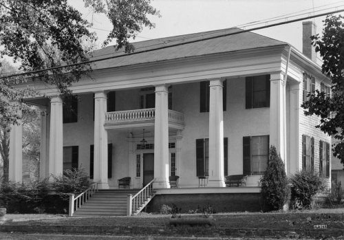


 1933
 1933
 1933
 1933
 1936
 1936
 1979
 1993
 1994
 1994
 1994
 1994
 1994
 1997
 1999


