Mobile has 115 places on the National Register, 4 of them National Historic Landmarks
More historic than 88% of U.S. towns · #4 of 187 in Alabama. What drives it
Dated to 1702 (Wikidata), with 6% of its homes built before 1940 and 18 historic districts holding 6,263 contributing buildings. Most of Mobile was built recently: 6% of its homes predate 1940 and the median home dates from 1975. Below: 12 old photos and papers, maps from 1885 on, the census since 1820, and every listing on the Register.
Founding year: Wikidata. First post office: 1814.The full story ↓
History grade
What drives Mobile’s History grade
On its age, its old homes and the National Register, Mobile is more historic than 88% of U.S. towns, #4 of 187 in Alabama. Its age holds the grade up; its share of homes from before 1940 pulls it down.
A
HistoryA character grade: shown, never part of Mobile’s overall grade.
Among the 400 U.S. cities of 100,000 or more, Mobile ranks #79 on History.
Alabama towns list about as much on the Register as the country (a typical Alabama town has 2.7 per 10,000 residents, the U.S. 2.4), so Mobile’s 308 sits above most of its state (92% of Alabama towns have fewer) while its 6,263 historic buildings outnumber those of 100% of U.S. towns.
NoteThe founding year comes from Wikidata alone; no second source gives 1702.
How sure. Graded on any two of the three inputs instead, the letter would range from B+ to A+. The pre-1940 share (±0.5 points) is firm at this size.
Founding year: Wikidata (other dates in Quick answers). Homes: Census ACS 2020–24. National Register: National Park Service, May 2026 list; each listing counted once (boundary changes and added documentation belong to their listing), and a historic district counts its contributing buildings. How TownRatings grades history →
What stands out about Mobile’s past
Read from the archive, the National Register and the record. The page puts what stands out first.
The country’s official list of buildings and places worth saving. 4 are National Historic Landmarks, the highest tier. Boundary changes and added documentation are counted with their listing.
National Park Service, National Register of Historic Places. Photos from Wikimedia Commons, credited on each place’s page.
Places that used to be
Lost post offices, old corners, places now gone and burying grounds
Mobile’s post office has been open since 1814. 11 other post offices opened and closed inside today’s town.
Mobile
1814–today
Spring Hill
1877–1944
Cox
1885–1892
Theodore
1886–today
Marchville
1890–1891
Crichton
1894–1945
Magazine
1894–1988
Noborne
1894–1896
Toulminville
1894–1898
Edenville
1896–1897
18101920today
Hamlets and corners on the map
Aces Trailer ParkAcropolis HeightsAkkaAllenvilleAlpine HillsBelle CheneBellwoodBelvedereBridlewoodBrills Trailer CourtBrookwoodBrowns Recreational Vehicle and Mobile Home ParkBurma HillsC J Trailer CourtCambridge EstatesCamelia Trace Mobile Home ParkCanebrakeCanterbury HeightsCarriage HillsCharmingdaleChas Bon Trailer CourtChesterfield EstatesClarke GardensCooper Mobile Home Park
Gone or out of use
Albert P Brewer Development CenterhospitalArreain Missionary Baptist ChurchchurchBattery BuchananmilitaryBattery GladdenmilitaryBattery McIntoshmilitaryBattery MissourimilitaryBethel African Methodist Episcopal ChurchchurchBooker T Washington Public SchoolschoolBoyd Lane Baptist ChurchchurchBrookley Air Force BasemilitaryBrothers and Sisters of Corinthians Hall Number OnechurchCity HospitalhospitalDePorres HospitalhospitalE L Marechal Public SchoolschoolFort Jeb StuartmilitaryFort MoutonmilitaryFort Sidney JohnstonmilitaryGates of Heaven Congregation Synagoguechurch
Ahavas Chesed Cemetery · Baker Cemetery · Bear Fork Road Cemetery · Carmelite Monastery Cemetery · Casher Cemetery · Catholic Cemetery · Church Street Cemetery · Ebenezer Cemetery · Gethsemane Cemetery · Green Mount Cemetery · Jewish Cemetery · Lartigue Cemetery · Little Magnolia Cemetery · Magnolia Cemetery · Miller Cemetery · Mobile National Cemetery · Morning Star Missionary Baptist Church Cemetery · Mount Zion Cemetery · New Hope Baptist Church Cemetery · Newell Cemetery · Noel Cemetery · Oaklawn Memorial Cemetery · Old Lewis Cemetery · Pine Crest Cemetery · Plateau Cemetery · Pleasant Valley Cemetery · Reformed Temple Jewish Cemetery · Rising Sons Cemetery · Sacred Heart Cemetery · Saint Austin Cemetery · Saint Edwards Cemetery · Spanish Burial Grounds · Spring Hill College Jesuit Cemetery · Spring Hill Graveyard · Visitation Monastery Cemetery · Wolf Ridge Cemetery
US Post Offices dataset (Blevins & Helbock, CC0). Places and cemeteries from the USGS Geographic Names Information System (2021).
The city is named after the Mobile tribe that the French colonists encountered living around Mobile Bay. Although it is debated by Alabama historians, they may have been descendants of the Native American tribe from the small fortress town, Mabila, in central Alabama. The Mobile tribe became allies with the French colonists and suggested the location for the original town of Mobile and a river fort. The tribe's language was the basis for Mobilian Jargon, a Choctaw-derived lingua franca widely used to facilitate trade among the various Gulf Coast peoples. About seven years after the founding of the French Mobile settlement, the Mobile tribe, along with the Tohomé, gained permission from the colonists to settle near the fort.
Passages that mention Mobile, cut from the printed page as they were published.
Colonial Mobile. An historical study, largely from original sources, of the Alabama-Tombigbee basin from the discovery of Mobile bay in 1519 until the demolition of Fort Charlotte in 18211897 · page 261Read the page →
Read the text
1781, after Pensacola had been captured and the British troops withdrawn from the province, the title of Grimarest changes from "governor ad interim'''' to "Political (or Civil) and Military Governor of the Town of Mobile and its District," so to remain with all his successors. This would seem to show Mobile as partly a presidio but mainly a puehlo, and indeed in later years (under Salazar) the commandant was to sign himself as "captain of the pueblo infantry regiment." To the east of
Text read by machine from the scan; it may contain errors.
Colonial Mobile. An historical study, largely from original sources, of the Alabama-Tombigbee basin from the discovery of Mobile bay in 1519 until the demolition of Fort Charlotte in 18211897 · page 128Read the page →
Read the text
After the removal of the capital to New Orleans, the more rapid growth was transferred from Mobile, but its cure had to make visitations over considerable territory. There was generally a missionary to the Christian Apalaches, but outside of that the parish of Mobile was a large one. We find the Mobile cure often at Dauphine Island, and sometimes at Pascagoula and among the Choctaws. In 1728, even the Apalaches of St.
Text read by machine from the scan; it may contain errors.
After the removal of the capital to New Orleans, the more rapid growth was transferred from Mobile, but its cure had to make visitations over considerable territory. There was generally a missionary to the Christian Apalaches, but outside of that the parish of Mobile was a large one. We find the Mobile cure often at Dauphine Island, and sometimes at Pascagoula and among the Choctaws. In 1728, even the Apalaches of St.
Text read by machine from the scan; it may contain errors.
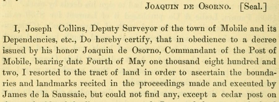
Joaquin de Osorno. [Seal.] I, Joseph Collins, Deputy Surveyor of the town of Mobile and its Dependencies, etc., Do hereby certify, that in obedience to a decree issued by his honor Joaquin de Osorno, Commandant of the Post of Mobile, bearing date Fourth of May one thousand eight hundred and two, I resorted to the tract of land in order to ascertain the boundaries and landmarks recited in the proceedings made and executed by James de la Saussaie, but could not find any, except a cedar post on
Text read by machine from the scan; it may contain errors.
Scans and text from the Internet Archive. Books published in 1930 or earlier, which are in the public domain.
Timeline
Mobile, 1702 to 1973
Woven from the archive, old maps, post office records, the National Register and the people born here.
Nothing in the archives for these yearsWeddings on Main Street, storms, parades, school pictures, the old store. If it’s in your family album, it belongs here.
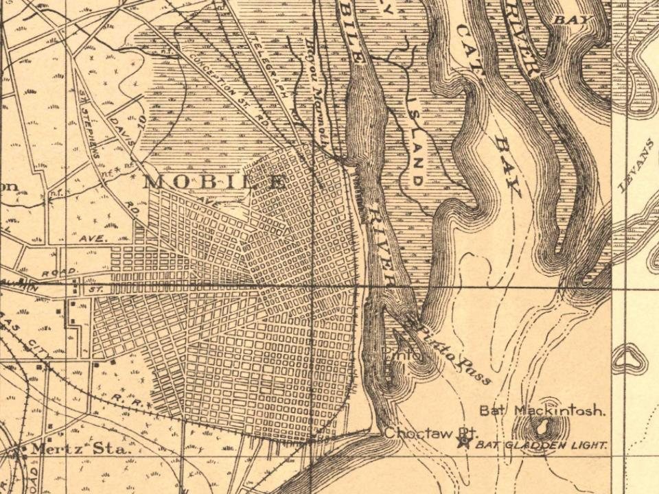
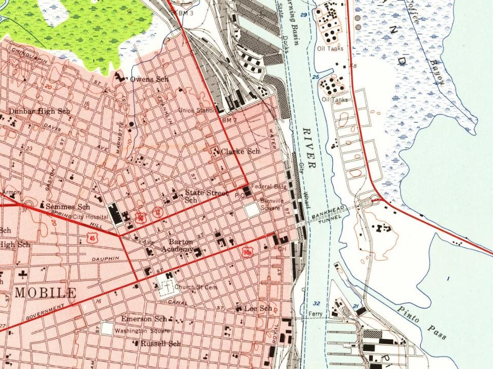
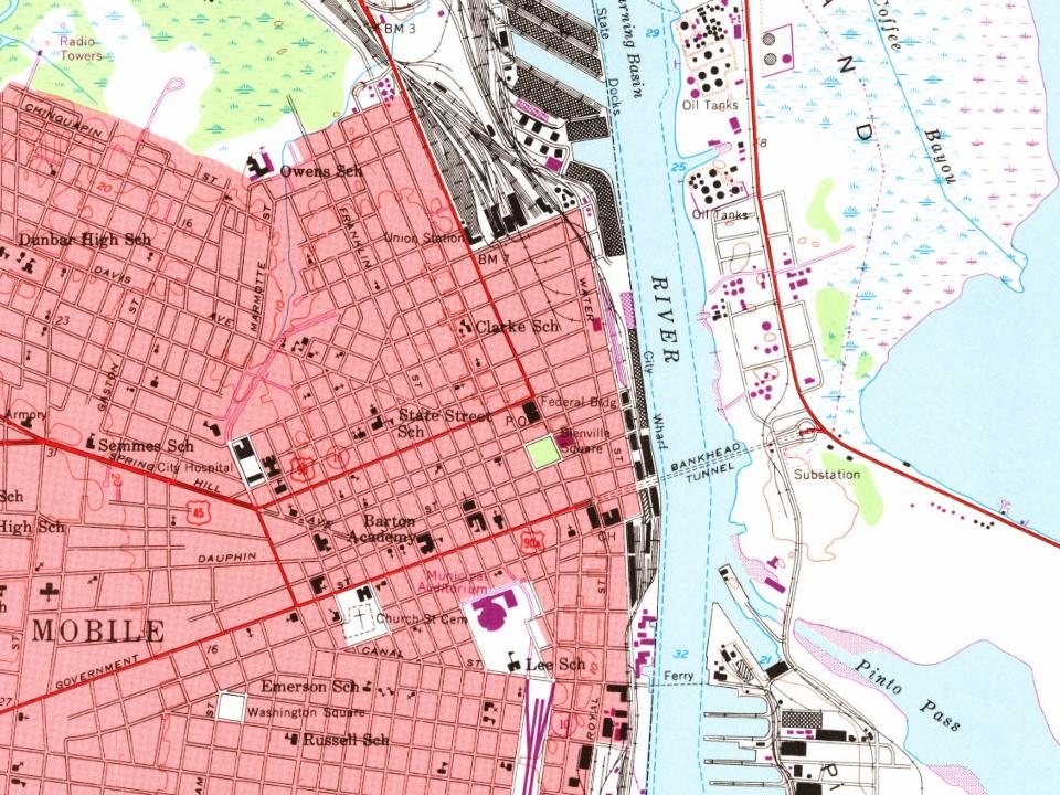
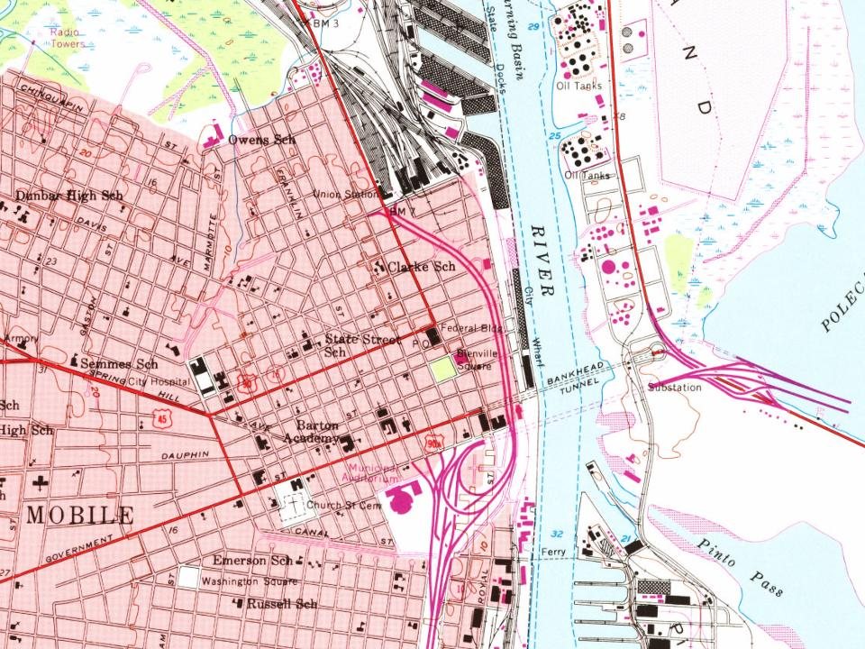
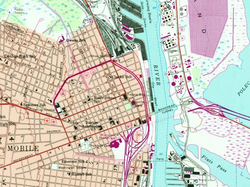
Every edition of the U.S. Geological Survey’s map of Mobile. Tap a year, or press play to watch the town change.
1922Mobile sheet · 1:62,500
U.S. Geological Survey historical topographic maps (public domain), via Esri’s collection of the scans. The red ring marks the center of Mobile.
Every building
Mobile, building by building, 1885–1925
Fire insurance maps drew every building, what it was made of and what it was used for, so insurers could price the risk of fire. Pick a year, then a sheet.
In 1702, according to Wikidata. Mobile’s post office opened in 1814, and the census of 1820 counted 1,500 people here.
How does Mobile rank for history?
Mobile is more historic than 88% of U.S. towns, #4 of 187 in Alabama. The History grade combines the town’s founding era, the share of homes built before 1940 and its National Register listings. It’s a character grade, so it isn’t part of the overall grade. How it works.
What is on the National Register in Mobile?
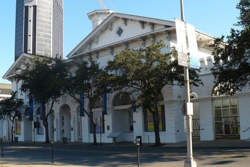
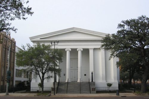
115 listings, 4 of them National Historic Landmarks: 92 buildings, among them the Mobile City Hall (a National Historic Landmark since 1973), 18 historic districts with 6,078 contributing buildings, 3 sites, and 2 structures. 6,263 historic buildings in all.
How old are the homes in Mobile?
6% of Mobile’s homes were built before 1940 (Census estimate), against a typical 3.2% for an Alabama town; the median home was built in 1975.
Founding dates: Wikidata, Wikipedia, the U.S. post office records of Blevins & Helbock (CC0) and the Census. Homes by year built: Census ACS 2020–24. National Register of Historic Places: National Park Service (list of May 22, 2026). Old photos, postcards and papers: Wikimedia Commons, the Library of Congress and other public archives, credited on each item’s page. Maps: U.S. Geological Survey historical topographic maps (via Esri) and Sanborn fire-insurance maps (Library of Congress). History text and census tables: Wikipedia (CC BY-SA 4.0). Places that used to be: USGS Geographic Names Information System (2021).
From the Library of Congress (12), the National Register of Historic Places (115), Wikipedia, Wikidata and Wikipedia for famous people, U.S. Geological Survey historical maps, U.S. Census counts (via Wikipedia), the US Post Offices dataset (Blevins & Helbock), the USGS Geographic Names Information System, Sanborn fire insurance maps (Library of Congress) and old county and town histories (Internet Archive). Archive images are copied here with their credits and licenses, shown on each photo’s page. Refreshed monthly.


 ★ Landmark
 ★ Landmark
 ★ Landmark
 ★ Landmark



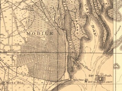


 1906
 1937
 1937
 1937
 1937
 1937
 1937
 1937
 1937
 1937