Birmingham has 147 places on the National Register, 3 of them National Historic Landmarks
More historic than 78% of U.S. towns · #19 of 187 in Alabama. What drives it
With 18% of its homes built before 1940 and 51 historic districts holding 8,199 contributing buildings. Below: 3 old photos and papers, maps from 1885 on, the census since 1880, and every listing on the Register.
The Birmingham post office opened in 1870, the earliest record of the town by name. Wikidata gives 1871. Ten smaller post offices, Greenville (1803), Carrolton (1819) and Elyton (1820), opened inside today’s city and later closed.
First census: 3,086 in 18802020 census: 200,733156 years
How historic is Birmingham?
A−
More historic than 78% of U.S. towns, on its age, its old homes and the National Register.
Founding year: the first Birmingham post office (Blevins & Helbock, CC0). Wikidata: 1871.The full story ↓
History grade
What drives Birmingham’s History grade
On its age, its old homes and the National Register, Birmingham is more historic than 78% of U.S. towns, #19 of 187 in Alabama. Its National Register listings hold the grade up; its age pulls it down.
A−
HistoryA character grade: shown, never part of Birmingham’s overall grade.
Among the 400 U.S. cities of 100,000 or more, Birmingham ranks #134 on History.
Alabama towns list about as much on the Register as the country (a typical Alabama town has 2.7 per 10,000 residents, the U.S. 2.4), so Birmingham’s 414 sits above most of its state (94% of Alabama towns have fewer) while its 8,199 historic buildings outnumber those of 100% of U.S. towns.
How sure. Graded on any two of the three inputs instead, the letter would range from B− to A. The pre-1940 share (±1.1 points) is firm at this size. The founding year is the first post office, not a stated founding date; Wikidata’s 1871 falls in the same era, so the grade doesn’t depend on which one is used.
Founding year: the first post office (other dates in Quick answers). Homes: Census ACS 2020–24. National Register: National Park Service, May 2026 list; each listing counted once (boundary changes and added documentation belong to their listing), and a historic district counts its contributing buildings. How TownRatings grades history →
What stands out about Birmingham’s past
Read from the archive, the National Register and the record. The page puts what stands out first.
The country’s official list of buildings and places worth saving. 3 are National Historic Landmarks, the highest tier. Boundary changes and added documentation are counted with their listing.
National Park Service, National Register of Historic Places. Photos from Wikimedia Commons, credited on each place’s page.
Places that used to be
Lost post offices, old corners, places now gone and burying grounds
Birmingham’s post office has been open since 1870. 34 other post offices opened and closed inside today’s town.
Greenville
1803–1828
Carrolton
1819–1821
Elyton
1820–1902
Woodlawn
1833–1902
Brownsville
1838–1890
Rockville
1842–1871
Bridgeton
1847–1905
Vinesville
1858–1867
Birmingham
1870–today
Woods Station
1871–1883
18001910today
Hamlets and corners on the map
AcipcovilleAirport HighlandsAltamont ParkAutumn ChaseAvon ParkAvondaleBarnisdale ForestBel AirBelle HavenBendaleBerkley HillsBerney PointsBeverly StationBiscayne HighlandsBoyles HighlandsBridgetonBrookhurstBrownvilleCahaba CommonsCentral HighlandsCentral Park HighlandsCloverdaleCrestline GardensCrestline Park
Gone or out of use
Abraham Baptist ChurchchurchAlfretta MinesmineAlfretta Number 1 MinemineAlfretta Number 2 MinemineAlice FurnacelocaleAlton Elementary SchoolschoolAntioch Baptist ChurchchurchAtwood FerrycrossingAvondale Baptist ChurchchurchAvondale Methodist Episcopal Church SouthchurchAvondale SchoolschoolBailey MinemineBanks High SchoolschoolBeulah Baptist ChurchchurchBirmingham Army Air FieldmilitaryBirmingham Municipal Airport-NorthairportBirmingham Municipal City Police AirportairportBush Hills Baptist Churchchurch
24cemeteries and burying grounds inside Birmingham
AtwoodBushEarltownEast LakeElmwoodEmanuelForest HillFraternalGrace HillGreenwoodHigginsInglenookKnesses IsraelMasonMcCombsMcElwain BaptistOak HillOaklandReedRobertsShadowlawn Memorial ParkUnion HillWiseZion Memorial Gardens
See all 24
Atwood Cemetery · Bush Cemetery · Earltown Cemetery · East Lake Cemetery · Elmwood Cemetery · Emanuel Cemetery · Forest Hill Cemetery · Fraternal Cemetery · Grace Hill Cemetery · Greenwood Cemetery · Higgins Cemetery · Inglenook Cemetery · Knesses Israel Cemetery · Mason Cemetery · McCombs Cemetery · McElwain Baptist Cemetery · Oak Hill Cemetery · Oakland Cemetery · Reed Cemetery · Roberts Cemetery · Shadowlawn Memorial Park · Union Hill Cemetery · Wise Cemetery · Zion Memorial Gardens
US Post Offices dataset (Blevins & Helbock, CC0). Places and cemeteries from the USGS Geographic Names Information System (2021).
The Birmingham area was historically part of the territory of the Muscogee Confederacy. The most prominent Indigenous settlement in the area in the 19th century was the Upper Creek community of Tvlwv Haco, meaning 'Crazy Town' in Muscogee, located in present-day Indian Springs Village.
Passages that mention Birmingham, cut from the printed page as they were published.
Historical and statistical review and mailing and shipping guide of North Alabama (illustrated) embracing the cities of Birmingham, Anniston, Gadsden, Huntsville, Decatur, Tuscaloosa and Bessemer, with their manufacturing and mercantile industries ... and1888 · page 225Read the page →
Read the text
Through recent railroad connection Huntsville is now in direct communication also with the great coal fields of Tennessee, by which steam coal is brought to her depot at $1.25 per ton. And upon completion of the railroad to Birmingham from this city, through Murphree's Valley, coal will be brought here much cheaper. This road is now under construction, and is expected to be completed by the first of January, 1889. This valley is one of the richest in the State in iron and coal, and is only about fifty miles south of Huntsville.
Text read by machine from the scan; it may contain errors.
Historical and statistical review and mailing and shipping guide of North Alabama (illustrated) embracing the cities of Birmingham, Anniston, Gadsden, Huntsville, Decatur, Tuscaloosa and Bessemer, with their manufacturing and mercantile industries ... and1888 · page 182Read the page →
Read the text
The Kansas City, ]Memphis & Birmingham Railroad is now regularly running to Birmingham, which is only sixty miles from Anniston. By way of the- Georgia Pacific Road, this important connection is really as valuable to Anniston, relatively, as it is to Birmingham.
Text read by machine from the scan; it may contain errors.
Jefferson County and Birmingham, Alabama1887 · page 300Read the page →
Read the text
Birtningham & Jones Valley Railroad. — Suburban street railroad extension is opening up to settlement a wide territory adjacent to the city of Birmingham. The line we here describe is eight miles long, penetrating a region of unsurpassed healthfulness, with abundance of the purest water and shade.
Text read by machine from the scan; it may contain errors.
Short history of the Philips--Yarbrough families1928Read the page →
Read the text
and capable elevator engineer, has held an important position with Otis Elevator Company for many years, living in many large cities, now in Birmingham, Ala. Pinckney Gay Hogan, born Feb. 25, 1892. arried Mayme Erwin of Birmingham, July 19, 1924. He was chief electrician in the U. 5.
Text read by machine from the scan; it may contain errors.
Scans and text from the Internet Archive. Books published in 1930 or earlier, which are in the public domain.
Timeline
Birmingham, 1803 to 1981
Woven from the archive, old maps, post office records, the National Register and the people born here.
Nothing in the archives for these yearsWeddings on Main Street, storms, parades, school pictures, the old store. If it’s in your family album, it belongs here.
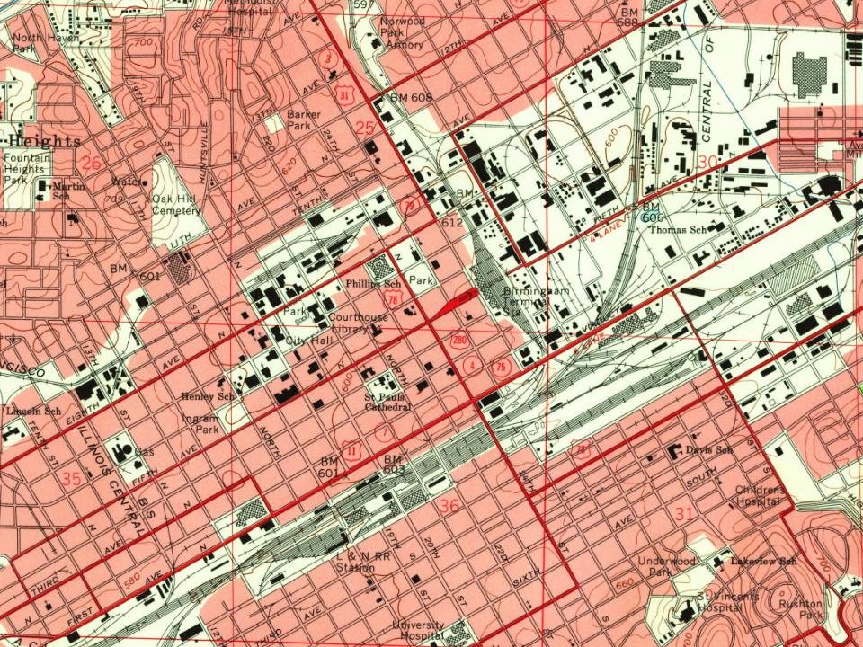
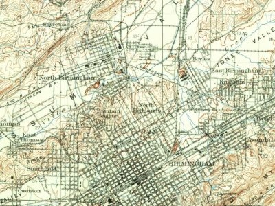
Every edition of the U.S. Geological Survey’s map of Birmingham. Tap a year, or press play to watch the town change.
1904Birmingham Coal District sheet · 1:62,500
U.S. Geological Survey historical topographic maps (public domain), via Esri’s collection of the scans. The red ring marks the center of Birmingham.
Every building
Birmingham, building by building, 1885–1917
Fire insurance maps drew every building, what it was made of and what it was used for, so insurers could price the risk of fire. Pick a year, then a sheet.
The Birmingham post office opened in 1870, the earliest record of the town by name (U.S. post office records). Wikidata gives 1871.
How does Birmingham rank for history?
Birmingham is more historic than 78% of U.S. towns, #19 of 187 in Alabama. The History grade combines the town’s founding era, the share of homes built before 1940 and its National Register listings. It’s a character grade, so it isn’t part of the overall grade. How it works.
What is on the National Register in Birmingham?
147 listings, 3 of them National Historic Landmarks: 92 buildings, among them the Arlington (listed 1970, the first), 51 historic districts with 8,098 contributing buildings, 2 sites, 1 structure, and 1 object. 8,199 historic buildings in all.
How old are the homes in Birmingham?
18% of Birmingham’s homes were built before 1940 (Census estimate, ±1.1 points), against a typical 3.2% for an Alabama town; the median home was built in 1965.
Founding dates: Wikidata, Wikipedia, the U.S. post office records of Blevins & Helbock (CC0) and the Census. Homes by year built: Census ACS 2020–24. National Register of Historic Places: National Park Service (list of May 22, 2026). Old photos, postcards and papers: Wikimedia Commons, the Library of Congress and other public archives, credited on each item’s page. Maps: U.S. Geological Survey historical topographic maps (via Esri) and Sanborn fire-insurance maps (Library of Congress). History text and census tables: Wikipedia (CC BY-SA 4.0). Places that used to be: USGS Geographic Names Information System (2021).
From Wikimedia Commons (2), the Library of Congress (1), Wikidata (9), the National Register of Historic Places (147), Wikipedia, Wikidata and Wikipedia for famous people, U.S. Geological Survey historical maps, U.S. Census counts (via Wikipedia), the US Post Offices dataset (Blevins & Helbock), the USGS Geographic Names Information System, Sanborn fire insurance maps (Library of Congress) and old county and town histories (Internet Archive). Archive images are copied here with their credits and licenses, shown on each photo’s page. Refreshed monthly.

 ★ Landmark
 ★ Landmark
 ★ Landmark



![The Kansas City, ]Memphis & Birmingham Railroad is now regularly running to Birmingham, which is only sixty miles from Anniston. By way of the- Georgia Pacific Road, this important connection is really as valuable to Anniston, relatively, as it is to Birmingham.](https://images.townratings.com/story/460/bk-fd73c0f53e20dbe5-l.jpg)





 1887