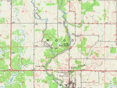
In the summer of 1851 a crew working for the U.S. government surveyed the outline of the six mile square that would become Wood. That November another crew marked all the section corners, walking through the woods and wading the swamps, measuring with chain and compass. When done, the deputy surveyor filed this general description:
Passages that mention Wood, cut from the printed page as they were published.
The Amalgamated wood workers' international union of America1912 · page 97Read the page →
Read the text
side over the shop meetings, where all business pertaining to that particular shop may be transacted. For the purpose of illustrating the working of the system, the rules and regulations adopted by the Amalgamated Wood Workers' Council of Chicago, and in force in Cook County, may be taken as typical cf the system developed by the Amalgamated Wood Workers' Union. These rules are formulated by the Wood Workers' Council, and then submitted to the general council for approval
Text read by machine from the scan; it may contain errors.
The Amalgamated wood workers' international union of America1912 · page 139Read the page →
Read the text
It has been the policy of the Amalgamated "Wood "Workers' Union to use the strike, only as a last resort, aand to declare in favor of arbitration in the settlement of labor disputes. But when attempts at arbitration have failed, the Wood Workers have followed what is now generally recognized as a legal right, namely, to strike. The character of a union is very well indicated by its regulations for ordering and managing a strike. In fact, the strength of an organization and its effectiveness as a
Text read by machine from the scan; it may contain errors.
Scans and text from the Internet Archive. Books published in 1930 or earlier, which are in the public domain.
Timeline
Wood, 1863 to 1967
Woven from the archive, old maps, post office records, the National Register and the people born here.
Founding dates: Wikidata, Wikipedia, the U.S. post office records of Blevins & Helbock (CC0) and the Census. Homes by year built: Census ACS 2020–24. National Register of Historic Places: National Park Service (list of May 22, 2026). Old photos, postcards and papers: Wikimedia Commons, the Library of Congress and other public archives, credited on each item’s page. Maps: U.S. Geological Survey historical topographic maps (via Esri) and Sanborn fire-insurance maps (Library of Congress). History text and census tables: Wikipedia (CC BY-SA 4.0). Places that used to be: USGS Geographic Names Information System (2021). How TownRatings grades history →
From Wikipedia, U.S. Geological Survey historical maps, the US Post Offices dataset (Blevins & Helbock), the USGS Geographic Names Information System and old county and town histories (Internet Archive). Archive images are copied here with their credits and licenses, shown on each photo’s page. Refreshed monthly.