WheatlandWI
Trash & recyclingIs Wheatland a good place to live?
Wheatland grades B− overall, 233rd among Wisconsin's 357 graded towns, with clear strengths and some subjects that lag. The median household earns $91K. On the other side, the typical home is worth about $445K, 5.5 years of the Kenosha metro’s $81K median household income. The biggest park or preserve is New Munster Wildlife Area, at 734 acres. Most errands need a car: it is less walkable than 76% of U.S. towns. John P. and Mary Runkel House is on the National Register of Historic Places.
What makes Wheatland stand out
Where Wheatland beats most towns.
93% of working residents leave Wheatland for work
Where Wheatland’s working residents go each day. Line width shows the share.
Census LEHD 2023
How Wheatland grades
Each subject compared with towns across the country (schools within Wisconsin), ordered by how far Wheatland is from typical.
How TownRatings grades towns →
Moving to Wheatland: who provides what
Who provides power, water and the rest in Wheatland, and how to reach them.
EPA SDWIS (Oct 9, 2026) · HIFLD + EIA-861 2025 · Census 2020 ZCTAs · NCES 2024–25 · registration: vote.gov, updated Nov 18, 2024.
The data
Ordered by what stands out in Wheatland.
Wheatland has added half again as many jobs in ten years and has colder winter nights than most of the country, though not than most of Wisconsin.
Most of Wheatland’s workers commute out: the town has 0.4 jobs for each of them
Jobs based here grew from 389 in 2013 to 690.
Most working residents leave Wheatland for work: only 7% work in town. 3% of residents live below the poverty line in Wheatland, against 6.4% in Wisconsin’s towns and 9.6% across U.S. towns. Since 2013, Wheatland has added 301 jobs, to 690 in 2023.
| Wheatland | Wisconsin towns | U.S. towns | |
|---|---|---|---|
| Below the poverty line | 3% | 6.4% | 9.6% |
| Average trip to work | 26 minutes | 22 minutes | 25 minutes |
| Median household income | $91,000 | $87,000 | $80,000 |
Where working residents work
Census LEHD 2023 · ACS
Public schools in Wheatland beat 73% of Wisconsin districts
Its public schools are run by the Wheatland J1 School District. Its one school is below.
| School | Level | Students | Letter |
|---|---|---|---|
| Wheatland Center ElementaryLargest public elementary schoolGrades PK–8 | Grades PK–8 | 644 | B |
NCES · EDFacts · graded within WI on state tests and graduation
Wheatland’s grade for cost of living is a C−
Typical home values rose 6.4% in the year to September 2026. At $1,399 a month, Wheatland’s median rent is above both Wisconsin’s towns ($1,076 a month) and U.S. towns ($1,185 a month). 80% of Wheatland households own their home.
| Wheatland | Wisconsin towns | U.S. towns | |
|---|---|---|---|
| Median rent | $1,399 a month | $1,076 a month | $1,185 a month |
| Households that own their home | 80% | 74% | 73% |
Typical home value
Census ACS, 2020–24 · Zillow Home Value Index · Redfin Data Center
Four seasons and pleasant summers in Wheatland
January nights average 13.8°: colder than most of the country, but milder than 98% of Wisconsin places with climate records; July afternoons average 82.8°.
Wheatland has cold, snowy winters and pleasant summers. The January low in Wheatland is 14°F. About 38 inches of snow falls in a winter.
| Wheatland | Wisconsin towns | U.S. towns | |
|---|---|---|---|
| January low | 14°F | 11°F | 22°F |
| July high | 83°F | 82°F | 85°F |
Typical low → high °F
NOAA U.S. Climate Normals, 1991–2020
Wheatland has set aside 7.8% of its land for conservation
5.0 miles of trail in 3 parks and preserves.
| Wheatland | Wisconsin towns | U.S. towns | |
|---|---|---|---|
| Conserved land | 7.8% | 3.8% | 4.3% |
| Miles of trail per square mile | 0.2 miles per square mile | 0.4 | 0.4 |
| Biggest places to walk | Trails | Acres |
|---|---|---|
| 1. Kenosha County Veterans Memorial Park | 4.5 mi | 178 |
| 2. New Munster Wildlife Area | — | 734 |
| 3. New Munster Park | — | 11 |
Trails & parks © OpenStreetMap contributors · Conserved land: USGS PAD-US
Residents of Wheatland are healthier than 58% of U.S. towns
Wheatland beats the Wisconsin average on 4 of 32 CDC measures and trails it on 2. 28% of adults feel lonely in Wheatland.
| Wheatland | Wisconsin towns | U.S. towns | |
|---|---|---|---|
| Feel lonely (CDC PLACES) | 28% | 30% | 33% |
| Obesity (CDC PLACES) | 40% | 38% | 35% |
| Binge drink (CDC PLACES) | 19% | 20% | 16% |
| Frequent mental distress (CDC PLACES) | 15% | 15% | 17% |
| What stands out | Wheatland | WI |
|---|---|---|
| Fewer adults facing housing insecurity | 8.4% | 9.7% |
| Fewer adults facing a utility shut-off | 4.8% | 5.5% |
| More adults with arthritis | 28.8% | 26.6% |
CDC PLACES 2025 · modeled estimates for adults · CMS · HRSA
An age mix much like Wisconsin’s
No broad age group is more than 4 points off the Wisconsin average. Wheatland’s median age is 46.1 years. 27% of adults 25 and older have a bachelor’s degree or more, vs 33% across Wisconsin.
| Wheatland | Wisconsin towns | U.S. towns | |
|---|---|---|---|
| Median age | 46.1 years | 42.1 years | 40.5 years |
| Aged 65 or older | 21% | 20% | 18% |
| Bachelor’s degree or more, 25+ | 27% | 32% | 29% |
Ages · share of residents
Education · adults 25 and older
Women and men · all residents
47% women, 53% men
That’s an even split within the survey’s margin of ±6.1 points. Across Wisconsin, 49.9% of residents are women.
| Wheatland | WI | U.S. | |
|---|---|---|---|
| Under 10 | 12.5% | 11.2% | 11.6% |
| 10 to 17 | 9.8% | 10.2% | 10.3% |
| 18 to 24 | 4.1% | 9.3% | 9.1% |
| 25 to 34 | 14.2% | 12.6% | 13.7% |
| 35 to 44 | 8.9% | 12.7% | 13.2% |
| 45 to 54 | 14.3% | 11.8% | 12.2% |
| 55 to 64 | 14.8% | 13.8% | 12.7% |
| 65 to 74 | 13.9% | 11.2% | 10.2% |
| 75 and older | 7.4% | 7.3% | 7% |
| No diploma | 10.8% | 6.4% | 10.4% |
| High school | 35.3% | 29.4% | 26% |
| Some college | 16.9% | 19.5% | 19.1% |
| Associate’s | 9.8% | 11.3% | 8.8% |
| Bachelor’s | 19.4% | 22% | 21.6% |
| Graduate | 7.8% | 11.4% | 14.1% |
U.S. Census Bureau · ACS 2020-2024 5-year estimates · in a town of 3,300, single groups can be off by several points
Inland flooding leads a moderate hazard risk in Wheatland
Expected storm and flood damage is higher than in 52% of U.S. communities. Since 2017, 8 flood insurance claims have been paid out in Wheatland.
FEMA flood insurance claims · FEMA National Risk Index · OpenFEMA
Six Flags Great America and 36 more within 40 miles
Museums, parks, gardens and other places to visit around Wheatland. Close and well known come first.
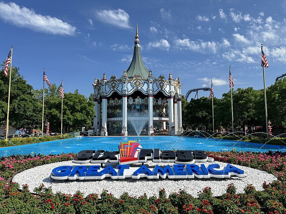 Big draw22 mi Theme parkSix Flags Great America3.0M visitors a year
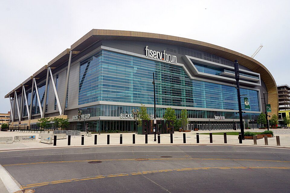 36 mi Stadium & arenaFiserv Forum
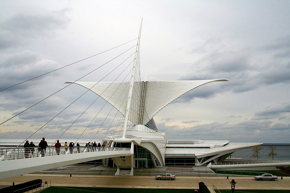 36 mi MuseumMilwaukee Art Museum350K visitors a year
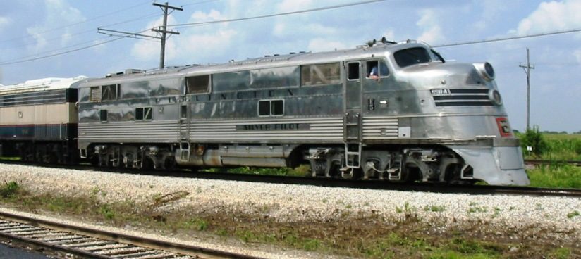 29 mi MuseumIllinois Railway Museum
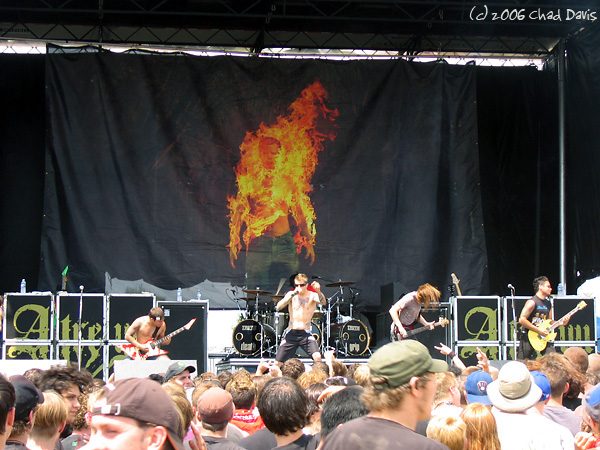 14 mi TheatreAlpine Valley Music Theatre
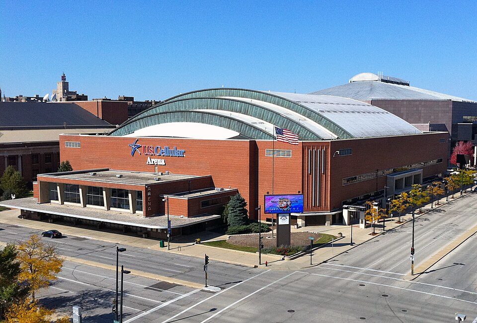 36 mi Stadium & arenaUW–Milwaukee Panther Arena
Photo credits
Six Flags Great America: Feather Better, CC BY 4.0 · Fiserv Forum: Michael Barera, CC BY-SA 4.0 · Milwaukee Art Museum: Michael Hicks (Mulad), CC BY 2.0 · Illinois Railway Museum: The original uploader was Slambo at English Wikipedia., CC BY-SA 2.0 · Alpine Valley Music Theatre: chad davis, CC BY-SA 2.0 · UW–Milwaukee Panther Arena: Shadowlink1014, Public domain


Everything we know about Wheatland
Colleges nearby
None within 15 miles of Wheatland; the nearest are
About 2 of every 100 Wheatland residents are enrolled in college, against 6 across Wisconsin.
About Wheatland
Town in Wisconsin, United States
Wheatland is a town in Kenosha County, Wisconsin, United States. The population was 3,391 at the 2020 census. The census-designated place of Powers Lake is located partially in the town. The unincorporated communities of Lily Lake, New Munster, and Slades Corners are also located in the town. Settlement in the town is centered along 328th Avenue (Kenosha County Highway W) north of 60th Street (Kenosha County Highway K). The former Wisconsin Central Railway Chicago-Twin Cities main line (now the Canadian National Railway) also runs through the town; a passenger and freight station used was located here well into the 20th century.
From Wikipedia, licensed CC BY-SA 4.0 · facts via Wikidata (CC0)
- Area
- 24 sq mi
- Elevation
- 807 ft
- Area code
- 262
Wheatland’s neighbors
3 towns share a border with Wheatland.
| Town | WI rank | Overall | Cost | Safety | Schools | Health |
|---|---|---|---|---|---|---|
| Wheatland | #233 | B− | C− | — | B+ | B |
| Randall | #153 | B+ | B | — | B− | B |
| Burlington | #193 | B+ | B− | — | B | B |
| Bohners Lake | — | — | — | — | — | — |
Wheatland, Randall and Burlington report no FBI crime data of their own. Bohners Lake isn’t graded (fewer than 1,000 residents, or not enough data). Compare Wheatland with a neighbor →
Questions about Wheatland
Short answers, built from the data on this page.
Is Wheatland, WI a good place to live?
Wheatland grades B− overall, better than 54% of U.S. towns and #233 of 357 in Wisconsin. It grades B for health and B+ for schools. Cost of living is its weak spot, with a C−.
Is Wheatland, WI expensive?
Yes. Cost of living, which also weighs rents, property taxes and how many households pay 30% or more of their income for housing, grades C−.