Every edition of the U.S. Geological Survey’s map of Waterloo. Tap a year, or press play to watch the town change.
1891Waterloo sheet · 1:62,500
U.S. Geological Survey historical topographic maps (public domain), via Esri’s collection of the scans. The red ring marks the center of Waterloo.
The story so far
Waterloo, in brief
Wikipedia doesn’t have a history of Waterloo yet. The photos, dates and memories neighbors add here are how it gets written.
Waterloo is a city in Jefferson County, Wisconsin, United States. The population was 3,628 at the 2020 census. The name Waterloo was suggested by a French resident who was one of Napoleon's soldiers at the Battle of Waterloo. Waterloo is located in the Watertown–Fort Atkinson micropolitan area. The city is the home of Trek Bicycle Corporation.
Between the 2010 and 2020 censuses its population fell from 909 to 867 (-5%).
Intro from Wikipedia. Population: U.S. Census Bureau.
From the old history books
What they wrote about Waterloo in 1915
Passages that mention Waterloo, cut from the printed page as they were published.
History of Waterloo 19 The land now comprising the town and village of Waterloo was, prior to 1845, a part of the town of Aztalan. From the best data available the political organization of Waterloo as a town was effected in 1 845 or 1 846, with Abram Vanderpool as its first chairman, and P. M. Brooks its first clerk. J. H.
Text read by machine from the scan; it may contain errors.
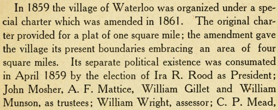
In 1 859 the village of Waterloo was organized under a special charter which was amended in 1861. The original charter provided for a plat of one square mile ; the amendment gave the village its present boundaries embracing an area of four square miles. Its separate political existence was consumated in April 1859 by the election of Ira R. Rood as President; John Mosher. A. F. Mattice, William Gillet and William Munson, as trustees; William Wright, assessor; C. P. Mead,
Text read by machine from the scan; it may contain errors.
Scans and text from the Internet Archive. Books published in 1930 or earlier, which are in the public domain.
Timeline
Waterloo, 1855 to 1956
Woven from the archive, old maps, post office records, the National Register and the people born here.
Founding dates: Wikidata, Wikipedia, the U.S. post office records of Blevins & Helbock (CC0) and the Census. Homes by year built: Census ACS 2020–24. National Register of Historic Places: National Park Service (list of May 22, 2026). Old photos, postcards and papers: Wikimedia Commons, the Library of Congress and other public archives, credited on each item’s page. Maps: U.S. Geological Survey historical topographic maps (via Esri) and Sanborn fire-insurance maps (Library of Congress). History text and census tables: Wikipedia (CC BY-SA 4.0). Places that used to be: USGS Geographic Names Information System (2021). How TownRatings grades history →
From Wikimedia Commons (5), Wikidata (1), the National Register of Historic Places (1), Wikidata and Wikipedia for famous people, U.S. Geological Survey historical maps, U.S. Census counts (via Wikipedia), the US Post Offices dataset (Blevins & Helbock), the USGS Geographic Names Information System and old county and town histories (Internet Archive). Archive images are copied here with their credits and licenses, shown on each photo’s page. Refreshed monthly.




 2007
 2007
 2007
 2007
 2007