The biggest trail networks: Rock Island State Park (10.2 mi), Green Bay National Wildlife Refuge (3.4 mi), Richter Community Forest Preserve (1.3 mi). 12% of Washington’s land is conserved, about 1,984 acres. 1,108 acres are parks and preserves, 1,380 per 1,000 residents.
Conserved land
12%
1,984 acres · of 25.5 sq mi of land
Trails
22 mi
0.9 per sq mi of land
Park land
1,108 ac
1,380 acres per 1,000 residents
Near a park
40%
of residents within ½ mile
Lakes & rivers
1
15 beaches · 2 boat launches
The map
Conserved land, trails & bike routes
Tap a number to zoom to a park. Tap a layer to hide it.
12% of Washington’s land. Water is left out: Washington has 25.5 square miles of land and 257.5 of water, so the share counts land only. Who manages Washington’s conserved land, from the USGS Protected Areas Database. Approximate, because parcels can overlap.
State natural resources1,530 ac
U.S. Fish and Wildlife Service926 ac
County381 ac
Bureau of Land Management1 ac
State Park · 1,022 acNational Wildlife Refuge · 926 acState Conservation Area · 879 acUnknown · 11 acNational Public Lands · 1 ac
The biggest protected parcels
Parcel (PAD-US)
Managed by
Acres
Public access
Rock Island State Park
State Park
State natural resources
981
Open
Green Bay National Wildlife Refuge
National Wildlife Refuge
U.S. Fish and Wildlife Service
926
Restricted
Natural Area
State Conservation Area
County
381
Restricted
Big And Little Marsh State Natural Area
State Conservation Area
State natural resources
319
Restricted
Coffey Swamp State Natural Area
State Conservation Area
State natural resources
179
Restricted
Grand Traverse Island State Park
State Park
State natural resources
30
Open
Gift Lands
Unknown
State natural resources
11
Open
Big And Little Marsh State Habitat Area
State Park
State natural resources
11
Open
Northeastern States District Office
National Public Lands
Bureau of Land Management
1
Open
Things to do
27 places to go in Washington
Beaches, playgrounds, peaks, falls and more. Pick a kind.
Bike lanes are often missing from the map in smaller towns, so that number is likely low.
Courts & fields
3Tennis
2Baseball
1Beach volleyball
1Soccer
Includes school and college facilities, which aren’t always open to the public.
History along the way
8 places on the National Register
The country’s official list of places worth saving (National Park Service). The map also marks 8 historic points from OpenStreetMap: plaques, memorials and old buildings.
The best walking months in Washington: May to August
NOAA’s 1991–2020 normals for the town and the daylight at its latitude. Outlined months have long days, highs of 59 to 86 °F and little rain for the place.
Jan
Feb
Mar
Apr
May
Jun
Jul
Aug
Sep
Oct
Nov
Dec
Daylight (h)
9.1
10.3
11.8
13.5
14.9
15.6
15.3
14.1
12.5
10.8
9.4
8.7
High (°F)
26
28
37
48
60
70
76
75
68
55
42
32
Rain (in)
1.8
1.3
1.8
2.8
3.0
3.2
3.2
2.9
3.4
3.5
2.4
2.1
February is the driest month (1.3 in) and July the warmest (highs of 76 °F). 3.5 inches fall in October, the wettest month. The climate in Washington →
The four inputs of the Outdoors grade, from the engine; shares are of land, not water.
Questions about parks and trails in Washington
Where can I hike in Washington?
The longest trail networks: Rock Island State Park, 10.2 miles; Green Bay National Wildlife Refuge, 3.4 miles; Richter Community Forest Preserve, 1.3 miles; Jackson Harbor Dunes Park, 0.9 miles. Each one is on the map above, with directions to the nearest trailhead or parking.
Are dogs allowed on Washington’s trails?
Rock Island State Park and Green Bay National Wildlife Refuge don’t have dog rules recorded on the map; check the signs at the trailhead.
Is there public land near Washington?
5,800 acres of parks and open public land lie inside Washington or within 10 miles of it (PAD-US), 1,110 of them inside the town line.
Trail talk
Conditions, parking and favorite walks from Washington neighbors.
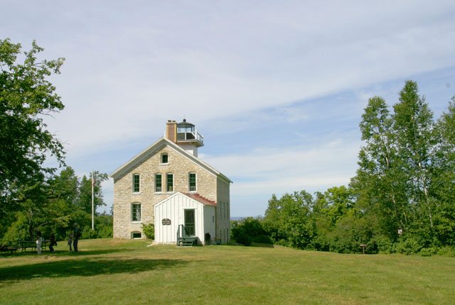 Pottawatomie Lighthouse · Public domain