Guest, Sign inJoin

Post to Stevens Point

We’ll email a one-tap link to publish your post. No password, and nothing is public until you click it.
Already a member? Sign in
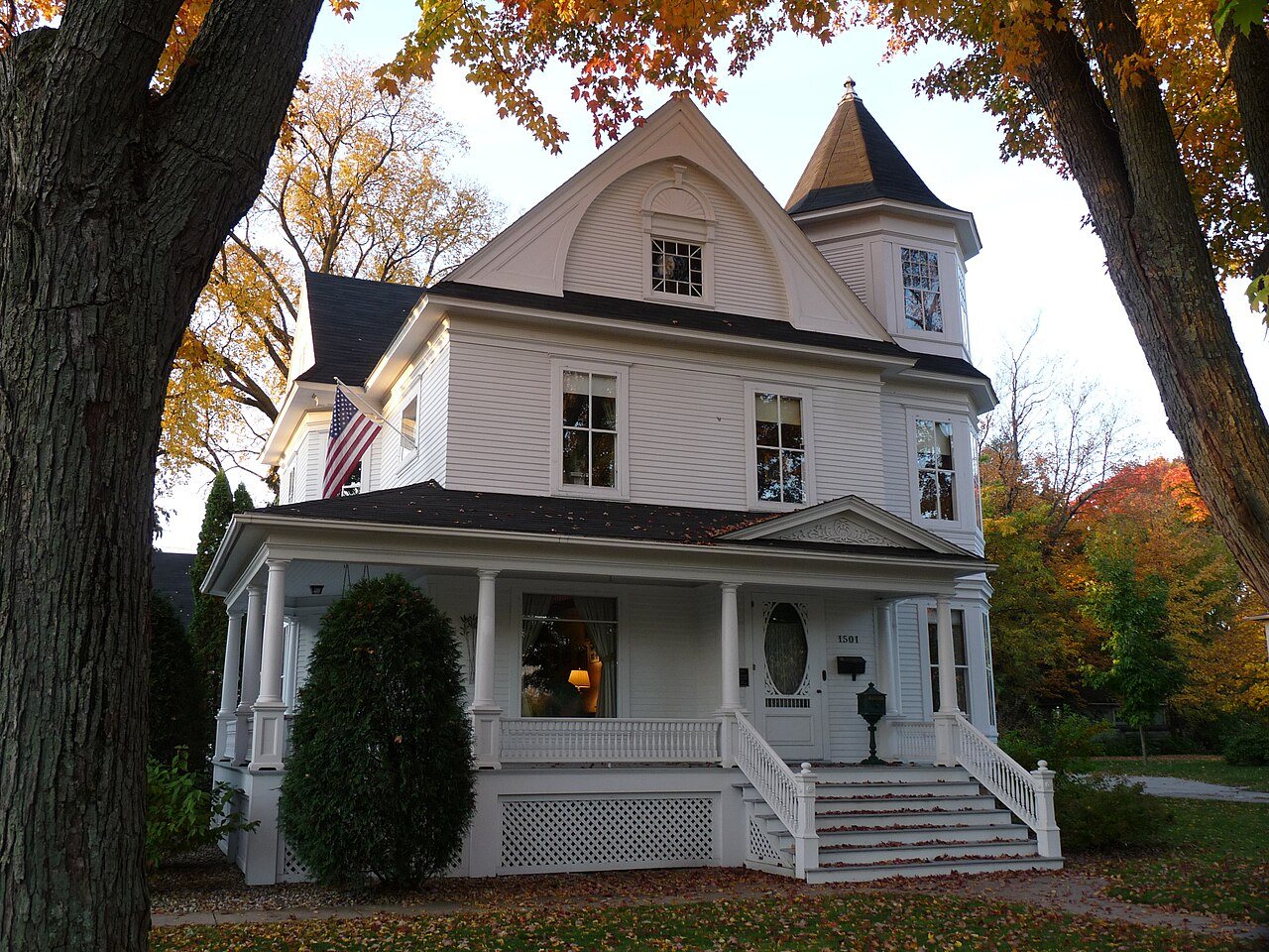
August G. and Theresa Green HouseAugust G. and Theresa Green House · Photo: Jeff the quiet · CC0
A+Outdoors
Outdoors in Stevens Point

Stevens Point has 44 miles of mapped trails, 2.5 for every square mile of land

99% of residents live within a half mile of a park. 1,137 acres are parks and preserves, 44 per 1,000 residents. The biggest trail networks: Schmeeckle Reserve (6.7 mi), Iverson Park (3.1 mi), Zenoff Park (0.8 mi).

Ahead of 96% of U.S. towns · #17 of 362 in Wisconsin. What drives it

Conserved land
8%
885 acres · of 17.5 sq mi of land
Trails
44 mi
2.5 per sq mi of land
Park land
1,137 ac
44 acres per 1,000 residents
Near a park
99%
of residents within ½ mile
Bike routes
24 mi
12 mi lanes · 10 mi paths
Lakes & rivers
4
6 beaches · 4 boat launches

What kind of outdoors town is Stevens Point?

Read from the map. The page puts what stands out first.

Outdoors grade

How much outdoors does Stevens Point have?

On conserved land, trails, park land and how close residents live to a park, Stevens Point is ahead of 96% of U.S. towns, #17 of 362 in Wisconsin. All four inputs are above most U.S. towns; trail miles rank highest, conserved land lowest.

A+
OutdoorsA character grade: shown, never part of Stevens Point’s overall grade.
All U.S. towns we grade (21,298)Ahead of 96%
LessMore
Wisconsin towns of 2,500+ (362)Ahead of 96%

Water is 7% of Stevens Point’s area (1 of 19 square miles), so every share here is of land; over land and water together, the conserved share would read 7%.

How sure. Graded on any three of the four inputs instead, the letter would range from A to A+. Trails and many small parks come from OpenStreetMap, mapped by volunteers, so coverage varies from town to town; the half mile is a straight line from each census block, so a river or highway in the way isn’t counted against it.

PAD-US, OpenStreetMap (© OpenStreetMap contributors), Census 2025 Gazetteer and 2020 blocks; details in Sources below. How TownRatings grades the outdoors →

The map

Conserved land, trails & bike routes

Tap a number to zoom to a park. Tap a layer to hide it.

12345678
Easements protect land from building but are usually private.© OpenStreetMap contributors · USGS PAD-US
Places to walk

Pick a walk

The longest trail network is Schmeeckle Reserve, with 6.7 miles. Directions go to the nearest trailhead or public parking.

Schmeeckle Reserve

Nature preserve
289 acres6.7 mi of trail
Green Circle TrailLake Loop TrailGreen Circle Trail (Pet Detour)Granite Parkway+1
Dog rules not recorded
Directionsto the parking lot

Iverson Park

Park
144 acres3.1 mi of trail
Dog rules not recorded
Directionsto Iverson Park (Winter)

Zenoff Park

Park
39 acres0.8 mi of trail
Green Circle Trail
Dog rules not recorded
Directionsto the parking lot

West River Park

Park
59 acres0.7 mi of trail
Dog rules not recorded
No trailhead mapped yet

Goerke Park

Park
28 acres0.7 mi of trail
Dog rules not recorded
Directionsto the parking lot

Bukolt Park

Park
53 acres0.5 mi of trail
Dog rules not recorded
Directionsto the parking lot

Parkdale Park

Park
34 acres0.4 mi of trail
Dog rules not recorded
Directionsto the parking lot

Koziczkowski Park

Park
15 acres0.4 mi of trail
Dog rules not recorded
Directionsto the parking lot
All 40 parks & preserves
Schmeeckle Reserve289 acres · 6.7 mi of trail
Directions
Iverson Park144 acres · 3.1 mi of trail
Directions
Zenoff Park39 acres · 0.8 mi of trail
Directions
West River Park59 acres · 0.7 mi of trail
Goerke Park28 acres · 0.7 mi of trail
Directions
Bukolt Park53 acres · 0.5 mi of trail
Directions
Parkdale Park34 acres · 0.4 mi of trail
Directions
Koziczkowski Park15 acres · 0.4 mi of trail
Directions
Godfrey & Maybelle Erickson Natural Area6 acres · 0.4 mi of trail
Directions
Yulga Disc Golf Course23 acres · 0.3 mi of trail
Directions
Yulga Park23 acres · 0.3 mi of trail
Pfiffner Pioneer Park22 acres · 0.3 mi of trail
Directions
Plover River Park19 acres · 0.3 mi of trail
Whitetail Park11 acres · 0.3 mi of trail
Directions
Mead Park18 acres · 0.2 mi of trail
Rogers Park8 acres · 0.2 mi of trail · City of Stevens Point Parks and Forestry
Vice Admiral A.W. Grant Park2 acres · 0.2 mi of trail
Directions
Village Green Park4 acres · 0.1 mi of trail
Morton Park4 acres · 0.1 mi of trail
Directions
Moses Creek Meadows2 acres · 0.1 mi of trail
Conifer Park2 acres · 0.1 mi of trail
Veteran's Memorial Park2 acres · 0.1 mi of trail · Stevens Point Parks Recreation and Forestry
Directions
Eastwood Park1 acres · 0.1 mi of trail
Portage County Park Centre1 acres · 0.1 mi of trail
Directions
McDill Pond Disc Golf Park16 acres
Directions
John S. Groholski Park12 acres · Stevens Point Parks, Recreation, and Forestry
Directions
Bob Engelhard Restoration Ecology Field9 acres
Rice Street Natural Area4 acres
Texas Park3 acres
Hein Park3 acres
Seramur Park2 acres
Mathias Mitchell Public Square2 acres
Directions
McGlachlin Park2 acres
Directions
Riverwoods Park2 acres
Directions
Slomann Park2 acres
Plover Hills Park2 acres
Atwell Park2 acres
Parkwood Park2 acres
Whiting Well Field1 acres
Brewery Park1 acres
Who protects it

885 conserved acres

8% of Stevens Point’s land. Water is left out: Stevens Point has 17.5 square miles of land and 1.2 of water, so the share counts land only. Who manages Stevens Point’s conserved land, from the USGS Protected Areas Database. Approximate, because parcels can overlap.

Town or city719 ac
Other state land164 ac
Bureau of Land Management4 ac
Local Park · 458 acLocal Recreation Area · 320 acLocal Conservation Area · 104 acNational Public Lands · 4 ac
The biggest protected parcels
Parcel (PAD-US)Managed byAcresPublic access
Green Circle Trail
Local Recreation Area
Town or city317Open
Schmeeckle Reserve
Local Park
Other state land164Open
West River Park
Local Conservation Area
Town or city71Open
Bukolt Park
Local Park
Town or city53Open
Iverson Park
Local Park
Town or city38Open
Zenoff Park
Local Park
Town or city36Open
Yulga Park
Local Park
Town or city25Open
Goerke Park
Local Park
Town or city22Open
Parkdale Park
Local Conservation Area
Town or city21Open
Stevens Point Dog Park
Local Park
Town or city20Open

5 smaller protected places aren’t shown.

Things to do

54 places to go in Stevens Point

Beaches, playgrounds, peaks, falls and more. Pick a kind.

Playgrounds in Stevens Point
Community Church Playground
Directions
Conifer Park PlaygroundIn Conifer Park
Directions
KASH PlaygroundIn Mead Park
Directions
Point of Discovery School Playground
Directions
Point of Discovery School Playground
Directions

34 playgrounds are on OpenStreetMap in all; the list shows named ones from the first 30.

Trails & water

21 named trails and 4 lakes & rivers

Named trails
Open to bikes · 15.8 miUnpaved · 6.4 mi
Green Circle Trail3.3 mi
Green Circle Trail (Pet Detour)0.9 mi
Lake Loop Trail0.9 mi
Green Hollow Trail0.7 mi
Granite Parkway0.5 mi
Blueberry Trail0.4 mi
Trail of Reflections0.3 mi
Sedge Meadow Trail0.3 mi
Porcupine Loop0.3 mi
Green Circle Trail - Shraeder Connection0.3 mi
11 more trails
Moses Creek Trail
0.3 mi
Frog Chorus Trail
0.2 mi
Berard Oaks Trail
0.2 mi
Savanna Trail
0.2 mi
Crossing Trail
0.2 mi
Plank Trail
0.2 mi
Pine Meadows Trail
0.1 mi
Restoration Trail
0.1 mi
Memorial Trail
0.1 mi
Plover River Crossing - Sentry Boardwalk
0.1 mi
Skinny Dip Point Trail
0.1 mi
Lakes & rivers tap for directions
Biking & sports

24 miles of bike routes

Bike lanes are often missing from the map in smaller towns, so that number is likely low.

12 mi
painted or protected bike lanes
10 mi
off-road bike paths
2.0 mi
shoulders & shared lanes
Green Circle TrailBike route
14 mi
Plover River TrailBike route
3.4 mi
University TrailBike route
2.3 mi
West Side LoopBike route
2.2 mi
River Pines TrailBike route
1.5 mi
Moses Creek TrailBike route
1.5 mi
Holiday TrailBike route
0.9 mi
Brickyard TrailBike route
0.9 mi
Courts & fields
33Tennis
18Baseball
16Soccer
11Basketball
10Volleyball
5Beach volleyball
1Skate park
1Tracks

Includes school and college facilities, which aren’t always open to the public.

History along the way

14 places on the National Register

The country’s official list of places worth saving (National Park Service). The map also marks 6 historic points from OpenStreetMap: plaques, memorials and old buildings.

History →
David McMillan HouseBuilding · listed 1974
About it
Stevens Point State Normal SchoolBuilding · listed 1976
About it
Christina Kuhl HouseBuilding · listed 1978
About it
Fox TheaterBuilding · listed 1982
About it
Mathias Mitchell Public Square-Main Street Historic DistrictDistrict · listed 1986
About it
J. L. Jensen HouseBuilding · listed 1988
About it
Hotel WhitingBuilding · listed 1990
About it
Folding Furniture Works BuildingBuilding · listed 1993
About it
Hardware Mutual Insurance Companies BuildingBuilding · listed 1994
About it
August G. and Theresa Green HouseBuilding · listed 2005
About it
Nelson HallBuilding · listed 2005
About it
Temple Beth IsraelBuilding · listed 2007
About it

2 more on the History page.

When to get out

The walking year in Stevens Point

NOAA’s 1991–2020 normals for the town and the daylight at its latitude. Outlined months have long days, highs of 59 to 86 °F and little rain for the place.

JanFebMarAprMayJunJulAugSepOctNovDec
Daylight (h)9.210.411.813.414.815.515.214.012.410.99.58.8
High (°F)242941556877817971584229
Rain (in)1.11.11.83.23.94.83.84.03.62.81.91.5

February is the driest month (1.1 in) and July the warmest (highs of 81 °F). 4.8 inches fall in June, the wettest month. The climate in Stevens Point →

Next door

Stevens Point and its neighbors

Stevens Point has the most mapped trails of the 7 towns around it. Tap a town to see its outdoors.

TownConserved
of land
Trail mi
per sq mi
Park acres
per 1,000
Near a park
½ mile
Outdoors
Stevens Point8%2.54499%A+
Hullunder 1%0.410175%B
Whiting14%5.416299%+A+
Plover7%0.154547%B+
Plover3%0.91796%A−
Stocktonunder 1%0.427017%B−
Linwoodunder 1%0.1175%C−

The four inputs of the Outdoors grade, from the engine; shares are of land, not water.

Questions about parks and trails in Stevens Point

Where can I hike in Stevens Point?

The longest trail networks: Schmeeckle Reserve, 6.7 miles; Iverson Park, 3.1 miles; Zenoff Park, 0.8 miles; West River Park, 0.7 miles. Each one is on the map above, with directions to the nearest trailhead or parking.

How much of Stevens Point is conserved land?

8% of its land, against a typical 4% for a Wisconsin town and 4% nationally (PAD-US). Conserved doesn’t always mean open to visitors: easements are usually private land.

Are dogs allowed on Stevens Point’s trails?

Schmeeckle Reserve and Iverson Park don’t have dog rules recorded on the map; check the signs at the trailhead.

Where can I bike in Stevens Point?

24 miles of bike routes are on the map: 12 of painted or protected lanes, 10 of off-road paths and 2.0 of shoulders and shared lanes. Named routes: Green Circle Trail, Plover River Trail and University Trail.

Is there public land near Stevens Point?

16,315 acres of parks and open public land lie inside Stevens Point or within 10 miles of it (PAD-US), 1,141 of them inside the city line.

How much outdoors does Stevens Point have?

Ahead of 96% of U.S. towns on the Outdoors grade, #17 of 362 in Wisconsin. The grade combines the share of land that is conserved, miles of mapped trail per square mile of land, park acres per 1,000 residents and the share of residents within a half mile of a park. It’s a character grade, so it isn’t part of the overall grade. How it works.

Trail talk

Conditions, parking and favorite walks from Stevens Point neighbors.
Town Square →
Share a tip
Sources

Where this page comes from

Conserved and public land: USGS Protected Areas Database of the United States (PAD-US), service updated July 2026. Parks, trails, playgrounds, beaches and other places: OpenStreetMap (© OpenStreetMap contributors, ODbL), map data as of 2026-10-28. Land and water area: Census 2025 Gazetteer. Residents near a park: 2020 Census blocks. National Register: National Park Service. How TownRatings grades the outdoors →