Stevens Point dates to 1847, and 25% of its homes were built before 1940
More historic than 94% of U.S. towns · #18 of 362 in Wisconsin. What drives it
14 places in town are on the National Register, among them three historic districts with 183 buildings between them. Below: 5 old photos and papers, maps from 1884 on, and the census since 1860.
Founding year: Wikidata. First post office: 1849.The full story ↓
History grade
What drives Stevens Point’s History grade
On its age, its old homes and the National Register, Stevens Point is more historic than 94% of U.S. towns, #18 of 362 in Wisconsin. All 3 inputs are above most U.S. towns; its National Register listings ranks highest and its age lowest.
A
HistoryA character grade: shown, never part of Stevens Point’s overall grade.
Wisconsin towns list more on the Register than most of the country (a typical Wisconsin town has 3.0 per 10,000 residents, the U.S. 2.4), so Stevens Point’s 76.0 sits above most of its state (92% of Wisconsin towns have fewer) while its 196 historic buildings outnumber those of 93% of U.S. towns.
How sure. Graded on any two of the three inputs instead, the letter would range from A− to A. The pre-1940 share (±2.5 points) is firm at this size. Two sources give 1847.
Founding year: Wikidata (other dates in Quick answers). Homes: Census ACS 2020–24. National Register: National Park Service, May 2026 list; each listing counted once (boundary changes and added documentation belong to their listing), and a historic district counts its contributing buildings. How TownRatings grades history →
What stands out about Stevens Point’s past
Read from the archive, the National Register and the record. The page puts what stands out first.
Historically part of the Menominee homelands, a three-mile strip along the Wisconsin River was ceded to the United States in an 1836 treaty. In 1854 the Menominee made its last treaty with the U.S., gathering on a reservation on the Wolf River. In the Menominee language it is called Pasīpahkīhnen which means "It juts out as land" or "point of land".
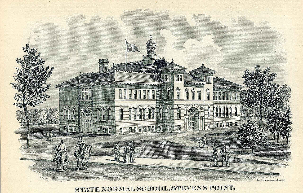
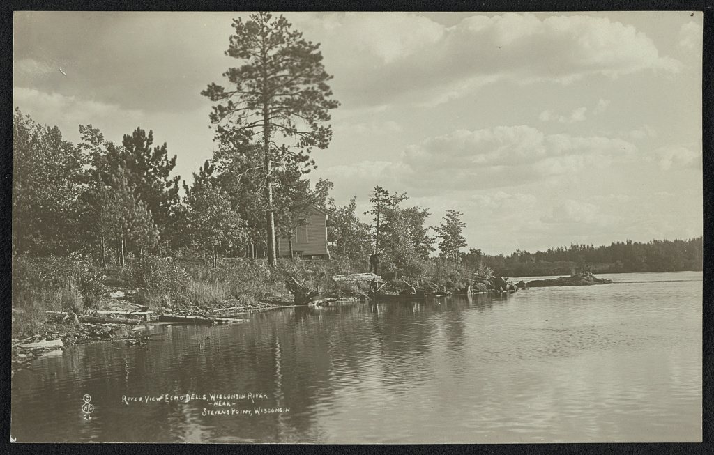
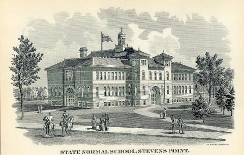
Passages that mention Stevens Point, cut from the printed page as they were published.
History of Portage county, Wisconsin ... read at the centennial celebration, held at the city of Stevens Point, July 4th, 18761876Read the page →
Read the text
her mam line through to Vshland — equal to about 340 miles in all of her own railroad pro per, besides her connections south of Menasha. Stevens Point is her headquarters, having her extensive freight and passenger depots, her turn table, round house and new, extensive machine shops, all here.
Text read by machine from the scan; it may contain errors.
Scans and text from the Internet Archive. Books published in 1930 or earlier, which are in the public domain.
Timeline
Stevens Point, 1847 to 1985
Woven from the archive, old maps, post office records, the National Register and the people born here.
Nothing in the archives for these yearsWeddings on Main Street, storms, parades, school pictures, the old store. If it’s in your family album, it belongs here.
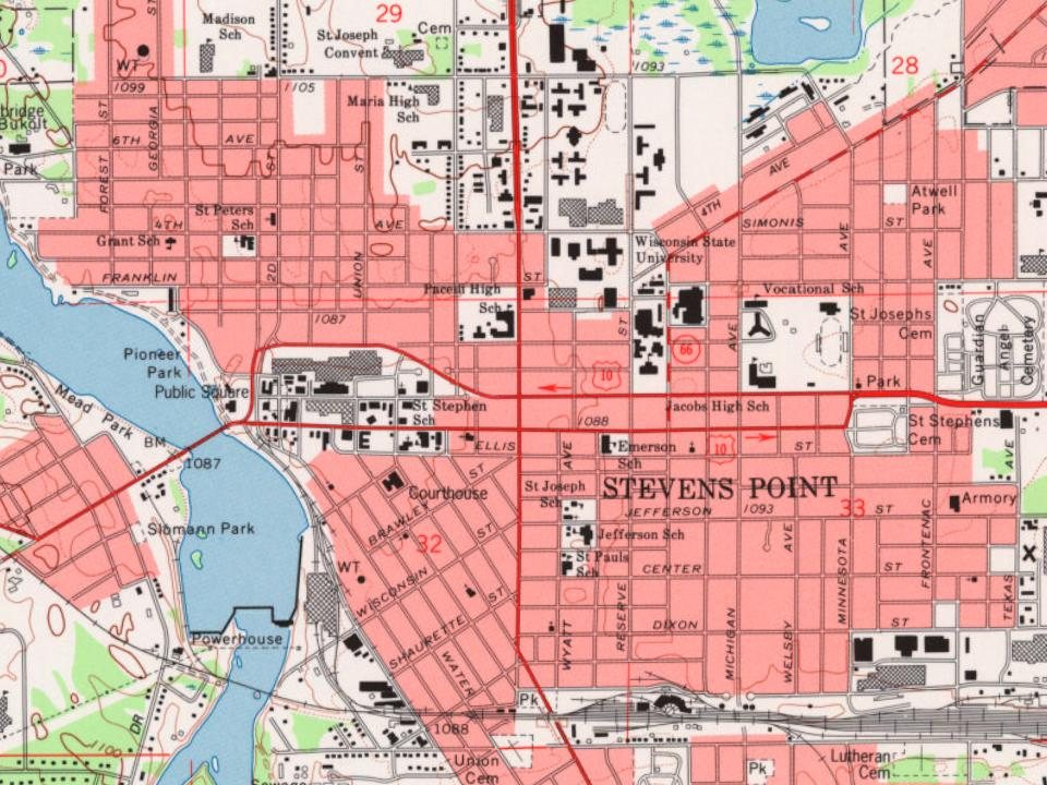
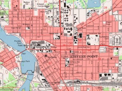
The U.S. Geological Survey’s map of Stevens Point.
1970Stevens Point sheet · 1:24,000
U.S. Geological Survey historical topographic maps (public domain), via Esri’s collection of the scans. The red ring marks the center of Stevens Point.
Every building
Stevens Point, building by building, 1884–1912
Fire insurance maps drew every building, what it was made of and what it was used for, so insurers could price the risk of fire. Pick a year, then a sheet.
Stevens Point’s post office has been open since 1849.
Gone or out of use
Carnegie Public LibrarybuildingGarfield Public SchoolschoolJackson Public SchoolschoolLincoln Public SchoolschoolNugent SchoolschoolPlover Hills SchoolschoolSaint Josephs Academyschool
6cemeteries and burying grounds inside Stevens Point
ForestGuardian AngelSaint JosephsSaint StephensSt Paul LutheranUnion
US Post Offices dataset (Blevins & Helbock, CC0). Places and cemeteries from the USGS Geographic Names Information System (2021).
Help out
Finish Stevens Point’s story
Most archives stop around 1920. The photos from after that are in family albums, not libraries.
Decades since 1900 with photos
00s10s20s30s40s50s60s70s80s90s
1 of 10 decades. The empty ones are waiting for someone’s album.
In 1847, according to Wikidata. Stevens Point’s post office opened in 1849, and the census of 1860 counted 1,538 people here.
How does Stevens Point rank for history?
Stevens Point is more historic than 94% of U.S. towns, #18 of 362 in Wisconsin. The History grade combines the town’s founding era, the share of homes built before 1940 and its National Register listings. It’s a character grade, so it isn’t part of the overall grade. How it works.
What is on the National Register in Stevens Point?
14 listings: 11 buildings, among them the David McMillan House (listed 1974, the first), and 3 historic districts, the Mathias Mitchell Public Square-Main Street Historic District, the Clark Street-Main Street Historic District and the Sisters of St. Joseph Complex, with 183 contributing buildings. 196 historic buildings in all.
How old are the homes in Stevens Point?
25% of Stevens Point’s homes were built before 1940 (Census estimate, ±2.5 points), against a typical 12% for a Wisconsin town; the median home was built in 1972.
Founding dates: Wikidata, Wikipedia, the U.S. post office records of Blevins & Helbock (CC0) and the Census. Homes by year built: Census ACS 2020–24. National Register of Historic Places: National Park Service (list of May 22, 2026). Old photos, postcards and papers: Wikimedia Commons, the Library of Congress and other public archives, credited on each item’s page. Maps: U.S. Geological Survey historical topographic maps (via Esri) and Sanborn fire-insurance maps (Library of Congress). History text and census tables: Wikipedia (CC BY-SA 4.0). Places that used to be: USGS Geographic Names Information System (2021).
From Wikimedia Commons (1), the Library of Congress (4), Wikidata (7), the National Register of Historic Places (14), Wikipedia, Wikidata and Wikipedia for famous people, U.S. Geological Survey historical maps, U.S. Census counts (via Wikipedia), the US Post Offices dataset (Blevins & Helbock), the USGS Geographic Names Information System, Sanborn fire insurance maps (Library of Congress) and old county and town histories (Internet Archive). Archive images are copied here with their credits and licenses, shown on each photo’s page. Refreshed monthly.









 1910
 1910
 1910