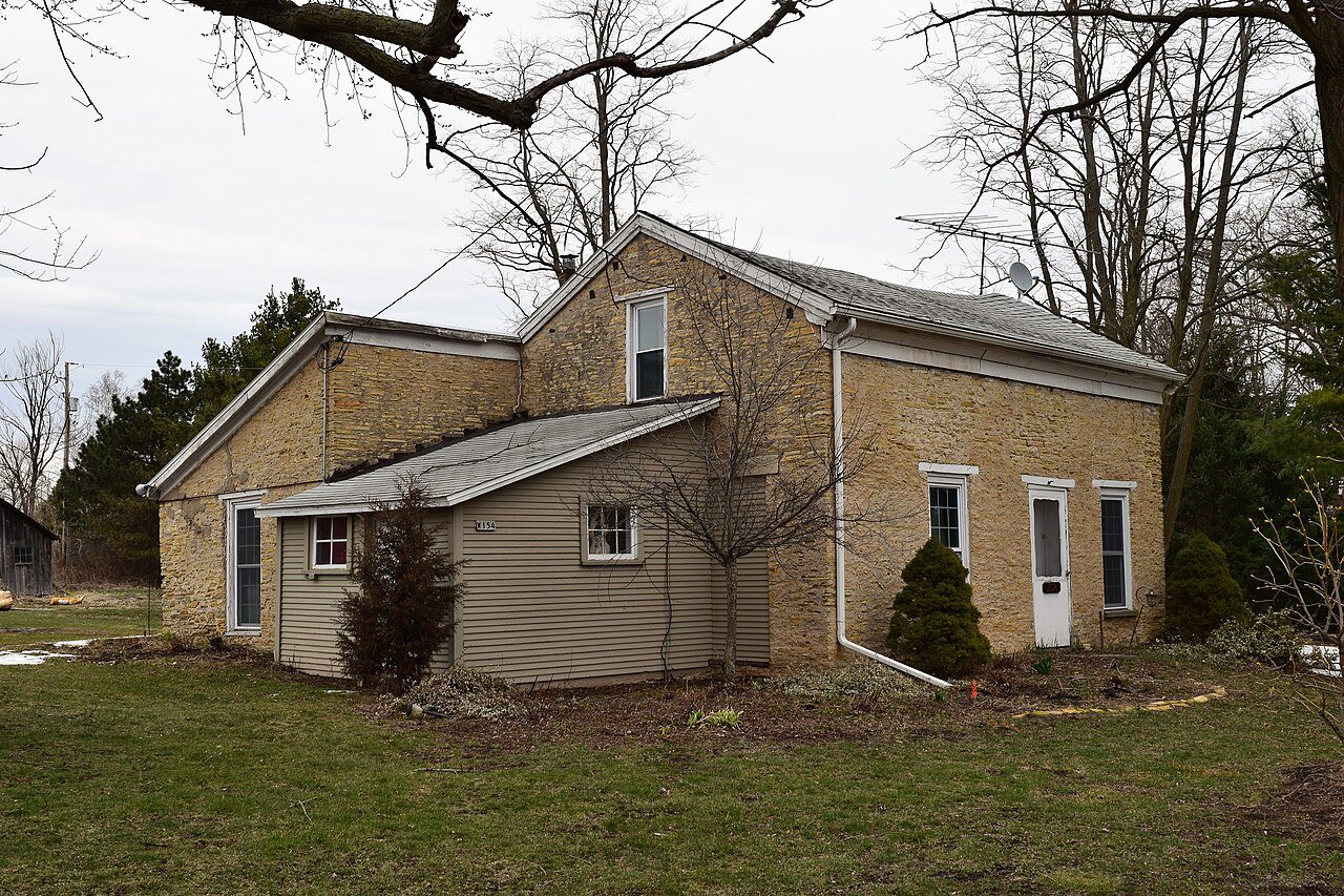
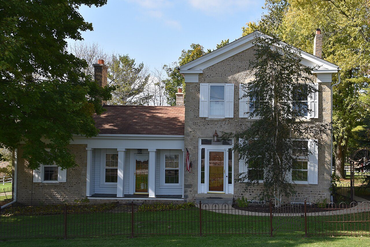
Its Register listings are the James Jesse Strang House, the Horace Loomis House and the John and Margaret Bell House. Below: maps from 1893 on and old-book passages.
The Spring Prairie post office opened in 1845, the earliest record of the town by name. Two smaller post offices, Franklin (1837) and Vienna (1849), opened inside today’s town and later closed.
2020 census: 2,123181 years
How historic is Spring Prairie?
A−
More historic than 77% of U.S. towns, on its age, its old homes and the National Register.
Founding year: the first Spring Prairie post office (Blevins & Helbock, CC0).The full story ↓
History grade
What drives Spring Prairie’s History grade
On its age, its old homes and the National Register, Spring Prairie is more historic than 77% of U.S. towns. All 3 inputs are above most U.S. towns; its age ranks highest and its share of homes from before 1940 lowest.
A−
HistoryA character grade: shown, never part of Spring Prairie’s overall grade.
Wisconsin towns list more on the Register than most of the country (a typical Wisconsin town has 3.0 per 10,000 residents, the U.S. 2.4), so Spring Prairie’s 16.0 sits above most of its state (80% of Wisconsin towns have fewer) while its 3 listings outnumber those of 65% of U.S. towns.
How sure. Graded on any two of the three inputs instead, the letter would range from B+ to A−. The pre-1940 share is a Census survey estimate (±4.7 points). The founding year is the first post office, not a stated founding date.
Founding year: the first post office (other dates in Quick answers). Homes: Census ACS 2020–24. National Register: National Park Service, May 2026 list; each listing counted once (boundary changes and added documentation belong to their listing), and a historic district counts its contributing buildings. How TownRatings grades history →
What stands out about Spring Prairie’s past
Read from the archive, the National Register and the record. The page puts what stands out first.
Every edition of the U.S. Geological Survey’s map of Spring Prairie. Tap a year, or press play to watch the town change.
1893Geneva sheet · 1:62,500
U.S. Geological Survey historical topographic maps (public domain), via Esri’s collection of the scans. The red ring marks the center of Spring Prairie.
Places that used to be
Lost post offices, old corners and burying grounds
Spring Prairie had its own post office from 1845 to 1925. Two other post offices opened and closed inside today’s town.
Franklin
1837–1845
Spring Prairie
1845–1925
Honey Creek
1849–today
Vienna
1849–1906
18301930today
Hamlets and corners on the map
Honey Creek
3cemeteries and burying grounds inside Spring Prairie
DienerGerman SettlementHickory Grove
US Post Offices dataset (Blevins & Helbock, CC0). Places and cemeteries from the USGS Geographic Names Information System (2021).
Spring Prairie was originally called Franklin. The name was changed when an early settler suggested naming the settlement after the natural springs that discharged into Spring Brook, a branch of Sugar Creek.
Passages that mention Spring Prairie, cut from the printed page as they were published.
History of Walworth county, Wisconsin ..1912 · page 349Read the page →
Read the text
This town, at first included in Spring Prairie, was set off March 21, 1843. It is town 3 north, range 17 east, less section 31, set off in 1846 to form the town of Elkhorn. Beginning on its north line, and following the direction of the sun, it is bounded by Troy, Spring Prairie, Geneva and Elkhorn, and Elkhorn and Sugar Creek. Its surface varies between 855 and 1,015 feet above sea-level — the lowest point a creek valley in section 8, its highest near Elkhorn, near section 31. Sugar creek crosses from west to east a little north of the middle line of the town, and affords a
Text read by machine from the scan; it may contain errors.
History of Walworth county, Wisconsin ..1912 · page 405Read the page →
Read the text
At the division of the county into five towns, January 2, 1838, the two townships, each numbered 3 north, lying in ranges 17 and 18 east, were included in the town of Spring Prairie, and were so joined until March 21, 1843. when the westernmost town was set off as Lafayette. The name was suggested to Mrs. Abigail A. ( Whitmore) Heminway by the natural features of the southern half of the town — the springs being in sections 19 and 20 and discharging themselves into Spring brook, a branch of Sugar creek. Rochester and Burlington lie eastward.
Text read by machine from the scan; it may contain errors.
History of Walworth County, Wisconsin, containing an account of its settlement, growth, development and resources...its war record, biographical sketches, portraits of prominent men and early settlers1882 · page 903Read the page →
Read the text
diameter, standing on the east line of the town of Spring Prairie, and south of White River bridge, where they would find three golden plates buried in three feet of earth. These precious plates would be enclosed in a case of sliglitly baked clay, and covered with a flat stone. Upon them would be found written a full account of an ancient people called Mormons. These men testified that they found the plates as directed by Strang, and imbedded in earth which had the appearance of having lain undisturbed for ages. The mysterious inscription was tianslated by Prophet Strang, and its most important clause seemed to be that Joseph Smith had appointed him to be his true and worthy
Text read by machine from the scan; it may contain errors.
History of Walworth County, Wisconsin, containing an account of its settlement, growth, development and resources...its war record, biographical sketches, portraits of prominent men and early settlers1882 · page 898Read the page →
Read the text
In 1836, when Spring Prairie was first settled, the nearest postoffice was at Racine, — the nearest saw-mill at the rapids of Root River, three miles beyond Racine, and the nearest grist-mill at Ottawa, 111.
Text read by machine from the scan; it may contain errors.
Scans and text from the Internet Archive. Books published in 1930 or earlier, which are in the public domain.
Timeline
Spring Prairie, 1837 to 1925
Woven from the archive, old maps, post office records, the National Register and the people born here.
The Spring Prairie post office opened in 1845, the earliest record of the town by name (U.S. post office records).
How does Spring Prairie rank for history?
Spring Prairie is more historic than 77% of U.S. towns. The History grade combines the town’s founding era, the share of homes built before 1940 and its National Register listings. It’s a character grade, so it isn’t part of the overall grade. How it works.
What is on the National Register in Spring Prairie?
Three places: the James Jesse Strang House (listed 1974), the Horace Loomis House (1974) and the John and Margaret Bell House (1994).
How old are the homes in Spring Prairie?
12% of Spring Prairie’s homes were built before 1940 (Census estimate, ±4.7 points), against a typical 12% for a Wisconsin town; the median home was built in 1990.
Founding dates: Wikidata, Wikipedia, the U.S. post office records of Blevins & Helbock (CC0) and the Census. Homes by year built: Census ACS 2020–24. National Register of Historic Places: National Park Service (list of May 22, 2026). Old photos, postcards and papers: Wikimedia Commons, the Library of Congress and other public archives, credited on each item’s page. Maps: U.S. Geological Survey historical topographic maps (via Esri) and Sanborn fire-insurance maps (Library of Congress). History text and census tables: Wikipedia (CC BY-SA 4.0). Places that used to be: USGS Geographic Names Information System (2021).
From Wikimedia Commons (5), Wikidata (1), the National Register of Historic Places (3), Wikipedia, Wikidata and Wikipedia for famous people, U.S. Geological Survey historical maps, the US Post Offices dataset (Blevins & Helbock), the USGS Geographic Names Information System and old county and town histories (Internet Archive). Archive images are copied here with their credits and licenses, shown on each photo’s page. Refreshed monthly.




 2013
 2013
 2013
 2013
 2006