Burlington’s post office opened in 1839, and 19% of its homes were built before 1940
More historic than 92% of U.S. towns · #31 of 362 in Wisconsin. What drives it
4 places in town are on the National Register, among them two historic districts with 217 buildings between them. Below: 33 old photos and papers, maps from 1887 on, and the census since 1860.
Founding year: the first Burlington post office (Blevins & Helbock, CC0). Wikidata: 1886.The full story ↓
History grade
What drives Burlington’s History grade
On its age, its old homes and the National Register, Burlington is more historic than 92% of U.S. towns, #31 of 362 in Wisconsin. All 3 inputs are above most U.S. towns; its National Register listings ranks highest and its share of homes from before 1940 lowest.
A
HistoryA character grade: shown, never part of Burlington’s overall grade.
Wisconsin towns list more on the Register than most of the country (a typical Wisconsin town has 3.0 per 10,000 residents, the U.S. 2.4), so Burlington’s 199 sits above most of its state (97% of Wisconsin towns have fewer) while its 219 historic buildings outnumber those of 94% of U.S. towns.
How sure. Graded on any two of the three inputs instead, the letter would range from A− to A. The pre-1940 share is a Census survey estimate (±4.9 points). The founding year is the first post office, not a stated founding date; Wikidata gives 1886.
Founding year: the first post office (other dates in Quick answers). Homes: Census ACS 2020–24. National Register: National Park Service, May 2026 list; each listing counted once (boundary changes and added documentation belong to their listing), and a historic district counts its contributing buildings. How TownRatings grades history →
What stands out about Burlington’s past
Read from the archive, the National Register and the record. The page puts what stands out first.
Nothing in the archives for these yearsWeddings on Main Street, storms, parades, school pictures, the old store. If it’s in your family album, it belongs here.
Prior to the arrival of Europeans in the area, Native American mounds were constructed near the present location of Burlington. A small Potawatomi village stood in what became Burlington.
The earliest certain European presence in what became Burlington was in the fall of 1799, when a group of French explorers and missionaries led by Francis Morgan de Vereceones made a portage from the Root River to the Fox River, reaching the Fox at approximately Burlington's present location.
Passages that mention Burlington, cut from the printed page as they were published.
Official record of the Old Settlers Society of Racine County, Wisconsin1871 · page 58Read the page →
Read the text
On the 1st of September, 1837, Lewis Royce, Esq., settled in Burlington and built a house west of the present Burlington railroad depot . He came by way of Racine, and there met Ephraim Perkins and family and having a team and conveyance, conveyed them to Burlington, bringing also with him a barrel of flour. He found at Foxville, Origen Perkins, occupying his new homestead; Ruel Nims, on the east side of the river; a small board shanty had also been put up to maintain a
Text read by machine from the scan; it may contain errors.
Official record of the Old Settlers Society of Racine County, Wisconsin1871 · page 57Read the page →
Read the text
Ruel Nims and family arrived in Burlington, (which was then known as Foxville,) on the 10th day of January, 1887, and went into occupation of a log house on the east side of the river, built by Woodbridge, and which during its occupation by Nims, was the first established public house for travelers in Burlington.
Text read by machine from the scan; it may contain errors.
In September there was complaint from Burlington that the Schwaebsden Saengerbund of Chicago had been having a three day "session" at Burlington, talking entirely in German and singing German songs. Burlington men who had attended the parties said the songs were merely drinking songs. As there was no witness handy who could testify that the songs
Text read by machine from the scan; it may contain errors.
Racine county in the world war1920 · page 104Read the page →
Read the text
It was decided that the Racine postoffice should act as the central office for the distribution of these stamps for the entire county, excepting the City of Burlington, the sales there to be in charge of Postmaster Henry Zimmermann.
Text read by machine from the scan; it may contain errors.
Scans and text from the Internet Archive. Books published in 1930 or earlier, which are in the public domain.
Timeline
Burlington, 1839 to 1981
Woven from the archive, old maps, post office records, the National Register and the people born here.
Fire insurance maps drew every building, what it was made of and what it was used for, so insurers could price the risk of fire. Pick a year, then a sheet.
The Burlington post office opened in 1839, the earliest record of the town by name (U.S. post office records). Wikidata gives 1886.
How does Burlington rank for history?
Burlington is more historic than 92% of U.S. towns, #31 of 362 in Wisconsin. The History grade combines the town’s founding era, the share of homes built before 1940 and its National Register listings. It’s a character grade, so it isn’t part of the overall grade. How it works.
What is on the National Register in Burlington?
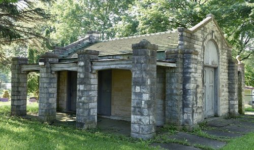
4 listings: 2 buildings and 2 historic districts, the Burlington Downtown Historic District and the Kane Street Historic District, with 217 contributing buildings. 219 historic buildings in all.
How old are the homes in Burlington?
19% of Burlington’s homes were built before 1940 (Census estimate, ±4.9 points), against a typical 12% for a Wisconsin town; the median home was built in 1970.
Founding dates: Wikidata, Wikipedia, the U.S. post office records of Blevins & Helbock (CC0) and the Census. Homes by year built: Census ACS 2020–24. National Register of Historic Places: National Park Service (list of May 22, 2026). Old photos, postcards and papers: Wikimedia Commons, the Library of Congress and other public archives, credited on each item’s page. Maps: U.S. Geological Survey historical topographic maps (via Esri) and Sanborn fire-insurance maps (Library of Congress). History text and census tables: Wikipedia (CC BY-SA 4.0). Places that used to be: USGS Geographic Names Information System (2021).
From Wikimedia Commons (29), the Library of Congress (4), Wikidata (3), the National Register of Historic Places (4), Wikipedia, Wikidata and Wikipedia for famous people, U.S. Geological Survey historical maps, U.S. Census counts (via Wikipedia), the US Post Offices dataset (Blevins & Helbock), the USGS Geographic Names Information System, Sanborn fire insurance maps (Library of Congress) and old county and town histories (Internet Archive). Archive images are copied here with their credits and licenses, shown on each photo’s page. Refreshed monthly.


 1907
 1907
 1907
 1907
 1933
 1933
 1933
 1933
 1933
 1933
 1933
 1933
 1933
 1933
 1933
 1933
 1933
 1933
 1933
 1933
 1933
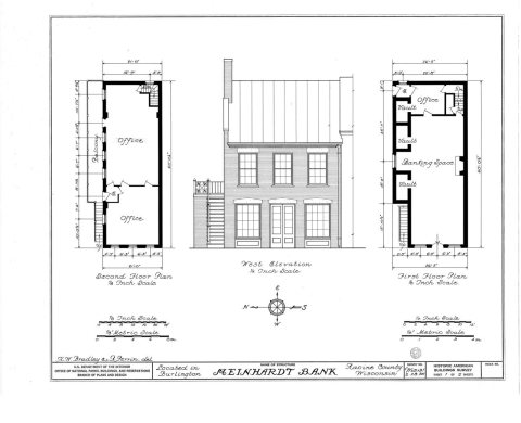 1933
 1933
 1933
 1933
 1933
 1933
 1933
 1968
 1968
 1968
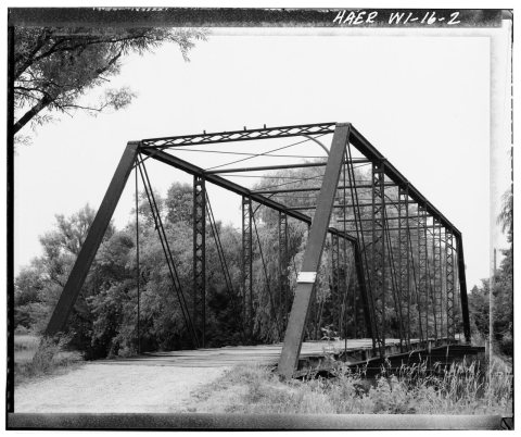 1968
 1968