Every edition of the U.S. Geological Survey’s map of Sharon. Tap a year, or press play to watch the town change.
1893Delavan sheet · 1:62,500
U.S. Geological Survey historical topographic maps (public domain), via Esri’s collection of the scans. The red ring marks the center of Sharon.
Places that used to be
Lost post offices and burying grounds
Two other post offices opened and closed inside today’s town.
South Grove
1846–1867
Elton
1863–1881
18401930today
3cemeteries and burying grounds inside Sharon
North SharonOakwoodSouth Grove
US Post Offices dataset (Blevins & Helbock, CC0). Places and cemeteries from the USGS Geographic Names Information System (2021).
The story so far
Sharon, in brief
Wikipedia doesn’t have a history of Sharon yet. The photos, dates and memories neighbors add here are how it gets written.
Sharon is a village in Walworth County, Wisconsin, United States. The population was 1,586 at the 2020 census. The village is situated within the Town of Sharon.
Between the 2010 and 2020 censuses its population fell from 907 to 861 (-5%).
Intro from Wikipedia. Population: U.S. Census Bureau.
From the old history books
What they wrote about Sharon, 1882–1912
Passages that mention Sharon, cut from the printed page as they were published.
History of Walworth County, Wisconsin, containing an account of its settlement, growth, development and resources...its war record, biographical sketches, portraits of prominent men and early settlers1882 · page 752Read the page →
Read the text
The village of Sharon is located on Section 33 of the town of Sharon, on the Wisconsin Division of the Chicago & North-Western Railroad, which enters the town on Section 34, and, running in a northwesterly direction, passes out on Section 30. The first settlers of the village were William Van Ostrand and a Mr. Southai'd, who located in 1842.
Text read by machine from the scan; it may contain errors.
History of Walworth County, Wisconsin, containing an account of its settlement, growth, development and resources...its war record, biographical sketches, portraits of prominent men and early settlers1882 · page 753Read the page →
Read the text
A schoolhouse was built near the site of the present one in the village of Sharon in about 1848. This was replaced by the present schoolhouse a few years afterwai'd, which has from time to time been remodeled and added to. It is situated in the northern part of the village, and is a two-story frame building, representing a valuation of aliout ?3,000.
Text read by machine from the scan; it may contain errors.
History of Walworth county, Wisconsin ..1912 · page 248Read the page →
Read the text
The town of Walworth (with Sharon) was set off in 1839, and the town of Darien early in the next year, leaving the name Delavan to town 2 north, range 16 east. One more dismemberment, February 2, 1846, gave section 1 to the new town of Elkhorn. Of seven measurements recorded by the state topographers the highest and lowest points were respectively nine hundred and sixty-eight ami nine hundred and five feet above sea-level.
Text read by machine from the scan; it may contain errors.
History of Walworth county, Wisconsin ..1912 · page 640Read the page →
Read the text
William C. Kinyon, of this sketch, was reared and educated in Boone county. Illinois, and early in life he took up farming for a livelihood and continued the same successfully. He owns a most excellent farm in section 31, Sharon township, which he placed under good improvements and kept well tilled. In 1900 he moved to the village of Sharon. His farm of two hundred acres lies in the southwest corner of Sharon township. He merely looks after it in a general way, keeping it rented.
Text read by machine from the scan; it may contain errors.
Scans and text from the Internet Archive. Books published in 1930 or earlier, which are in the public domain.
Timeline
Sharon, 1846 to 1991
Woven from the archive, old maps, post office records, the National Register and the people born here.
Fire insurance maps drew every building, what it was made of and what it was used for, so insurers could price the risk of fire. Pick a year, then a sheet.
Founding dates: Wikidata, Wikipedia, the U.S. post office records of Blevins & Helbock (CC0) and the Census. Homes by year built: Census ACS 2020–24. National Register of Historic Places: National Park Service (list of May 22, 2026). Old photos, postcards and papers: Wikimedia Commons, the Library of Congress and other public archives, credited on each item’s page. Maps: U.S. Geological Survey historical topographic maps (via Esri) and Sanborn fire-insurance maps (Library of Congress). History text and census tables: Wikipedia (CC BY-SA 4.0). Places that used to be: USGS Geographic Names Information System (2021). How TownRatings grades history →
From Wikimedia Commons (2), Wikidata and Wikipedia for famous people, U.S. Geological Survey historical maps, U.S. Census counts (via Wikipedia), the US Post Offices dataset (Blevins & Helbock), the USGS Geographic Names Information System, Sanborn fire insurance maps (Library of Congress) and old county and town histories (Internet Archive). Archive images are copied here with their credits and licenses, shown on each photo’s page. Refreshed monthly.


 2024
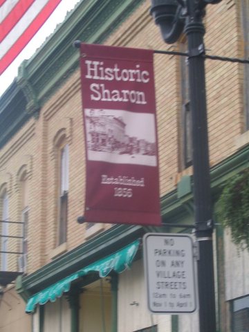 2014


