
MukwonagoRiver, 2005
Mukwonago’s story
Mukwonago in pictures
Census counts: 239 in 1880, 8,262 in 2020. The archive holds 6 old photos and papers going back to 1842 and 4 maps from 1892 on.
Explore the history →Each edition grades its towns against each other only.
A town of 7,763.
Of the 183 Wisconsin towns we compare, none has a lower property crime rate than Mukwonago. 15% of the land in Mukwonago is conserved, against 3.8% in Wisconsin’s towns and 4.3% across U.S. towns. Kettle Moraine State Forest-Mukwonago River Unit, at 550 acres with 4 miles of trail, is the biggest park or preserve. We don’t grade Mukwonago yet; the figures below are still real.
Where Mukwonago’s working residents go each day. Line width shows the share.
Census LEHD 2023
Census counts: 239 in 1880, 8,262 in 2020. The archive holds 6 old photos and papers going back to 1842 and 4 maps from 1892 on.
Explore the history →Who provides power, water and the rest in Mukwonago, and how to reach them.
EPA SDWIS (Oct 9, 2026) · HIFLD + EIA-861 2025 · Census 2020 ZCTAs · NCES 2024–25 · registration: vote.gov, updated Nov 18, 2024.
Ordered by what stands out in Mukwonago.
Most working residents leave Mukwonago for work: only 2% work in town. Mukwonago’s median household income is $137,000, above both Wisconsin’s towns ($87,000) and U.S. towns ($80,000). The average trip to work in Mukwonago is 29 minutes.
| Mukwonago | Wisconsin towns | U.S. towns | |
|---|---|---|---|
| Median household income | $137,000 | $87,000 | $80,000 |
| Average trip to work | 29 minutes | 22 minutes | 25 minutes |
| Below the poverty line | 2.4% | 6.4% | 9.6% |
| Working residents who work in town | 2.2% | 8.3% | 8% |
Census LEHD 2023 · ACS
Its public schools are run by the Mukwonago School District. Its three schools are below.
| School | Level | Students | Letter |
|---|---|---|---|
| Rolling Hills ElementaryLargest public elementary schoolGrades PK–6 | Grades PK–6 | 455 | A+ |
| Natures Classroom Institute & Montessori School PrivateLargest high schoolGrades PK–12 | Grades PK–12 | 58 | – |
| Section ElementaryTop results in townGrades PK–6 | Grades PK–6 | 438 | A+ |
NCES · EDFacts
Adults 35 to 64 are 48% of residents (38% statewide); adults 18 to 34 are 14% of residents (22% statewide). 42% of Mukwonago adults 25 and older hold a bachelor’s degree or more.
| Mukwonago | Wisconsin towns | U.S. towns | |
|---|---|---|---|
| Bachelor’s degree or more, 25+ | 42% | 32% | 29% |
| Median age | 43.3 years | 42.1 years | 40.5 years |
| Aged 65 or older | 17% | 20% | 18% |
| Under 18 | 20% | 21% | 22% |
47% women, 53% men
About 114 men for every 100 women (the survey’s margin: ±2.7 points). Across Wisconsin, 49.9% of residents are women.
| Mukwonago | WI | U.S. | |
|---|---|---|---|
| Under 10 | 10.1% | 11.2% | 11.6% |
| 10 to 17 | 10.3% | 10.2% | 10.3% |
| 18 to 24 | 7% | 9.3% | 9.1% |
| 25 to 34 | 7.4% | 12.6% | 13.7% |
| 35 to 44 | 16.8% | 12.7% | 13.2% |
| 45 to 54 | 11.6% | 11.8% | 12.2% |
| 55 to 64 | 19.4% | 13.8% | 12.7% |
| 65 to 74 | 13.2% | 11.2% | 10.2% |
| 75 and older | 4.3% | 7.3% | 7% |
| No diploma | 1.4% | 6.4% | 10.4% |
| High school | 20.8% | 29.4% | 26% |
| Some college | 22.5% | 19.5% | 19.1% |
| Associate’s | 13.8% | 11.3% | 8.8% |
| Bachelor’s | 28.5% | 22% | 21.6% |
| Graduate | 13.1% | 11.4% | 14.1% |
U.S. Census Bureau · ACS 2020-2024 5-year estimates
Expected storm and flood damage is lower than in 69% of U.S. communities.
FEMA National Risk Index · OpenFEMA
Mukwonago has cold, snowy winters and pleasant summers. July afternoons reach 82°, January nights drop to 13° and about 51 inches of snow falls in a winter.
NOAA U.S. Climate Normals, 1991–2020
| Biggest places to walk | Trails | Acres |
|---|---|---|
| 1. Kettle Moraine State Forest-Mukwonago River Unit | 4 mi | 550 |
| 2. Mukwonago County Park | — | 355 |
| 3. Stone Brook Hollow Walking Trails | — | 31 |
Trails & parks © OpenStreetMap contributors · Conserved land: USGS PAD-US
Mukwonago's reported crime rate is well below Wisconsin's. Mukwonago’s violent crime rate is 0.5 per 1,000 residents.
FBI crime data, 2025 · crimes reported to police
Mukwonago beats the Wisconsin average on 16 of 32 CDC measures and trails it on 1. 22% of adults binge drink in Mukwonago.
| Mukwonago | Wisconsin towns | U.S. towns | |
|---|---|---|---|
| Binge drink (CDC PLACES) | 22% | 20% | 16% |
| Frequent mental distress (CDC PLACES) | 14% | 15% | 17% |
| Get no exercise (CDC PLACES) | 21% | 26% | 25% |
| Feel lonely (CDC PLACES) | 29% | 30% | 33% |
| What stands out | Mukwonago | WI |
|---|---|---|
| Fewer adults facing food insecurity | 7.6% | 12.1% |
| Fewer older adults who have lost all their teeth | 6.8% | 9.9% |
| More adults who have had cancer | 9.4% | 8.6% |
CDC PLACES 2025 · modeled estimates for adults · CMS · HRSA
Museums, parks, gardens and other places to visit around Mukwonago. Close and well known come first.
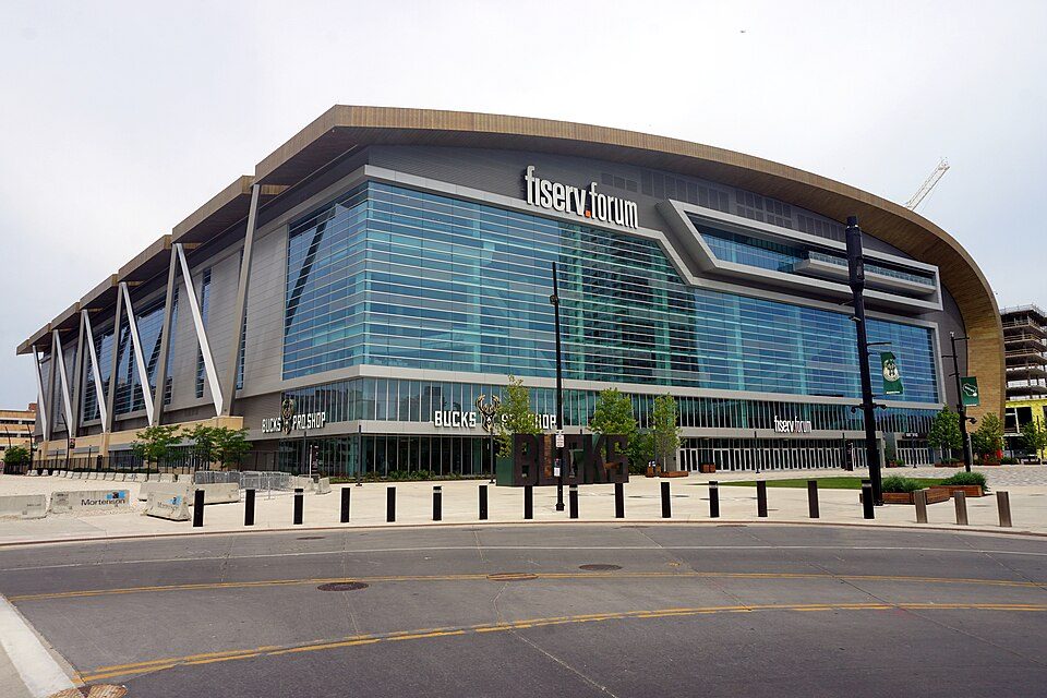 25 mi Stadium & arenaFiserv Forum
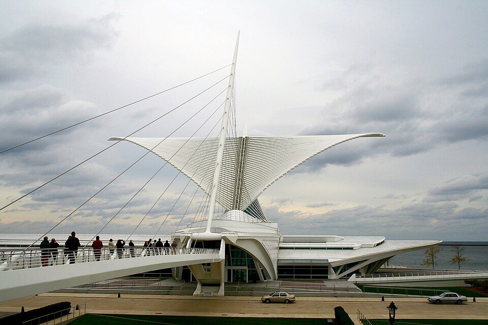 26 mi MuseumMilwaukee Art Museum350K visitors a year
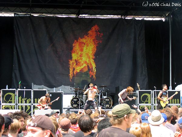 11 mi TheatreAlpine Valley Music Theatre
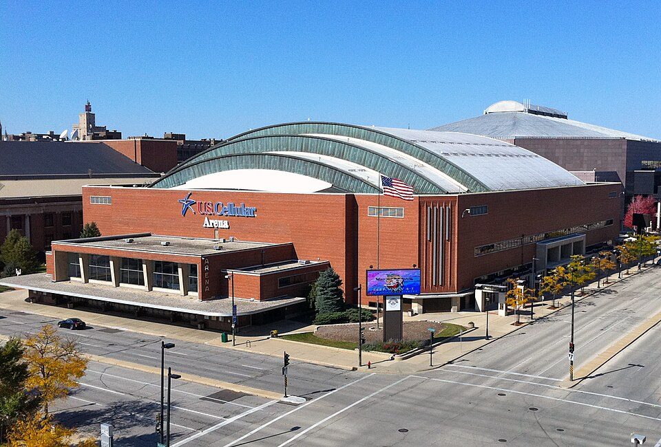 25 mi Stadium & arenaUW–Milwaukee Panther Arena
 28 mi State parkAztalan State Park
 25 mi MuseumHarley-Davidson Museum300K visitors a year
Fiserv Forum: Michael Barera, CC BY-SA 4.0 · Milwaukee Art Museum: Michael Hicks (Mulad), CC BY 2.0 · Alpine Valley Music Theatre: chad davis, CC BY-SA 2.0 · UW–Milwaukee Panther Arena: Shadowlink1014, Public domain · Aztalan State Park: Joshua Mayer - Flickr user wackybadger, CC BY-SA 2.0 · Harley-Davidson Museum: Dori, CC BY-SA 3.0 us
3 within 15 miles of the center of Mukwonago
About 5 of every 100 Mukwonago residents are enrolled in college, about the same as Wisconsin.
Village in Wisconsin, United States
Mukwonago () is a village in Waukesha and Walworth counties in the U.S. state of Wisconsin. It is along the Mukwonago River and Lower Phantom Lake. The population was 8,262 at the 2020 census, of which 8,040 were in Waukesha County and 222 were in Walworth County. The village is located mostly within the Town of Mukwonago in Waukesha County, with a small portion extending into the Town of East Troy in Walworth County.
From Wikipedia, licensed CC BY-SA 4.0 · facts via Wikidata (CC0)
8 towns share a border with Mukwonago.
| Town | WI rank | Overall | Cost | Safety | Schools | Health |
|---|---|---|---|---|---|---|
| Mukwonago | — | — | — | — | — | — |
| Mukwonago | #92 | A− | C | B | A | A− |
| North Prairie | — | — | C+ | — | A | A |
| Genesee | #166 | B+ | C | — | B | A− |
| Vernon | — | — | A− | — | A | — |
| East Troy | #186 | B+ | C− | — | B+ | B+ |
| Eagle | #130 | A− | C | — | A | A− |
| Waukesha | — | — | A | — | B− | — |
North Prairie has fewer than 2,500 residents, so it gets subject grades but no overall grade. North Prairie, Genesee, Vernon, East Troy, Eagle and Waukesha report no FBI crime data of their own. Mukwonago, Vernon and Waukesha aren’t graded (fewer than 1,000 residents, or not enough data). Compare Mukwonago with a neighbor →
Short answers, built from the data on this page.
We don’t grade Mukwonago yet; the figures below are still real.


