Founding year: the first Elkhorn post office (Blevins & Helbock, CC0).The full story ↓
History grade
What drives Elkhorn’s History grade
On its age, its old homes and the National Register, Elkhorn is more historic than 80% of U.S. towns, #86 of 362 in Wisconsin. All 3 inputs are above most U.S. towns; its age ranks highest and its share of homes from before 1940 lowest.
A−
HistoryA character grade: shown, never part of Elkhorn’s overall grade.
Wisconsin towns list more on the Register than most of the country (a typical Wisconsin town has 3.0 per 10,000 residents, the U.S. 2.4), so Elkhorn’s 6.8 sits above most of its state (69% of Wisconsin towns have fewer) while its 7 listings outnumber those of 73% of U.S. towns.
How sure. Graded on any two of the three inputs instead, the letter would range from B+ to A−. The pre-1940 share is a Census survey estimate (±4.4 points). The founding year is the first post office, not a stated founding date.
Founding year: the first post office (other dates in Quick answers). Homes: Census ACS 2020–24. National Register: National Park Service, May 2026 list; each listing counted once (boundary changes and added documentation belong to their listing), and a historic district counts its contributing buildings. How TownRatings grades history →
What stands out about Elkhorn’s past
Read from the archive, the National Register and the record. The page puts what stands out first.
Every edition of the U.S. Geological Survey’s map of Elkhorn. Tap a year, or press play to watch the town change.
1893Delavan sheet · 1:62,500
U.S. Geological Survey historical topographic maps (public domain), via Esri’s collection of the scans. The red ring marks the center of Elkhorn.
Every building
Elkhorn, building by building, 1893–1911
Fire insurance maps drew every building, what it was made of and what it was used for, so insurers could price the risk of fire. Pick a year, then a sheet.
1893Sheet 1 of 1
Edition
Sheets
BrickWoodStone
Sanborn Map Company, via the Library of Congress. Editions published in 1930 or earlier, which are in the public domain.
In 1836, Colonel Samuel Phoenix spotted a rack of elk antlers in a tree and proclaimed the area as "Elk Horn."
The area's beauty and fertile soil led Daniel Bradley, his brother Milo, and LeGrand Rockwell to create a community in the area. Its growth to a population of 539 led to the first town meeting in 1846. Elkhorn was designated county seat that same year because of its location in Walworth County.
In 1851, Elkhorn became the location of the Walworth County Fair, which is now hosted annually at the Walworth County Fairgrounds which lasts for six days having Labor Day as the last. The Walworth County Fair is the largest county fair in Wisconsin.
In the 1870s, saline water from springs located in Elkhorn was believed to cure rheumatism.
Passages that mention Elkhorn, cut from the printed page as they were published.
History of Walworth County, Wisconsin, containing an account of its settlement, growth, development and resources...its war record, biographical sketches, portraits of prominent men and early settlers1882 · page 501Read the page →
Read the text
Elkhorn.N In 1873, he was elected Chairman of the village of Elkhorn, and re-elected in 1874, 1875 and 1876; was Deputy Connty Clerk nnder his brother. Myron E., and, upon said brother's death, in Mai-ch, 1874,, became e.r'officin Clerk for the unexpired term; has served continuously several terms as Assessor of the village of Elkhorn; represented the First Assembly District of AV^alworth County in the Legislature of 1879; has been, for six or seven yeai's past regular Elkhorn correspondent for the Lake Geneva Herald. JVlr. D. married, at White Pigeon, Mich., Elizabeth Dixon, who was born in England, and came with her parents to America in her childhood. Mr. and :Mi-s. D. had one child, Mary M., who died Feb. u, 1876, while at school in
Text read by machine from the scan; it may contain errors.
History of Walworth County, Wisconsin, containing an account of its settlement, growth, development and resources...its war record, biographical sketches, portraits of prominent men and early settlers1882 · page 472Read the page →
Read the text
March 21, 1843, the town of La Grange was detached from the remaining ten-itory (Town 4, Range 16), leaving under the name of Elkhorn Town 3, Range 16, it being the present town of Sugar Creek, less a single section. Its boundaries remained unchanged until February 2, 1846, at which time, by act of the Legislatiu-e, a new town of Elkhorn was incorporated, which embraced but a single section of the original town, viz.. Section 36, in Town 3, Range 16. By that act, the present town of Elkhorn was established. The boundaries were described as follows: "All that part of the county of Walworth comprised in Section 36, in the town of Elkhorn; Section 1, in the town of Delavan: Section 6, in the town of Geneva, and Section 31, in
Text read by machine from the scan; it may contain errors.
History of Walworth county, Wisconsin ..1912 · page 349Read the page →
Read the text
This town, at first included in Spring Prairie, was set off March 21, 1843. It is town 3 north, range 17 east, less section 31, set off in 1846 to form the town of Elkhorn. Beginning on its north line, and following the direction of the sun, it is bounded by Troy, Spring Prairie, Geneva and Elkhorn, and Elkhorn and Sugar Creek. Its surface varies between 855 and 1,015 feet above sea-level — the lowest point a creek valley in section 8, its highest near Elkhorn, near section 31. Sugar creek crosses from west to east a little north of the middle line of the town, and affords a
Text read by machine from the scan; it may contain errors.
History of Walworth county, Wisconsin ..1912 · page 248Read the page →
Read the text
The town of Walworth (with Sharon) was set off in 1839, and the town of Darien early in the next year, leaving the name Delavan to town 2 north, range 16 east. One more dismemberment, February 2, 1846, gave section 1 to the new town of Elkhorn. Of seven measurements recorded by the state topographers the highest and lowest points were respectively nine hundred and sixty-eight ami nine hundred and five feet above sea-level.
Text read by machine from the scan; it may contain errors.
Scans and text from the Internet Archive. Books published in 1930 or earlier, which are in the public domain.
Timeline
Elkhorn, 1836 to 1990
Woven from the archive, old maps, post office records, the National Register and the people born here.
Nothing in the archives for these yearsWeddings on Main Street, storms, parades, school pictures, the old store. If it’s in your family album, it belongs here.
The Elkhorn post office opened in 1837, the earliest record of the town by name (U.S. post office records).
How does Elkhorn rank for history?
Elkhorn is more historic than 80% of U.S. towns, #86 of 362 in Wisconsin. The History grade combines the town’s founding era, the share of homes built before 1940 and its National Register listings. It’s a character grade, so it isn’t part of the overall grade. How it works.
What is on the National Register in Elkhorn?
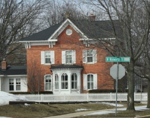
7 listings: 6 buildings, among them the Joseph P. Webster House (listed 1972, the first), and 1 structure.
How old are the homes in Elkhorn?
14% of Elkhorn’s homes were built before 1940 (Census estimate, ±4.4 points), against a typical 12% for a Wisconsin town; the median home was built in 1990.
Founding dates: Wikidata, Wikipedia, the U.S. post office records of Blevins & Helbock (CC0) and the Census. Homes by year built: Census ACS 2020–24. National Register of Historic Places: National Park Service (list of May 22, 2026). Old photos, postcards and papers: Wikimedia Commons, the Library of Congress and other public archives, credited on each item’s page. Maps: U.S. Geological Survey historical topographic maps (via Esri) and Sanborn fire-insurance maps (Library of Congress). History text and census tables: Wikipedia (CC BY-SA 4.0). Places that used to be: USGS Geographic Names Information System (2021).
From Wikimedia Commons (5), Wikidata (6), the National Register of Historic Places (7), Wikipedia, Wikidata and Wikipedia for famous people, U.S. Geological Survey historical maps, U.S. Census counts (via Wikipedia), the US Post Offices dataset (Blevins & Helbock), the USGS Geographic Names Information System, Sanborn fire insurance maps (Library of Congress) and old county and town histories (Internet Archive). Archive images are copied here with their credits and licenses, shown on each photo’s page. Refreshed monthly.




 2012
 2010
 2010
 2010


