Eau Claire’s post office opened in 1856, and 18% of its homes were built before 1940
More historic than 75% of U.S. towns · #106 of 362 in Wisconsin. What drives it
63 places in town are on the National Register, among them seven historic districts with 355 buildings between them. Below: 4 old photos and papers, maps from 1883 on, and the census since 1870.
How Eau Claire began, and where its name came from
When was Eau Claire founded?
1856
The Eau Claire post office opened in 1856, the earliest record of the town by name. Two smaller post offices, Clear Water (1849) and West Eau Claire (1862), opened inside today’s city and later closed.
First census: 2,293 in 18702020 census: 69,421170 years
How did Eau Claire get its name?
Eau Claire took its name from Eau Claire County.
More on the name
"Eau Claire" is the singular form of the original French name, "Eaux Claires", meaning "Clear Waters", for the Eau Claire River. According to local legend, the river was so named because early French explorers journeying down the rain-muddied Chippewa River, came upon the confluence with the Eau Claire River, and excitedly exclaimed the contrast: "Voici l'eau claire!" ("Here is the clear water!").
How historic is Eau Claire?
A−
More historic than 75% of U.S. towns, on its age, its old homes and the National Register.
On its age, its old homes and the National Register, Eau Claire is more historic than 75% of U.S. towns, #106 of 362 in Wisconsin. Its National Register listings hold the grade up; its age pulls it down.
A−
HistoryA character grade: shown, never part of Eau Claire’s overall grade.
Wisconsin towns list more on the Register than most of the country (a typical Wisconsin town has 3.0 per 10,000 residents, the U.S. 2.4), so Eau Claire’s 59.2 sits above most of its state (90% of Wisconsin towns have fewer) while its 416 historic buildings outnumber those of 97% of U.S. towns.
How sure. Graded on any two of the three inputs instead, the letter would range from B− to A. The pre-1940 share (±1.6 points) is firm at this size. The founding year is the first post office, not a stated founding date.
Founding year: the first post office (other dates in Quick answers). Homes: Census ACS 2020–24. National Register: National Park Service, May 2026 list; each listing counted once (boundary changes and added documentation belong to their listing), and a historic district counts its contributing buildings. How TownRatings grades history →
What stands out about Eau Claire’s past
Read from the archive, the National Register and the record. The page puts what stands out first.
National Park Service, National Register of Historic Places. Photos from Wikimedia Commons, credited on each place’s page.
Places that used to be
Lost post offices, old corners, places now gone and burying grounds
Eau Claire’s post office has been open since 1856. Two other post offices opened and closed inside today’s town.
Clear Water
1849–1856
Eau Claire
1856–today
West Eau Claire
1862–1873
18401930today
Hamlets and corners on the map
Berghs Mobile Home ParkBluff Crest Mobile Home ParkCamino Mobile Home ParkMaples Mobile Home ParkOak Ridge Village Mobile Home ParkPinehurstPutnam HeightsShawtownTerrace HillUnionVilla Diann Mobile Home Park
Gone or out of use
Christian and Missionary Alliance ChurchchurchRobins SchoolschoolTruax SchoolschoolWood Schoolschool
3cemeteries and burying grounds inside Eau Claire
Calvary CatholicForest HillLakeview
US Post Offices dataset (Blevins & Helbock, CC0). Places and cemeteries from the USGS Geographic Names Information System (2021).
The Eau Claire area was first visited by Europeans in the late 17th century. It had been occupied for thousands of years before European fur traders began settling there for trade with local Native American tribes.
The First Treaty of Prairie du Chien, signed in 1825, established the Chippewa River "half a day's march below the falls" as the boundary between the Sioux and Chippewa, and the "Clear Water River, a branch of the Chippewa" as the boundary between the Chippewa and Winnebago.
Passages that mention Eau Claire, cut from the printed page as they were published.
History of Eau Claire county, Wisconsin, past and present1914 · page 916Read the page →
Read the text
Eau Claire Bedding Co., 484 Eau Claire Book & Stationery Co., 484 Eau Claire Business College, 429 Eau Claire Business Houses, 461 Eau Claire Churches, 511 Eau Claire City, 381 Eau Claire Cornice & Heating Co., 483
Text read by machine from the scan; it may contain errors.
History of Eau Claire county, Wisconsin, past and present1914 · page 40Read the page →
Read the text
Washington Township is rectangular in shape, but irregular in outline and contains sixty-six square miles. It was set off in January, 1866, and is bounded on the north by the city of Eau Claire and the town of Seymour, on the south by the towns of Clear Creek and Otter Creek, on the east by the town of Lincoln and on the west by the city of Eau Claire and the town of Brunswick. Otter creek runs through the town from the extreme southeast to the extreme northwest, and Low's creek
Text read by machine from the scan; it may contain errors.
Scans and text from the Internet Archive. Books published in 1930 or earlier, which are in the public domain.
Timeline
Eau Claire, 1849 to 1983
Woven from the archive, old maps, post office records, the National Register and the people born here.
Nothing in the archives for these yearsWeddings on Main Street, storms, parades, school pictures, the old store. If it’s in your family album, it belongs here.
Every edition of the U.S. Geological Survey’s map of Eau Claire. Tap a year, or press play to watch the town change.
1972Eau Claire East sheet · 1:24,000
U.S. Geological Survey historical topographic maps (public domain), via Esri’s collection of the scans. The red ring marks the center of Eau Claire.
Every building
Eau Claire, building by building, 1883–1897
Fire insurance maps drew every building, what it was made of and what it was used for, so insurers could price the risk of fire. Pick a year, then a sheet.
The Eau Claire post office opened in 1856, the earliest record of the town by name (U.S. post office records).
How does Eau Claire rank for history?
Eau Claire is more historic than 75% of U.S. towns, #106 of 362 in Wisconsin. The History grade combines the town’s founding era, the share of homes built before 1940 and its National Register listings. It’s a character grade, so it isn’t part of the overall grade. How it works.
What is on the National Register in Eau Claire?
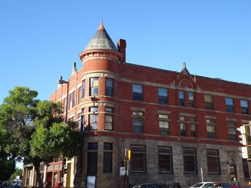
63 listings: 51 buildings, among them the Community House, First Congregational Church (listed 1974, the first), 7 historic districts with 355 contributing buildings, and 5 structures. 416 historic buildings in all.
How old are the homes in Eau Claire?
18% of Eau Claire’s homes were built before 1940 (Census estimate, ±1.6 points), against a typical 12% for a Wisconsin town; the median home was built in 1975.
Founding dates: Wikidata, Wikipedia, the U.S. post office records of Blevins & Helbock (CC0) and the Census. Homes by year built: Census ACS 2020–24. National Register of Historic Places: National Park Service (list of May 22, 2026). Old photos, postcards and papers: Wikimedia Commons, the Library of Congress and other public archives, credited on each item’s page. Maps: U.S. Geological Survey historical topographic maps (via Esri) and Sanborn fire-insurance maps (Library of Congress). History text and census tables: Wikipedia (CC BY-SA 4.0). Places that used to be: USGS Geographic Names Information System (2021).
From the Library of Congress (4), Wikidata (7), the National Register of Historic Places (63), Wikipedia, Wikidata and Wikipedia for famous people, U.S. Geological Survey historical maps, U.S. Census counts (via Wikipedia), the US Post Offices dataset (Blevins & Helbock), the USGS Geographic Names Information System, Sanborn fire insurance maps (Library of Congress) and old county and town histories (Internet Archive). Archive images are copied here with their credits and licenses, shown on each photo’s page. Refreshed monthly.




 1880
 1880
 1880


