De Pere’s post office opened in 1837, and 10% of its homes were built before 1940
More historic than 85% of U.S. towns · #64 of 362 in Wisconsin. What drives it
19 places in town are on the National Register, among them eight historic districts with 282 buildings between them. Below: 7 old photos and papers, maps from 1884 on, and the census since 1860.
The De Pere post office opened in 1837, the earliest record of the town by name. Wikidata gives 1857. Another post office, West De Pere (1875), opened inside today’s city and later closed.
First census: 508 in 18602020 census: 25,410189 years
How historic is De Pere?
A−
More historic than 85% of U.S. towns, on its age, its old homes and the National Register.
Founding year: the first De Pere post office (Blevins & Helbock, CC0). Wikidata: 1857.The full story ↓
History grade
What drives De Pere’s History grade
On its age, its old homes and the National Register, De Pere is more historic than 85% of U.S. towns, #64 of 362 in Wisconsin. Its National Register listings hold the grade up; its share of homes from before 1940 pulls it down.
A−
HistoryA character grade: shown, never part of De Pere’s overall grade.
Wisconsin towns list more on the Register than most of the country (a typical Wisconsin town has 3.0 per 10,000 residents, the U.S. 2.4), so De Pere’s 118 sits above most of its state (95% of Wisconsin towns have fewer) while its 298 historic buildings outnumber those of 95% of U.S. towns.
How sure. Graded on any two of the three inputs instead, the letter would range from B to A. The pre-1940 share is a Census survey estimate (±3.2 points). The founding year is the first post office, not a stated founding date; Wikidata gives 1857.
Founding year: the first post office (other dates in Quick answers). Homes: Census ACS 2020–24. National Register: National Park Service, May 2026 list; each listing counted once (boundary changes and added documentation belong to their listing), and a historic district counts its contributing buildings. How TownRatings grades history →
What stands out about De Pere’s past
Read from the archive, the National Register and the record. The page puts what stands out first.
National Park Service, National Register of Historic Places. Photos from Wikimedia Commons, credited on each place’s page.
Every building
De Pere, building by building, 1884–1914
Fire insurance maps drew every building, what it was made of and what it was used for, so insurers could price the risk of fire. Pick a year, then a sheet.
When the first European, Jean Nicolet, visited the place in 1634–35, De Pere was the site of a polyglot settlement of several thousand attracted by the fishing at the first rapids of the Fox River. In 1671, French Jesuit explorer Père Claude-Jean Allouez founded the St. Francis Xavier Mission at the last set of rapids on the Fox River before it enters The Bay of Green Bay. The site was known as Rapides Des Pères (rapids of the fathers) which became modern day De Pere.
Passages that mention De Pere, cut from the printed page as they were published.
History of Brown County, Wisconsin, past and present1913 · page 339Read the page →
Read the text
in what is now New Denmark, Brown county, when that district was still a wilderness and part of De Pere. He and his family were the first settlers in the district and when it was set apart from De Pere they named the little town which they founded after their native country. The father became one of the leading citizens of New Denmark and held at various times practically all the township offices. He died February 22, 1894, at the age of eighty years. His wife lived until April 12, 1898, her death occurring when she was seventy-six years of age, and she is buried beside her husband
Text read by machine from the scan; it may contain errors.
History of Brown County, Wisconsin, past and present1913 · page 532Read the page →
Read the text
He resided on the farm until July, 1855, when he removed to Erie, Pennsylvania, where he was engaged in business until 1S58, at which time he returned to Wisconsin, locating at De Pere where he had large interests, having purchased, in June, 1854. from Joshua F. Cox, an undivided half interest in the town of De Pere, and also purchased the water power created by the dam at De Pere as well as the riparian rights on both sides of the river. He was president of the little band of men which helped to organize the Fox River Bank at Green Bay and was one of the founders of the Fox & Wis-
Text read by machine from the scan; it may contain errors.
Scans and text from the Internet Archive. Books published in 1930 or earlier, which are in the public domain.
Timeline
De Pere, 1837 to 1984
Woven from the archive, old maps, post office records, the National Register and the people born here.
Nothing in the archives for these yearsWeddings on Main Street, storms, parades, school pictures, the old store. If it’s in your family album, it belongs here.
The De Pere post office opened in 1837, the earliest record of the town by name (U.S. post office records). Wikidata gives 1857.
How does De Pere rank for history?
De Pere is more historic than 85% of U.S. towns, #64 of 362 in Wisconsin. The History grade combines the town’s founding era, the share of homes built before 1940 and its National Register listings. It’s a character grade, so it isn’t part of the overall grade. How it works.
What is on the National Register in De Pere?
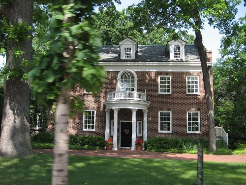
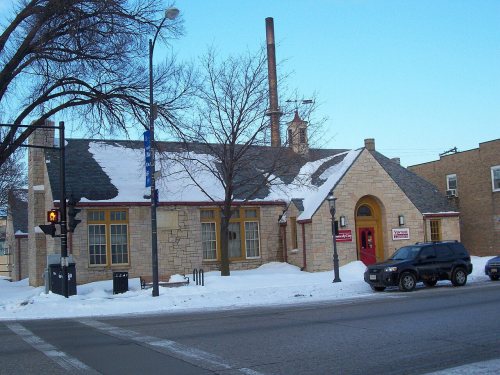
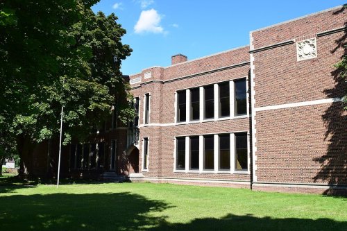
19 listings: 11 buildings and 8 historic districts with 282 contributing buildings. 298 historic buildings in all.
How old are the homes in De Pere?
10% of De Pere’s homes were built before 1940 (Census estimate, ±3.2 points), against a typical 12% for a Wisconsin town; the median home was built in 1985.
Founding dates: Wikidata, Wikipedia, the U.S. post office records of Blevins & Helbock (CC0) and the Census. Homes by year built: Census ACS 2020–24. National Register of Historic Places: National Park Service (list of May 22, 2026). Old photos, postcards and papers: Wikimedia Commons, the Library of Congress and other public archives, credited on each item’s page. Maps: U.S. Geological Survey historical topographic maps (via Esri) and Sanborn fire-insurance maps (Library of Congress). History text and census tables: Wikipedia (CC BY-SA 4.0). Places that used to be: USGS Geographic Names Information System (2021).
From Wikimedia Commons (30), the Library of Congress (7), Wikidata (15), the National Register of Historic Places (19), Wikipedia, Wikidata and Wikipedia for famous people, U.S. Geological Survey historical maps, U.S. Census counts (via Wikipedia), the US Post Offices dataset (Blevins & Helbock), the USGS Geographic Names Information System, Sanborn fire insurance maps (Library of Congress) and old county and town histories (Internet Archive). Archive images are copied here with their credits and licenses, shown on each photo’s page. Refreshed monthly.








 1898
 Date?
 Date?
 Date?
 Date?
 Date?
 2017
 2017
 2017
 2016
 2016
 2016
 2016
 2016
 2016
 2016
 2016
 2015
 2015
 2014
 2009
 2009
 2009
 2009
 2009
 2009
 2009
 2008
 2007
 2007
 2007
 2007
 2007
 2007
 2007
 2006


