On its age, its old homes and the National Register, Cottage Grove is more historic than 74% of U.S. towns, #107 of 362 in Wisconsin. All 2 inputs are above most U.S. towns; its National Register listings ranks highest and its share of homes from before 1940 lowest.
B+
HistoryA character grade: shown, never part of Cottage Grove’s overall grade.
Wisconsin towns list more on the Register than most of the country (a typical Wisconsin town has 3.0 per 10,000 residents, the U.S. 2.4), so Cottage Grove’s 16.1 sits above most of its state (80% of Wisconsin towns have fewer) while its 6 historic buildings outnumber those of 72% of U.S. towns.
How sure. Graded on two of the three inputs, so a change in either one moves the letter more than it would with three. The pre-1940 share is a Census survey estimate (±5.7 points).
Founding year: our sources. Homes: Census ACS 2020–24. National Register: National Park Service, May 2026 list; each listing counted once (boundary changes and added documentation belong to their listing), and a historic district counts its contributing buildings. How TownRatings grades history →
What stands out about Cottage Grove’s past
Read from the archive, the National Register and the record. The page puts what stands out first.
Every edition of the U.S. Geological Survey’s map of Cottage Grove. Tap a year, or press play to watch the town change.
1890Sun Prairie sheet · 1:62,500
U.S. Geological Survey historical topographic maps (public domain), via Esri’s collection of the scans. The red ring marks the center of Cottage Grove.
The story so far
Cottage Grove, in brief
Wikipedia doesn’t have a history of Cottage Grove yet. The photos, dates and memories neighbors add here are how it gets written.
Cottage Grove is a village in Dane County, Wisconsin, United States. Its population was 7,303 at the 2020 census. A suburb of Madison, it shares a school district with Monona. The village is located partially within the survey township of Cottage Grove. The village was named from a settler's cottage in a grove near the village site.
Between the 2010 and 2020 censuses its population fell from 3,875 to 3,791 (-2%).
Intro from Wikipedia. Population: U.S. Census Bureau.
From the old history books
What they wrote about Cottage Grove, 1874–1880
Passages that mention Cottage Grove, cut from the printed page as they were published.
History of Dane County, Wisconsin ... preceded by a history of Wisconsin, statistics of the state, and an abstract of its laws and constitution and of the Constitution of the United States1880 · page 915Read the page →
Read the text
When, in 1847, the town of Cottage Grove was created, it also included the territory now constituting the town of Deerfield. However, by an act of the State Legislature, approved March 17, 1849, Township 7 north, of Range 12 east, which was then the east half of Cottage Grove, was made a separate town, and named Deerfield.
Text read by machine from the scan; it may contain errors.
A history of Madison, the capital of Wisconsin1874 · page 397Read the page →
Read the text
The village of Cottage Grove is a small settlement located in section 7. Door Creek post office is on section 33. The town was first settled in 1837 by Amos Harris, who located on section 9. Amos Beecher, William Wells and H. Cattine, on section 7. The town received its name from a burr-oak grove in the midst of which a public house was built, and where the post office was kept. The town was organized April 6, 1847. Henry L. Bush was elected Chair¬ man, and F. A. Mitchell Town Clerk. There seems to have been no
Text read by machine from the scan; it may contain errors.
History of Dane County, Wisconsin ... preceded by a history of Wisconsin, statistics of the state, and an abstract of its laws and constitution and of the Constitution of the United States1880 · page 1125Read the page →
Read the text
TH01IA8 A. McCRYSTAL, farmer Sec. 10 ; P. 0. Cottage Grove; born March 17, 1848, in the city of Milwaukee ; his father, Ambrose McCrystal, came to Dane Co., and settled in Cottage Grove in 1850 ; remained a couple of years, then went to Madison and lived there eight years ; then back to Cottage Grove and died there in 1858 or 1859. Thomas A. enlisted in February, 1865, in the 50th jW. V. I., Co. I, and was in the service till June, 1866, being at Ft. Rice, Dakota, after the war closed; after returning from the army, he attended the University at Madison two and a half years, except when teaching during the winter ; in the fall. of 1869, went to Colorado, where he spent nearly two years; was Engrossing Clerk in the Legislature the first winter he was there, and afterward taught school two terms ;
Text read by machine from the scan; it may contain errors.
Scans and text from the Internet Archive. Books published in 1930 or earlier, which are in the public domain.
Timeline
Cottage Grove, 1847 to 1985
Woven from the archive, old maps, post office records, the National Register and the people born here.
Cottage Grove is more historic than 74% of U.S. towns, #107 of 362 in Wisconsin. The History grade combines the town’s founding era, the share of homes built before 1940 and its National Register listings. It’s a character grade, so it isn’t part of the overall grade. How it works.
What is on the National Register in Cottage Grove?
One place: the Hammond Farmstead (listed 2023).
How old are the homes in Cottage Grove?
12% of Cottage Grove’s homes were built before 1940 (Census estimate, ±5.7 points), against a typical 12% for a Wisconsin town; the median home was built in 1979.
Founding dates: Wikidata, Wikipedia, the U.S. post office records of Blevins & Helbock (CC0) and the Census. Homes by year built: Census ACS 2020–24. National Register of Historic Places: National Park Service (list of May 22, 2026). Old photos, postcards and papers: Wikimedia Commons, the Library of Congress and other public archives, credited on each item’s page. Maps: U.S. Geological Survey historical topographic maps (via Esri) and Sanborn fire-insurance maps (Library of Congress). History text and census tables: Wikipedia (CC BY-SA 4.0). Places that used to be: USGS Geographic Names Information System (2021).
From Wikimedia Commons (6), the National Register of Historic Places (1), Wikidata and Wikipedia for famous people, U.S. Geological Survey historical maps, U.S. Census counts (via Wikipedia), the US Post Offices dataset (Blevins & Helbock), the USGS Geographic Names Information System and old county and town histories (Internet Archive). Archive images are copied here with their credits and licenses, shown on each photo’s page. Refreshed monthly.


 2013
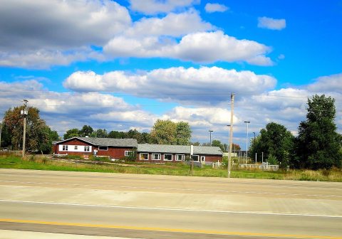 2013
 2013
 2013
 2013
 2004