Walla Walla dates to 1856, and 26% of its homes were built before 1940
More historic than 81% of U.S. towns · #11 of 285 in Washington. What drives it
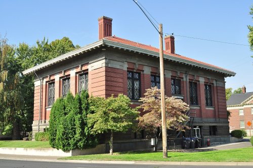
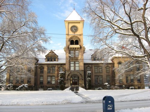
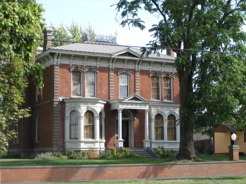
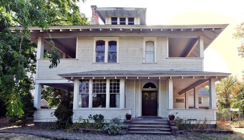
24 places in town are on the National Register, among them two historic districts with 82 buildings between them. Below: 14 old photos and papers, maps from 1884 on, and the census since 1870.
Founding year: Wikidata; Wikipedia’s history section gives the same year. First post office: 1862.The full story ↓
History grade
What drives Walla Walla’s History grade
On its age, its old homes and the National Register, Walla Walla is more historic than 81% of U.S. towns, #11 of 285 in Washington. Its National Register listings hold the grade up; its age pulls it down.
A−
HistoryA character grade: shown, never part of Walla Walla’s overall grade.
Few Washington towns list much on the Register (a typical Washington town has 0.1 per 10,000 residents, the U.S. 2.4), so Walla Walla’s 31.2 sits above most of its state (93% of Washington towns have fewer) while its 106 historic buildings outnumber those of 90% of U.S. towns.
How sure. Graded on any two of the three inputs instead, the letter would range from B to A. The pre-1940 share is a Census survey estimate (±3.3 points). Two sources give 1856.
Founding year: Wikidata (other dates in Quick answers). Homes: Census ACS 2020–24. National Register: National Park Service, May 2026 list; each listing counted once (boundary changes and added documentation belong to their listing), and a historic district counts its contributing buildings. How TownRatings grades history →
What stands out about Walla Walla’s past
Read from the archive, the National Register and the record. The page puts what stands out first.
National Park Service, National Register of Historic Places. Photos from Wikimedia Commons, credited on each place’s page.
Every building
Walla Walla, building by building, 1884–1905
Fire insurance maps drew every building, what it was made of and what it was used for, so insurers could price the risk of fire. Pick a year, then a sheet.
Walla Walla's history starts in 1806 when the Lewis and Clark Expedition encountered the Walawalałáma (Walla Walla people) near the mouth of Walla Walla River. Other inhabitants of the valley included the Liksiyu (Cayuse), Imatalamłáma (Umatilla), and Niimíipu (Nez Perce) indigenous peoples. In 1818, Fort Walla Walla (originally Fort Nez Percés), a fur trading outpost run by Hudson's Bay Company (HBC), was established and operated as an important stopping point in Oregon Country. Abandoned in 1855, it is now underwater behind the McNary Dam.
Passages that mention Walla Walla, cut from the printed page as they were published.
An illustrated history of southeastern Washington, including Walla Walla, Columbia, Garfield and Asotin counties, Washington1906 · page 132Read the page →
Read the text
During the 1883 session of the Legislative Assembly the city of Walla Walla was reincorporated, the bill being approved by the governor November 28th, and bearing title, "An act to incorporate the city of Walla Walla, and to particularly define the powers thereof." As this charter was the only one of the kind then in the territory, it is of peculiar interest. The
Text read by machine from the scan; it may contain errors.
An illustrated history of southeastern Washington, including Walla Walla, Columbia, Garfield and Asotin counties, Washington1906 · page 91Read the page →
Read the text
January 28, 1862, the Legislative Assembly passed an act declaring Walla Walla City to be the county seat of Walla Walla county. On the same date the assembly passed another act legalizing the acts of the county commissioners of Walla Walla county, thus avoiding possibility of the illegality of the acts because of the fact that the sessions had been
Text read by machine from the scan; it may contain errors.
Historic sketches of Walla Walla, Whitman, Columbia and Garfield counties, Washington Territory, and Umatilla County, Oregon1882 · page 401Read the page →
Read the text
Until 1875 Dayton was simply a town of Walla Walla county, a place of secondary importance to the county seat. This was a condition of affairs the people here determined to remedy, by becoming the county seat and chief town of a county of their own, and the steps by which this was accomplished have been detailed in the history of the county. This object was attained in November, 1875, though the thriving town of Dayton, as yet was but four years old. With this came increased prosperity. Public attention was drawn still more in this direction. Cheap buildings on Main street were succeeded by better ones, some of them of brick, while fine residences
Text read by machine from the scan; it may contain errors.
Scans and text from the Internet Archive. Books published in 1930 or earlier, which are in the public domain.
Timeline
Walla Walla, 1856 to 1969
Woven from the archive, old maps, post office records, the National Register and the people born here.
Nothing in the archives for these yearsWeddings on Main Street, storms, parades, school pictures, the old store. If it’s in your family album, it belongs here.
In 1856, according to Wikidata and Wikipedia’s history of the town. Walla Walla’s post office opened in 1862, and the census of 1870 counted 1,394 people here.
How does Walla Walla rank for history?
Walla Walla is more historic than 81% of U.S. towns, #11 of 285 in Washington. The History grade combines the town’s founding era, the share of homes built before 1940 and its National Register listings. It’s a character grade, so it isn’t part of the overall grade. How it works.
What is on the National Register in Walla Walla?
24 listings: 22 buildings and 2 historic districts, the Fort Walla Walla Historic District and the Walla Walla Downtown Historic District, with 82 contributing buildings. 106 historic buildings in all.
How old are the homes in Walla Walla?
26% of Walla Walla’s homes were built before 1940 (Census estimate, ±3.3 points), against a typical 4.3% for a Washington town; the median home was built in 1967.
Founding dates: Wikidata, Wikipedia, the U.S. post office records of Blevins & Helbock (CC0) and the Census. Homes by year built: Census ACS 2020–24. National Register of Historic Places: National Park Service (list of May 22, 2026). Old photos, postcards and papers: Wikimedia Commons, the Library of Congress and other public archives, credited on each item’s page. Maps: U.S. Geological Survey historical topographic maps (via Esri) and Sanborn fire-insurance maps (Library of Congress). History text and census tables: Wikipedia (CC BY-SA 4.0). Places that used to be: USGS Geographic Names Information System (2021).
From Wikimedia Commons (14), Wikidata (4), the National Register of Historic Places (24), Wikipedia, Wikidata and Wikipedia for famous people, U.S. Geological Survey historical maps, U.S. Census counts (via Wikipedia), the US Post Offices dataset (Blevins & Helbock), the USGS Geographic Names Information System, Sanborn fire insurance maps (Library of Congress) and old county and town histories (Internet Archive). Archive images are copied here with their credits and licenses, shown on each photo’s page. Refreshed monthly.








 1863
 1863
 c. 1870
 1876
 1876
 1877
 1883
 1884
 c. 1885
 c. 1888


