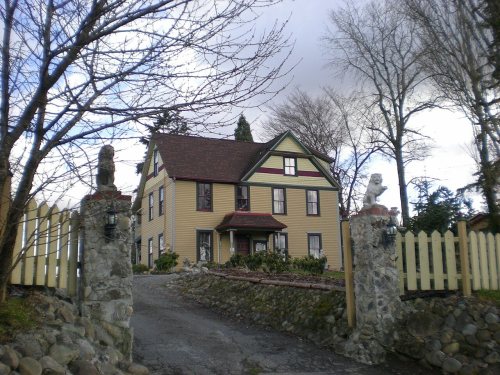
135 years in pictures
Census counts: 21,012 in 1970, 38,623 in 2020. The archive holds 11 old photos and papers going back to 1905 and 5 maps from 1941 on.
4 places on the National Register of Historic Places.
- 1891Parkland is settled

Each edition grades its towns against each other only.

Parkland is a solid, middle-of-the-road choice. It grades C− overall, ranked 216th of 285 in Washington, with no subject far below average. Its best mark is incomes: the median household earns $72K. Expect to pay for it: the typical home is worth about $459K, 4 years of the Seattle metro’s $115K median household income. Parkland is more walkable than 92% of U.S. towns. Parkland is home to Pacific Lutheran University. 52% of households own their home in Parkland, below both the Washington town median (71%) and the median of U.S. towns (73%).
Where Parkland beats most towns.
| College | Students |
|---|---|
| Pacific Lutheran University | 2,685 |
Old MainEach subject compared with towns across the country (schools within Washington), ordered by how far Parkland is from typical.
How TownRatings grades towns →
Census counts: 21,012 in 1970, 38,623 in 2020. The archive holds 11 old photos and papers going back to 1905 and 5 maps from 1941 on.
4 places on the National Register of Historic Places.
Museums, parks, gardens and other places to visit around Parkland. Close and well known come first.
Big draw33 mi LookoutSpace Needle
Big draw32 mi Stadium & arenaLumen Field
Big draw33 mi Stadium & arenaClimate Pledge Arena
7 mi Stadium & arenaTacoma Dome
32 mi Stadium & arenaT-Mobile Park
11 mi Theme parkWild Waves Theme ParkSpace Needle: Another Believer, CC BY-SA 4.0 · Lumen Field: "Smart Destinations", GoSeattleCard.com, and Go Seattle Card Blog, CC BY-SA 2.0 · Climate Pledge Arena: Sea Cow, CC BY-SA 4.0 · Tacoma Dome: Broran28, Public domain · T-Mobile Park: MyName (Cacophony), CC BY-SA 3.0 · Wild Waves Theme Park: Jessica Spengler from Hove, United Kingdom, CC BY 2.0
Parkland is unincorporated, so Pierce County and regional agencies provide most services.
EPA SDWIS (Oct 9, 2026) · HIFLD + EIA-861 2025 · Census 2020 ZCTAs · NCES 2024–25 · registration: vote.gov, updated Sep 30, 2026.
Ordered by what stands out in Parkland.
Parkland has fewer 90° days than nearly all U.S. towns, but it has many renters stretched by housing costs.
Most working residents leave Parkland for work: only 4% work in town. The average trip to work in Parkland is 31 minutes. Since 2013, Parkland has added 1,002 jobs, to 6,970 in 2023.
| Parkland | Washington towns | U.S. towns | |
|---|---|---|---|
| Work from home | 7.2% | 15% | 11% |
| Average trip to work | 31 minutes | 27 minutes | 25 minutes |
| Below the poverty line | 13% | 7.9% | 9.6% |
| Median household income | $72,000 | $98,000 | $80,000 |
Census LEHD 2023 · ACS
Its public schools are run by the Franklin Pierce School District. Two of its 9 schools are below, each with why it’s listed.
| School | Level | Students | Letter |
|---|---|---|---|
| Perry G Keithley Middle SchoolLargest public middle schoolGrades 6–8 | Grades 6–8 | 804 | – |
| Washington High SchoolLargest public high schoolGrades 9–12 | Grades 9–12 | 989 | – |
NCES · EDFacts · graded within WA on state tests and graduation
Expected storm and flood damage is higher than in 74% of U.S. communities. Since 1991, 30 flood insurance claims have been paid out in Parkland.
FEMA flood insurance claims · FEMA National Risk Index · OpenFEMA
5.5 miles of trail in 5 parks and preserves. The biggest place to walk is Bresemann Forest, 60 acres with 2.3 miles of trail.
| Parkland | Washington towns | U.S. towns | |
|---|---|---|---|
| Miles of trail per square mile | 0.6 miles per square mile | 0.8 | 0.4 |
| Conserved land | 5.3% | 4% | 4.3% |
| Biggest places to walk | Trails | Acres |
|---|---|---|
| 1. Bresemann Forest | 2.3 mi | 60 |
| 2. Parkland Prairie Nature Reserve | 0.4 mi | 4 |
| 3. Gonyea Playfield | 0.1 mi | 12 |
Trails & parks © OpenStreetMap contributors · Conserved land: USGS PAD-US
62.4% of renter households pay 30% or more of their income for housing, against 49.9% across Washington.
The typical Parkland home is worth about $459,000, about the same as a year ago, 22% below the Washington typical home. Parkland’s median rent is $1,663 a month.
Census ACS, 2020–24 · Zillow Home Value Index · Redfin Data Center
The Mcmillin Rsvr weather station, 9 miles away, records that about 3 days a year reach 90°, fewer than in 98% of U.S. towns. July afternoons average 77°, cooler than in 97% of U.S. towns; January nights average 35.5°.
Parkland has mild winters and pleasant summers. About 6 inches of snow falls in a winter.
| Parkland | Washington towns | U.S. towns | |
|---|---|---|---|
| July high | 77°F | 77°F | 85°F |
| January low | 36°F | 35°F | 22°F |
NOAA U.S. Climate Normals, 1991–2020
41% of adults sleep under 7 hours in Parkland.
| Parkland | Washington towns | U.S. towns | |
|---|---|---|---|
| Yearly checkup (CDC PLACES) | 69% | 71% | 79% |
| Frequent mental distress (CDC PLACES) | 21% | 17% | 17% |
| Sleep under 7 hours (CDC PLACES) | 41% | 33% | 36% |
| Obesity (CDC PLACES) | 39% | 33% | 35% |
| What stands out | Parkland | WA |
|---|---|---|
| Fewer adults who have had cancer | 6.2% | 7.9% |
| More adults facing food insecurity | 17.7% | 10.2% |
CDC PLACES 2025 · modeled estimates for adults · CMS · HRSA
9 within 15 miles of the center of Parkland
About 6 of every 100 Parkland residents are enrolled in college, about the same as Washington.
Where Parkland’s working residents go each day. Line width shows the share.
Census LEHD 2023
4 places in Parkland on the National Register of Historic Places.
Census-designated place in Washington, United States
Parkland is a census-designated place (CDP) in Pierce County, Washington. The population was 35,803 at the time of the 2010 census and had grown to 38,623 as of the 2020 census. It is an unincorporated suburb of the city of Tacoma and is home to Pacific Lutheran University. Parkland borders most of Tacoma's southern cutoff at 96th St, and borders with much of the northern cutoff of Spanaway, Washington, at 152nd St (or Military Rd E). The most influential motorway is State Route 7/Pacific Ave, which travels north and south, and leads from Interstate 5 in Tacoma all the way to Mount Rainier. Pacific Ave is also a main commercial corridor through much of the county, including Parkland. It was…
From Wikipedia, licensed CC BY-SA 4.0 · facts via Wikidata (CC0)
7 towns share a border with Parkland.
| Town | WA rank | Overall | Cost | Safety | Schools | Health |
|---|---|---|---|---|---|---|
| Parkland | #216 | C− | C | — | C+ | C+ |
| McChord AFB | #218 | C− | D− | — | C+ | A− |
| Clover Creek | #241 | C− | C− | — | C | C+ |
| Tacoma | #234 | C− | C− | D− | C+ | B |
| Lakewood | #262 | D | C | D | C | C+ |
| Spanaway | #180 | C | C | — | C+ | C+ |
| Midland | #187 | C | C+ | — | C | C+ |
| Frederickson | #178 | C | C− | — | C+ | B |
Parkland, McChord AFB, Clover Creek, Spanaway, Midland and Frederickson report no FBI crime data of their own. Compare Parkland with a neighbor →
Short answers, built from the data on this page.
Parkland grades C− overall, better than 23% of U.S. towns and #216 of 285 in Washington. It grades C+ for health and C+ for schools. Hazard risk is its weak spot, with a C−.
Cost of living, which also weighs rents, property taxes and how many households pay 30% or more of their income for housing, grades C.