
LewisvilleWA
Home to 2,465 people, the town was settled in 1882.
Is Lewisville a good place to live?
Lewisville’s best subject grades are an A− for incomes and an A for the outdoors; its weakest is a C for cost of living. 97% of households are owner-occupiers in Lewisville, above both the Washington town median (71%) and the median of U.S. towns (73%). Lewisville’s trail density is 1.6 miles per square mile, against 0.8 in Washington’s towns and 0.4 across U.S. towns. Battle Ground Lake State Park, at 276 acres with 7.3 miles of trail, is the biggest park or preserve. Lewisville has fewer than 2,500 residents, so it gets subject grades but no overall grade.
How Lewisville grades
Each subject compared with towns across the country (schools within Washington), ordered by how far Lewisville is from typical.
How TownRatings grades towns →
99% of working residents leave Lewisville for work
Where Lewisville’s working residents go each day. Line width shows the share.
Census LEHD 2023
The data
Ordered by what stands out in Lewisville.
Most of Lewisville’s workers commute out: the town has 0.1 jobs for each of them
Commuting out is the norm in Lewisville: 1% of working residents work locally. The town’s median household income stands at $126,000. It had 79 jobs in 2023, up 23 from 2013. 3.3% of Lewisville residents live below the poverty line.
| Lewisville | Washington towns | U.S. towns | |
|---|---|---|---|
| Median household income | $126,000 | $98,000 | $80,000 |
| Below the poverty line | 3.3% | 7.9% | 9.6% |
| Working residents who work in town | 1% | 4.9% | 8% |
| Average trip to work | 27 minutes | 27 minutes | 25 minutes |
Where working residents work
Census LEHD 2023 · ACS
Lewisville is healthier than three in four U.S. towns
Among adults in Lewisville, 28% sleep under 7 hours. Of 31 CDC measures, Lewisville beats the Washington average on 11 and trails it on 7. 72% of adults in the town had a checkup this year; 27% have been diagnosed with depression.
| Lewisville | Washington towns | U.S. towns | |
|---|---|---|---|
| Sleep under 7 hours (CDC PLACES) | 28% | 33% | 36% |
| Yearly checkup (CDC PLACES) | 72% | 71% | 79% |
| Depression (CDC PLACES) | 27% | 26% | 23% |
| Food insecurity (CDC PLACES) | 7.7% | 10% | 14% |
| What stands out | Lewisville | WA |
|---|---|---|
| Fewer uninsured adults | 6% | 8.4% |
| Fewer adults facing food insecurity | 7.7% | 10.2% |
| More adults who have had cancer | 10.9% | 7.9% |
CDC PLACES 2025 · modeled estimates for adults · CMS · HRSA
Mild winters and pleasant summers in Lewisville
A winter brings about 3 inches of snow, with January nights at 35° and July afternoons at 80°.
Typical low → high °F
NOAA U.S. Climate Normals, 1991–2020
Lewisville has set aside 11.2% of its land for conservation
8.7 miles of trail in 3 parks and preserves.
| Biggest places to walk | Trails | Acres |
|---|---|---|
| 1. Battle Ground Lake State Park | 7.3 mi | 276 |
| 2. Lewisville Park | 1.2 mi | 231 |
| 3. Yacolt Burn State Forest | — | 34 |
Trails & parks © OpenStreetMap contributors · Conserved land: USGS PAD-US
Natural hazards: high risk in Lewisville, mostly inland flooding
Expected losses in Lewisville break down as 73% from inland flooding and 11% from cold waves. FEMA expects more storm and flood damage locally than in 62% of U.S. communities. Paid flood insurance claims in the town since 1996: 2.
FEMA flood insurance claims · FEMA National Risk Index · OpenFEMA
A home in Lewisville sells for about $1.31M at the median
Zillow Home Value Index · Redfin Data Center
Everything we know about Lewisville
Mount St. Helens and 161 more within 40 miles
Museums, parks, gardens and other places to visit around Lewisville. Close and well known come first.
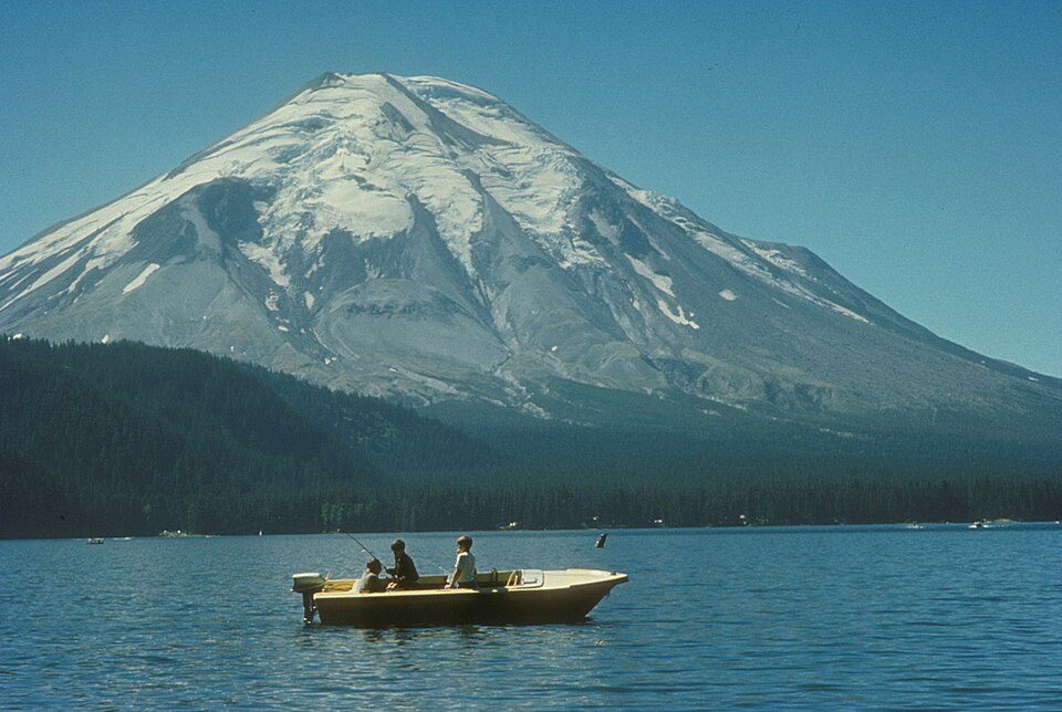 Big draw31 mi MountainMount St. Helens
 25 mi WaterfallMultnomah Falls
 21 mi Stadium & arenaModa Center
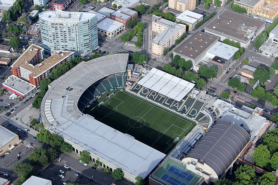 22 mi Stadium & arenaProvidence Park
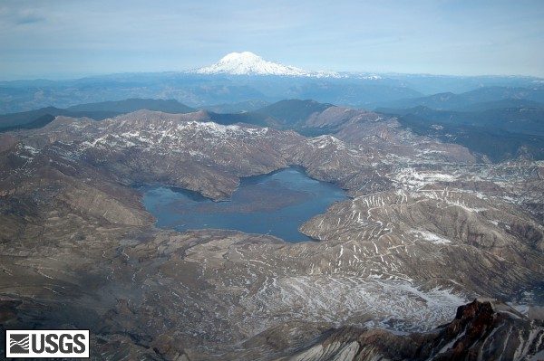 36 mi LakeSpirit Lake
 35 mi Canyon & gorgeColumbia River Gorge
Photo credits
Mount St. Helens: U.S. Forest Service- Pacific Northwest Region, Public domain · Multnomah Falls: John Fowler from Placitas, NM, USA, CC BY 2.0 · Moda Center: Lugnuts, CC BY-SA 3.0 · Providence Park: Pdx.rollingthunder, CC BY-SA 4.0 · Spirit Lake: Matt Logan, Public domain · Columbia River Gorge: Hux, Public domain


Moving to Lewisville: who provides what
Lewisville is unincorporated, so Clark County and regional agencies provide most services.
EPA SDWIS (Oct 9, 2026) · HIFLD + EIA-861 2025 · Census 2020 ZCTAs · NCES 2024–25 · registration: vote.gov, updated Sep 30, 2026.
Colleges nearby
1 within 15 miles of the center of Lewisville
About 1 of every 100 Lewisville residents are enrolled in college, against 6 across Washington.
About Lewisville
Census-designated place in Washington, United States
Lewisville is a census-designated place (CDP) in Clark County, Washington, United States. The population was 1,860 at the 2020 census.
From Wikipedia, licensed CC BY-SA 4.0 · facts via Wikidata (CC0)
- Area
- 5.6 sq mi
- Elevation
- 413 ft
- Area code
- 360
Lewisville’s neighbors
3 towns share a border with Lewisville.
| Town | WA rank | Overall | Cost | Safety | Schools | Health |
|---|---|---|---|---|---|---|
| Lewisville | — | — | C | — | B− | B+ |
| Battle Ground | #99 | B | C− | B | B− | B |
| Venersborg | #192 | C | C− | — | B− | A− |
| Cherry Grove | — | — | — | — | — | — |
Lewisville has fewer than 2,500 residents, so it gets subject grades but no overall grade. Lewisville and Venersborg report no FBI crime data of their own. Cherry Grove isn’t graded (fewer than 1,000 residents, or not enough data). Compare Lewisville with a neighbor →
Questions about Lewisville
Short answers, built from the data on this page.
Is Lewisville, WA expensive?
The typical home is worth about $663,000, 13% above the Washington typical home. Cost of living, which also weighs rents, property taxes and how many households pay 30% or more of their income for housing, grades C.
Say something about Lewisville.
Ask a question, answer one, post a photo or an event. Free, and the parts only a neighbor would know are the parts worth reading.