The British explorer and navigator George Vancouver camped on Ketron Island in May of 1792.
The island's name in the Lushootseed language is saʔilc, meaning "bad rock". The island was originally named "Kittson Island" in English by Charles Wilkes during the Wilkes Expedition of 1838–1842, but was misspelled "Ketron" by his cartographers. The island was named for William Kittson, an employee of the Hudson's Bay Company, who supervised the construction of Fort Nisqually in 1833 and served as its chief factor.
The entire island was bought by an entrepreneur in 1946 with plans to build 200 homes, but this attempt was abandoned due to the cost of a sewer system.
Every edition of the U.S. Geological Survey’s map of Ketron Island. Tap a year, or press play to watch the town change.
1948Anderson Island sheet · 1:24,000
U.S. Geological Survey historical topographic maps (public domain), via Esri’s collection of the scans. The red ring marks the center of Ketron Island.
Famous people
Famous people close to Ketron Island
Nobody well known was born in Ketron Island itself, so here are the best known from just nearby.
Founding dates: Wikidata, Wikipedia, the U.S. post office records of Blevins & Helbock (CC0) and the Census. Homes by year built: Census ACS 2020–24. National Register of Historic Places: National Park Service (list of May 22, 2026). Old photos, postcards and papers: Wikimedia Commons, the Library of Congress and other public archives, credited on each item’s page. Maps: U.S. Geological Survey historical topographic maps (via Esri) and Sanborn fire-insurance maps (Library of Congress). History text and census tables: Wikipedia (CC BY-SA 4.0). Places that used to be: USGS Geographic Names Information System (2021). How TownRatings grades history →
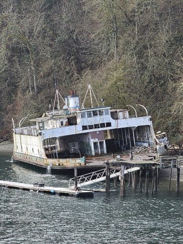
From Wikimedia Commons (4), Wikipedia and U.S. Geological Survey historical maps. Archive images are copied here with their credits and licenses, shown on each photo’s page. Refreshed monthly.

 2024
 2024
 2024
 2008


