142 years in pictures
Census counts: 853 in 1890, 136,588 in 2020. The archive holds 5 maps from 1949 on.
1 place on the National Register of Historic Places.
- 1884Kent is settled

Each edition grades its towns against each other only.

A city of 134,871, settled in 1884.
Kent is a city of 134,871, and it grades C− overall, 221st among Washington's 285 graded towns. It is healthier than 83% of U.S. towns and it is more walkable than 93% of U.S. towns. The trade-offs: its police reported 362 violent crimes reported to the FBI in 2025, a higher rate per resident than 92% of U.S. towns, and FEMA rates its natural-hazard risk higher than 82% of U.S. communities, with earthquakes at the top. On civic life, just 18 of Washington’s 198 towns do worse. Kent’s median rent is $1,909 a month, above both Washington’s towns ($1,737 a month) and U.S. towns ($1,185 a month). Erick Gustave Sanders Mansion is on the National Register of Historic Places.
Where Kent beats most towns, and one thing worth knowing.
92,411 counted in 2010 and 136,588 in 2020; an estimated 134,871 in 2025.
Growth has leveled off: within 1% of 2020, after 47.8% in the decade before.
U.S. Census 2010 & 2020 counts · Census Bureau estimate, July 1, 2025
Each subject compared with towns across the country (schools within Washington), ordered by how far Kent is from typical.
How TownRatings grades towns →
Census counts: 853 in 1890, 136,588 in 2020. The archive holds 5 maps from 1949 on.
1 place on the National Register of Historic Places.
Museums, parks, gardens and other places to visit around Kent. Close and well known come first.
Big draw17 mi LookoutSpace Needle
Big draw15 mi Stadium & arenaLumen Field
Big draw17 mi Stadium & arenaClimate Pledge Arena
15 mi Stadium & arenaT-Mobile Park
16 mi Ancient siteSeattle Underground
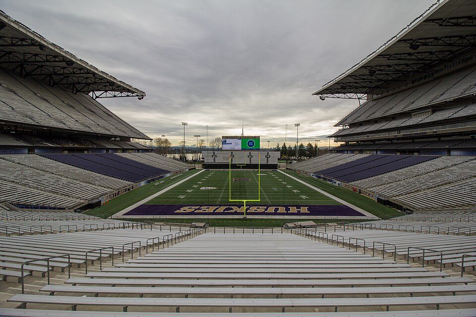
18 mi Stadium & arenaHusky StadiumSpace Needle: Another Believer, CC BY-SA 4.0 · Lumen Field: "Smart Destinations", GoSeattleCard.com, and Go Seattle Card Blog, CC BY-SA 2.0 · Climate Pledge Arena: Sea Cow, CC BY-SA 4.0 · T-Mobile Park: MyName (Cacophony), CC BY-SA 3.0 · Seattle Underground: Mark Hursh, CC BY-SA 3.0 · Husky Stadium: Atomic Taco, CC BY-SA 2.0
Who provides power, water and the rest in Kent, and how to reach them.
EPA SDWIS (Oct 9, 2026) · HIFLD + EIA-861 2025 · Census 2020 ZCTAs · NCES 2024–25 · registration: vote.gov, updated Sep 30, 2026.
Ordered by what stands out in Kent.
Kent has cooler summers than nearly all U.S. towns and has seen reported crime fall by about half.
Reported crimes fell from 7,528 to 3,224 over the last three FBI years, a drop beyond ordinary year-to-year swings.
Kent’s property crime rate is 21 per 1,000 residents. Kent reports more crime per resident than most U.S. towns we grade: about 92% report less. Kent’s violent crime rate is 2.7 per 1,000 residents.
| Kent | Washington towns | U.S. towns | |
|---|---|---|---|
| Property crimes per 1,000 (2025) | 21 per 1,000 residents | 15 | 9.9 |
| Violent crimes per 1,000 (2025) | 2.7 per 1,000 residents | 1.5 | 1.6 |
FBI crime data, 2025 · crimes reported to police
Its public schools are run by the Kent School District. Two of its 38 schools are below, each with why it’s listed.
| School | Level | Students | Letter |
|---|---|---|---|
| Mill Creek Middle SchoolLargest public middle schoolGrades 6–8 | Grades 6–8 | 866 | – |
| Kentridge High SchoolLargest public high schoolGrades 9–12 | Grades 9–12 | 2,186 | – |
NCES · EDFacts · graded within WA on state tests and graduation
39 miles of trail in 63 parks and preserves. The trail density in Kent is 1.2 miles per square mile. The biggest place to walk is Green River Natural Resources Area, 294 acres with 2.9 miles of trail.
| Kent | Washington towns | U.S. towns | |
|---|---|---|---|
| Miles of trail per square mile | 1.2 miles per square mile | 0.8 | 0.4 |
| Conserved land | 6.9% | 4% | 4.3% |
| Biggest places to walk | Trails | Acres |
|---|---|---|
| 1. Clark Lake Park | 4.7 mi | 156 |
| 2. Green River Natural Resources Area | 2.9 mi | 294 |
| 3. Lake Fenwick Park | 2.1 mi | 97 |
Trails & parks © OpenStreetMap contributors · Conserved land: USGS PAD-US
26% of Kent adults have obesity. Kent beats the Washington average on 4 of 31 CDC measures and trails it on 10. 69% of Kent adults had a checkup this year.
| Kent | Washington towns | U.S. towns | |
|---|---|---|---|
| Obesity (CDC PLACES) | 26% | 33% | 35% |
| Yearly checkup (CDC PLACES) | 69% | 71% | 79% |
| High blood pressure (CDC PLACES) | 29% | 31% | 35% |
| Smoke cigarettes (CDC PLACES) | 10% | 11% | 14% |
| What stands out | Kent | WA |
|---|---|---|
| Fewer adults who have had cancer | 5.9% | 7.9% |
| Fewer adults with obesity | 25.7% | 30.6% |
| More adults facing food insecurity | 14.9% | 10.2% |
CDC PLACES 2025 · modeled estimates for adults · CMS · HRSA
Since 1986, 24 flood insurance claims have been paid out in Kent.
FEMA flood insurance claims · FEMA National Risk Index · OpenFEMA
July afternoons average 77°, cooler than in 97% of U.S. towns; January nights average 35.7°.
Kent has mild winters and pleasant summers. About 6 inches of snow falls in a winter.
| Kent | Washington towns | U.S. towns | |
|---|---|---|---|
| July high | 77°F | 77°F | 85°F |
| January low | 36°F | 35°F | 22°F |
NOAA U.S. Climate Normals, 1991–2020
Most working residents leave Kent for work: only 15% work in town. Jobs based in Kent grew to 74,415 in 2023, 15,088 more than in 2013. The top destinations are Seattle (22%), Renton (8%) and Bellevue (5%).
| Kent | Washington towns | U.S. towns | |
|---|---|---|---|
| Average trip to work | 30 minutes | 27 minutes | 25 minutes |
| Working residents who work in town | 15% | 4.8% | 8% |
| Below the poverty line | 11% | 7.9% | 9.6% |
| Median household income | $92,000 | $98,000 | $80,000 |
Census LEHD 2023 · ACS
People 65 and older are 12% of residents (17% statewide). 30% of adults 25 and older have a bachelor’s degree or more, vs 40% across Washington.
| Kent | Washington towns | U.S. towns | |
|---|---|---|---|
| Aged 65 or older | 12% | 16% | 18% |
| Median age | 35.5 years | 38.6 years | 40.5 years |
| Under 18 | 24% | 22% | 22% |
49.0% women, 51.0% men
About 104 men for every 100 women. Across Washington, 49.6% of residents are women. Median age: women 36.6, men 34.6.
| Kent | WA | U.S. | |
|---|---|---|---|
| Under 10 | 13.6% | 11.5% | 11.6% |
| 10 to 17 | 10.1% | 9.9% | 10.3% |
| 18 to 24 | 9% | 8.5% | 9.1% |
| 25 to 34 | 16.5% | 15.2% | 13.7% |
| 35 to 44 | 14% | 14.3% | 13.2% |
| 45 to 54 | 12.7% | 12% | 12.2% |
| 55 to 64 | 12.2% | 12% | 12.7% |
| 65 to 74 | 7.6% | 10.1% | 10.2% |
| 75 and older | 4.3% | 6.5% | 7% |
| No diploma | 13.2% | 7.7% | 10.4% |
| High school | 24.5% | 21.6% | 26% |
| Some college | 21.4% | 21% | 19.1% |
| Associate’s | 11.2% | 10% | 8.8% |
| Bachelor’s | 21.5% | 24% | 21.6% |
| Graduate | 8.3% | 15.6% | 14.1% |
U.S. Census Bureau · ACS 2020-2024 5-year estimates
The typical Kent home is worth about $631,000, down 1.2% in a year, 7% above the Washington typical home. 57% of households own their home in Kent.
| Kent | Washington towns | U.S. towns | |
|---|---|---|---|
| Households that own their home | 57% | 71% | 73% |
| Renters paying 30%+ of income on rent | 55% | 51% | 48% |
Census ACS, 2020–24 · Zillow Home Value Index · Redfin Data Center
9 within 15 miles of the center of Kent
About 6 of every 100 Kent residents are enrolled in college, about the same as Washington.
22 notable people were born in Kent.


City in Washington, United States
Kent is a city in King County, Washington, United States. It is part of the Seattle metropolitan area and had a population of 136,588 as of the 2020 census. The population was estimated at 134,871 in 2025, making it the fourth-most populous municipality in greater Seattle and the sixth-most populous in Washington. The city is connected to Seattle, Bellevue, and Tacoma via State Route 167 in addition to Interstate 5, Sounder commuter rail, and commuter buses. Incorporated in 1890, Kent is the second-oldest incorporated city in the county, after the county seat of Seattle. It is generally divided into three areas: West Hill (mixed residential and commercial along Interstate 5), Valley (primar…
From Wikipedia, licensed CC BY-SA 4.0 · facts via Wikidata (CC0)
8 towns share a border with Kent.
| Town | WA rank | Overall | Cost | Safety | Schools | Health |
|---|---|---|---|---|---|---|
| Kent | #221 | C− | D | D | B− | A− |
| Tukwila | #236 | C− | C− | D− | C+ | A− |
| Des Moines | #235 | C− | D | C− | C− | A− |
| SeaTac | #245 | D | C− | D | C− | A− |
| Covington | #170 | C+ | D | C− | B− | A |
| Auburn | #214 | C− | D | D | B− | A− |
| Renton | #193 | C | D | D | C+ | A |
| Lake Morton-Berrydale | #137 | B− | D | — | B− | A |
Lake Morton-Berrydale reports no FBI crime data of its own. Compare Kent with a neighbor →
Short answers, built from the data on this page.
Kent grades C− overall, better than 22% of U.S. towns and #221 of 285 in Washington. It grades A− for health, D for safety and B− for schools. Safety is its weak spot, with a D.
Yes. That is 5.5 years of the area's median household income ($115,177 across the Seattle-Tacoma-Bellevue, WA metro area). Cost of living, which also weighs rents, property taxes and how many households pay 30% or more of their income for housing, grades D.
22 notable people were born here, including PZ Myers and Courtney Vandersloot.