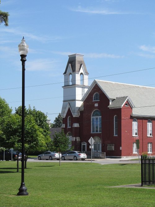
222 years in pictures
The archive holds 12 old photos and papers going back to 1930 and 2 maps from 1914 on.
6 places on the National Register of Historic Places.
- 1804Swanton is settled
Each edition grades its towns against each other only.

Swanton is a solid, middle-of-the-road choice. It grades B− overall, 37th of 71 graded towns in Vermont, with no subject far below average. Its best mark is schools: its schools outperform 67% of the state's. Its lowest everyday mark is in cost of living: the typical home is worth about $285K, 3.1 years of the Burlington metro’s $93K median household income. 32% of the land in Swanton is conserved, above both the Vermont town median (14%) and the median of U.S. towns (4.3%). Swanton has 6 places on the National Register of Historic Places, among them Richwood Estate and Rockledge. Only 4 of the 71 Vermont towns we compare have a lower share of adults with a bachelor’s degree than Swanton.
Where Swanton beats most towns.
The archive holds 12 old photos and papers going back to 1930 and 2 maps from 1914 on.
6 places on the National Register of Historic Places.
Each subject compared with towns across the country (schools within Vermont), ordered by how far Swanton is from typical.
How TownRatings grades towns →
Who provides power, water and the rest in Swanton, and how to reach them.
EPA SDWIS (Oct 9, 2026) · HIFLD + EIA-861 2025 · Census 2020 ZCTAs · NCES 2024–25 · registration: vote.gov, updated Aug 3, 2026.
Ordered by what stands out in Swanton.
Swanton keeps more of its land conserved than most of Vermont, gets more snow than nearly all U.S. towns and is healthy by national standards but behind most towns in Vermont.
Its 12,401 conserved acres are a larger share of the town than in 96% of Vermont towns.
17 miles of trail in 6 parks and preserves. The biggest park or preserve is Maquam Bay Wildlife Management Area, at 932 acres. Swanton’s trail density is 0.3 miles per square mile, below Vermont’s towns (0.6) and close to U.S. towns (0.4).
| Biggest places to walk | Trails | Acres |
|---|---|---|
| 1. Maquam Bay Wildlife Management Area | 0.8 mi | 932 |
| 2. Fairfield Swamp Wildlife Management Area | — | 186 |
| 3. John Raleigh III Memorial Field | — | 7 |
Trails & parks © OpenStreetMap contributors · Conserved land: USGS PAD-US
Its public schools are run by the Missisquoi Valley School District #89. Its one school is below.
| School | Level | Students | Letter |
|---|---|---|---|
| Swanton SchoolLargest public elementary schoolGrades PK–6 | Grades PK–6 | 644 | B |
NCES · EDFacts · graded within VT on state tests and graduation
Most working residents leave Swanton for work: only 16% work in town. Jobs based in Swanton grew to 1,837 in 2023, 354 more than in 2013. Only 6 of the 71 Vermont towns we compare have a lower share of workers working from home than Swanton.
| Swanton | Vermont towns | U.S. towns | |
|---|---|---|---|
| Work from home | 8.1% | 15% | 11% |
| Below the poverty line | 13% | 9.2% | 9.6% |
| Working residents who work in town | 16% | 16% | 8% |
| Average trip to work | 23 minutes | 22 minutes | 25 minutes |
Census LEHD 2023 · ACS
Expected storm and flood damage is lower than in 69% of U.S. communities. Since 1978, 25 flood insurance claims have been paid out in Swanton.
FEMA flood insurance claims · FEMA National Risk Index · OpenFEMA
The St Albans Radio weather station records that 80 inches of snow fall in a normal winter, more than in 95% of U.S. towns. The St Albans Radio weather station records that the frost-free season runs about 161 days: shorter than most of the country, but longer than 92% of Vermont places with climate records.
Swanton has cold, snowy winters and pleasant summers. The July high in Swanton is 80°F.
NOAA U.S. Climate Normals, 1991–2020
Within Vermont it is less healthy than 86% of the 71 graded towns: Vermont sets a high bar.
Swanton beats the Vermont average on 0 of 31 CDC measures and trails it on 14. 38% of Swanton adults have obesity. Among 71 Vermont towns, just 6 have a higher share of adults who sleep under 7 hours than Swanton.
| Swanton | Vermont towns | U.S. towns | |
|---|---|---|---|
| Obesity (CDC PLACES) | 38% | 30% | 35% |
| Sleep under 7 hours (CDC PLACES) | 34% | 30% | 36% |
| Frequent mental distress (CDC PLACES) | 18% | 16% | 17% |
| Yearly checkup (CDC PLACES) | 76% | 76% | 79% |
| What stands out | Swanton | VT |
|---|---|---|
| More older adults who have lost all their teeth | 14.5% | 10.1% |
| More adults with obesity | 37.8% | 28.6% |
| More adults facing a utility shut-off | 7.5% | 5.7% |
CDC PLACES 2025 · modeled estimates for adults · CMS · HRSA
None within 15 miles of Swanton; the nearest are
About 3 of every 100 Swanton residents are enrolled in college, against 7 across Vermont.
Where Swanton’s working residents go each day. Line width shows the share.
Census LEHD 2023
6 places in Swanton on the National Register of Historic Places.
6 towns share a border with Swanton.
| Town | VT rank | Overall | Cost | Safety | Schools | Health |
|---|---|---|---|---|---|---|
| Swanton | #37 | B− | C+ | — | B+ | B |
| Highgate | #35 | B− | B | — | B+ | B− |
| Alburgh | — | — | C+ | — | C | A− |
| North Hero | — | — | — | — | — | — |
| Fairfield | — | — | C+ | — | C+ | A− |
| St. Albans | — | — | — | — | — | — |
| Sheldon | — | — | B | — | C+ | B |
Alburgh, Fairfield and Sheldon have fewer than 2,500 residents, so they get subject grades but no overall grade. Swanton, Highgate, Alburgh, Fairfield and Sheldon report no FBI crime data of their own. North Hero and St. Albans aren’t graded (fewer than 1,000 residents, or not enough data). Compare Swanton with a neighbor →
Short answers, built from the data on this page.
Swanton grades B− overall, better than 51% of U.S. towns and #37 of 71 in Vermont. It grades B for health and B+ for schools.
Cost of living, which also weighs rents, property taxes and how many households pay 30% or more of their income for housing, grades C+.