Rockingham dates to 1752, and 56% of its homes were built before 1940
Among the most historic 1% of U.S. towns · #2 of 71 in Vermont. What drives it
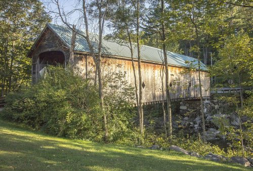
24 places in town are on the National Register, among them the Rockingham Meetinghouse, a National Historic Landmark, and ten historic districts with 595 buildings between them. Below: 11 old photos and papers, maps from 1927 on, and the census since 1790.
Founding year: Wikidata. First post office: 1801.The full story ↓
History grade
What drives Rockingham’s History grade
On its age, its old homes and the National Register, Rockingham is among the most historic 1% of U.S. towns, #2 of 71 in Vermont. All 3 inputs put Rockingham near the top nationally; its share of homes from before 1940 ranks highest.
A+
HistoryA character grade: shown, never part of Rockingham’s overall grade.
Vermont towns list more on the Register than most of the country (a typical Vermont town has 147 per 10,000 residents, the U.S. 2.4), so Rockingham’s 1,271 sits above most of its state (99% of Vermont towns have fewer) while its 611 historic buildings outnumber those of 98% of U.S. towns.
NoteThe founding year comes from Wikidata alone; no second source gives 1752.
How sure. Graded on any two of the three inputs instead, the letter would still be A+. The pre-1940 share is a Census survey estimate (±6.5 points).
Founding year: Wikidata (other dates in Quick answers). Homes: Census ACS 2020–24. National Register: National Park Service, May 2026 list; each listing counted once (boundary changes and added documentation belong to their listing), and a historic district counts its contributing buildings. How TownRatings grades history →
What stands out about Rockingham’s past
Read from the archive, the National Register and the record. The page puts what stands out first.
The country’s official list of buildings and places worth saving. One is a National Historic Landmark, the highest tier. Boundary changes and added documentation are counted with their listing.
One of the New Hampshire grants, it was chartered by Governor Benning Wentworth on December 28, 1752, and named for Lord Rockingham. The township was granted to Samuel Johnson and 72 others. When the Town was first settled in 1753 by pioneers, its rivers were sites of fishing for salmon and shad, as they had been for the original indigenous inhabitants. By 1771, the population reached 225. In 1785, Colonel Enoch Hale erected the first bridge over the Connecticut River, and until 1796, it remained the only bridge across. The village of Bellows Falls became an important mill town, which reduced the runs of palatable fish.
Passages that mention Rockingham, cut from the printed page as they were published.
History of the town of Rockingham, Vermont, including the villages of Bellows Falls, Saxtons River, Rockingham, Cambridgeport and Bartonsville, 1753-1907, with family genealogies1907 · page 475Read the page →
Read the text
other towns as follows : "I give the inhabitants and their successors of my native town of Rockingham in Windham county and state of Vermont, $20,000, wishing the lawful authorities and their successors of said town of Rockingham to invest the amount of this bequest and keep it safely invested in productive real estate or interest paying securities, and use the annual income of the investment in aid and support of the Indigent Poor and Paupers of said town of Rockingham ; I give the inhabitants and their successors of four towns in Windsor
Text read by machine from the scan; it may contain errors.
History of the town of Rockingham, Vermont, including the villages of Bellows Falls, Saxtons River, Rockingham, Cambridgeport and Bartonsville, 1753-1907, with family genealogies1907 · page 330Read the page →
Read the text
330 Hislory of Rockingham Because of the fact of the Rutland road's having seven or eight miles of its line built through the town of Rockingham, that line has always been more closely identified with this town than the others, which only barely touch the village of Bellows Falls. In the early days of railroads, this road was advertised as extending " from Burlington to Rockingham," and Bellows Falls was hardly known as even a station on
Text read by machine from the scan; it may contain errors.
Scans and text from the Internet Archive. Books published in 1930 or earlier, which are in the public domain.
Timeline
Rockingham, 1752 to 2000
Woven from the archive, old maps, post office records, the National Register and the people born here.
Nothing in the archives for these yearsWeddings on Main Street, storms, parades, school pictures, the old store. If it’s in your family album, it belongs here.
In 1752, according to Wikidata. Rockingham’s post office opened in 1801, and the first U.S. census counted 1,235 people here in 1790.
How does Rockingham rank for history?
Rockingham is among the most historic 1% of U.S. towns, #2 of 71 in Vermont. The History grade combines the town’s founding era, the share of homes built before 1940 and its National Register listings. It’s a character grade, so it isn’t part of the overall grade. How it works.
What is on the National Register in Rockingham?
24 listings: 10 buildings, among them the Rockingham Meetinghouse (a National Historic Landmark since 2000), 10 historic districts with 595 contributing buildings, and 4 structures. 611 historic buildings in all.
How old are the homes in Rockingham?
56% of Rockingham’s homes were built before 1940 (Census estimate, ±6.5 points), against a typical 22% for a Vermont town; the median home was built in 1938.
Founding dates: Wikidata, Wikipedia, the U.S. post office records of Blevins & Helbock (CC0) and the Census. Homes by year built: Census ACS 2020–24. National Register of Historic Places: National Park Service (list of May 22, 2026). Old photos, postcards and papers: Wikimedia Commons, the Library of Congress and other public archives, credited on each item’s page. Maps: U.S. Geological Survey historical topographic maps (via Esri) and Sanborn fire-insurance maps (Library of Congress). History text and census tables: Wikipedia (CC BY-SA 4.0). Places that used to be: USGS Geographic Names Information System (2021).
From Wikimedia Commons (15), the Library of Congress (2), the National Register of Historic Places (24), Wikipedia, Wikidata and Wikipedia for famous people, U.S. Geological Survey historical maps, U.S. Census counts (via Wikipedia), the US Post Offices dataset (Blevins & Helbock), the USGS Geographic Names Information System and old county and town histories (Internet Archive). Archive images are copied here with their credits and licenses, shown on each photo’s page. Refreshed monthly.


 ★ Landmark




 1900
 1933
 1933
 1933
 1933
 1933
 1933
 1933
 1933
 2016
 2016
 2016
 2016
 2006
 2004


