6 places in town are on the National Register, among them a historic district with 26 buildings. Below: 13 old photos and papers, maps from 1885 on, and old-book passages.
Founding year: the first Ludlow post office (Blevins & Helbock, CC0).
History grade
What drives Ludlow’s History grade
On its age, its old homes and the National Register, Ludlow is more historic than 89% of U.S. towns. All 3 inputs are above most U.S. towns; its share of homes from before 1940 ranks highest and its age lowest.
A
HistoryA character grade: shown, never part of Ludlow’s overall grade.
Vermont towns list more on the Register than most of the country (a typical Vermont town has 147 per 10,000 residents, the U.S. 2.4), so Ludlow’s 171 sits above most of its state (68% of Vermont towns have fewer) while its 34 historic buildings outnumber those of 82% of U.S. towns.
How sure. Graded on any two of the three inputs instead, the letter would range from A− to A. The pre-1940 share is a Census survey estimate (±4.6 points). The founding year is the first post office, not a stated founding date.
Founding year: the first post office (other dates in Quick answers). Homes: Census ACS 2020–24. National Register: National Park Service, May 2026 list; each listing counted once (boundary changes and added documentation belong to their listing), and a historic district counts its contributing buildings. How TownRatings grades history →
What stands out about Ludlow’s past
Read from the archive, the National Register and the record. The page puts what stands out first.
Fire insurance maps drew every building, what it was made of and what it was used for, so insurers could price the risk of fire. Pick a year, then a sheet.
Nothing in the archives for these yearsWeddings on Main Street, storms, parades, school pictures, the old store. If it’s in your family album, it belongs here.
Wikipedia doesn’t have a history of Ludlow yet. The photos, dates and memories neighbors add here are how it gets written.
Its first post office opened in 1809. Between the 2010 and 2020 censuses its population grew from 1,963 to 2,172 (+11%).
From the old history books
What they wrote about Ludlow in 1891
Passages that mention Ludlow, cut from the printed page as they were published.
History of Windsor County, Vermont, with illustrations and biographical sketches of some of its prominent men and pioneers1891Read the page →
Read the text
Railroad. — Ludlow is traversed by the Rutland and Burlington Railroad, which enters the town on its eastern boundary line from Cavendish and follows up the valley of the Black River until it reaches the village, which is the only station in the town. .A.fter leaving the village the railroad takes a northerly course until it reaches the pass in the Green Mountains two hundred feet above the bed of the west branch of Black River, the maximum grade of which is one and a half per cent., or seventy-six feet to the mile. The route of the railroad near the village of
Text read by machine from the scan; it may contain errors.
Roads. — The first road in Ludlow was laid out and surveyed September 6, 1784, by Solomon Button and built from Cavendish to Ludlow. Bridle-paths were cut from this road to the north and south hills and later in other directions. This was the only road till the organization of the town, when it was continued through Shrewsbury and further west; it subsequently became known as the Green Mountain Turnpike and the original owners were the Fletcher brothers, of Ludlow, Salmon Button, Christopher Webber, of Cavendish, the latter being the business mana-
Text read by machine from the scan; it may contain errors.
History of Windsor County, Vermont, with illustrations and biographical sketches of some of its prominent men and pioneers1891Read the page →
Read the text
Roads. — The first road in Ludlow was laid out and surveyed September 6, 1784, by Solomon Button and built from Cavendish to Ludlow. Bridle-paths were cut from this road to the north and south hills and later in other directions. This was the only road till the organization of the town, when it was continued through Shrewsbury and further west; it subsequently became known as the Green Mountain Turnpike and the original owners were the Fletcher brothers, of Ludlow, Salmon Button, Christopher Webber, of Cavendish, the latter being the business mana-
Text read by machine from the scan; it may contain errors.
Early Settlement and Organization. — There is no evidence that any of the original proprietors of the town of Ludlow ever became an actual settler. Over a score of years passed away from the time the original grant was given before any white man attempted to make a permanent settlement. In the year 1784 James Whitney moved into the town and became the first settler, locating his land on the North Hill, about one mile from the river. The following year Simeon Read and Jesse and Josiah Fletcher moved with their families from Massachusetts, and set-
Text read by machine from the scan; it may contain errors.
Scans and text from the Internet Archive. Books published in 1930 or earlier, which are in the public domain.
Timeline
Ludlow, 1809 to 1941
Woven from the archive, old maps, post office records, the National Register and the people born here.
The Ludlow post office opened in 1809, the earliest record of the town by name (U.S. post office records).
How does Ludlow rank for history?
Ludlow is more historic than 89% of U.S. towns. The History grade combines the town’s founding era, the share of homes built before 1940 and its National Register listings. It’s a character grade, so it isn’t part of the overall grade. How it works.
What is on the National Register in Ludlow?
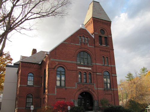
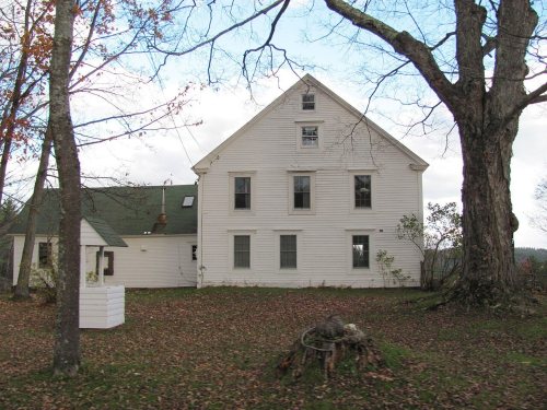
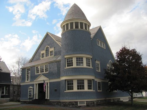
6 listings: 5 buildings, among them the Black River Academy (listed 1972, the first), and 1 historic district, the Ludlow Village Historic District, with 26 contributing buildings. 34 historic buildings in all.
How old are the homes in Ludlow?
24% of Ludlow’s homes were built before 1940 (Census estimate, ±4.6 points), against a typical 22% for a Vermont town; the median home was built in 1982.
Founding dates: Wikidata, Wikipedia, the U.S. post office records of Blevins & Helbock (CC0) and the Census. Homes by year built: Census ACS 2020–24. National Register of Historic Places: National Park Service (list of May 22, 2026). Old photos, postcards and papers: Wikimedia Commons, the Library of Congress and other public archives, credited on each item’s page. Maps: U.S. Geological Survey historical topographic maps (via Esri) and Sanborn fire-insurance maps (Library of Congress). History text and census tables: Wikipedia (CC BY-SA 4.0). Places that used to be: USGS Geographic Names Information System (2021).
From Wikimedia Commons (9), the Library of Congress (9), the National Register of Historic Places (6), U.S. Geological Survey historical maps, the US Post Offices dataset (Blevins & Helbock), the USGS Geographic Names Information System, Sanborn fire insurance maps (Library of Congress) and old county and town histories (Internet Archive). Archive images are copied here with their credits and licenses, shown on each photo’s page. Refreshed monthly.



 1859
 c. 1865
 c. 1865
 1900
 1900
 1900
 1900
 1900
 c. 1906
 c. 1910
 1941
 1941
 1941
 2014
 2014
 2010
 2010
 2003


