Chester dates to 1754, and 30% of its homes were built before 1940
Among the most historic 1% of U.S. towns · #7 of 71 in Vermont. What drives it
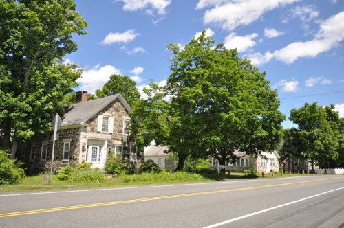
6 places in town are on the National Register, among them two historic districts with 205 buildings between them. Below: 10 old photos and papers, maps from 1900 on, and the census since 1790.
Founding year: Wikidata; Wikipedia’s history section gives the same year. First post office: 1800.The full story ↓
History grade
What drives Chester’s History grade
On its age, its old homes and the National Register, Chester is among the most historic 1% of U.S. towns, #7 of 71 in Vermont. All 3 inputs are above most U.S. towns; its age ranks highest and its share of homes from before 1940 lowest.
A+
HistoryA character grade: shown, never part of Chester’s overall grade.
Vermont towns list more on the Register than most of the country (a typical Vermont town has 147 per 10,000 residents, the U.S. 2.4), so Chester’s 705 sits above most of its state (93% of Vermont towns have fewer) while its 211 historic buildings outnumber those of 94% of U.S. towns.
How sure. Graded on any two of the three inputs instead, the letter would still be A+. The pre-1940 share is a Census survey estimate (±7.3 points). Two sources give 1754.
Founding year: Wikidata (other dates in Quick answers). Homes: Census ACS 2020–24. National Register: National Park Service, May 2026 list; each listing counted once (boundary changes and added documentation belong to their listing), and a historic district counts its contributing buildings. How TownRatings grades history →
What stands out about Chester’s past
Read from the archive, the National Register and the record. The page puts what stands out first.
US Post Offices dataset (Blevins & Helbock, CC0). Places and cemeteries from the USGS Geographic Names Information System (2021).
Every building
Chester, building by building, 1900–1912
Fire insurance maps drew every building, what it was made of and what it was used for, so insurers could price the risk of fire. Pick a year, then a sheet.
The town was originally chartered by New Hampshire Governor Benning Wentworth as Flamstead in 1754. The terms of the charter were not met and the town was re-chartered as New Flamstead in 1761. In 1766, a patent was issued by New York that changed the name of the town to Chester, after George Augustus Frederick, the Earl of Chester and the eldest son of King George III. Later, the governing authority of Chester reverted to the 1761 charter by an act of the Vermont legislature, although it left the name "Chester" in place. 2011 was thus the 250th anniversary of the town.
Passages that mention Chester, cut from the printed page as they were published.
Proceedings at Chester, Vermont, June 29, 1909, on Old Home Day1909Read the page →
Read the text
February 13, 1777, Jabez Sargeant, the first settler, was elected as the representative of Chester to attend the special convention to be held at Dorset and act for the good of the State of New ('onnecticut, and for the town of (Chester, according to his best \uiderstanding. He died August 5, 1788, at Chester. He was town treasurer in 1777, selectman in 1777-1778.
Text read by machine from the scan; it may contain errors.
Proceedings at Chester, Vermont, June 29, 1909, on Old Home Day1909Read the page →
Read the text
Town of Chester. The house occupied by Mr. Jonathan Tarbell, and at which this meeting was held, should be as sacred to the citizens of Chester, as Independence Hall, Philadelphia, is to the citizens of the United States, but unfortunately it has been destroyed by fire.
Text read by machine from the scan; it may contain errors.
History of Windsor County, Vermont, with illustrations and biographical sketches of some of its prominent men and pioneers1891 · page 668Read the page →
Read the text
pleased with Chandler's efforts at jail building, were now doubly incensed at his failure at courthouse construction. Before the commencement of this last failure efforts had been made to remove the shire town from Chester, and, after much agitation, some rioting, etc., the supervisors, at a meeting held at Chester, May 26, 1772, chose Westminster for the shire town of Cumberland county. Thus ended the history of Chester as a county seat, and we conclude the history of this period with a sketch of the man who was, without doubt, one of the most prominent
Text read by machine from the scan; it may contain errors.
Scans and text from the Internet Archive. Books published in 1930 or earlier, which are in the public domain.
Timeline
Chester, 1754 to 1941
Woven from the archive, old maps, post office records, the National Register and the people born here.
Nothing in the archives for these yearsWeddings on Main Street, storms, parades, school pictures, the old store. If it’s in your family album, it belongs here.
Nothing in the archives for these yearsWeddings on Main Street, storms, parades, school pictures, the old store. If it’s in your family album, it belongs here.
In 1754, according to Wikidata and Wikipedia’s history of the town. Chester’s post office opened in 1800, and the first U.S. census counted 981 people here in 1790.
How does Chester rank for history?
Chester is among the most historic 1% of U.S. towns, #7 of 71 in Vermont. The History grade combines the town’s founding era, the share of homes built before 1940 and its National Register listings. It’s a character grade, so it isn’t part of the overall grade. How it works.
What is on the National Register in Chester?
6 listings: 4 buildings and 2 historic districts, the Stone Village Historic District and the Chester Village Historic District, with 205 contributing buildings. 211 historic buildings in all.
How old are the homes in Chester?
30% of Chester’s homes were built before 1940 (Census estimate, ±7.3 points), against a typical 22% for a Vermont town; the median home was built in 1972.
Founding dates: Wikidata, Wikipedia, the U.S. post office records of Blevins & Helbock (CC0) and the Census. Homes by year built: Census ACS 2020–24. National Register of Historic Places: National Park Service (list of May 22, 2026). Old photos, postcards and papers: Wikimedia Commons, the Library of Congress and other public archives, credited on each item’s page. Maps: U.S. Geological Survey historical topographic maps (via Esri) and Sanborn fire-insurance maps (Library of Congress). History text and census tables: Wikipedia (CC BY-SA 4.0). Places that used to be: USGS Geographic Names Information System (2021).
From Wikimedia Commons (21), the Library of Congress (1), Wikidata (2), the National Register of Historic Places (6), Wikipedia, Wikidata and Wikipedia for famous people, U.S. Geological Survey historical maps, U.S. Census counts (via Wikipedia), the US Post Offices dataset (Blevins & Helbock), the USGS Geographic Names Information System, Sanborn fire insurance maps (Library of Congress) and old county and town histories (Internet Archive). Archive images are copied here with their credits and licenses, shown on each photo’s page. Refreshed monthly.




 1933
 1933
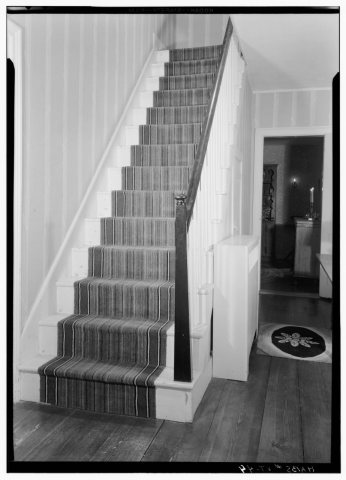 1933
 1933
 1933
 1933
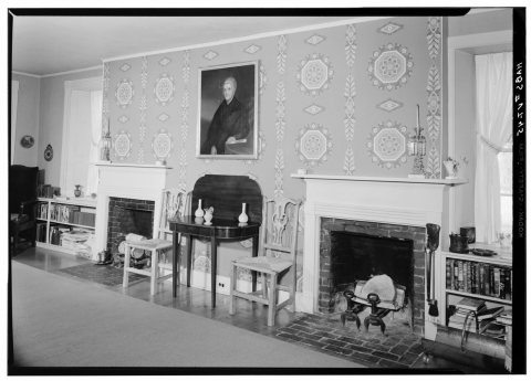 1933
 2010
 2010
 2010
 2010
 2010
 2010
 2010
 2010
 2010
 2008
 2006
 2004


