Essex Junction dates to 1892, and 1 of its places is on the National Register
More historic than 40% of U.S. towns · #68 of 71 in Vermont. What drives it
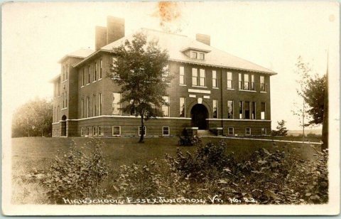
Most of Essex Junction was built recently: 10% of its homes predate 1940 and the median home dates from 1983. Below: 9 old photos and papers, maps from 1894 on, and the census since 1900.
Founding year: Wikidata; Wikipedia’s history section gives the same year. First post office: 1849.The full story ↓
History grade
What drives Essex Junction’s History grade
On its age, its old homes and the National Register, Essex Junction is more historic than 40% of U.S. towns, #68 of 71 in Vermont. Its National Register listings hold the grade up; its age pulls it down.
C+
HistoryA character grade: shown, never part of Essex Junction’s overall grade.
Vermont towns list more on the Register than most of the country (a typical Vermont town has 147 per 10,000 residents, the U.S. 2.4), so Essex Junction’s 9.3 sits below most of its state (20% of Vermont towns have fewer) while its 10 historic buildings outnumber those of 76% of U.S. towns.
How sure. Graded on any two of the three inputs instead, the letter would range from C to B−. The pre-1940 share is a Census survey estimate (±3.1 points). Two sources give 1892.
Founding year: Wikidata (other dates in Quick answers). Homes: Census ACS 2020–24. National Register: National Park Service, May 2026 list; each listing counted once (boundary changes and added documentation belong to their listing), and a historic district counts its contributing buildings. How TownRatings grades history →
What stands out about Essex Junction’s past
Read from the archive, the National Register and the record. The page puts what stands out first.
Fire insurance maps drew every building, what it was made of and what it was used for, so insurers could price the risk of fire. Pick a year, then a sheet.
1894Sheet 1 of 1
Edition
Sheets
BrickWoodStone
Sanborn Map Company, via the Library of Congress. Editions published in 1930 or earlier, which are in the public domain.
On the map
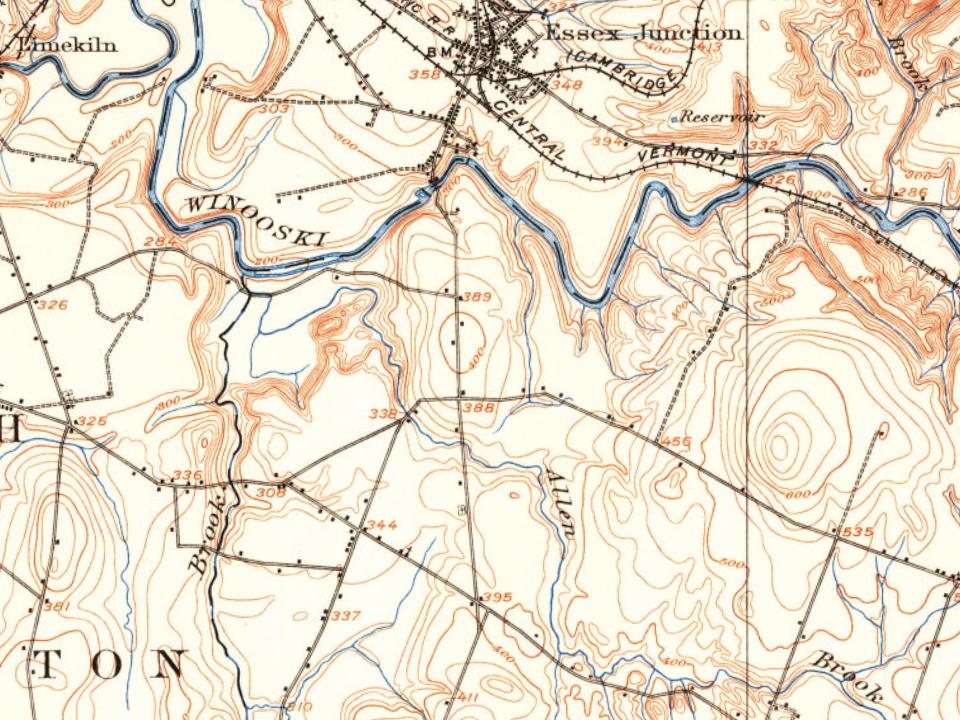
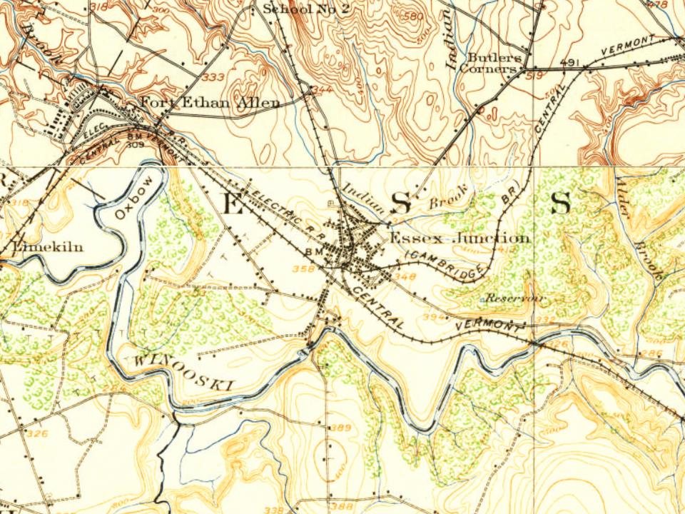
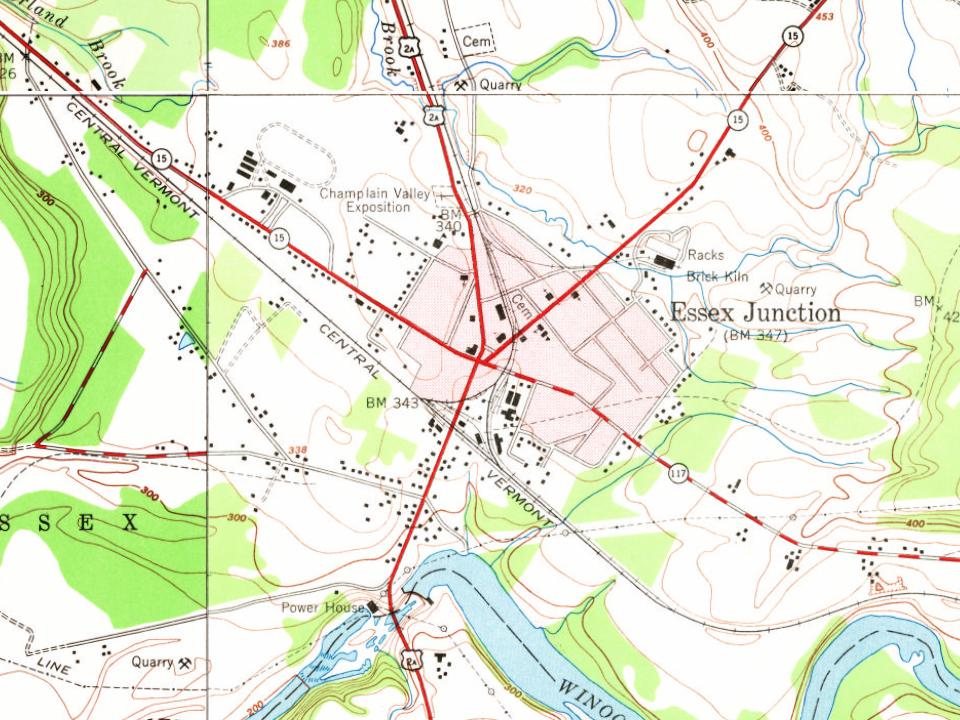
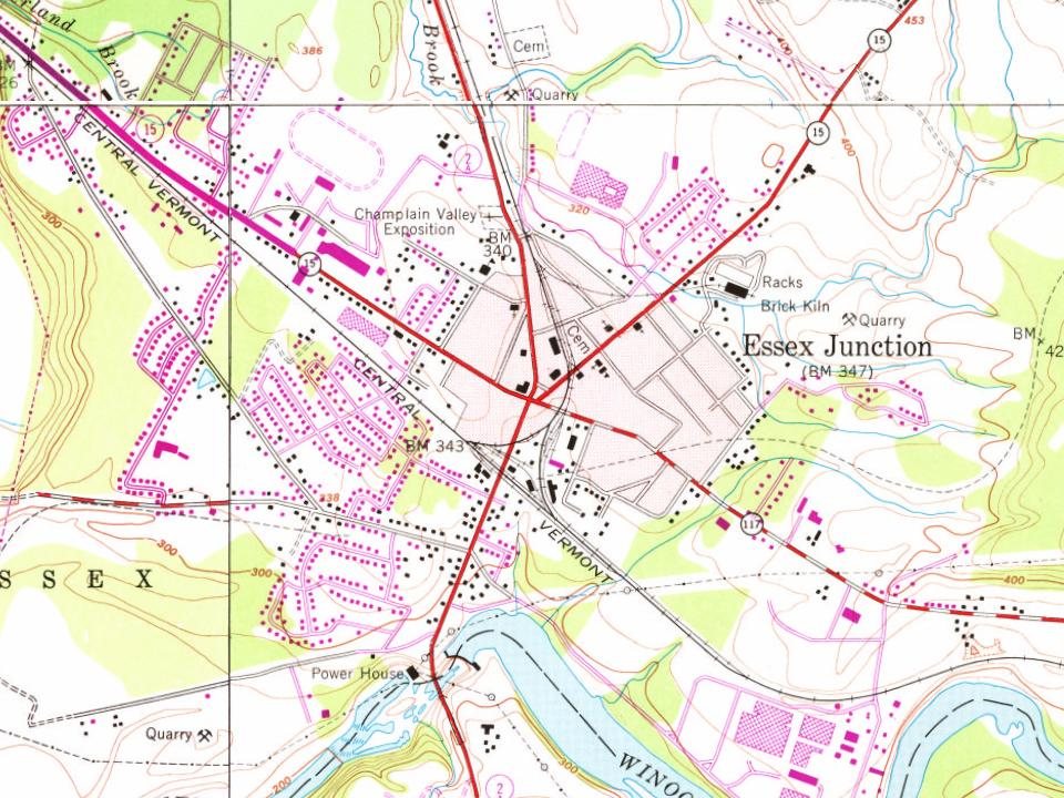
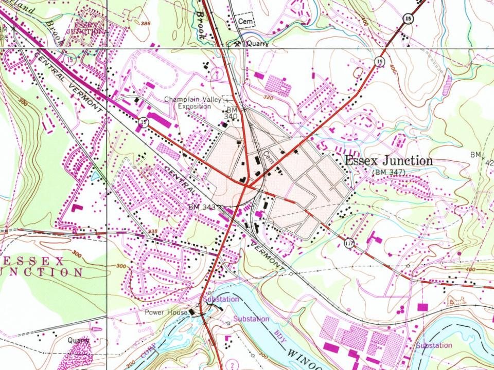
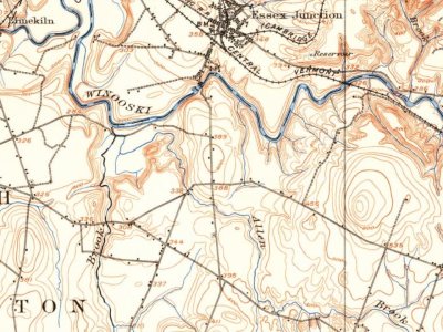
Essex Junction on the map, 1906 to 1987
Every edition of the U.S. Geological Survey’s map of Essex Junction. Tap a year, or press play to watch the town change.
1906Burlington sheet · 1:62,500
U.S. Geological Survey historical topographic maps (public domain), via Esri’s collection of the scans. The red ring marks the center of Essex Junction.
In 1958, IBM opened a 40,000 square feet (3,700 m2) data processing facility in Essex Junction, employing 500. In 1969, the plant (now owned by GlobalFoundries) expanded to 820,000 square feet (7.6 ha). In 1982, employment reached an all-time high of 8,000. In 2007, the value of the plant was $104 million. The plant's workforce was slightly over 5,000 in 2011, and in 2015, GlobalFoundries employed about 3,000 employees.
In 2003, as a result of the nationally publicized suicide of an Essex Junction teenager, Vermont and other states passed legislation against cyberbullying.
Passages that mention Essex Junction, cut from the printed page as they were published.
History of Chittenden County, Vermont, with illustrations and biographical sketches of some of its prominent men and pioneers1886 · page 576Read the page →
Read the text
Settlement of Essex Junction. — The extensive water power at this place was utiUzed at an early day. It was named Hubbel's Falls, from a man who was one of the first settlers. The first dam was made by Abraham Stevens across the locality known as Rock Island. The first sawmill was built by John Johnson and Daniel Hurlburt ; later William Ward put in a carding machine joining the saw-mill. Later another dam was built, probably upon the site of the present one, by Mr. Tichout, and the mills by John Bradley and Michael Sinclair. Here was located the carding and manufacturing works of
Text read by machine from the scan; it may contain errors.
History of Chittenden County, Vermont, with illustrations and biographical sketches of some of its prominent men and pioneers1886 · page 729Read the page →
Read the text
termini in Burlington. But the excitement ran so high during the building that Governor Paine, after becoming sure that his line would be built, gave up coming to Burlington, and arranged, with the aid of John Smith and Lawrence Brainerd, of St. Albans, to make a line north from Essex Junction, thus practically extending the main line of the Central to Rouse's Point, leaving Burlington to one side to be reached by a branch. This move gave the final blow to Burlington, and left the Rutland Railroad without any rail connection north, and forced it to make its connections with the Ogdensburgh and Champlain and St. Lawrence Railroads at Rouse's Point by boat. To meet this emer-
Text read by machine from the scan; it may contain errors.
Scans and text from the Internet Archive. Books published in 1930 or earlier, which are in the public domain.
Timeline
Essex Junction, 1849 to 1972
Woven from the archive, old maps, post office records, the National Register and the people born here.
Nothing in the archives for these yearsWeddings on Main Street, storms, parades, school pictures, the old store. If it’s in your family album, it belongs here.
In 1892, according to Wikidata and Wikipedia’s history of the town. Essex Junction’s post office opened in 1849, and the census of 1900 counted 1,141 people here.
How does Essex Junction rank for history?
Essex Junction is more historic than 40% of U.S. towns, #68 of 71 in Vermont. The History grade combines the town’s founding era, the share of homes built before 1940 and its National Register listings. It’s a character grade, so it isn’t part of the overall grade. How it works.
What is on the National Register in Essex Junction?
One place: the Downtown Essex Junction Commercial Historic District (listed 2004).
How old are the homes in Essex Junction?
10% of Essex Junction’s homes were built before 1940 (Census estimate, ±3.1 points), against a typical 22% for a Vermont town; the median home was built in 1983.
Founding dates: Wikidata, Wikipedia, the U.S. post office records of Blevins & Helbock (CC0) and the Census. Homes by year built: Census ACS 2020–24. National Register of Historic Places: National Park Service (list of May 22, 2026). Old photos, postcards and papers: Wikimedia Commons, the Library of Congress and other public archives, credited on each item’s page. Maps: U.S. Geological Survey historical topographic maps (via Esri) and Sanborn fire-insurance maps (Library of Congress). History text and census tables: Wikipedia (CC BY-SA 4.0). Places that used to be: USGS Geographic Names Information System (2021).
From Wikimedia Commons (6), the Library of Congress (6), the National Register of Historic Places (1), Wikipedia, Wikidata and Wikipedia for famous people, U.S. Geological Survey historical maps, U.S. Census counts (via Wikipedia), the US Post Offices dataset (Blevins & Helbock), the USGS Geographic Names Information System, Sanborn fire insurance maps (Library of Congress) and old county and town histories (Internet Archive). Archive images are copied here with their credits and licenses, shown on each photo’s page. Refreshed monthly.


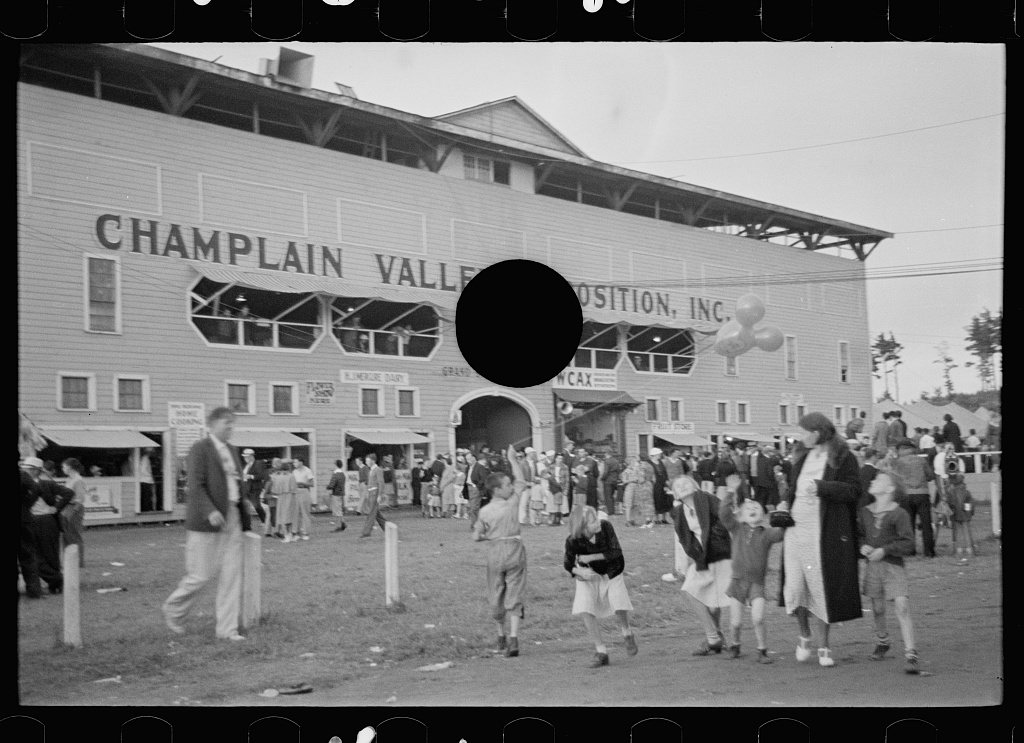






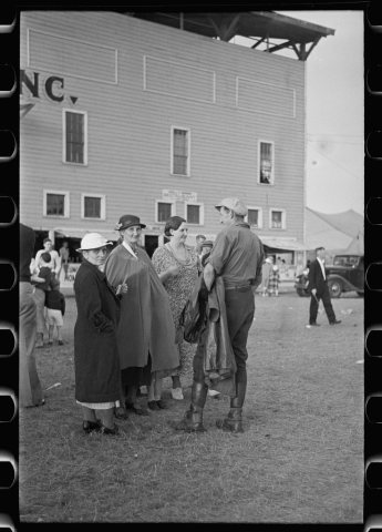 1937
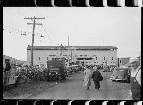 1937
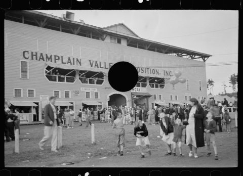 1937
 1937
 1937
 1937
 2009
 2009
 2009
