The story so far
Barre, in brief
Wikipedia doesn’t have a history of Barre yet. The photos, dates and memories neighbors add here are how it gets written.
Its population held steady between the last two censuses: 7,924 in 2010, 7,923 in 2020.
Each edition grades its towns against each other only.
Its Register listing is the Nichols House. Below: 18 old photos and papers, maps from 1884 on, and old-book passages.
Read from the archive, the National Register and the record. The page puts what stands out first.
Fire insurance maps drew every building, what it was made of and what it was used for, so insurers could price the risk of fire. Pick a year, then a sheet.
 1884Sheet 1 of 2
Sanborn Map Company, via the Library of Congress. Editions published in 1930 or earlier, which are in the public domain.
2 decades in the archive, from the 1910s to the 1940s. Scroll each row; tap a photo for its story.
 1916Alfred Hicks, a 10-year-old newsie, selling Boston pa…
 1940Barre, Vermont. Marble center
 1940Untitled photo, possibly related to: Barre, Vermont. …
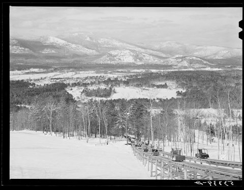 1940Untitled photo, possibly related to: Barre, Vermont. …
 1941Barre, Vermont. Main Street
 1941Barre, Vermont. The main street
 1941The Wells-Lemson granite quarry near Barre, Vermont
 1941At the Wells-Lemson granite quarry near Barre, Vermont
 1941At the Wells-Lemson granite quarry near Barre, Vermont
 1941Untitled photo, possibly related to: Barre, Vermont. …
 1941Untitled photo, possibly related to: Barre, Vermont. …
 1941Untitled photo, possibly related to: The Wells-Lemson…
 1941Untitled photo, possibly related to: At the Wells-Lem…
 1941Untitled photo, possibly related to: At the Wells-Lem…
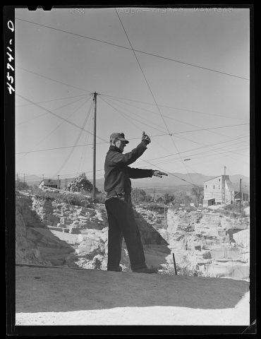 1941Untitled photo, possibly related to: At the Wells-Lem…
 1941Untitled photo, possibly related to: At the Wells-Lem…
 1941Untitled photo, possibly related to: At the Wells-Lem…
 1941Untitled photo, possibly related to: At the Wells-Lem…
Old hamlets and crossroads still carry their names on the map.
US Post Offices dataset (Blevins & Helbock, CC0). Places and cemeteries from the USGS Geographic Names Information System (2021).
Wikipedia doesn’t have a history of Barre yet. The photos, dates and memories neighbors add here are how it gets written.
Its population held steady between the last two censuses: 7,924 in 2010, 7,923 in 2020.
Passages that mention Barre, cut from the printed page as they were published.

When the small streams had been bridged again to permit trafhe into Barre, these quarry gangs went over and helped the railroads to lift their bridges back into place, working not only with much speed but also with remarkable precision. Huge derrick sticks from the Barre quarries also were put to use in bridging the Winooski river where the “two-way” bridge
Text read by machine from the scan; it may contain errors.
The flood, of course, occupied all the territory of the low-lying ground. Swift currents tore their way through the railroad yards of the Barre and .Chelsea, the Central) Vernionteand the Montpelier and Wells River railroads, carrying debris of all descriptions. A number of people were marooned in the passenger station of the Central Vermont railroad' and when the
Text read by machine from the scan; it may contain errors.
two or three such appointees, and one of them usually resident at Plainfield. On and after the conference of 1838, this station lost its identity with Barre circuit, and the preachers were appointed directly to Plainfield. The complete list of Methodist preachers on Vershire circuit to 1804, and on Barre circuit from that time to 1838,
Text read by machine from the scan; it may contain errors.
two or three such appointees, and one of them usually resident at Plainfield. On and after the conference of 1838, this station lost its identity with Barre circuit, and the preachers were appointed directly to Plainfield. The complete list of Methodist preachers on Vershire circuit to 1804, and on Barre circuit from that time to 1838,
Text read by machine from the scan; it may contain errors.Scans and text from the Internet Archive. Books published in 1930 or earlier, which are in the public domain.
Woven from the archive, old maps, post office records, the National Register and the people born here.
In the archiveAlfred Hicks, a 10-year-old newsie, selling Boston papers at noon. Location: Barre, Vermo…In the archiveBarre, Vermont. Marble center On the mapFirst mapped by the U.S. Geological Survey
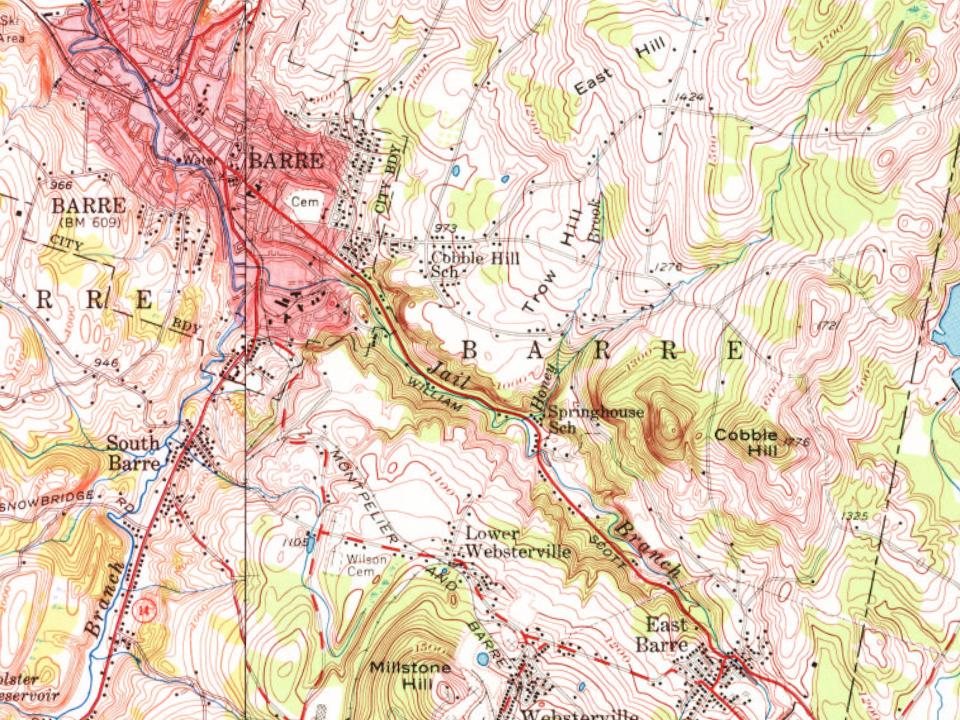
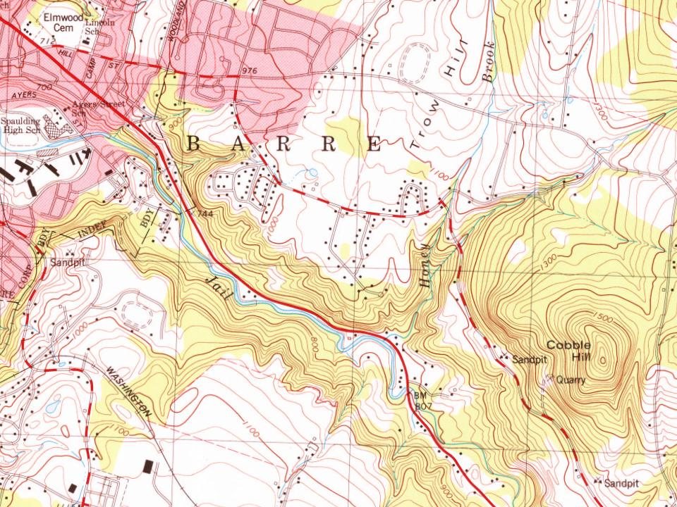
Every edition of the U.S. Geological Survey’s map of Barre. Tap a year, or press play to watch the town change.

U.S. Geological Survey historical topographic maps (public domain), via Esri’s collection of the scans. The red ring marks the center of Barre.
No then-and-now pairs yet. Take a photo from the same spot as an old one and they appear here side by side.

Find the spot, match the angle, and add your photo. It becomes the first then-and-now pair on Barre’s page.
Retake this view · +15The country’s official list of buildings and places worth saving.
National Park Service, National Register of Historic Places. Photos from Wikimedia Commons, credited on each place’s page.
Most archives stop around 1920. The photos from after that are in family albums, not libraries.
Each neighbor’s History grade, on the same three inputs.
One place: the Nichols House (listed 1978).
What the archives can’t tell you, neighbors can.
Founding dates: Wikidata, Wikipedia, the U.S. post office records of Blevins & Helbock (CC0) and the Census. Homes by year built: Census ACS 2020–24. National Register of Historic Places: National Park Service (list of May 22, 2026). Old photos, postcards and papers: Wikimedia Commons, the Library of Congress and other public archives, credited on each item’s page. Maps: U.S. Geological Survey historical topographic maps (via Esri) and Sanborn fire-insurance maps (Library of Congress). History text and census tables: Wikipedia (CC BY-SA 4.0). Places that used to be: USGS Geographic Names Information System (2021). How TownRatings grades history →
From the Library of Congress (18), the National Register of Historic Places (1), U.S. Geological Survey historical maps, the US Post Offices dataset (Blevins & Helbock), the USGS Geographic Names Information System, Sanborn fire insurance maps (Library of Congress) and old county and town histories (Internet Archive). Archive images are copied here with their credits and licenses, shown on each photo’s page. Refreshed monthly.